Richland Creek
1) Moore to Richland Creek Campground (6.2 miles)(Upper)
| Difficulty | III-IV+ |
| Length | 6.2 mi |
| Avg Gradient | 55 fpm |
| Gauge | Richland Creek Near Witts Spring, Ar |
| Flow Rate as of 19 minutes | 0.90 ftbelow recommended |
| Reach Info Last Updated | April 3, 2017 |
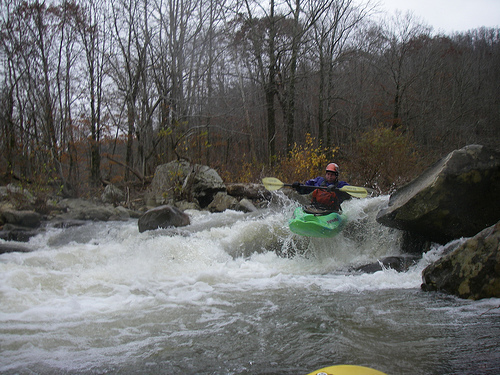
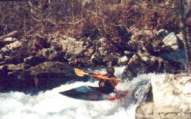
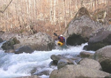
Richland Creek is one of the more impressive runs in Arkansas, not hair, but good class III/IV creekin'. A++ Scenery as 90% of the run is inside the Richland Creek Wilderness Area.
Typical hazards for a creek, undercuts, downed wood, strong hydraulics. Gradient by mile: 25, 35, 65, 75, 70, 65.
Put-in: Located by taking Newton County Road 5050 (FSR 1203) North for 4 miles at the community of Ben Hur on Hwy 16. A low water bridge and painted gauge referenced above and below are located here. Park on the North Side of the creek if possible and don't block the intersection. South side is private land. Ben Hur is about 9 miles East of of the Hwy 7/Hwy 16 intersection at Pelsor.
Take-out: Reached by continuing East on Hwy 16 from Ben Hur for 1.5 miles and turning onto Upper Falling Water Road (NFS 1205) and following to the NFS Richland Creek Campground. This road will parallel Falling Water Creek most of the way. This can also be reached by taking Falling Water Road farther East off Hwy 16.
More info and photos at:

At the listed put-in drainage area is ~23 square miles (as calculated by USGS StreamStats 4.2.0 software).
After the confluence with Long Devil's Fork it has increased to ~41.6 square miles, and by the listed take-out, ~67.3 square miles.
Put-in. Park on North side of creek (if possible). Hand painted gauge referenced above is located here.
For the first 1.5 miles the creek meanders through some class II willow shoals and a couple of shallow bedrock shoals before entering the gorge.
The gorge starts at the first bluff on river right.
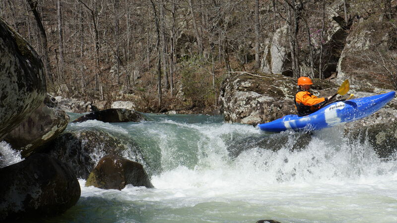
Wide bedrock shoals spread the water out thin at low levels, medium to high levels offer lots of surf spots. Follow the deepest water and drop over a couple small ledges.
Nice surf holes. Flat shelf rocks on both side of the creek for resting and spectating. Eddys on both sides. Located at the end of the first bluffs on river right, just before the creek narrows and enters the meat of the gorge.
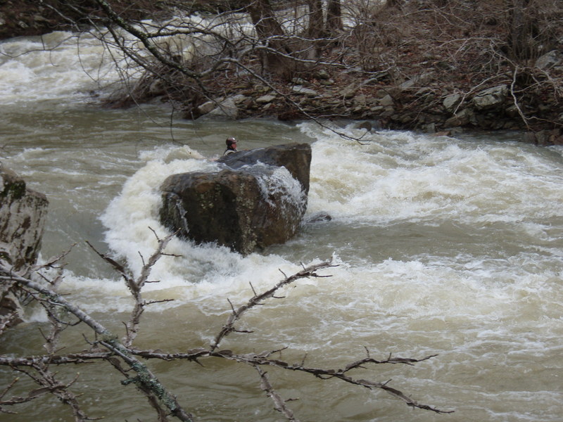
Small 2-3 foot ledge, but watch the hydraulic at medium to high water levels.
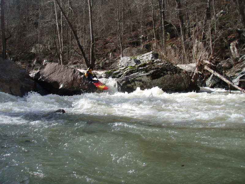
Excellent Splat Rock! Smooth and wide. Entire river current flows into the rock. Excellent recovery/setup eddys on both sides. Nice rock upstream for photos and spectating. Hard to actually touch the rock at higher flows due to the large pillow. Located below the first large bluff on river left and where the creek narrows as it enters the gorge.
First multi-move rock garden. Lots of eddys to work and a couple holes at higher levels before a sharp left turn leading to the Road Block rock.
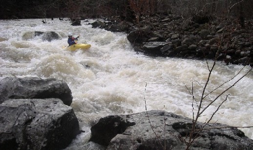
After the March 2008 floods, a large rock has moved in the bottom ledge of the drop an now creates a undercut pin hazard that the majority of the current flows into. Eddys are located on both sides of the creek above the rock an lines are available far right and far left. Drifters or swimmers will likely be drawn into the undercut by the current. Photo is taken at high water >5 ft.
A around 4ft, the right side of the rock looks good from upstream. Beware to get far right and enter very close to the right bank to slide down the drop. The rock forming the drop has a diagonal ridge that funnels boats into the center undercut if you don't enter far right.
After Road Block, several large boulders appear in the middle of the stream. Take the shallow entrance to the right to go through the crack, but beware of the hole below, especially at higher flows. Lots of boats and swimmers have spent time here. The left side offers most of the flow without the crack.
Located, just after the creek turns back to the right below Crack-in-the-Rock. Most of the water heads through a slot in the middle of the creek. Beware of the large moss covered rock (Green Rock) directly downstream of the slot. It is undercut and feeds a sieve to the left. Be prepared to eddy left or move right as you exit the slot.
A fast flume with an S shaped ride. Catch the eddies for added challenge.
River drops steeply over a rock pile and turns sharply back to the right at the bottom over some sharp shelf rock. Bracing into the pillow at the bottom will make you understand the rapid's name. An excellent splat rock is located just below the rapid (only good at medium to high flows).
Just after Knucklebuster, the creek turns to the left, A small waterfall is visible from high above the river. Just above the large boulder sitting on the left side of the bedrock streambed lies one sweet surf wave. Will surf at any runnable level, but the higher the river, the bigger the wave. It is shallow in the trough, so vertical moves are not advised, but you can surf, spin and blunt till it hurts! A couple other waves develop above and below the main wave at medium to high water levels.
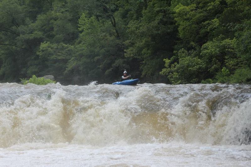
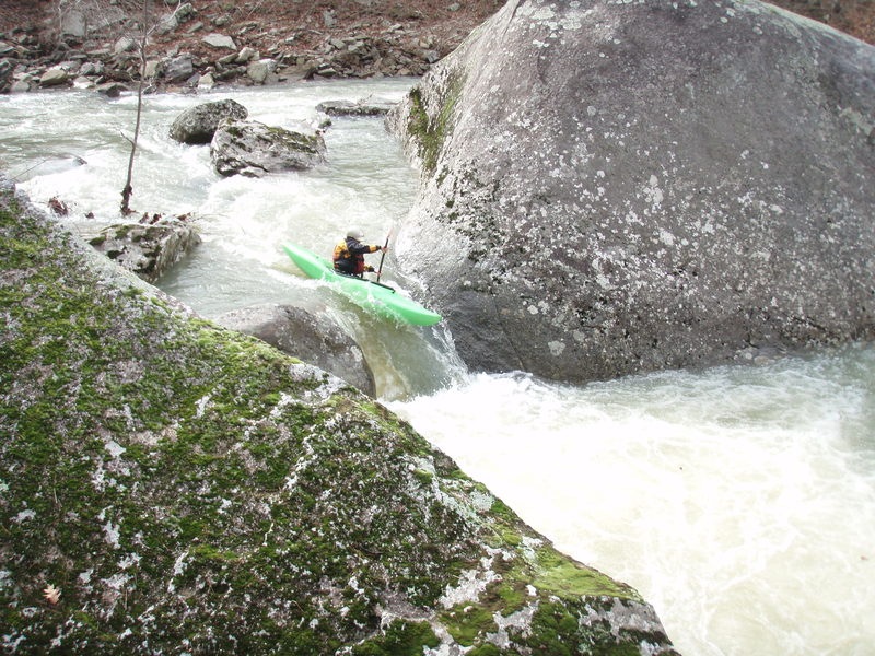
Below the Surf Wave, a large pool leads to the wide but shallow entrance to the Falls. The Falls are a riverwide 6-8 foot tall ledge. The left side is a little taller, but takes more water to pad up the entrance. A sticky hole that recirculates back under the bluff develops at levels above 4.5 feet. The right side has a small channel that reduces scraping at low water and the ledge is not undercut on this side. The ledge can be run just about anywhere except just right of center where a chunk of rock has fallen into the pool below.
The Devil's Fork Creek enters on the left. Hike up 0.25 miles to see Twin Devil's Falls formed by the confluence of Long Devil's Creek and Big Devil's Creek. The rapid directly above the confluence holds pin potential and has an undercut on the far left. The rapid directly below the confluence can develop a couple of sticky holes at levels above 4.5 feet.
After the creek swings hard left around a large boulder, the creek splits into three channels. The main channel heads to the right toward a large rectangular boulder. The main flow heads down a flume to the left of the boulder. At higher water levels, a more creeky line to the right of the boulder opens up. However a new far left line is opening up and takes a lot of the flow from the main channel. At levels below 4 feet, the main channel and left channel will be bony and require lots of rock dodging.
After some nice class III boogie creekin' be on the lookout for Cindy's Hole. Boulders will split the flow in multiple slots to form two short main channels. When the channels come back together, a small horizon line will be located among some more boulders. The water pours over a flat rock forming a sticky ledge hole that feeds an overhanging rock on the river right side of the hole. The higher the level, the stickier the hole. Good downstream momentum will likely carry you through, but if you go in with no speed, get ready for a ride. High water sneaks can be had through the far left slot and far right slide. (Other names the drop goes by are 'Bill's Thrill' and 'Jaws')
The next rapid below Cindy's again splits into two main channels, they converge and funnel through several slots. The center slot is the cleanest, the left slot consists of a turn with a potential pin rock. Avoid the far left side above 4.5 feet. The sloped triangle rock (like a piece of apple pie) on the bottom left forms a sieve above this level. There have been some close calls here. At lower levels, the sieve is no factor as water is not flowing through it. Big holes develop above 5.5 feet.
Below Apple Pie, the main channel to the left leads to a 10-foot wide slot with a ledge drop. Head off with some speed to the center. The hole below can be a little sticky, but don't let the boat veer into the notch on the left side of the slot. Use enough speed to pass the notch, but slow enough to ride the left side of the ledge for a sweet boof. Portage trail is to the right which continues around the next rapid as-well.
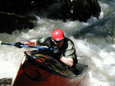
A great tight technical rapid, but features several hazards, which include: 3 tight entrance slots, at least 4 notable undercuts, shallow rocks in fast current, holes and most commonly high pin or head-to-rock contact potential.
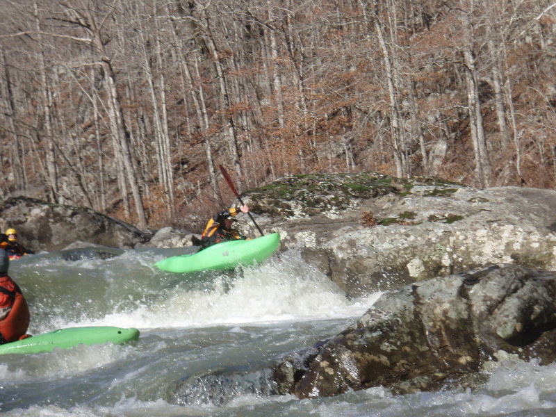
The rapid consists of two main drops. The first part is a set of slots known as the 'Doors'. The Doors are numbered from the river right to the left. Door #1, requires a boof with left angle to avoid pining in the first undercut on river right directly below Door #1. Door #2 is the most narrow slot and requires an off angle entry. Door #3 enters at close to a 90-degree angle to the first two. Door #4 is the far left boulder jumble, usually not runnable except at high levels if logs are not present.
Doors #1, #2 and #3 converge for another 4-5 foot double-drop over shallow rocks into a wave/hole to complete for first half of the rapid. There is a nice eddy on river right and a small eddy on river left to catch before entering the lower part of the rapid. The river right eddy is usually the eddy that paddlers portaging the Doors re-enter the creek. Undercut #2, more of a slopped overhang, is located on river right just below this eddy.
The lower drop consists a ledge hole followed by threading through several ill-placed rocks. Several pins have occured in this location. Beware of the large boulder on bottom left, it is extremely undercut. The large boulder on river right is too, but to a much lesser extent.
The portage trail can be accessed on river right.
A small ledge extending from the right bank is great for side-surfs and spins. Followed by a slide into some more nice bouncy, but shallow, surf holes.
A steep double-drop over a pile of rocks. Beware of pin rocks a low water. Nice boof on the left side of the second drop.
Short rapid at the confluence of Falling Water Creek leads to this access point. Primitive campground with pit toliets and picnic tables. Ample parking here, nice swimming hole and rock beach.
Many folks take out at the campground for the upper run and put-in at the bridge for the lower run. This results in this nice rapid being forgotten many times. It is recommended to end runs of this section at the bridge and start runs of the lower section at the campground beach so to include this rapid. Enter through the willow jungle and watch out for the hole at the bottom during medium to high flows.
Internet and stick gauge located here on North (river left) side of bridge. Limited parking available on both sides of bridge.
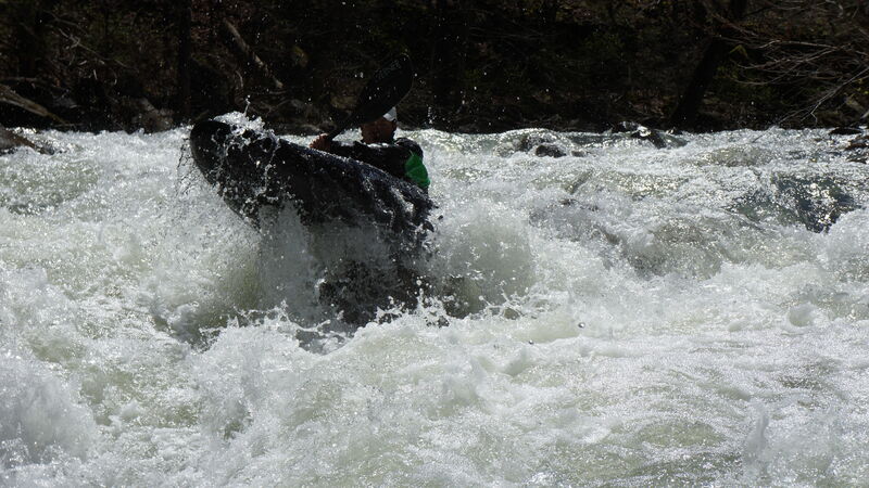
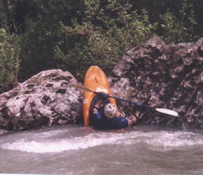
Canoe splat on the undercut spectator rock below Door #1.