Similkameen
Palmer Lake to Oroville
| Difficulty | I-II(III) |
| Length | 18 mi |
| Avg Gradient | n/a |
| Gauge | Similkameen River Near Nighthawk, Wa |
| Flow Rate as of 36 minutes | 551 cfsbelow recommended |
| Reach Info Last Updated | March 3, 2023 |
American Whitewater supports protecting the environmental, recreational, and other values of a fully connected and continuously flowing Similkameen River system. Our interests include sufficient year-round flow necessary to protect aquatic resources and other designated beneficial uses. WAC 173-201A-600 identifies the designated uses in the Similkameen River: salmonid spawning, rearing [...]Read More
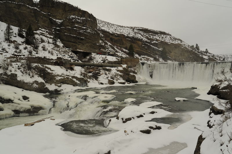
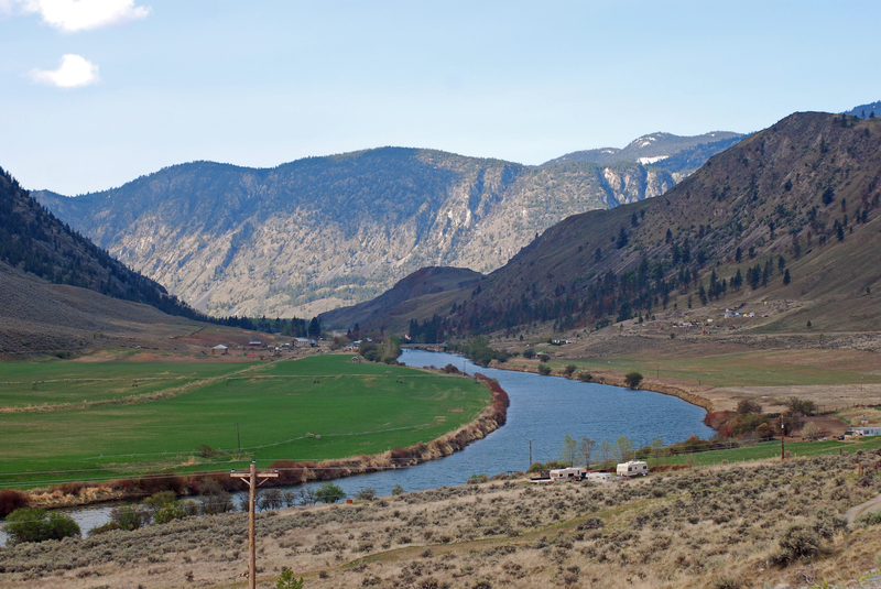
Known for good whitewater on the Canadian side of the border, the Similkameen carves a more mellow course in Washington State. The first few miles downstream of Palmer Lake are a gentle float through ranch land. Below Nighthawk the gradient picks up and the river soon enters a very scenic section of public land managed by Bureau of Land Management. This section has a few good class II rapids that taper off as you reach Shankers Bend and the slackwater of Enloe Reservoir. The river then cascades over Enloe Dam and the dramatic Coyote Falls (aka Similkameen Falls), at one time used for power production, before continuing on it's course through a gorge with class III rapids. The action tapers off at you get to the town of Oroville with the river continuing down to the confluence with the Okanogan River.
Enloe Dam was part of a hydropower project that generated electricity up until 1958. Although the local PUD has made various attempts to resurrect the project over the years, the economics are poor and the site offers very limited capacity for hydropower production. The dam has long been a candidate for removal. Removing the dam would open up a very scenic 9-mile whitewater run from Similkameen Recreation Site, through Shankers Bend, and through the lower canyon below the dam with a likely portage at Coyote Falls.
Logistics: The put-in is up at Palmer Lake where access is available from a DNR site and the run starts out with a short stretch on Palmer Creek. An intermediate access point at Similkameen Recreation Site can be used as a take-out for those who want to focus on the mellow section or a put-in for others who want to concentrate on the more challenging section. It is worth checking out Coyote Falls (aka Similkameen Falls) just below Enloe Dam as the focus of the Similkameen River Trail, which will become part of the 1,200-mile Pacific Northwest National Scenic Trail. You can put in here to continue a run through the very scenic lower gorge down to
...
Good access at a DNR-managed campground on Palmer Lake with easy beach access. Starting from this point requires a short paddle across the lake to the outlet of Palmer Creek that soon joins the Similkameen River. Located 17.0 miles driving distance from Oroville.
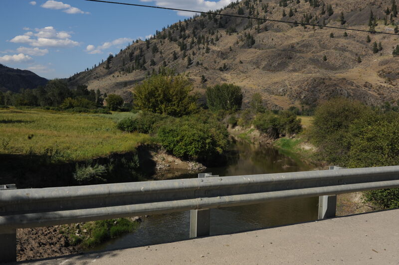
Potential access point if you want to avoid the paddle across a short section of the lake but the banks are steep and access is not great. Located 16.0 miles driving distance from Oroville and 0.3 miles down Chopaka Road to the bridge.
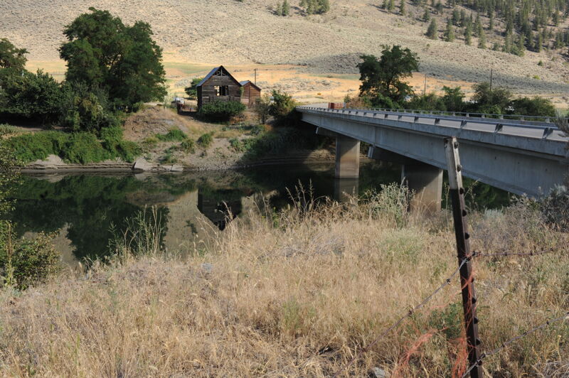
Access administed by WDFW just upstream of the Nighthawk Bridge. Most of the land in this area is privately owned but WDFW has this small parcel providing river access.
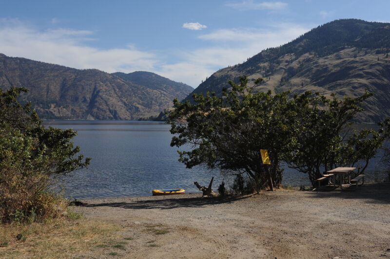
Access point at a Bureau of Land Managment Recreation Site that is open for camping. Easy access suitable for rafts. Located 8.3 miles driving distance from Oroville.
Access point at a Bureau of Land Managment Recreation Site that is open for camping. Located 6.4 miles driving distance from Oroville at USGS river mile 11.3.
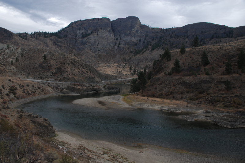
Scenice stretch of the canyon previously considered as a site for a high dam. Located at USGS river mile 10.4 just before the Enloe Reservoir.
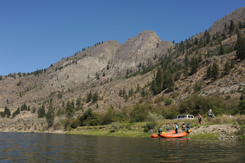
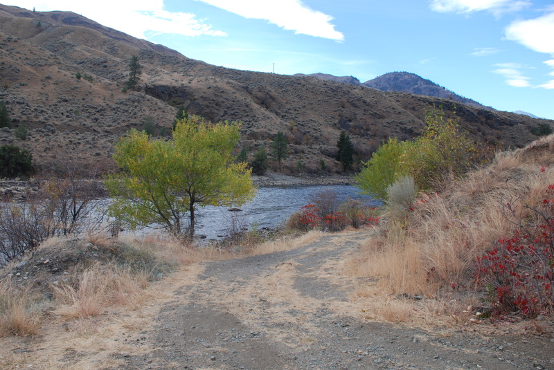
A good access point suitable for rafts is available at the upstream end of the reservoir. A high-clearance vehicle is helpful to get to this access point adjacent to the reservoir as the road is deeply rutted. It is also possible to carry smaller boats up the road to the highway. Access is located 5.0 miles driving distance from Oroville where a dirt road turns off the highway.
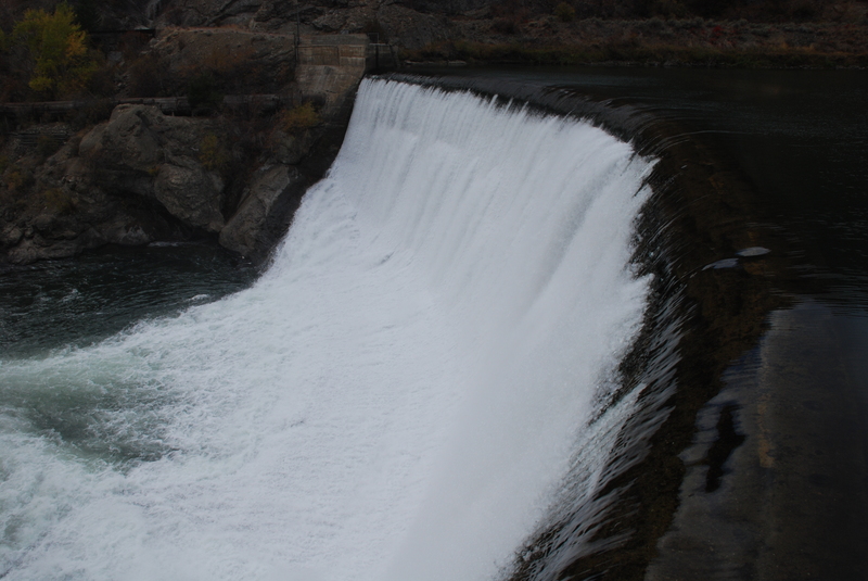
The Enloe Dam was completed in 1920. It is 54 feet with a crest length of about 290 feet. The dam was named after the president of the Okanogan Valley Power Company, Eugene Enloe. Enloe Dam Road which, a steep unimproved dirt road that leads down to the dam turns off the highway 3.7 miles driving distance from Oroville. The dam is located at USGS river mile 8.8.
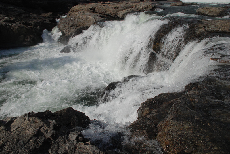
Coyote Falls or Similkameen Falls were also called Squantl or the “Rock Wall” by the Similkameen Bands. The waterfall is immediately downstream of the dam at USGS river mile 8.7.
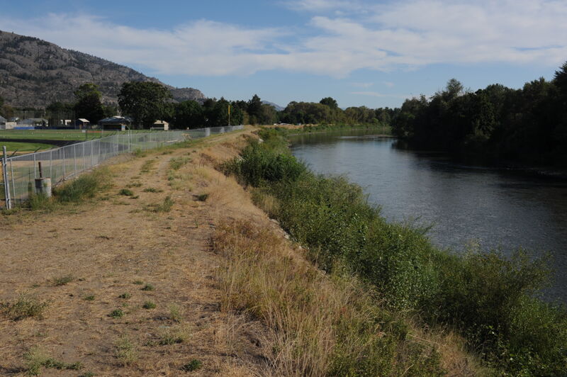
It is possible to take out within the bridge right-of-way on river left behind the middle school. The bank is steep and access is not great but it is possible.
Aug 16, 2022
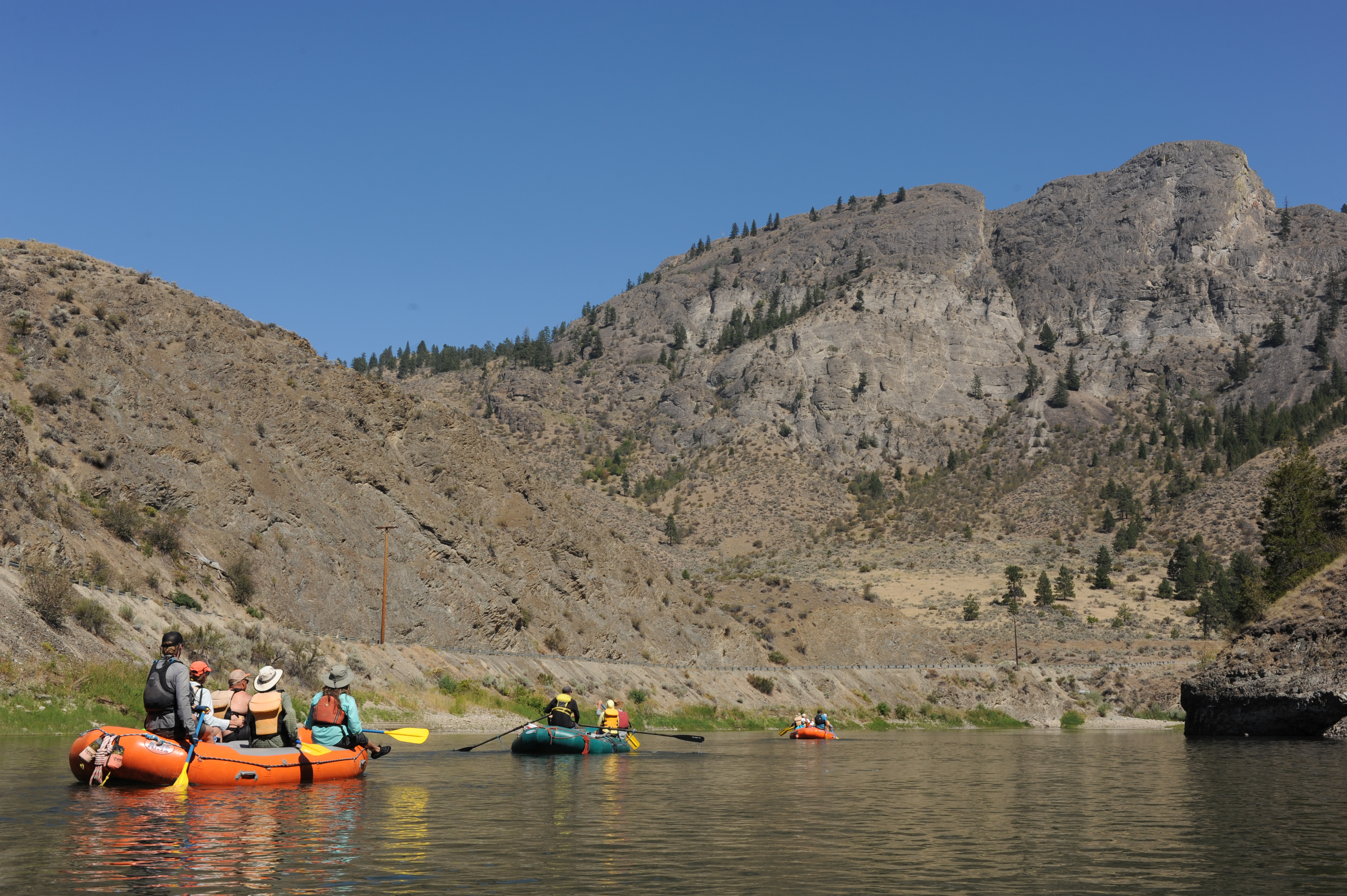
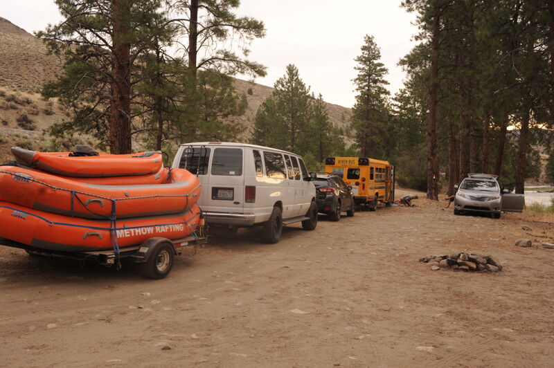
It was below the optimal flow but possible to get down in lightly loaded rafts. We boated from Similkameen Recreation site, through Shankers Bend, finishing at the Enloe Reservoir. This was a trip with local, regional, and state leaders to experience the river and gain a better understanding of the restoration potential of removing Enloe Dam.
Jan 30, 2022
Site visit to Enloe Dam with Aboriginal Outfitters on a cold winter dam.