Clackamas, North Fork
to North Fork Reservoir

| Difficulty | IV(V) |
| Length | 3.9 mi |
| Avg Gradient | 200 fpm |
| Gauge | Fish Creek Near Three Lynx, or |
| Flow Rate as of 56 minutes | 3.87 ftbelow recommended |
| Reach Info Last Updated | January 12, 2023 |
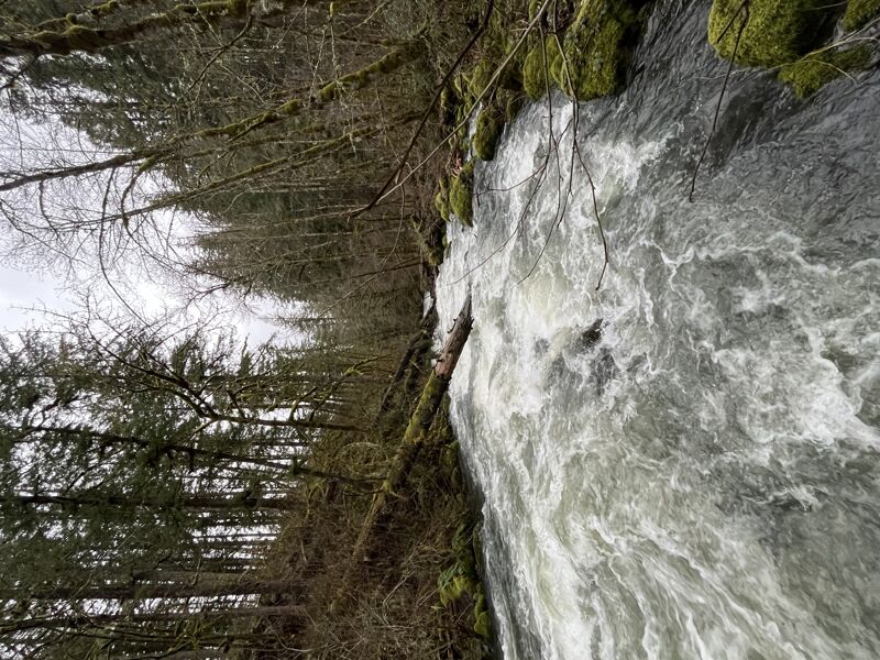
The NF Clack starts as a tiny river with some small rapids and gets progressively harder as boaters work their way down the river giving everyone a chance to get warmed up. The river is tiny throughout the run but most of the major rapids have a couple options. The first significant drop is an obvious horizon line on a sharp left turn. There is a second more difficult ledge just downstream so be sure to scout carefully. This rapid will give you a general idea of what to expect throughout the day. If you don't like this drop, seriously consider hiking out on the left on an old roadbed as it only gets harder downstream and exit access gets more difficult.
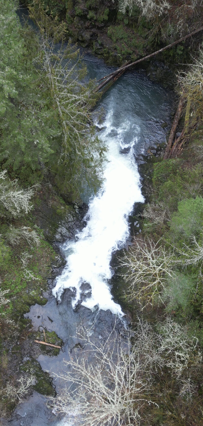
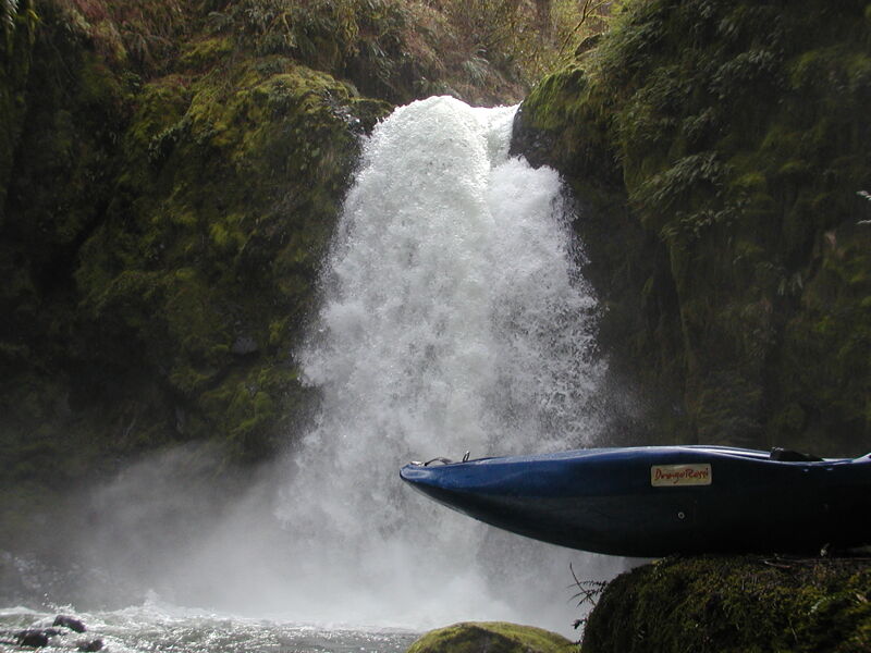
After about a mile and a half and a nice section of continuous rapids, be on the lookout for a gradual easing of the gradient after a sharp right turn. After this short break the river starts to enter some shallow bedrock slides on a gradual left bend. These slides end in a 10' waterfall which is shortly followed by a 45ft. unrunnable waterfall. Look for a faint trail on the left before the slides to portage both waterfalls or scout the first and then portage the second waterfall on the left up into the forest and down a steep gully which ends at the base of the waterfall.
The portage trail takes you high above the river before heading back down and downstream. The best way back down to the river is down a steep trail about 25 yards downstream of a steep creek coming in on the right side of the river. This puts you directly above a sweet 20-ft. waterfall, Stairway to Heaven. Needless to say, this section needs to be scouted carefully or go with someone who knows the river the first time.
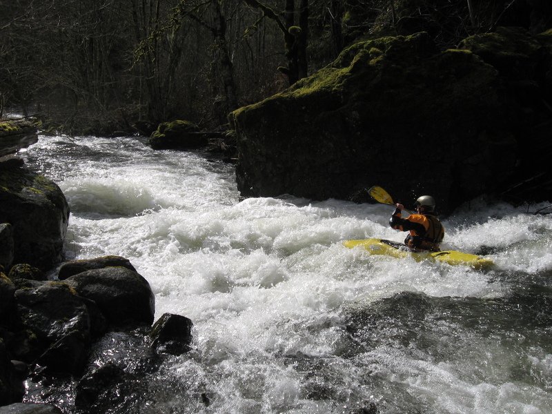
Stairway to Heaven is a wild ride through a big hole at the bottom. It is fairly easy to put-in at the base of the waterfall to set safety or to portage.
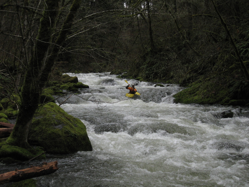
Below this waterfall the steep gradient continues but the rapids generally consist of boulder gardens rather than ledges and can have more wood and pin sp
...Put in at the end of the old road where it reaches the river.
Park at the head of the old spur road going off to the left approximately 3 miles from the highway. Follow this road down to where it bends to the right and then meets the river at a small pool just above a small rapid with a boulder in the middle of the creek.
Recognizing and having a plan for the portage around this waterfall can be the crux of the run. Portage on the old road/trail about 50m above the first 10-15' waterfall or run the first waterfall and portage the main waterfall on the left. Bring rope and watch the exposure if you choose the second route.
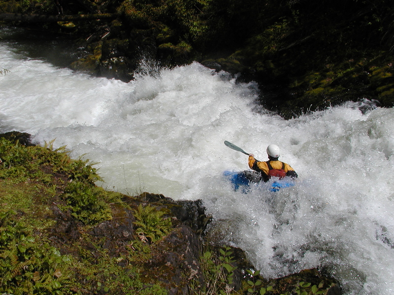
There are two possible lines depending on flow. At lower flows, boaters often boof the small ledge on the left and then follow the current back to the middle to run the bottom ledge. At higher flows it is possible to take a more direct line starting middle-right at the top.
Parking is available on the side of the highway by the usually locked gate.
Jun 23, 2025
Feb 18, 2025
I hiked up the trail from the take out Feb 18, there were a couple logs just before the reservoir, and Storm Drain was woody as were the next hundred yards. I would have boated the left channel at Storm Drain if I had been paddling to avoid some of the wood.
The Eagle Creek gauge was at 1.8' and fish creek was at 6'. The NF was at a fast paced medium flow, eddies were not abundant.
Feb 18, 2024
NF said 69cfs and 3 lynx was at around 2k. I hiked in to peak at it with a drone.