| Difficulty | IV+ |
| Length | 2.6 mi |
| Avg Gradient | 91 fpm |
| Reach Info Last Updated | January 18, 2026 |
River Description
This creek needs heavy rain and a solid groundwater table to be runnable. It is also unremarkable and would only be interesting to most if it were not just in the neighborhood of some of the best whitewater in the PNW. Most of the land is private.
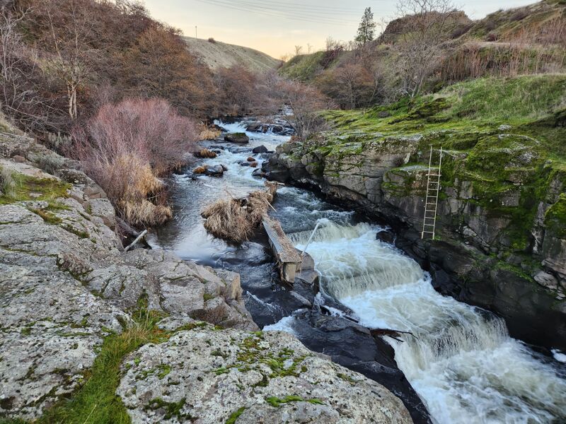
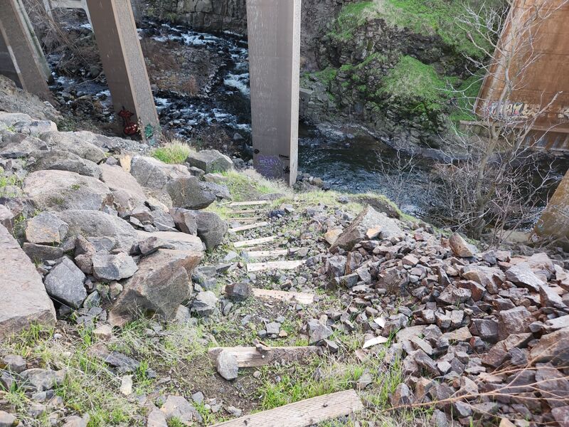
The creek starts with some small whitewater that are likely bumpy. After the confluence with Eightmile Creek the flows increase and be wary of wood but the creek has little to offer. Then as you approach the interstate and the powerlines the whitewater returns. Most are basalt rock drops but be warry of trees if you have not run it recently. There is a good 5-7 foot drop and Cushing Falls just a few hundred yards above the takeout. This is a waterfall ledge on river right and a sketchy fish ladder on the main flow. From here there is a tight gorge with a few more smaller rapids and then a takeout just under the interstate bridge with a staircase on river right.
Shuttle: Takeout at the Dalles Dam Viewpoint and hike out on the access trail. Put in at Petersburg up the hill.
River Features
Put In
Access PointDistance: 0 mi
Trip Reports
Log in to add a report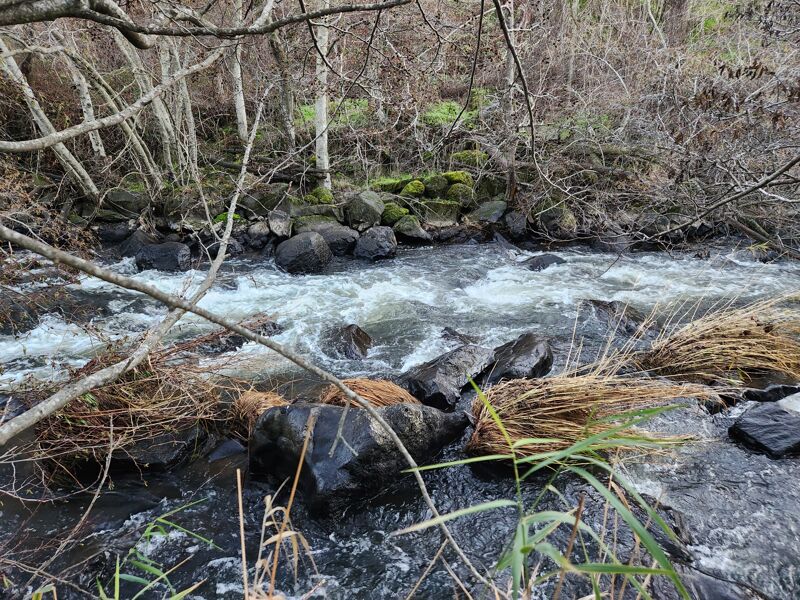
WR
Cushing Falls and Fish Ladder - Will Reeves
Jan 18, 2026
The largest and most dangerous drop on the creek
WR
Cushing Falls and Fish Ladder - Will Reeves
Jan 18, 2026
These are the largest and probably most dangerous drops
PT
P T
Apr 20, 2024
I paddled this on 4/10, about a week after all the rivers spiked.
Flow: Was low, the moves felt very slowed down, but way less bumping over rocks than I expected from the put-in. The boniest spots were the rapid under the takeout bridge and the first half mile. So if the put-in and take-out look okay, the rest of the run should have enough water.
Whitewater: A couple drops right at the start of the run that are probably exciting at some level, but for my lap were too bumpy and grindy to enjoy much. About half a mile in, Eightmile Creek joined, and the flow felt a lot more reasonable. No other rapids stood out until the last mile-ish, where the drops got steeper and more channelized. Most were read-and-run, but I scouted a couple spots that looked questionable, and was glad I did. The first was a two-tiered drop, maybe 7' total, that I was happy to get eyes on and plan a line. The second was a sequence that started friendly enough, but led right into a dam hidden around a left-hand bend with a fish ladder on the left and a diagonal ledge drop into a rocky landing on the right. Both sides looked runnable by somebody, but I wasn't tempted. At my flow, there was time to eddy out between the lead-in and the dam, but I was glad to know it was coming.
Wood: Two big logs right away, one fifty feet from the put-in, the other a hundred yards after the first. A spot maybe a mile in where logjams reach out from both banks, with a narrow but reasonable line between them. A large tree limb blocking the entrance to the fish ladder.