Trip Reports
Log in to add a reportRM
Randy Mckinney
Mar 2, 2021
I would suggest 4.5 or better on the upstream gage or 1 or higher on the painted on gage on the old trestle at the put in.
RM
Randy Mckinney
Apr 6, 2020
Ran it 3/28/20 at 3.86 ft on US 221 guage. It was pretty fun but I'd say that was Probably bare minimum. Ran it back in nov/December at 4.6 on the US 221 guage and it was pretty good.
https://water.weather.gov/ahps2/hydrograph.php?gage=nfkn7&wfo=gsp
DF
Daniel Frye
Jun 25, 2019
Wasn't real sure about this run, being that not much information has been recorded about it. When we ran this,Catawba from: 1. ROUTE 1234 BRIDGE TO US ROUTE 221 BRIDGE was running @ 354 cfs. This being so close is a good gauge for the amount of water running in this section. When we put in, my first thought was this is going to be a lazy day on the river. However, to my surprise it was rock garden after rock garden just about the entire ride. I will say, at this flow rate it is definitely a place for intermediates to hone their skills on reading the water. If the water was above 600 cfs on the Catawba in Old Fort it would turn into a much more adrenaline filled ride. I will go back at higher levels!
FG
Frank Garrett
Jul 26, 2005
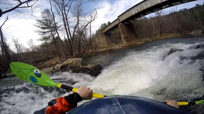
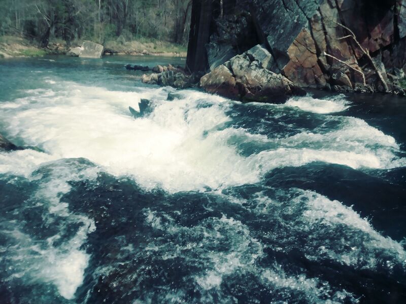
There is a boulder garden below the git-in that has a nice little class II drop into a reactionary on the left. The first RR tresle is visible as you approach a large island. Get out and scout the rapid under the bridge. The line is right down the middle, just follow the tounge. The next rapid that needs to be scouted forms a horizon line. There is a nice slide with a couple of ledges right below it. Best run on the right just left of the top hole. Below this there is a lot of flat water. Allow about 3 1/2 hours.
RT
Rusty Tylenda
Apr 2, 2005
Ran this today after about an inch of rain in the area. Had a foot on the old spray painted guage , which needs replacing. This is a good run for low intermediates looking to step up there water reading skills.It reminds me some of the U. Chattahoocee and it's good alternative to the Natahala or Upper Green. But probably a tad easier than either. It has two low class III rapids. The first is manky with a difficult scout if you find yourself in the steep walled eddy on river right just above the drop. You'll know it when you get there. The second is a nice granite slide with holes, best run on the right. Other than that there is an abundance of class II drops, some not being user friendly. A Big undercut wall and plenty of trees come to mind. A few good play waves and holes are sprinkled throuout, one of which i can't wait to hit at higher water. Then there's the obligatory rope swing and cliff jump.The scenery is trashed after the first couple of miles thanks to abundant loggin and mining. Suprisingly the water stays pretty clear. Oh and the old Gauge readings are wrong. Zero is a bare minimun, 1 foot good, 2 ft better and 3 ft high.
RM
Randy Mckinney
Jan 1, 1900
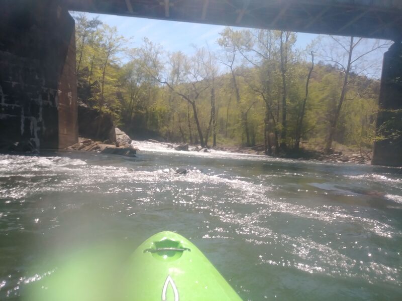
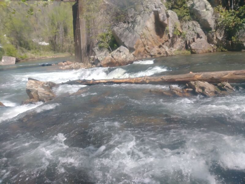
New tree in the trestle drop.
RM
Randy Mckinney
Jan 1, 1900
3.86 ft on US221 guage.
RM
Randy Mckinney
Jan 1, 1900
New tree in trestle drop
RM
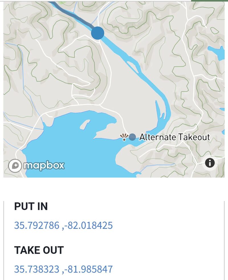
Randy Mckinney
Jan 1, 1900
Photos of Alternate Takeout
RM
Randy Mckinney
Jan 1, 1900
Photos of Alternate Takeout

RM
Randy Mckinney
Jan 1, 1900
Photos of Alternate Takeout

RM
Randy Mckinney
Jan 1, 1900
Photos of Alternate Takeout