Cane Creek
Rooks Rd. to Bee Rock (6 miles)

| Difficulty | IV |
| Length | 6.2 mi |
| Avg Gradient | 40 fpm |
| Gauge | Lynn Camp Creek at Corbin, Ky |
| Flow Rate as of 41 minutes | 12 cfsbelow recommended |
| Reach Info Last Updated | May 8, 2011 |
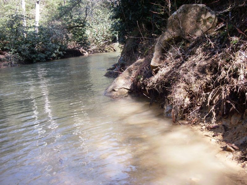
Cane Creek flows through the Cane Creek Wildlife Management Area as it makes it's way into the Rockcastle River one mile above Bee Rock in Laurel County. The 20 mi. sq. drainage area is largely undisturbed, the scenery is top-notch and the water quality seems to be thoroughly decent. The first three miles average about 25 fpm, with the last two miles averaging 60 fpm and containing all the good rapids. The final mile out on the Rockcastle is mostly flat, but has the potential to be big water. The rapids are pool / drop with undercuts and some sieves. Most of the rapids are in the class III spectrum with two or three class IVs. The streambed is tight, the eddies can be small, and wood is always a concern. Autofeed and Go Right both have notable hazards to be aware of.
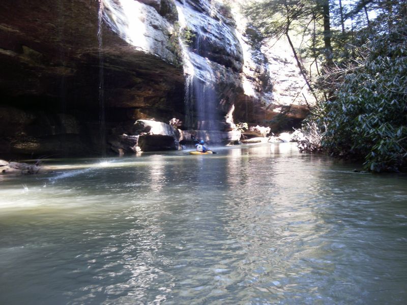
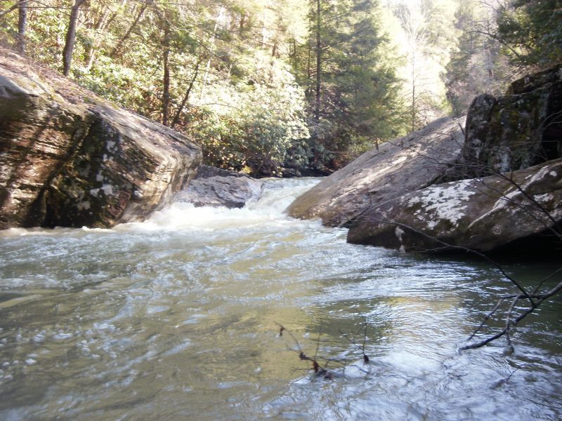
The beginning section winds through old growth hemlocks in a sandstone micro-canyon. Frequently, waterfalls cascade off landing directly in the creek. Be on the lookout for a footbridge over the creek. This is where the Sheltowee Trace hiking trail crosses and it signifies the beginning of the goods. Over the next mile several class III rapids work through a series of increasing sized boulders. This set finishes with a three part rapid to the right of a house sized block and then a brief interlude before the crux series.
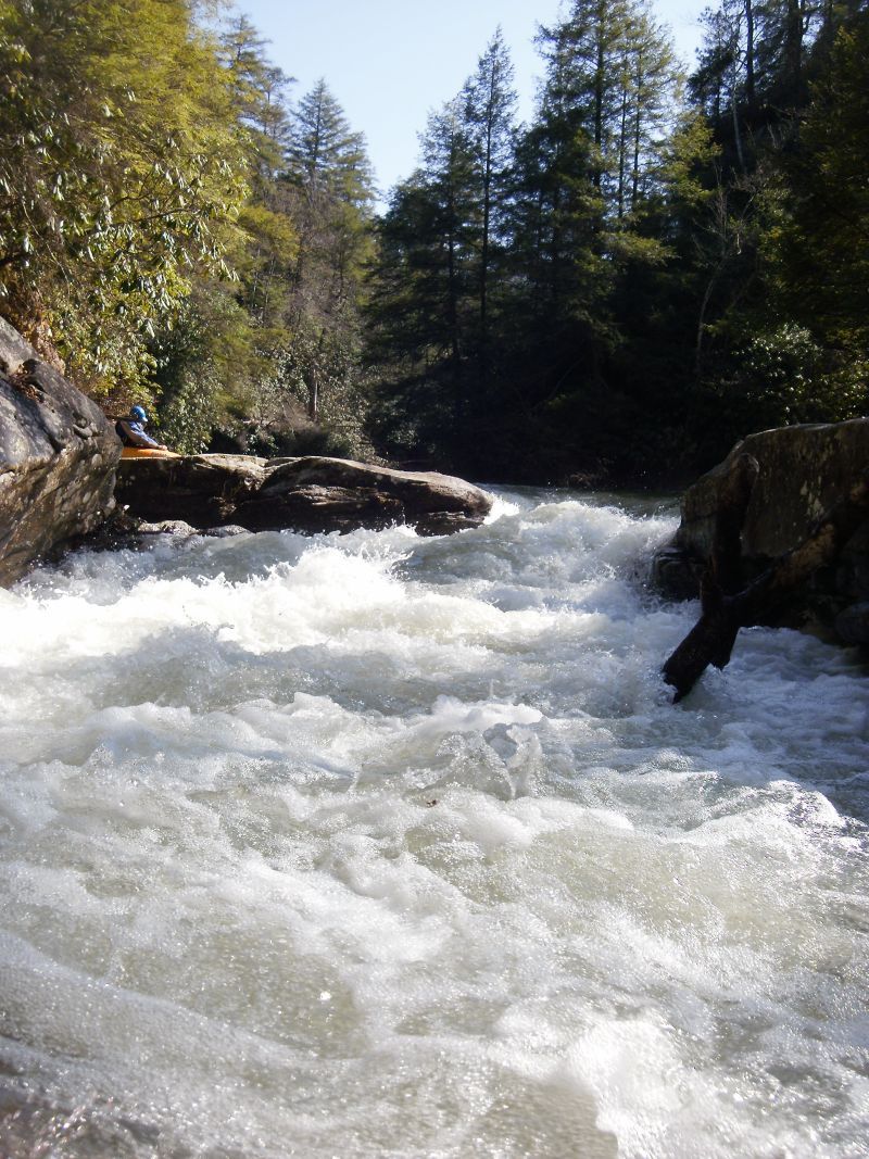
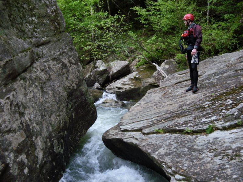
Autofeed is up next and is kind of hard to scout and has a notable pinning hazard on the left in the final drop. Eddy hop down the right over a few ledges toward a giant boulder with a sieve in front of it, then drive to the center eddy where you can ferry over to the left to scout the final drop. Here the creek pours into a box-type drop of about 4’ with most of the flow pushing into an ugly looking undercut on the left. Drive left to right with a good boof stroke at the lip to carry you away from the junk.
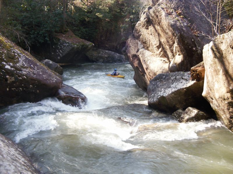
The next rapid, Go Right, comes up quickly and has a large sieve /
...
The put in is at the end of Rooks Rd. Park on the left before the road enters the water.
The first couple of miles are mostly flat, but the scenery makes up for it.
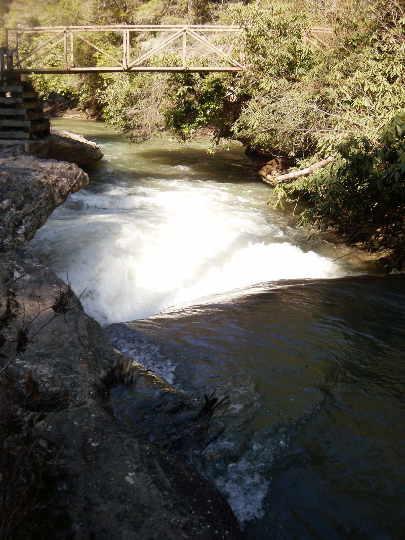
When you see the foot bridge across the creek you will know you have arrived at the Bridge Rapid. Punch the hole at the bottom of this sliding drop. Scout on the left.
The hiking trail also provides access to highway 192 which lies 2 miles to the south. It is possible to put in here but the carry in probably takes longer than paddling.
Just below the Bridge Rapid comes this little drop. Wood often collects here, so have a little look before you run it.
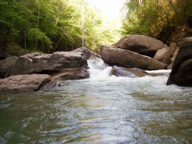
After 0.5 miles of boogie and a flume style rapid you come to this drop. Angle left here and boof away from the undercut on the right. Follow this up by working right of a large boulder and then through a narrow chute.
Autofeed is identified by a hozizon line with wood on the left, and has a large square boulder sitting on the right bank mid-way through the rapid. Work your way down the right side into one of the small eddies in front of the big boulder. From here, ferry to the left to get a visual on the final and crux move. Drive left to right across the lip of the drop, taking a well timed boof stroke to pull you away from the apparent undercut. The move is not that hard but the consequences are real. Scout where you can and portage on the right.
Just after Autofeed be on the lookout for a good place to get out and have a look at Go Right! The move here is to cut right as soon as possible into a side channel that goes around the right side of a large mid-stream boulder, bypassing a sieve.
The last rapid on Cane Creek. This one drops about 8-10 feet through some boulders, requiring a move to the right part-way down to avoid contact.
This one can be hard to catch because as the Rockcastle River rises it backs up into the mouth of Cane Creek inundating this drop. When the Rockcastle is running over 10,000 this rapid is covered by flat water and one could paddle over top of it and never know it was there.
Mar 15, 2011
This is the final drop of Autofeed, the pinning hazard is visible just left of center.