Roaring Paunch
742 to Barthell (5.4 miles)(The Upper Paunch)
| Difficulty | IV |
| Length | 5.9 mi |
| Avg Gradient | 35 fpm |
| Gauge | South Fork Cumberland River Near Stearns, Ky |
| Reach Info Last Updated | May 7, 2011 |
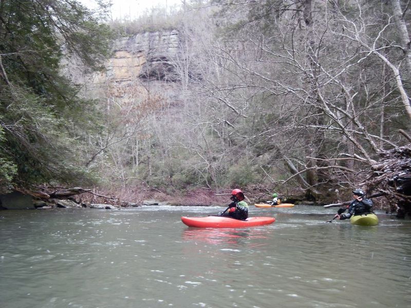
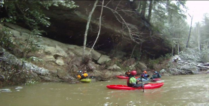
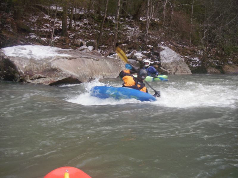
The upper paunch isn't exactly a destination run, but it does have a few nice rapids, some good boogie water and pleasant scenery. Typical to the area, it has several undercuts and sieves in the streambed, one of which is normally a portage. The class IV on this run is brief and not terribly difficult, but there are a few spots to watch out for. Most of this stretch is heavily forested and there are many nice cliffs. Toward the end of the run the O&W Scenic Railway parallels the creek as you float through the Barthell Mining Museum. Shortly below Barthell there will be a nice rapid with surfing waves and cables that go across the river. Take out just past the cables on the left and walk up to the road.
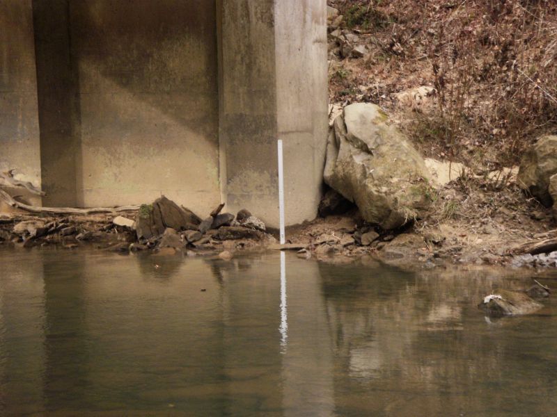
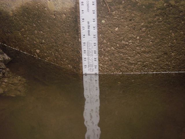
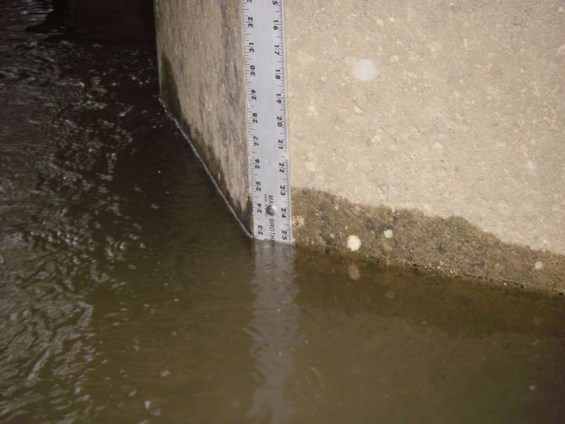
Look for around 1” of rain. Maybe less when the ground is wet. The drainage area is about 40 sq.mi., so it holds for a few days after big rain. There is a paddlers gauge on the downstream face of the river left bridge pier. Something over 12” is a low level, with 22” being a nice busy medium level. Not sure what the upper limit is. Watch out for the hole at Squeaker at high water.
Directions:
Follow 742 out of Stearns toward Blue Heron in the BSF National Park. A few miles out of town the road will wind down a hill and cross the Roaring Paunch Creek at a concrete bridge. This is the put-in and the location of the gauge. To find the take-out, continue on 742 another 4.5 miles into the park and then down the hill. At the bottom of the grade you will see a road that turns right to the Barthell mining museum, park at this intersection. Parking is limited at the put-in and the take-out but there are many parking spaces on the side of the road past the take-out.
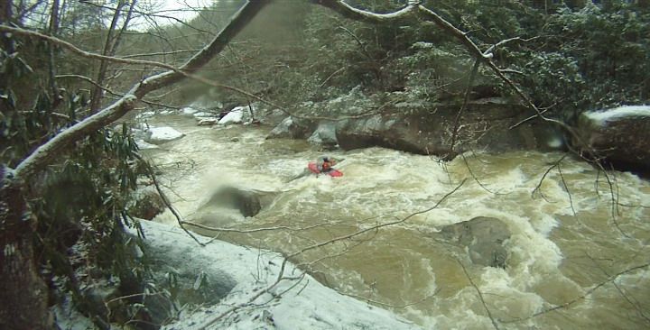
After a mile of flat water you will notice a tributary and a campsite on the left. From here the next mile is mostly II/III with a few small pools between.
The camp series ends with this noticable rock shelter on the left. This signifies that the portage and the good rapids will be coming up in 0.4 miles.
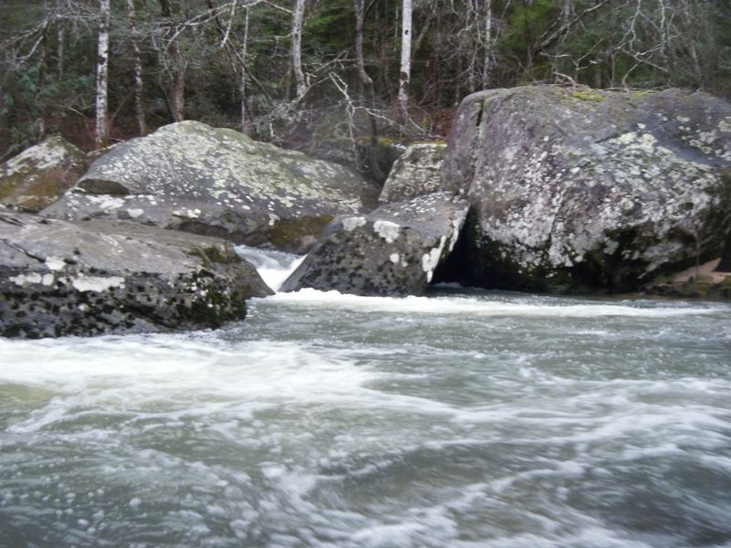
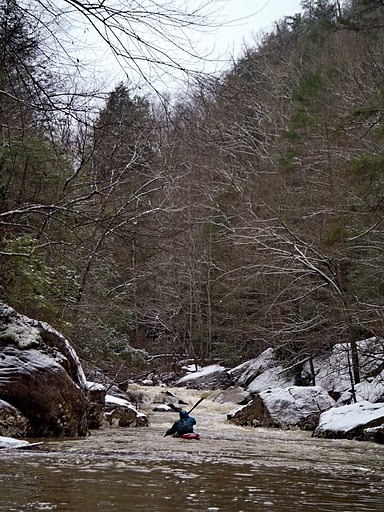
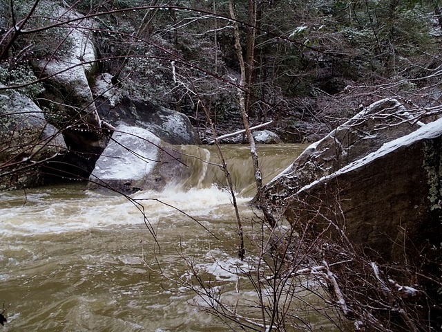
This is the first noticeable horizon line on the run and indicates the beginning of the steepest mile. This comes up shortly after a tributary on the right where the creek turns west. At low water, this is a riverwide rocky blockage with three boat-sized sieves and wood. At higher water (20'+) it could probably be run, but I still wouldn't call it a runnable rapid. It's pretty easy to see this one coming if you are paying attention and there are multiple eddies to get out in. Scout and portage on the left.
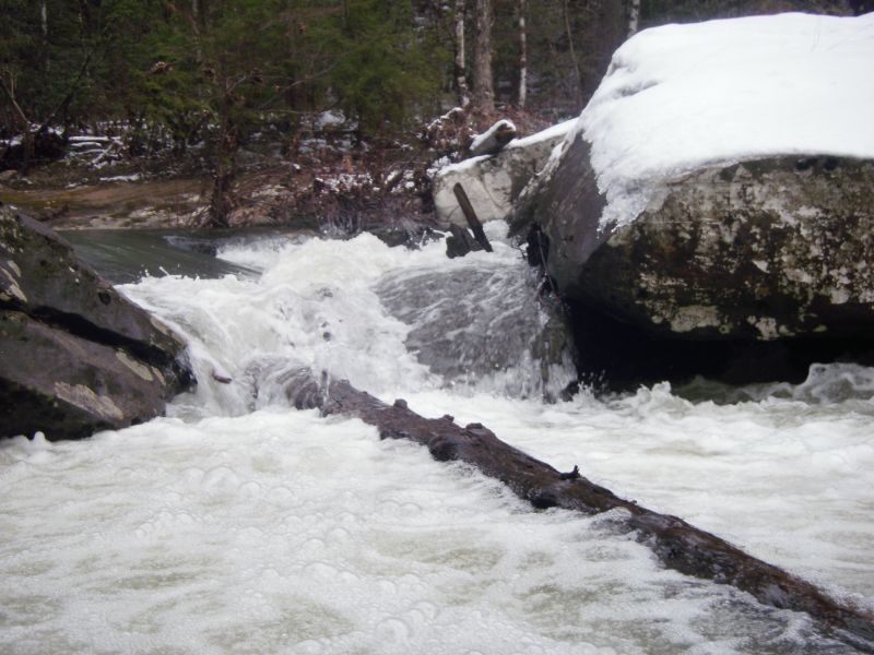
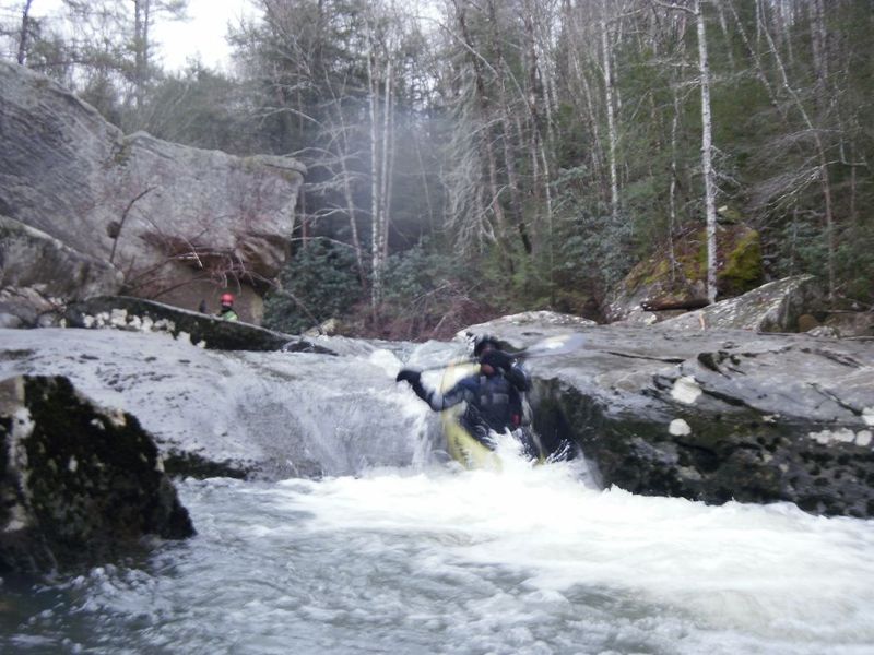
Once around the portage, there is a brief stretch of boogie leading into Squeaker. This 6 foot ledge drop forms a strong, chundersome hydraulic, particularly on the right side. The right side is also backed up by a nasty looking undercut and sieve combo. Left of center is where you want to be on this one. Don't forget to boof. At 12' this drop is in the III+ range while at 22' this is a very solid IV. Set safety on the left below the drop.
Pauncharelli is the next little horizon line below Squeaker. Go right here. The left side is a little obstructed.
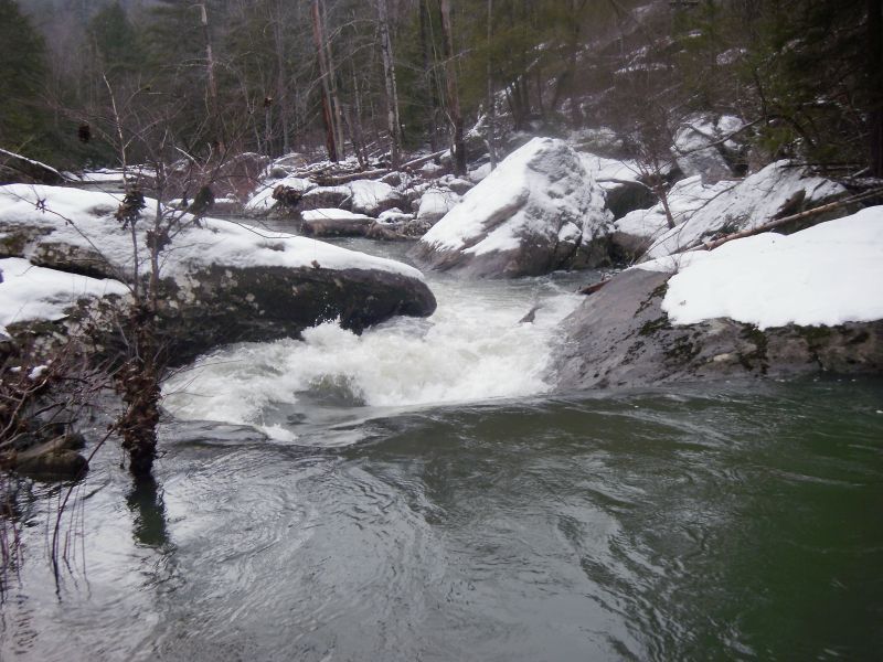
The Donkeypaunch is a high quality rapid. Some busy entrance features lead into a rocky chute that can be approached from the left or the right where you then boof into the chute and boogie on down.
Following Donkeypaunch, some fun boogie will lead you to the mining camp where the creek passes under a bridge. Just a short ways downstream of the bridge you will see a set of cables crossing the creek with some surfing waves underneath. Takeout here on the left and follow the path of least resistance up to the road. This is also the putin for the Lower Paunch.
Mar 18, 2011
This fills in with more water, but the right line is the better choice here.