Caesar Creek, Flat Fork
Oregonia Road to Flat Fork Boat Ramp
April 23, 2011
| Reporter | Ron Metzger |
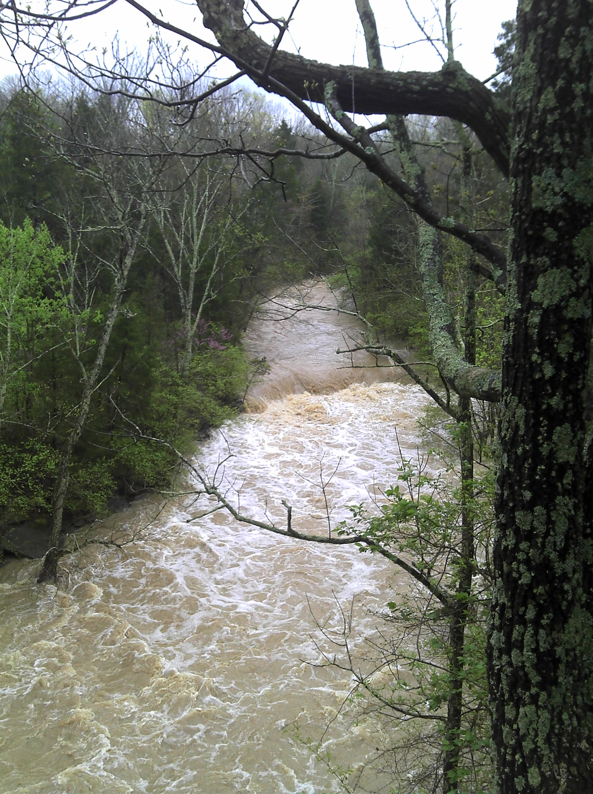
A rough gauge we use is by looking over the down stream side of the bridge from Oregonia road. You'll see a small mound of dirt in the stream near the river left side; if the ground is just showing over the top of the water its near its minimum runnable level. Its pretty good with the water covering the dirt by a couple of inches (you can still see the plants growing on it to help determine depth). You can also look at the river right bank just below the bridge - if the water is level with the grassy flat area its really pumping. At about a foot below where the back drops off is its its min levels. (yes I know - I need to build a real gauge sometime)
There are often trees down across the section above horseshoe falls (as its a very narrow stream bed) so keep an eye out as you run down. There are usually small shoreline eddies to grab at the last minute if you run into anything around the semi-blind corners. At medium flows there are a couple of small playable waves above the falls but its mostly creeky. The falls are best run on the left dropping into the eddy but can also usually be run on the left center flake as its landing in water moving downstream (be careful of this at higher flows though as it recirculates pretty heavy just right of this spot). Its a fairly shallow landing but I've never hit bottom (even with a missed boof from time to time) and is friendlier than it looks on most occasions. The run out into the lake is continuous and partially in the trees but I've never run across a river wide strainer in this section. On really high flow days a great surf wave forms as the water enters the lake but the run is very hairy to get there. The last section just above horseshoe falls to the lake has a river right trail alongside so this section can easily be run multiple times with a short carry (maybe a 1/4 mile).
The land along the river is all Army Corp property and I've never had any access issues but please park on the downstream side of the road as I think its private property on the upstream side.
Its a fun little run (and I've never seen anyone else on it over the past 4 years) and worth a quick paddle if you're in the area and its running. At lower flows its a class 2-3 at best with the strainer potential being the most danger in the run. At high flows the strainers can become more serious as the pace picks up and the falls get quite meaty. A shorter takeout paddle can be had by parking at the fossil collecting area and carrying back up from the mouth of the cove you come out in (left side - gravel landing). Otherwise its a couple mile paddle to the Wellman launch ramp.
Oh - the lake has buried a ten foot waterfall that used to be on this run. Old images of the area pre-dam shows a beautiful creek with some fun looking drops as it connects to the now flooded Caesar creek.