Caesar Creek, Flat Fork

Oregonia Road to Flat Fork Boat Ramp

Reach banner
DifficultyII-III
Length1.4 mi
Avg Gradient100 fpm
Reach Info Last UpdatedJune 17, 2012

River Description

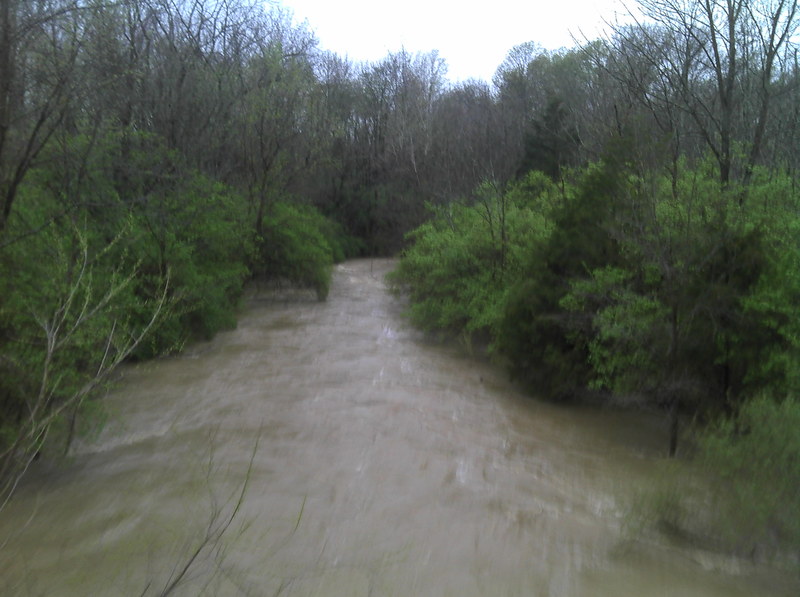
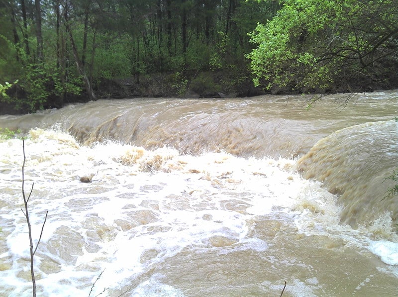
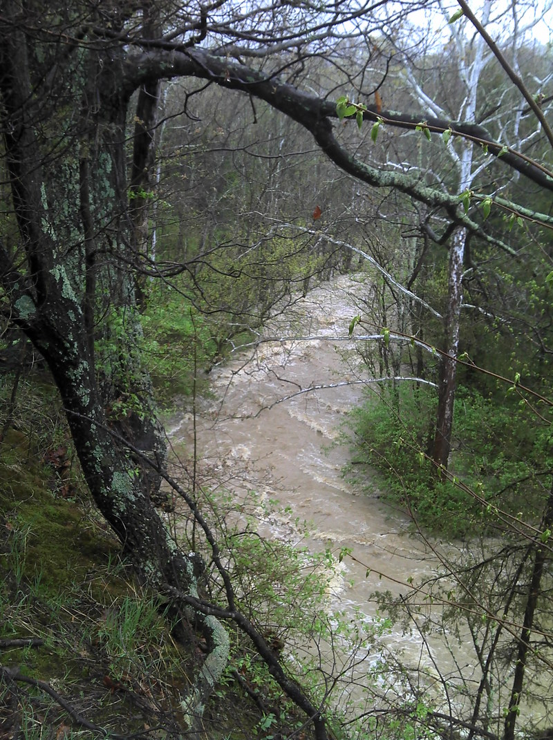
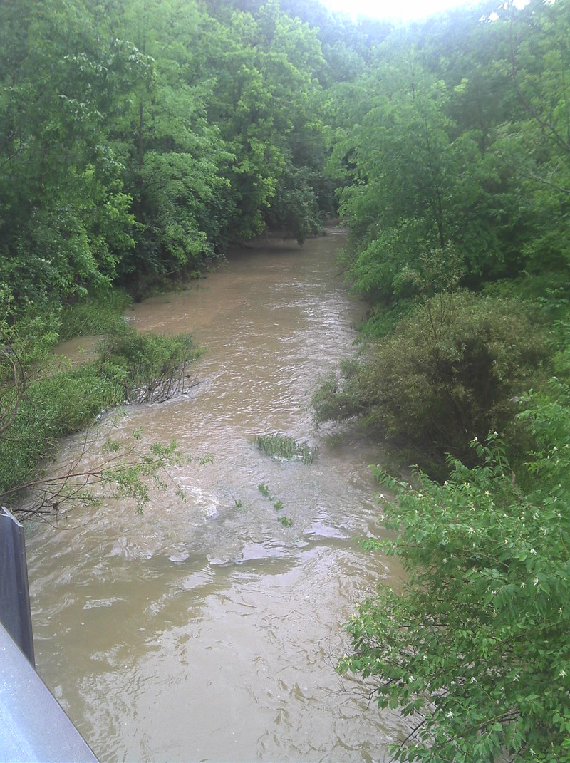
This short creek runs to Caesar Creek Lake. The gradient is deceiving since it drops about 50 feet in the half mile. Most of this is over tilted riverbed with flat shale. The main attraction is Horseshoe Falls. This small waterfall is the scenic attraction for Caesar Creek hiking trails and is often photographed. The drop is fairly simple with multiple lines. The Flat Fork of Caesar Creek takes a big storm to get enough water to run. I've seen it go from boatable, to huge, to scrapy, and then unrunnably low in about 24 hours. Overall this is probably a draw only for local boaters and it can easily be combined with Caesar Creek Gorge. If the Flat Fork is running then the Army Corps will probably be holding water back on Caesar Creek. Be watchful for strainers.

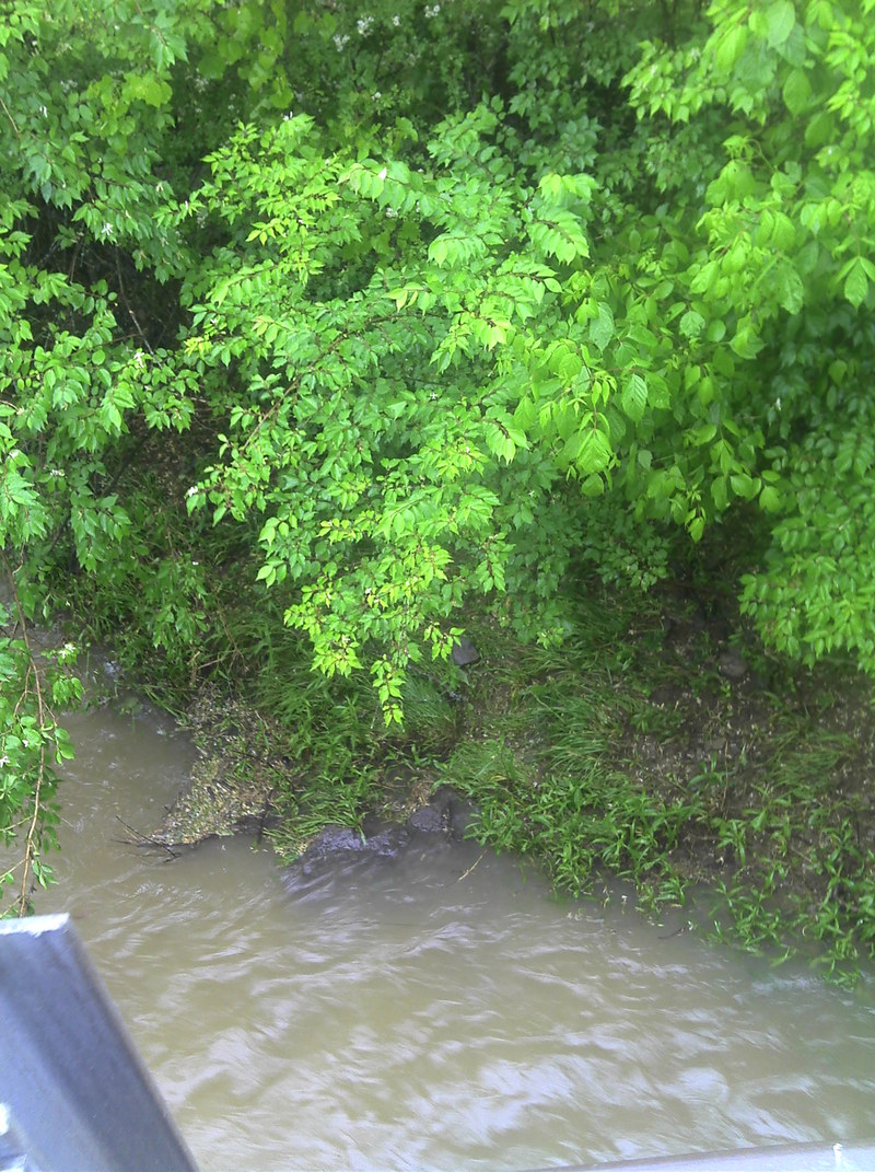
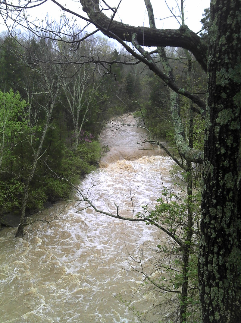
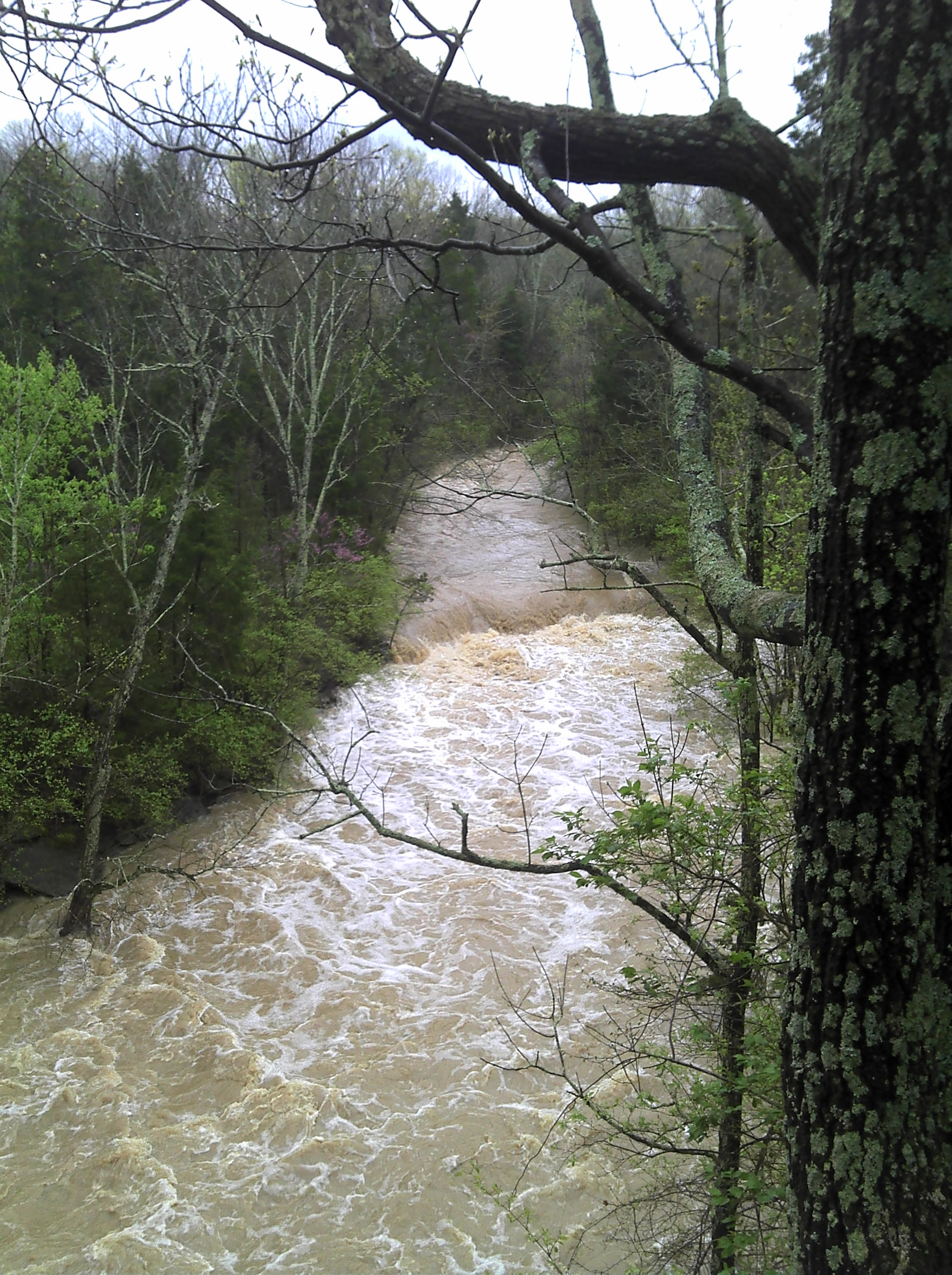
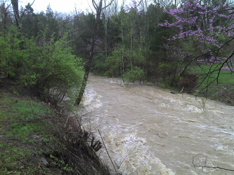
I ran this after about 2 inches of local rain. The river was bank-full in low flood. The water is brown but does not smell. There were no river wide strainers. Be careful, however, since there are trees in the river. Once you get on, the flow is fast and there are a few good wave trains. The stream picks up speed and hits a few easy class II rapids. However, your skills should actually rank solid Class III or higher, because if you swim you are not getting your stuff back till the falls or the lake. Pay very close attention to the cliff walls. Once the massive shale cliff appears on the left you are a few hundred yards above the big drop. There is a right of way that crosses where the foot bridge was. I would suggest stopping here. Even if you decide to run Horseshoe Falls you will want to look. It is easier on the left than the right. The falls at high water was crazy scary with a MASSIVE hydraulic. The only line was on the far left. After the falls, the best rapids on the river pick up immediately till the lake. It made me wonder what got buried in the lake. The takeout is on the left. I did it solo and walked the shutt

...

River Features

put in

Distance: 0 mi
put in

Prefalls

Class: II+Distance: 0.39 mi
Hazard
Prefalls

Watch for this site.  It is the last stop to stop before the falls.  At high flows it could be the last eddie you see. You can also hike out here.

Horseshoe Falls

Class: IIIDistance: 0.4 mi (approx.)
Waterfall / Large Drop
Horseshoe Falls

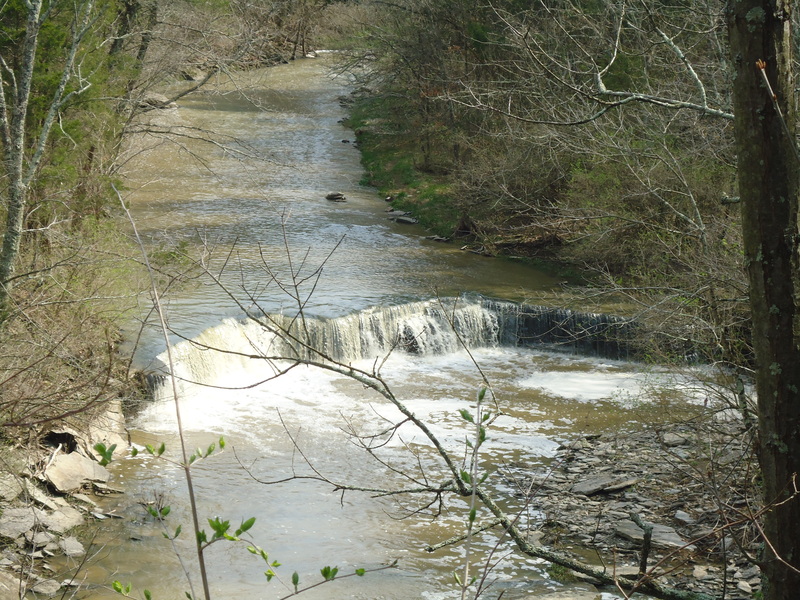
Horseshoe Falls is the centerpiece drop for this creek. It is a fairly straightforward ledge.

High flow

Class: IV+Distance: 0.4 mi
Hazard
Waterfall / Large Drop
High flow

Massive

The LAKE

Distance: 0.5 mi (approx.)
Take Out
The LAKE

You have to paddle across a bit of Caesar Creek Lake.


WR
Will Reeves

Apr 11, 2015


I just ran the creek with the new low lake level.
It adds about 2 small but fun rapids.
You can see the footage near the end of my video here
https://www.youtube.com/watch?v=mvYLq1CVfh8&feature=youtu.be

KG
Keith Gillis

Apr 8, 2015


The lake is way down for a boat dock construction project. Where your video ends, the old stream bed continues for quite a ways and is VERY active...We were hiking and everyone said it would be neat to have the kayak out!

SP
Scott Puthoff

Jan 31, 2013


Currently no portages required due to wood, however, there is one spot that is quite tight to avoid the brush. I agree with the assessment of needing Class III skills to run this. Fun little creek!

Here's some video of a higher water run: http://www.youtube.com/watch?v=GaM1Qc9BbyM

WR
Will Reeves

Jun 16, 2012


A video from the top of the falls to the lake is at
http://www.youtube.com/watch?v=jk2UinvCvDY&feature=plcp

WR
Will Reeves

May 26, 2011


Absolute min flow on the guage rock

WR
Will Reeves

May 26, 2011


A view of the Flat Fork at the absolute minimum level

RM
Ron Metzger

Apr 23, 2011


A rough gauge we use is by looking over the down stream side of the bridge from Oregonia road. You'll see a small mound of dirt in the stream near the river left side; if the ground is just showing over the top of the water its near its minimum runnable level. Its pretty good with the water covering the dirt by a couple of inches (you can still see the plants growing on it to help determine depth). You can also look at the river right bank just below the bridge - if the water is level with the grassy flat area its really pumping. At about a foot below where the back drops off is its its min levels. (yes I know - I need to build a real gauge sometime)

There are often trees down across the section above horseshoe falls (as its a very narrow stream bed) so keep an eye out as you run down. There are usually small shoreline eddies to grab at the last minute if you run into anything around the semi-blind corners. At medium flows there are a couple of small playable waves above the falls but its mostly creeky. The falls are best run on the left dropping into the eddy but can also usually be run on the left center flake as its landing in water moving downstream (be careful of this at higher flows though as it recirculates pretty heavy just right of this spot). Its a fairly shallow landing but I've never hit bottom (even with a missed boof from time to time) and is friendlier than it looks on most occasions. The run out into the lake is continuous and partially in the trees but I've never run across a river wide strainer in this section. On really high flow days a great surf wave forms as the water enters the lake but the run is very hairy to get there. The last section just above horseshoe falls to the lake has a river right trail alongside so this section can easily be run multiple times with a short carry (maybe a 1/4 mile).

The land along the river is all Army Corp property and I've never had any access issues but please park on the downstream side of the road as I think its private property on the upstream side.

Its a fun little run (and I've never seen anyone else on it over the past 4 years) and worth a quick paddle if you're in the area and its running. At lower flows its a class 2-3 at best with the strainer potential being the most danger in the run. At high flows the strainers can become more serious as the pace picks up and the falls get quite meaty. A shorter takeout paddle can be had by parking at the fossil collecting area and carrying back up from the mouth of the cove you come out in (left side - gravel landing). Otherwise its a couple mile paddle to the Wellman launch ramp.

Oh - the lake has buried a ten foot waterfall that used to be on this run. Old images of the area pre-dam shows a beautiful creek with some fun looking drops as it connects to the now flooded Caesar creek.

WR
Will Reeves

Apr 21, 2011


The wave train below the falls had some great play spots. There were very few good eddies that were not full of trees.

WR
Will Reeves

Apr 21, 2011


Horseshoe Falls at high water is a bit scary. The line on the far left was best.

WR
Will Reeves

Apr 21, 2011


When you cross this point it is a good time to catch the last eddies for the falls. I did both right and left eddies and the left is better.