Ludlow Creek
SR55 to Horseshoe Road Bend (river right)
| Difficulty | II+(IV) |
| Length | 3.8 mi |
| Avg Gradient | 5 fpm |
| Permit | Depends on who you ask. |
| Gauge | Greenville Creek Near Bradford Oh |
| Flow Rate as of 1 hour | 45 cfsbelow recommended |
| Reach Info Last Updated | February 5, 2012 |
Ludlow Creek is interesting in how it has a mixed set of rules.The river is listed as an official part of the Stillwater River Scenic River Trail.It has put-in and take-outs marked on the map with the falls marked as a probable portage.However, the local law enforcement at Ludlow Falls will jump on you in a heartbeat if they see you unload your boats at the falls.This is a crying shame since the falls are a beautiful vertical drop into nice green water.Now if you use the access points noted on the Miami Conservancy District maps you can probably blitz down stream and plunge over the falls and then disappear into the gorge never to be seen.Just don’t hang out and wait to see what happens.The falls are very nice and there are a few other rapids downstream.

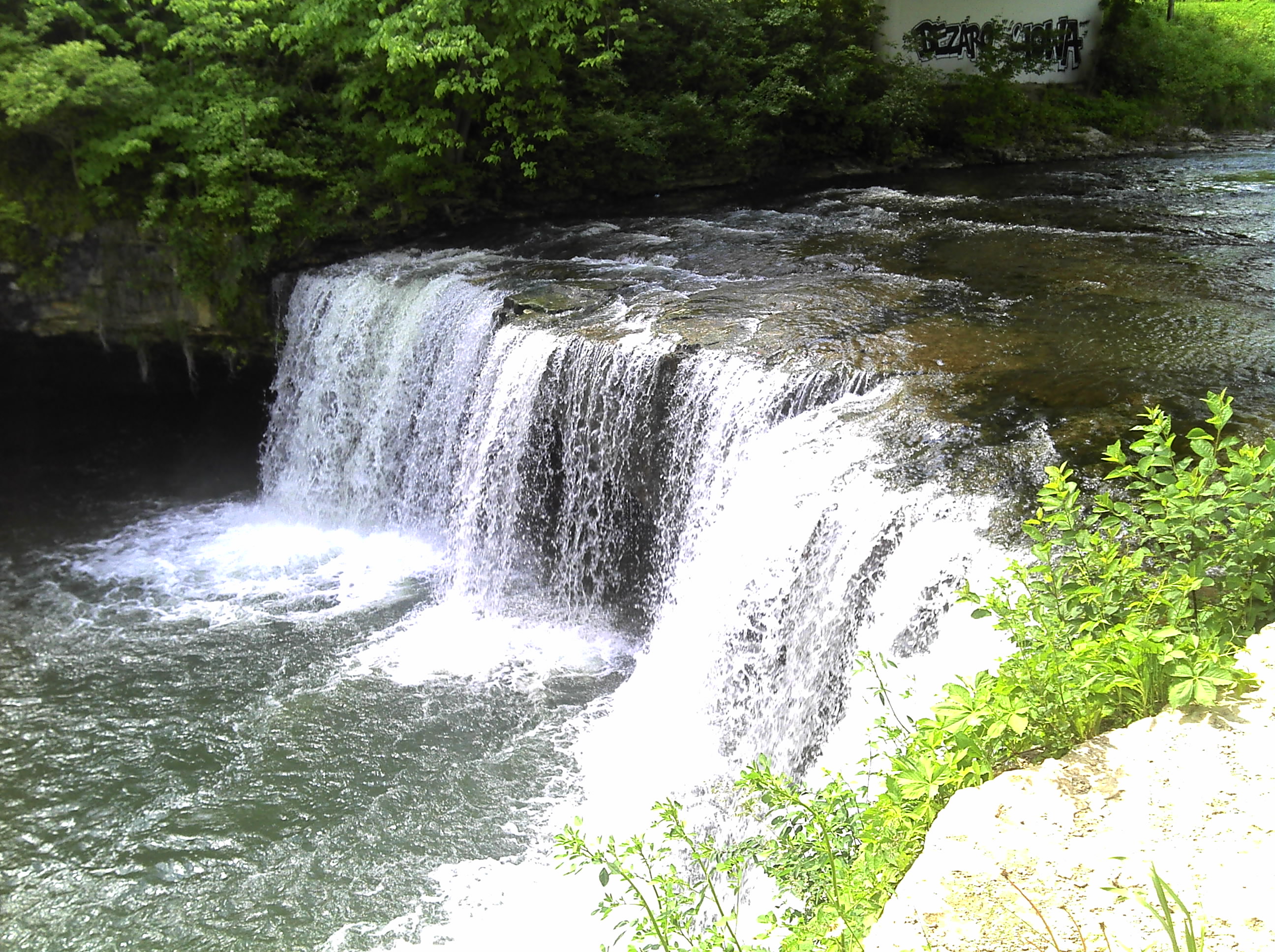
A big vertical waterfall of over 10 feet.
Enjoy the following low-water (120 cfs) park-and-huck kof the falls:
May 4, 2015
If you want to see a video of it being run:
https://www.youtube.com/watch?v=UxHGZwCquA8
This was a low water parn n huck. About 120cfs.
Jan 28, 2012
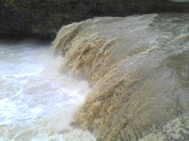
Perhaps it is too high
Jan 28, 2012
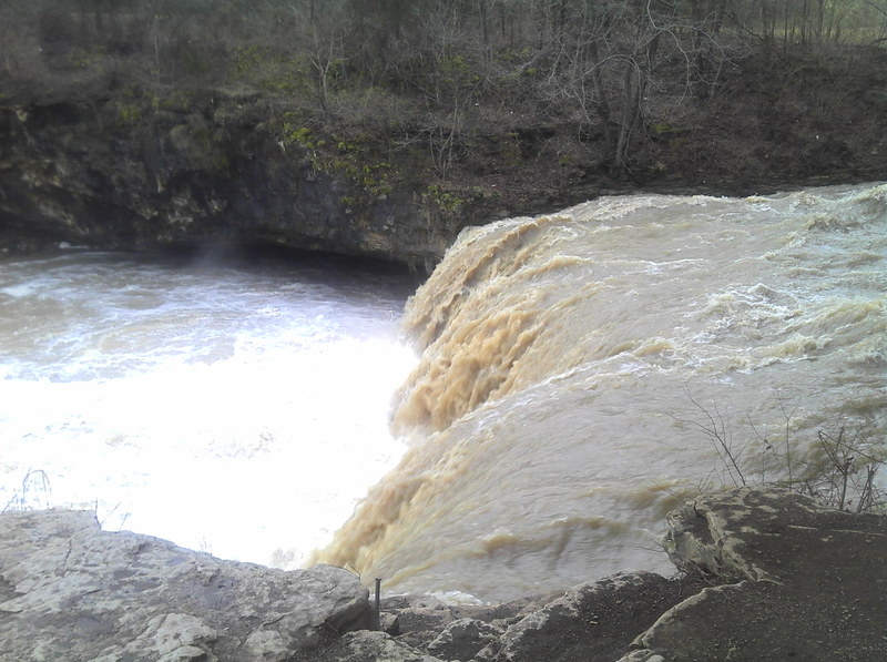
Ludlow Falls at high flow
May 23, 2011
Ludlow Falls. Local police frown on swimmers/boaters. The conservation district says the creek is navigable.