| Difficulty | II(III) |
| Length | 3.3 mi |
| Avg Gradient | 19 fpm |
| Gauge | Cedar Creek at Thixton Road Near Louisville, Ky |
| Flow Rate as of 21 minutes | 0.52 ftbelow recommended |
| Reach Info Last Updated | October 12, 2013 |
River Description
Video: http://vimeo.com/25889247
Visual Gauge: I recently found out that there is a visual gauge at the takeout on the downstream side of the bridge pillar. If it says 1.3 feet you are probabley too late since you now have to drive to the put-in. 1.5 should work as a minimum, and anything much over 2 should be reserved for experts.
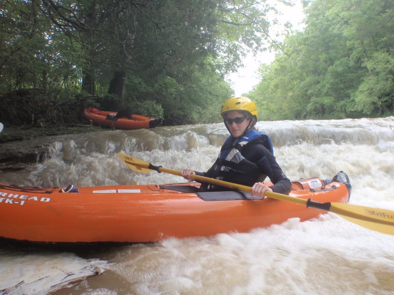
5/26/11 Trip Report:
We had a big storm at 11:00 p.m the night before and I noticed Cedar Creek didn't hit it's max of 2.5 feet until 4 a.m. This gave me hope that running Cane Creek the next day might be possible. I wanted to put in at 9:00 a.m, but I didn't end up putting in until 12:30. At that time Cedar was at 1.3 feet and that was a good sign that this creek would be runnable since 1.3 feet is the minimum for Cedar Creek which is close by.
Our takeout was Thurman Road and our put-in was Taylorsville Lake Road. Both have A+ parking and creek access. Here is a map with how to park: http://maps.google.com/maps/ms?hq=http:%2F%2Fmaps.google.com%2Fhelp%2Fmaps%2Ftour%2Fmapleft.kml&ie=UTF8&hl=en&t=p&msa=0&msid=214505246309052560756.0004a1487dc1c78ac32dd&ll=38.164087,-85.461702&spn=0.02588,0.066047&z=15
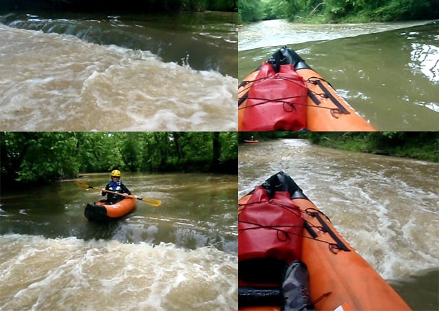
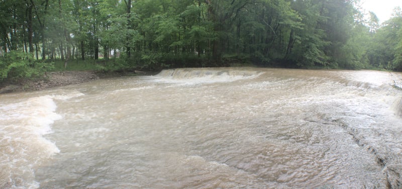
The adventure started out kind of slow with a few I+ drops and the creek was kind of scrapey. We picked up more water from Dunbar Creek, the creek got much wider, and things got much more interesting. We found a 1.5 foot ledge and had some fun on it. A few minutes later we found a slide rapid, but it wasn't much at the low level we were running it at and it wasn't very steep. A couple minutes later we found three ledges in a row and I have dubbed this Triple Ledges. A couple minu
...River Features
Put In
Access PointDistance: 0 mi
First Slide
RapidClass: IDistance: 1 mi
It wasn't very good at a low level but it might kick up some surf at a higher level.
Second Ledge
RapidClass: IIDistance: 1.1 mi
A ledge that's probabley slightly under a foot tall.
Triple Ledges
RapidClass: IIDistance: 1.2 mi
The first two ledges are probabley under a foot tall but the third one is probabley over a foot tall and it's a sloping ledge that makes some great surf.
Three Foot Ledge
RapidClass: II+Distance: 1.3 mi
If it looks too mean go river left where it flushes out more.
Back Run Slide Jr.
RapidClass: II+Distance: 1.4 mi
River right is a 3 foot ledge and river left is the normal slide. This thing has a great surf wave but be warned, it's a frowning shape, and it might be possible for this thing to kick up a red wave.
Half Diagonal Ledge
RapidClass: IIDistance: 1.6 mi
River right is a normal ledge and river left is a diagonal ledge.
Creekwide Strainer
HazardDistance: 1.7 mi

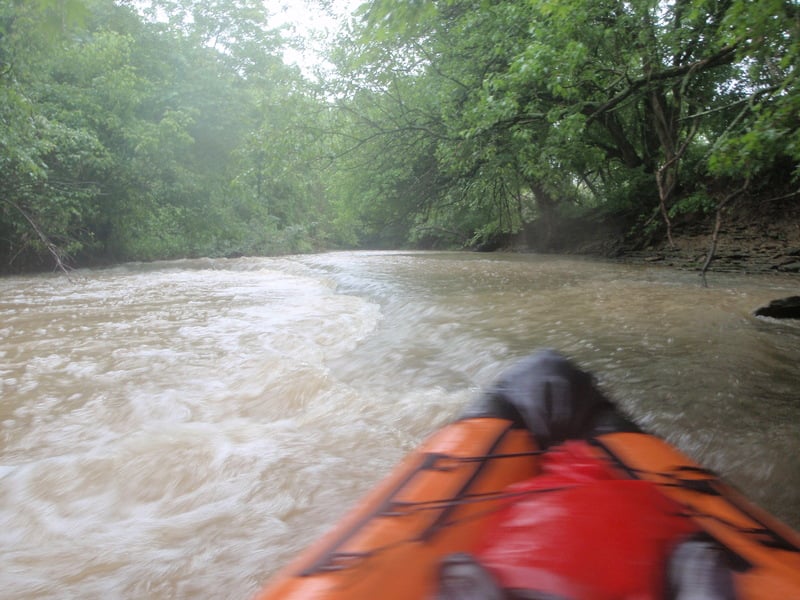
I recently did another scrapey very low run and there was a creekwide strainer 2 feet above the current water level. After you do the big slide, there is a couple more drops, and then you will see a giant pile of logs on river right. Right after that is the strainer. You can see the giant pile of logs from far away and so portaging shouldn't be a problem. The level was so low we went under it.
15 Minute Wave
RapidClass: IDistance: 2.3 mi
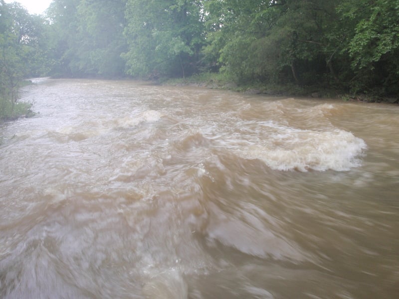
15 minutes went by without us seeing a ledge, slide, or wave and then we found this beautiful wave created from a slide. Even at a really low level it was great and easy to catch. A lot of water is forced to the center of the creek and this was the least shallow slide we saw all day.
Two Rapids
RapidClass: IIDistance: 2.5 mi
The first one is a slide, but not a very great one, but enough to kick up some WW. The next rapid is a ledge on river right that almost spans the entire creek but flushes out on river left.
Diagonal Wave Slide
RapidClass: IIDistance: 2.7 mi
A slide rapid that creates a small diagonal wave.
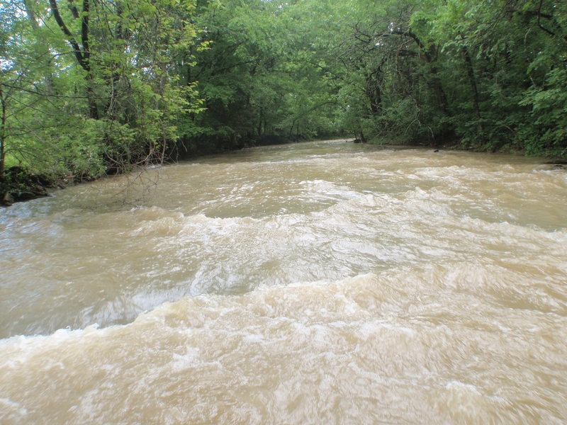
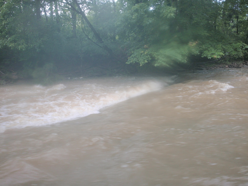
Flash Flood Rapids
RapidClass: II+Distance: 2.9 mi
You will get to an island where the main creek goes river left. If you go river right you will find this: 3 rapids in a row. The first is a small ledge with some surf. There used to be a strainer there but now it's gone. The next one is the best one and only gets bigger at high water. The third one is great and makes a nice surf wave at medium levels but totally washes out at high water.
From scouting the left side of the island, I think there is at least one large drop created from rock deposits, and it might be around 2 feet tall. After that it ends with a 6 inch ledge which washes out at high water.
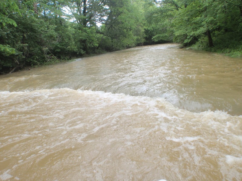
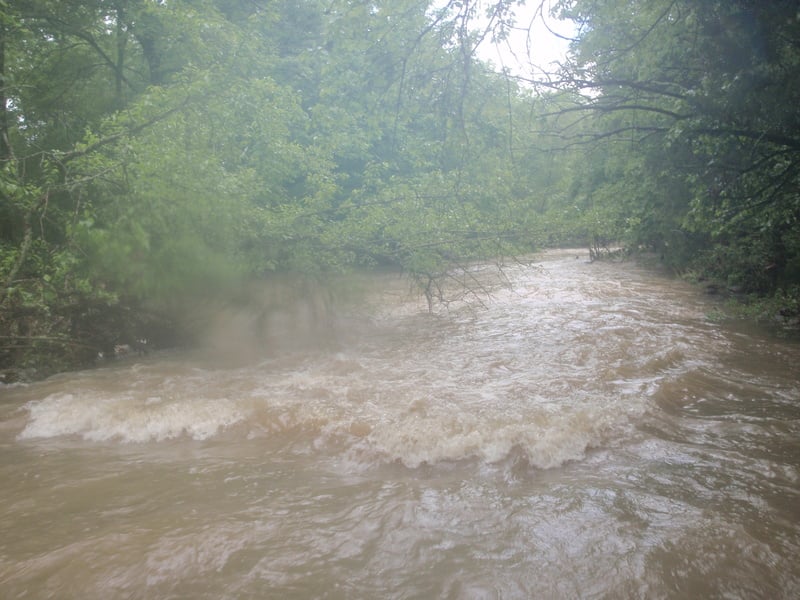
Unavoidable Ledge
RapidClass: II+Distance: 3 mi
I have only seen it at high water and it was pretty mean. I didn't see any way to get around it and so my girlfriend and I punched through it.
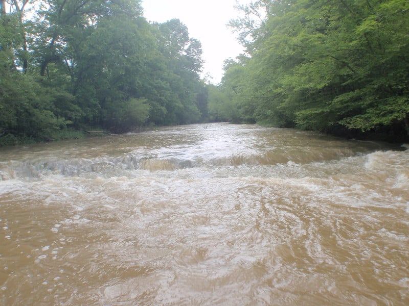
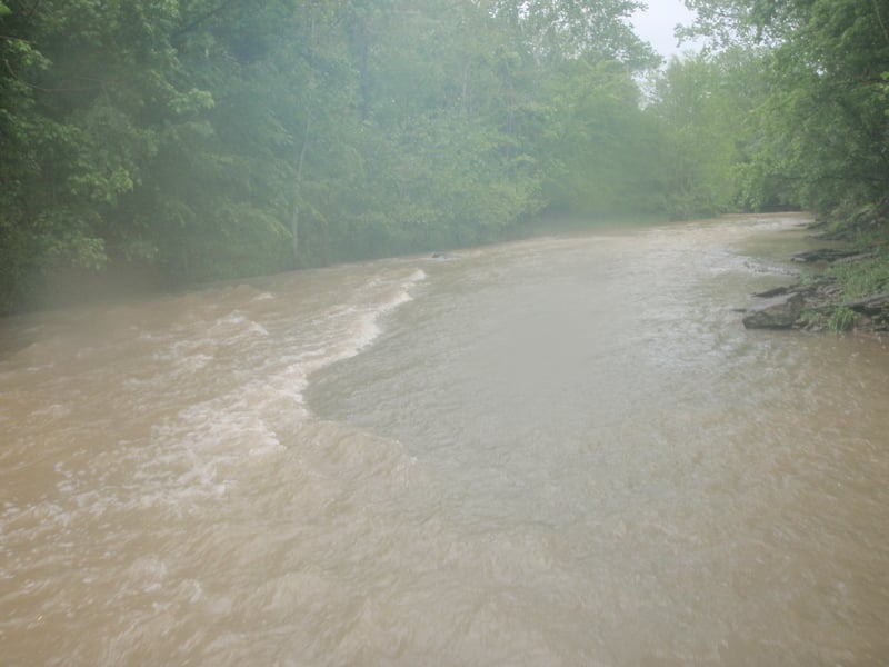
Last Rapid
RapidClass: IIDistance: 3.2 mi
You can see this ledge from the bridge, but it's kind of far away and so you really can't tell how good it is from the bridge. During high water I opted to go around it by going river right. It was big and we were trying to get the heck out of there because of the flash flood.
Takeout Gauge
Access PointHazardDistance: 3.25 mi
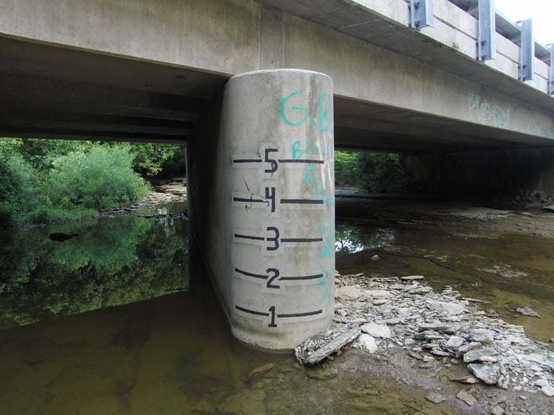
I recently found out that there is a visual gauge at the takeout on the downstream side of the bridge pillar. 1 foot will probably be an ok minimum, 2 feet would be great, and anything over that should be reserved for experts. Be careful of the bridge pillar at high flows, it looks like it could easily pin a boat against it. The takeout is directly after the bridge on the right.