Waterman Brook
Upper French Hill Rd to River Rd
| Difficulty | IV-V |
| Length | 1.8 mi |
| Avg Gradient | 198 fpm |
| Gauge | Lamoille River at Johnson, Vt |
| Flow Rate as of 48 minutes | 148 cfs |
| Reach Info Last Updated | May 3, 2018 |
Waterman is another micro of the Northern Peaks of Mansfield, specifically Sterling Peak (yes Waterman drains Sterling Peak, and Sterling drains Madonna peak) emptying into the Lamoille. It begins as a tiny creek but confluences with French Hill Brook and Belding Pond Brook half way through to gain volume. The second half contains good ledges and a great clean 15 foot falls into cauldron, known as Kettle falls. It runs on similar schedule to Sterling and Kenfield Brooks but is a slight step up from both. Most drops are in the IV+ range but one is a serious V with a big sieve and undercut eddy/room at the end. One descent of this rapid known to date. Water levels can be a bit tricky with a narrow window for a good medium, through which the creek passes quickly. As with all micros wood can be an issue so don't go running anything blind.
The gauge is located on the Lamoille near the confluence where the Waterman ends. The flow range is estimated based on going above the 75th percentile. If you run this section please leave a comment with more beta.
Jul 10, 2011
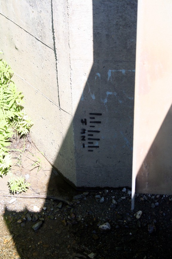
Gauge on waterman, used to be the 'e' in 'Matt is Sexy' but it was starting to fade so a numerical one was put up. One is minimum, two is medium, three is medium high, four is high. Located at the take-out bridge, river left abutment, upstream side. Please text level to necreeking@gmail.com when you get a visual. Thanks!
May 10, 2009
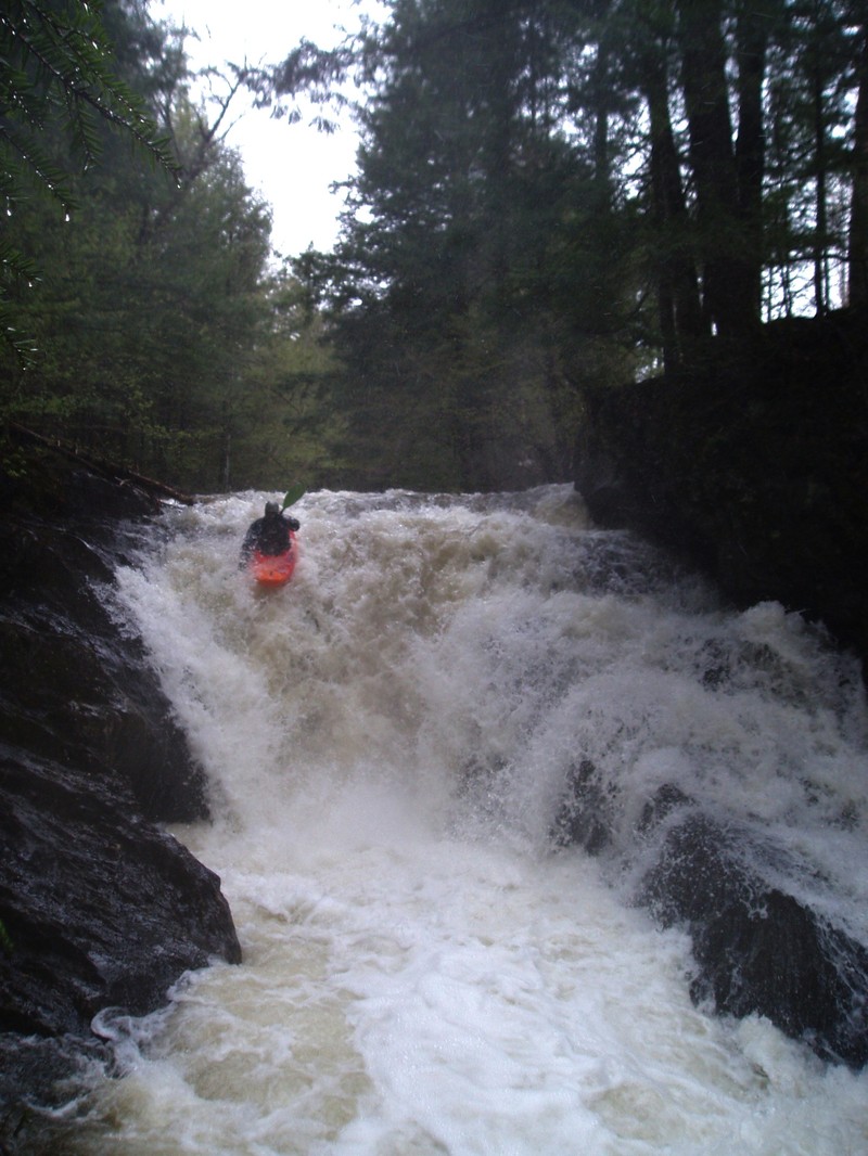
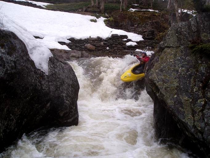
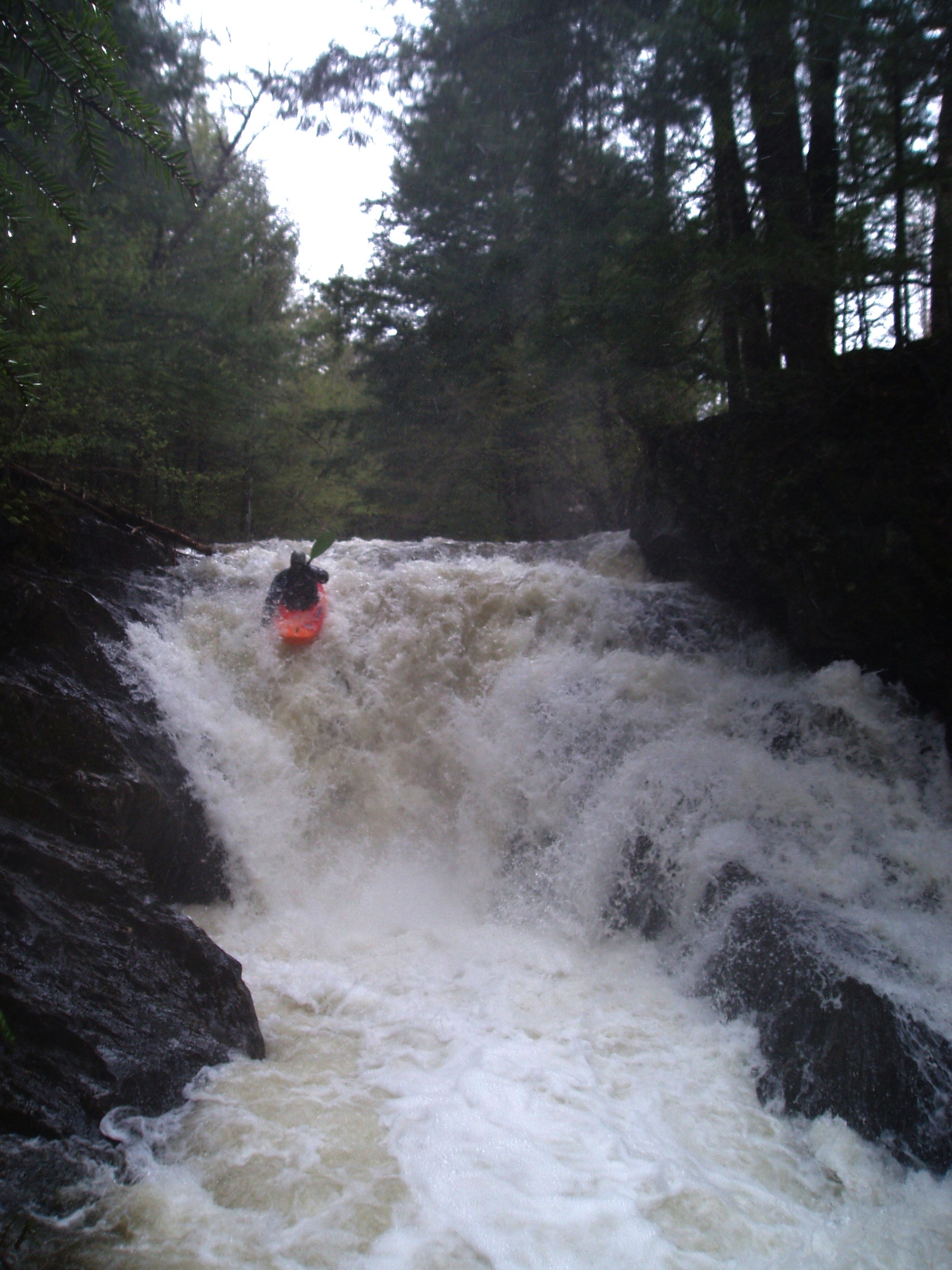
Simone running Kettle.
May 10, 2009
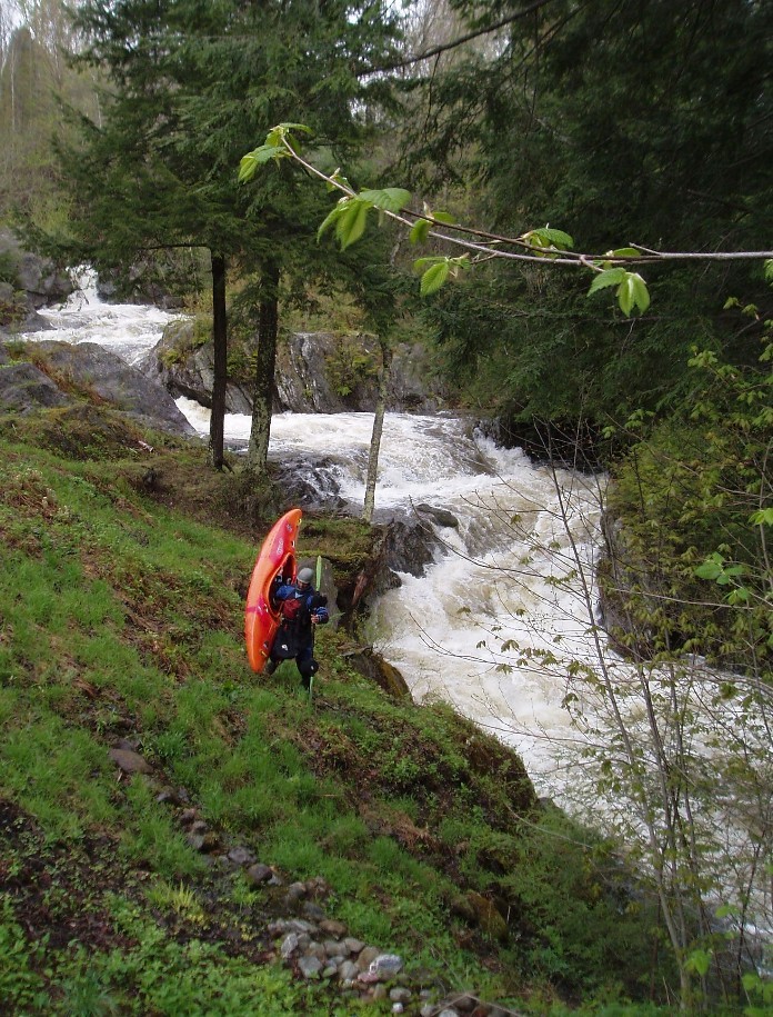
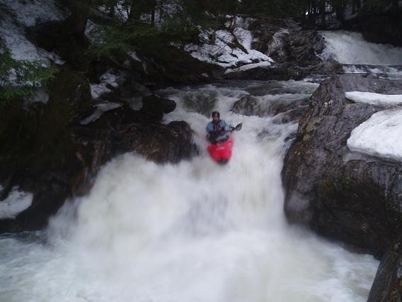
Ignorance is Bliss in the background, the Terraces in the foreground. Two people and high flows = shouldering the boats around these two.
Apr 11, 2008
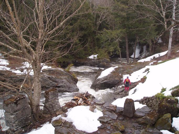
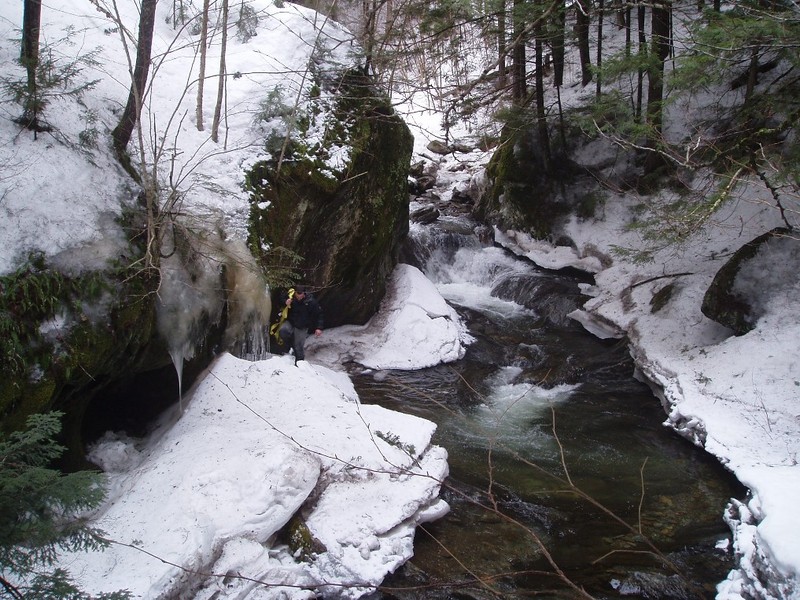
Marshall scouts the Terraces, beginning with a 5ft ledge drop between two rock walls, then making a 90 degree turn and dropping another 5 or 6 ft sliding over a couple ledge holes
Apr 11, 2008
Marshall drying out and falling off the left side of the opening drop of the Terraces
Apr 11, 2008
Second to last good ledge of the run, two exit options left or right below this, very common wood choke point right here, always check it out.
Apr 5, 2008
Before the confluence, drops are of this nature, taken on a wood cleaning mission early spring 2008.
Apr 5, 2008
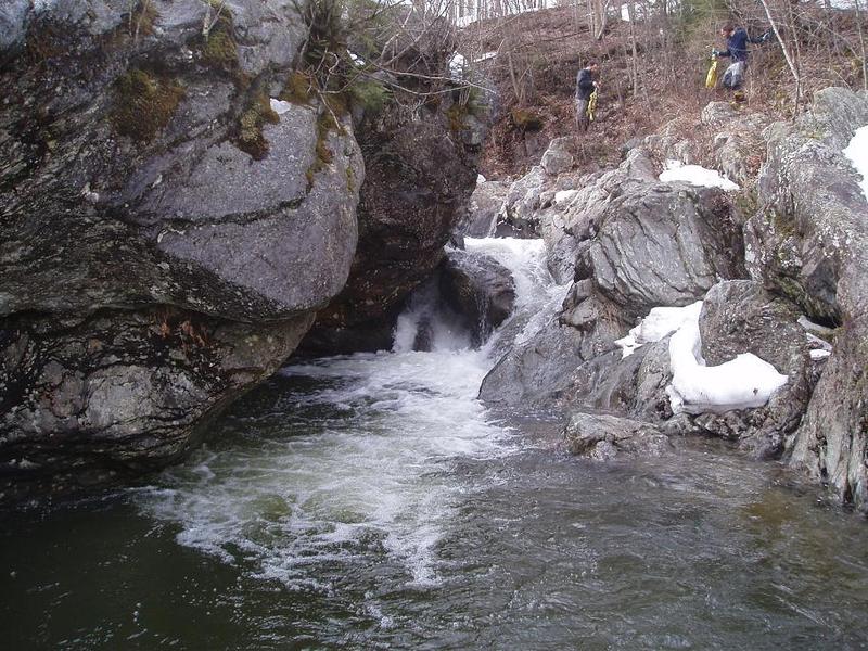
First big drop after the bridge below the confluence. We worked on this log from upstream for a good 30 minutes before looking downstream to find it was a nasty sieve which the log extended through. Scary stuff, this one got run at high water about a year later with the sieve unknown to the paddler earning the name Ignorance is Bliss. Even despite the sieve, the river right undercut wall is a scary sight.