Holes Creek
Grant Park Red trail to Grant Peak or playgorund
| Difficulty | II-III |
| Length | 1.3 mi |
| Avg Gradient | 50 fpm |
| Permit | No |
| Gauge | Holes Creek Near Kettering Oh |
| Flow Rate as of 40 minutes | 2.49 ftbelow recommended |
| Reach Info Last Updated | December 23, 2011 |
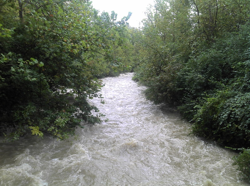
For the majority of Ohio boaters this creek is too short for anyone to drive an appreciable distance.However on the plus side if you live near Dayton the creek can be entertaining.There are several options for access.With two cars it is simple to put in as Holes Creek flows into Grant Park and then drive down to Grant Peak or one of the children’s play parks below the cascades.The other option is to access the river at the main entrance to Grant Park and hike up the hill.It will take about 8 minutes to reach the put in.The takeout requires you ti hike back to your car or do a running shuttle of about 1.1 miles.
The put in has a small play wave at 2.7 feet but it washes out at higher flows.
The river then meanders for a hundred yards and there is a threat of downed trees.In 2011 there was one somewhat scary tree in the flat water section.
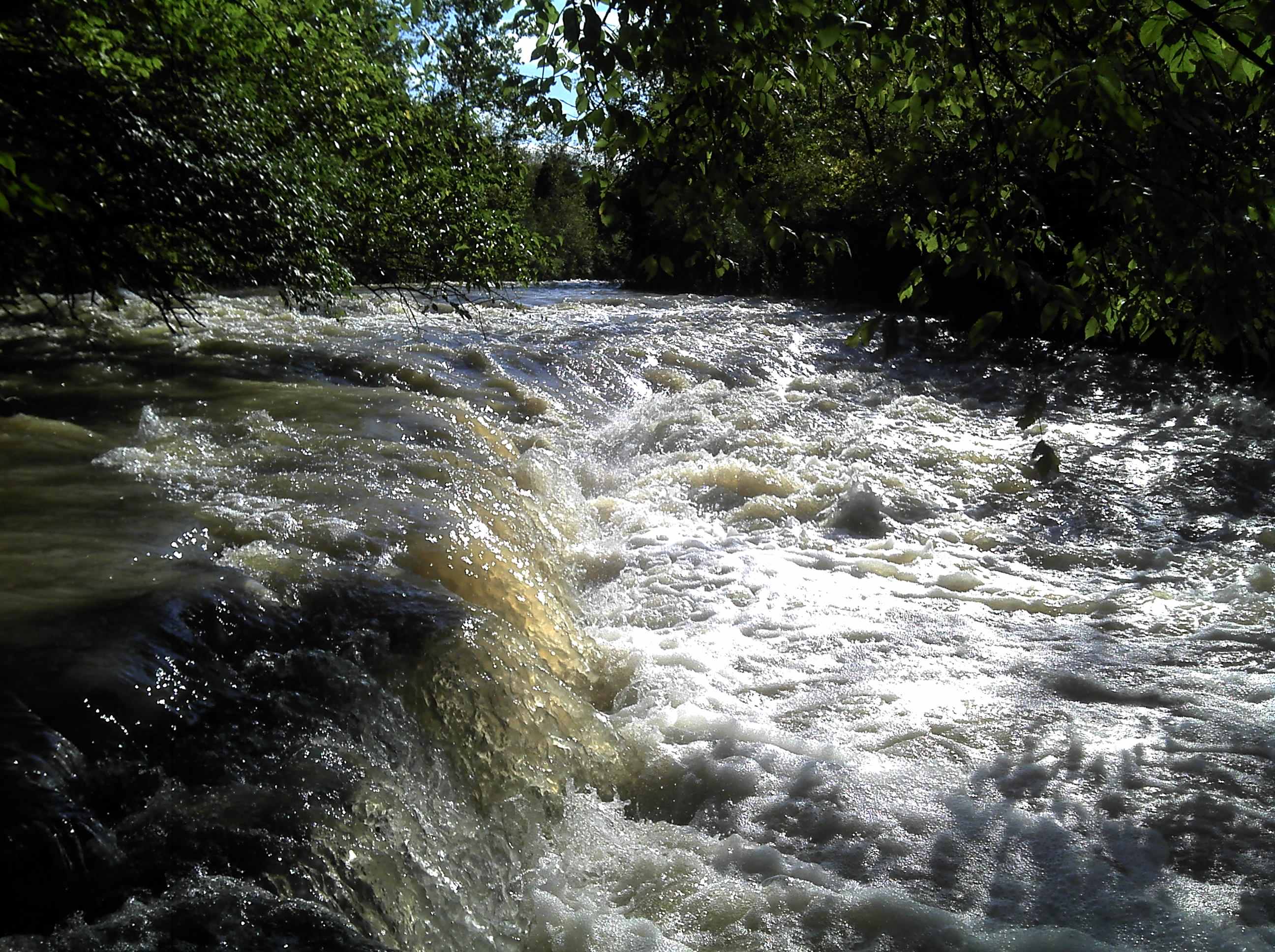
The majority of the rapids are in the “cascades section”.The river drops around 50 feet in this half mile section of somewhat gorged in river.The drops are all slides or small ledges.None are really difficult but they are continuous.The water is unfortunately somewhat poor in quality so even with cool play spots I’m not sure I would want to flip.
This is a short continuous downhill slide with ledges and waves. When the level is over 1500 cfs the rapids are AMAZING.Actually they get kind of scary with big waves, trees, and massive holes.
Be careful! Over 2000 cfs the bridge near the end will kill you.
Start at the ford where the brown/red trail crosses and heads into the 'cascades' according to the park map. Takeout near the chimneys.
You can continue further downstream and there is another small ledge but the takeout is more arduous and strainers are more common.

This ledge is one of the larger drops in the river.It can have a sticky hole and a large man made concrete structure is downstream on the left.
This feature can easily be reached on foot by hiking upstream on the river right trail from the elementary school parking lot at Grant Park.
Nov 6, 2018
There looks to be a pretty good rapid under the Alex Bell road bridge and some rapids are visible along Alex Bell road all the way to the bridge.
Mar 13, 2016
The alternative put in is just upstream of the Park on McNeal and you take out down where McNeal crosses the river.
Sep 1, 2014
I ran this today 8/31/2014 @ 5ft good first time level the hike wasn't bad at all is a very fast run only took 4 minutes. First island there is a tree across the channel and strainers just past that. Not bad choice when nothing else is flowing. Here is my video of the run http://youtu.be/AIsc5N9rJ2A