Boomershine Branch
Germantown Nature Center to Twin Creek
| Difficulty | III-IV |
| Length | 0.6 mi |
| Avg Gradient | 100 fpm |
| Reach Info Last Updated | June 3, 2025 |
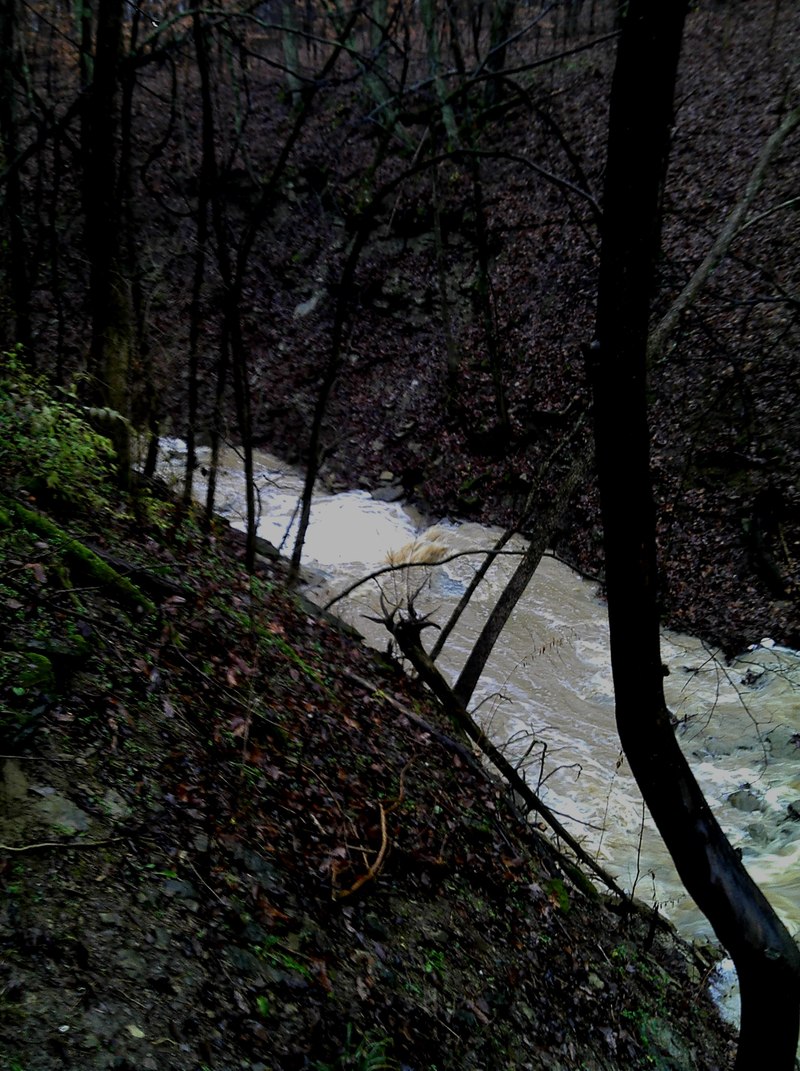
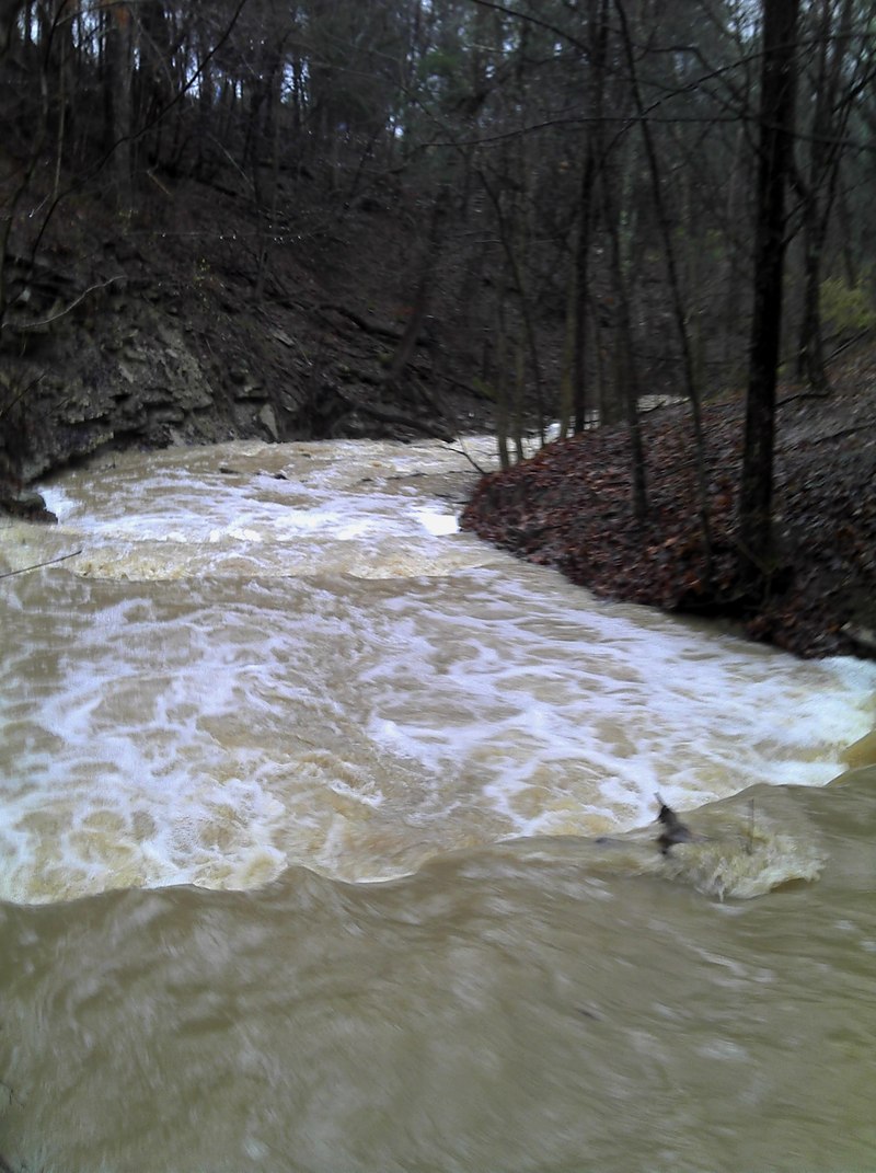
First lets be clear about this little creek. It rarely has good flows because it is a small creek. However it drains a large area of flat corn fields and thus has somewhat muddy but ample water when there are heavy rains.
Ok how does this creek add up? It is not a steep creek by southeastern standards but it would be if it were longer.This run will take 15-30 minutes for a good creek boater and you can run laps if the water level holds.
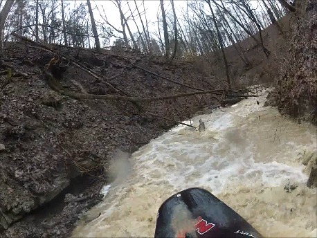
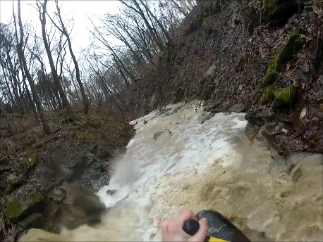
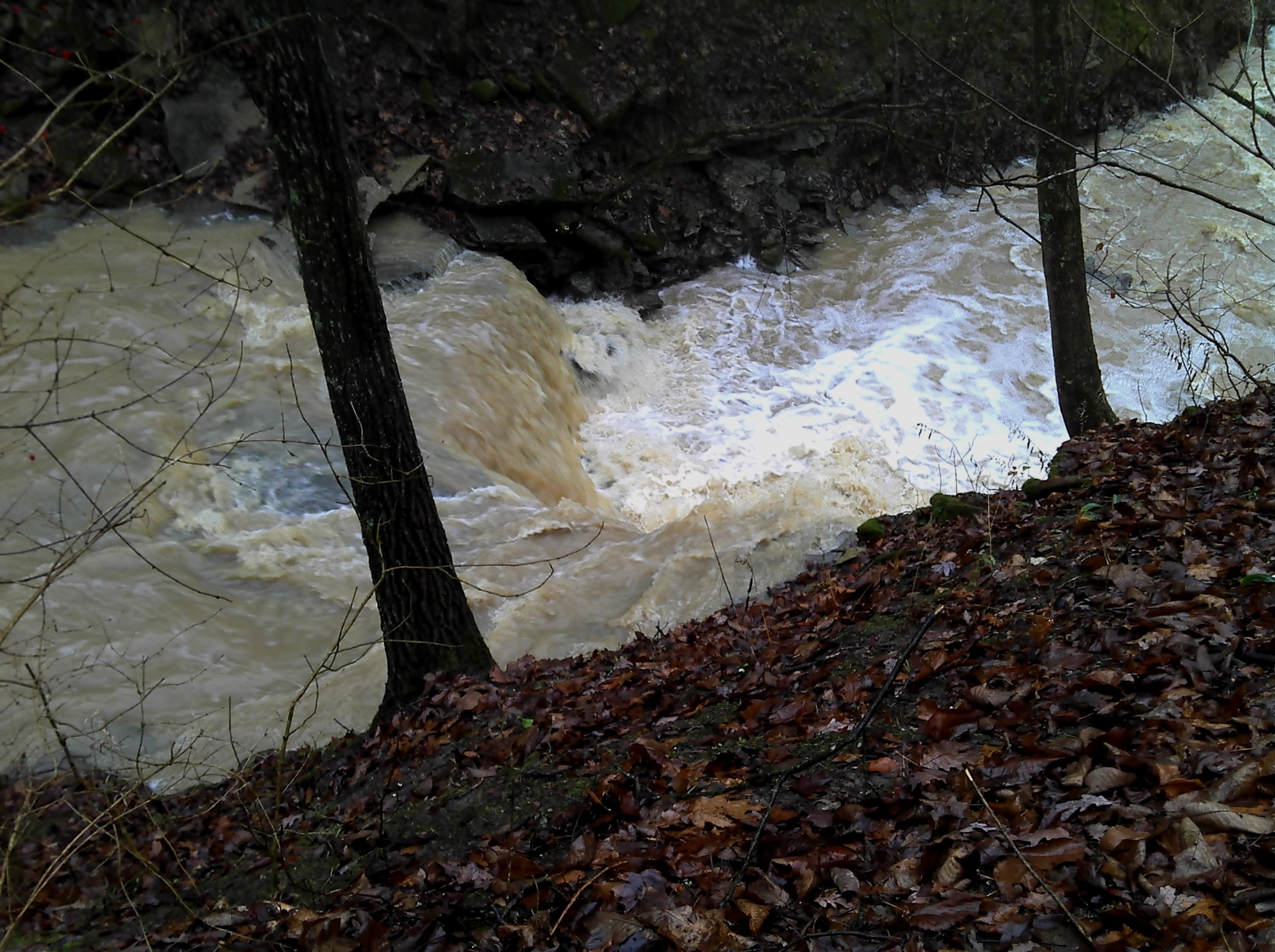
The put in is located where the trailhead crosses the stream above the gorge. It takes off in a matter of feet after the put in.You will start screaming down the slope over 1 to 5 foot ledges. Keep your eyes open for trees. On my first and second run I had 2 trees that I needed to walk around.There were some other pieces of wood that were poorly placed but manageable. After the first few ledges the action really starts to pick up and you are going to be hitting the two big drops that are over 5 to almost 7 feet in height.The difficulty picks up and some of the drops could lead to pinning. After the big ledge the gradient picks up and feels quite steep. Make sure there is no wood in here before you start or at least avoid boating past the last eddy you can see.The gradient eases up as you approach Twin Creek. Get out on river left or right to hike back up. I prefered river right.
The gradient is a bit of an exaggeration.The creek is only 0.5 mile in length and it drops about 150 feet in one crazy downhill rock slide or boulders and ledges.
The first ledges are small and reletivly easy slides. Watch for trees.
You are below the nature center observation deck. This drop is a straightforward drop.Check it out at low water to see all the broken shale in the landing zone.
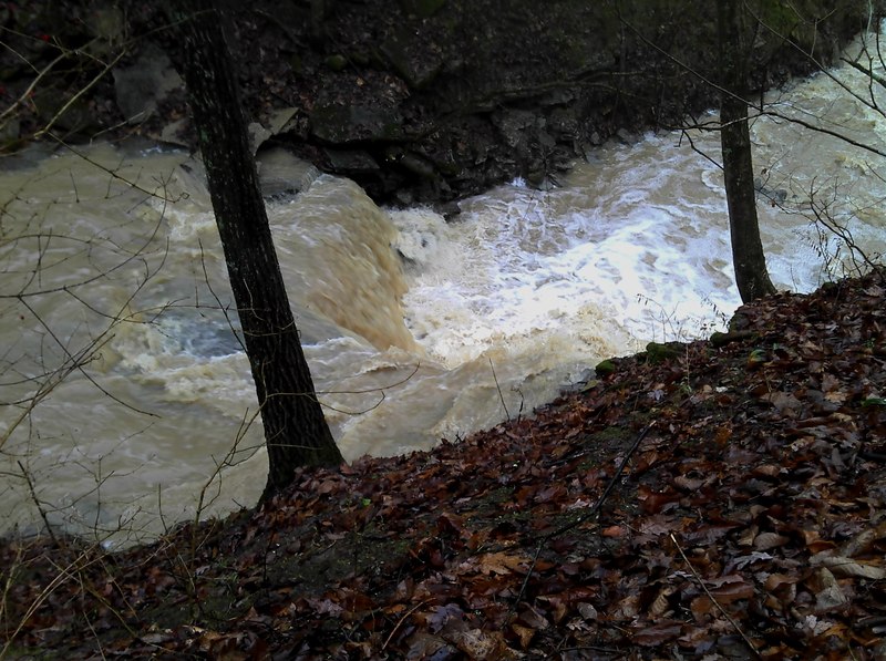
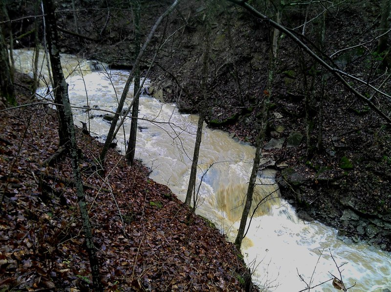
The largest drop on the river is a broken ledge that is slightly over 7 or 8 feet in height. The best line looks like a clean shot off the right side.However, most boats seem to get pushed left as they go over the drop and turn into the crack.You can pin here so be careful.The gradient really picks up at this point.
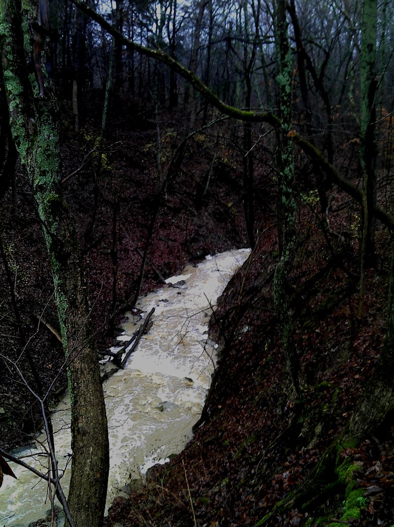
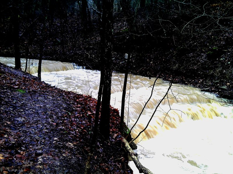
The big ledges are gone but you are now faced with blind turns, small ledges, slides, trees, and razor sharp boulders.All of this action adds up so be careful not to boat past the last safe eddy.
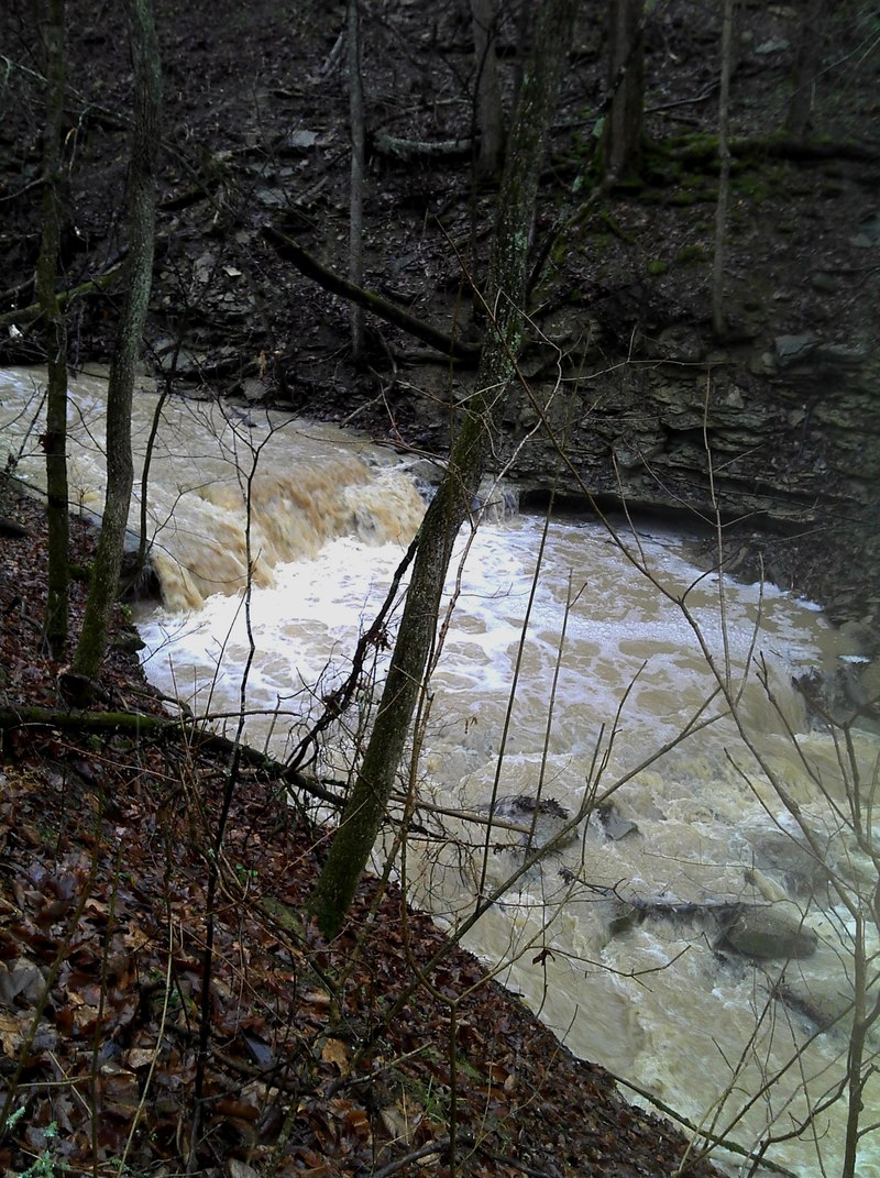
Going over the lip of the falls at low flow.