| Difficulty | II(III) |
| Length | 3.3 mi |
| Avg Gradient | 34 fpm |
| Gauge | French Creek at Utica, Pa |
| Flow Rate as of 1 hour | 1.69 ftbelow recommended |
| Reach Info Last Updated | February 1, 2012 |
River Description
Description courtesy of Matt Pascal:
Directions: Getting to Utica, PA is simple with a map or Internet directions. In town, follow Grant Street only about 1/4 mile to the one-lane take-out bridge. From the take-out in Utica, take a left onto Academy St and travel several miles. You can see the bottom section of the run from the drive. After crossing the creek it will disappear from view on the right. Take the next right onto Mill Creek Rd. After a mile or more, turn right at the stop sign onto Foster Rd. The put-in is about 100 yards down the road at the bridge.
Min: 24 inches of clearance under the bridge at the put-in. At 6 inches of clearance, the run takes on class 3 characteristics.
Nearby Gauges: French Creek at Utica should be high (at least 7 feet). In the winter, snowpack with a half-inch of rain should do it, but in the summer the watershed will need several inches of rain. This creek does not stay up for long.
Length of run: Approx 2.5 to 3 miles
Gradient: Negligible for the first mile, approximately 40 – 50 ft per mile thereafter.
Access: Limited parking is available at the put-in and take-out, which are both at bridges on public roads. At the take-out, care should be taken to avoid private property.
Hazards: There are several man-made and natural strainers. Boaters should continue with caution.
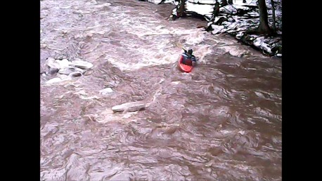
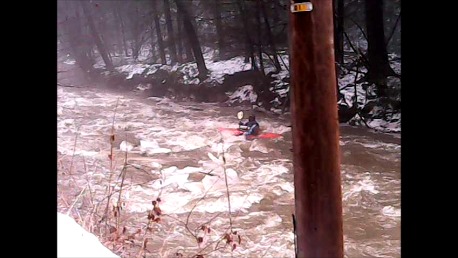
Description: Mill Creek is a fun and beautiful NW PA run for boaters with class 3 skills and cold weather paddling equipment who wish to experience creeking. The first mile of paddling is flat, through a marsh with thick vegetation, and the remaining mileage increases to continuous class II (class III at higher levels) water as it drops toward French Creek Canyon. Boaters shoul
...River Features
Put In
Access PointDistance: 0 mi
Take Out
Access PointDistance: 2.5 mi