Navarro
Hendy Woods State Park to Navarro Beach
| Difficulty | I-II |
| Length | 25.6 mi |
| Avg Gradient | n/a |
| Gauge | Navarro R Nr Navarro Ca |
| Flow Rate as of 1 hour | 8 cfsbelow recommended |
| Reach Info Last Updated | August 8, 2012 |
This beautiful stretch of redwood-lined river is usually run as two distinct sections.
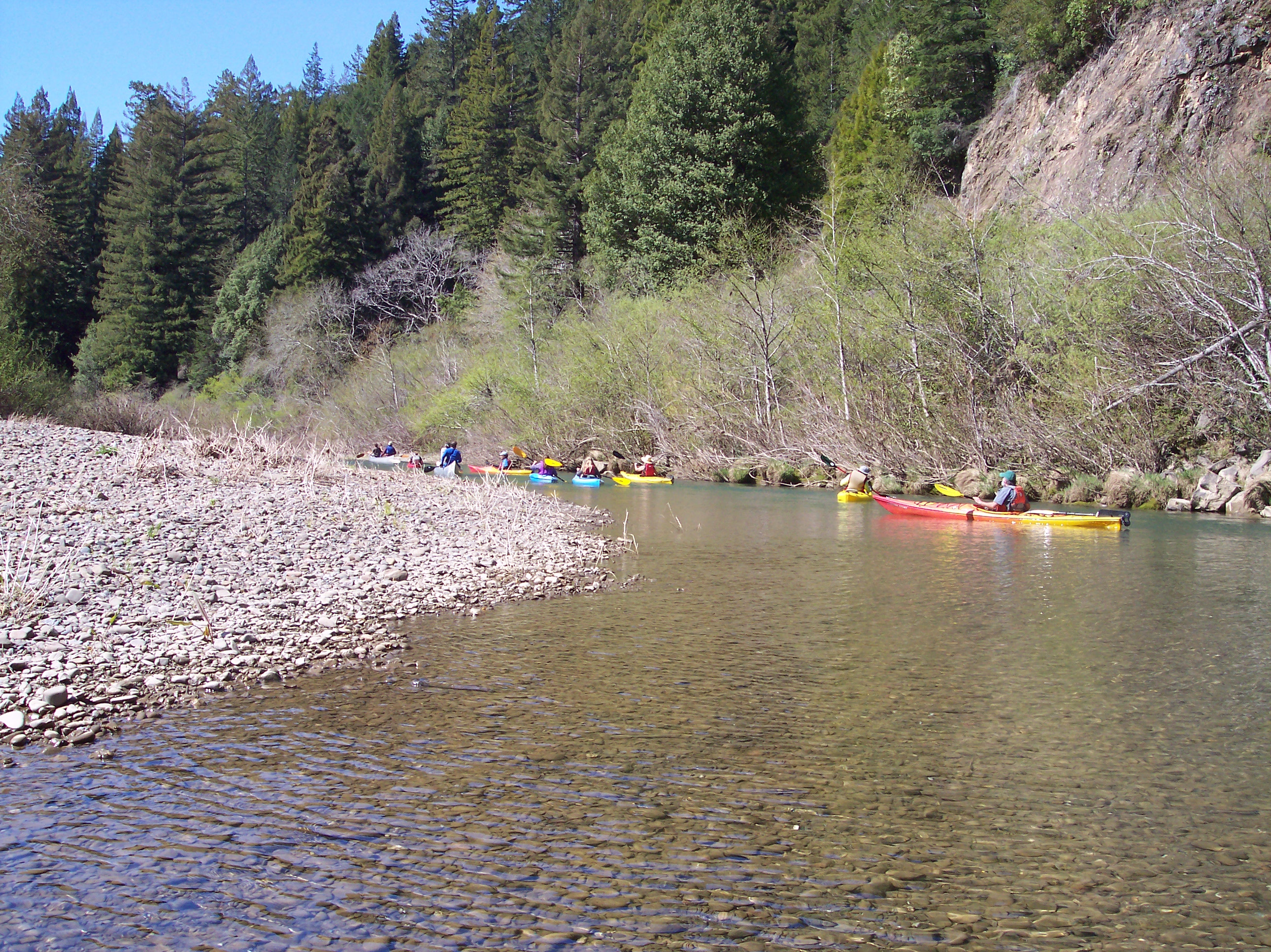
The upper 'wilderness run' is 12 miles of class I+ to II depending on flows, mostly roadless, heavily forested, and seldom run. Once started on this run, you are committed to finishing or walking out on a logging road. Best for novice to intermediate levels with strong maneuvering skills. Put-In at Hendy CG on route 128 (Greenwood - Philo Road). Take out at Dimmick CG. Watch for wood hazards. Best for IKs and hardshells.
The 'ocean run' is 8 miles (seems like more) from Dimmick CG to the lagoon on Hwy 1. Class I to I+. Starts out narrow, winding and brushy creeking with some wood hazards, soon opens up to a nice float through open redwood country much like a smaller version of the south fork Eel, with lots of wildlife and serenity despite being close to a road. Put-In at Dimmick CG. Take-Out at the south side of the lagoon past the Hwy1 bridge, follow sand road on south side of the river (right off Hwy 1) to day-use parking. Can be run by a variety of craft that can negotiate tight turns including sea kayaks. Sea kayaks or canoes may be advisable on this stretch due to up-river winds and flatwater the last few miles (inflatables not recommended). Hug the left bank to stay out of the wind most days. Leave time for a nice picnic at this beautiful beach (leave some warm clothes in the car at take-out, it will be about 25 degrees cooler there).
Flows:
400 - Barely Runnable
600 - 800 Optimum
1200 - Upper Runnable - Advanced Novice to Intermediate
1200 - ?? Intermediate to Expert
Season - Late Winter to Spring. After a rain, watch the flows come down and plan accordingly with weather forecast in mind.
Due to annual floods, this river changes frequently. Local knowledge will probably not be too much help. New slides, strainers, sweepers, etc. can appear overnight. Always scout blind bends and anything you can't see from the boa
...
This is a good put in for the lower 8 miles to the ocean. This is also the confluence of the NF Navarro River.
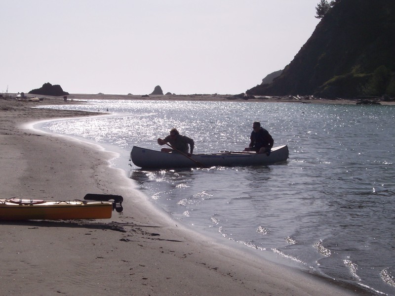
Paddle under the Highway 1 bridge and on out into the Navarro Lagoon. The beach is almost a mile past the bridge at the mouth of the river. At moderate flows a large sand bar will usually separate the river from the ocean. When you see the parking area, take out on the beach and carry across the sand to the parking lot.