| Difficulty | I-II |
| Length | 6.8 mi |
| Avg Gradient | n/a |
| Gauge | Deep River at Ramseur, Nc |
| Flow Rate as of 45 minutes | 43 cfsbelow recommended |
| Reach Info Last Updated | August 5, 2024 |
River Description
This section is covered pretty well in Paddling Eastern North Carolina by Paul Ferguson, but below is given for those that do not have that book.
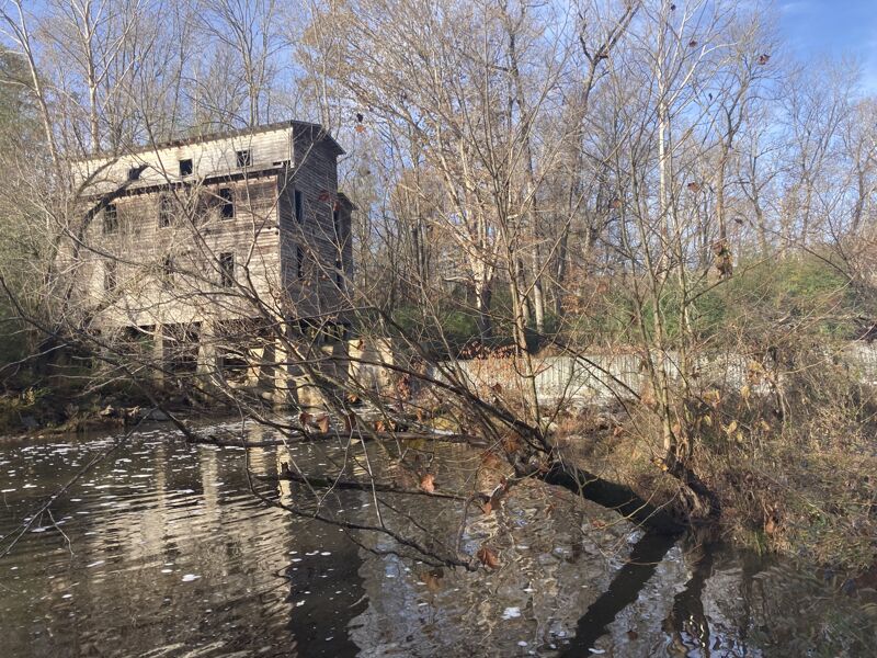
This section of river is about 1/3 rapids and 2/3 flat water. That being said, the section with rapids is a good one with mostly class II boulder gardens and wavetrains. Once you reach the second set of rapids with an island in view downstream, take out on river right to scout. Ahead at the horizon line is the Johnson Ford rapid, which is class II+ and probably class III at higher water. It is not a difficult drop, but you'll want to decide your route ahead of time since it is not obvious from your boat if you choose to go river right. If lined up correctly, there is a neat kicker boof rock that drops maybe 3 ft or so followed by a smaller ledge immediately after. The other option is to take the river left side of the island that is just a fast wavetrain and can probably be boat scouted from an eddy before commiting. Watch for trees down if you go river left, but it is more gradual of a drop. From this point on, you have flat water till you reach the High Falls dam which is likely to be demolished at some point in the future, offering more excitement for the run. Portage left at the dam. If water is high, an alternative is to paddle upstream on Bear Creek, about 1/4 mile past the Johnson's Ford rapid to take out at the Reynolds Mill canoe launch. This, however, means attaining/portaging about 1/4 mile worth of small rapids on the creek and carrying around a dam right after the small rapids. Most of the distance is flat water though and easy to paddle upstream.
River Features
Put In
Access PointDistance: 0 mi
Johnson's Ford
RapidClass: II+Distance: 2.45 mi
Scout from river right. The left channel of the island is fast wavy water. The right side is steeper and more technical.
Take Out
Access PointDistance: 6.5 mi