Eno
2. Route 1567 below Duke Dam to US Route 501
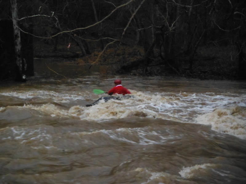
Dec 23, 2013
Santa was spotted having a little fun before the big night!
May 5, 2010
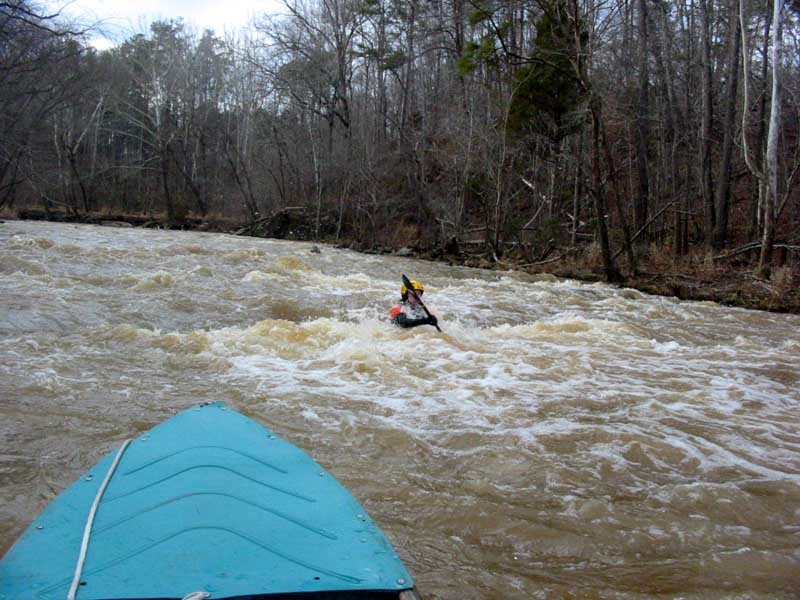
This is a screenshot from some video I shot at Geer Dam. The level was somewhere around 5.3 and there is a sweet V wave that forms off the corner of the dam where it was broken.
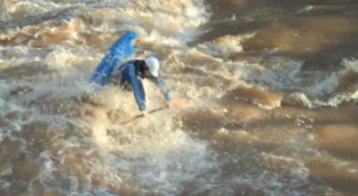
May 5, 2010
This is a screenshot from some video I shot at Geer Dam on the Eno. A sweet V wave forms at certain levels off the corner of the dam where it was broken. Great spot for lefty blunts! The level was around 5.3 on the AW site.
Mar 29, 2010
This little hole is located just below the Guess Rd bridge around 5.4 on the AW gauge.
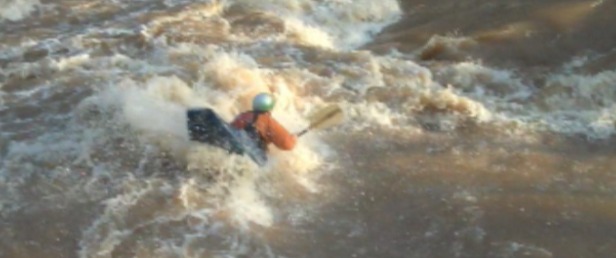
Mar 29, 2010
This is the wave that is formed at high water (5'+) at Geer Dam just above Guess Rd. Sweet V wave great for righty blunts, etc.
Mar 14, 2010
This is the ledge hole below Guess Rd on the Eno. The level here was 3.14 on Rt.1516 - 501.
Great spot for spinning, low angle ends at this level.
Dec 8, 2009
PLlease, Streamkeeper, don't keep sending paddlers down the Eno at 3' ft and under.While hiking, I have seen and rescued many a novice and low-intermediate paddler go broadside against rocks, flip, lose boat and paddles and, occasionally, need rescuing. Under 3' is a very technical run in Bobbit's Hole or at the broken dam near Guess Road. le scott, Dec 09
Apr 23, 2006
First trip on the Eno since the dam was modified. The minimum may need some adjusting. We ran the river at 3.75 on the USGS. The visual gauge said just under 2'(see pictures). Most of the rapids were washed out. Still some good surf waves, but nothing too difficult. I prefer the river about 6' lower, the drops are a little more defined. Still, we highly recommend this river, one of the prettiest runs in the Triangle.
Aug 4, 2004
8/4/2004
We paddled this at 2.9' (USGS Gauge) yesterday (8/3/2004) and there were three or four trees across the river between Pleasant Green Rd and Cole Mill Rd. Not much problem getting over/under them at this level. Most of them would be farther underwater at higher levels, but at least one could be a danger at higher levels. Just be aware and keep your eyes open.
Feb 15, 2004
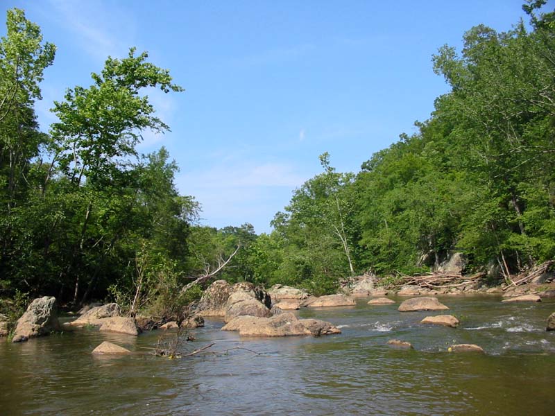
This is the old Guess-Geer Dam, close to the Guess Road Bridge. The right side of the dam is blasted away.
There are many, nice rapids between the Colemill Park and WestPoint. At 4.0 on the USGS gage, the river is a class 2+, at 6 feet it gets pushy, at 8 feet, it's similar to the Ocoee
This is a trouble spot for many novice canoers. At 4 feet is class 2+, but get quickly to a 3+ at higher levels
This is the old Guess-Geer dam, close to the Guess Road Bridge. The right side of the dam is blasted away.
Scouting is recommended at any level.
Jul 15, 2003
This is a beautiful rock garden, approx 1 mile downriver of the Pleasant Green put in. It is easy at low water, above 6 feet it get's a little bit tricky.
Feb 9, 2003
February 8, 2003
Although there were reports in December of a dam and crane in the river bed at Guess Road, we saw neither during our trip from Pleasant Green to West Point. A nasty tangle of rebar rose out of the river right eddy beneath the new bridge. There is probably more rebar in the river bed so be careful when paddling here.
Jan 6, 2003
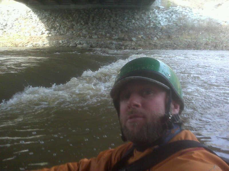
I ran this yesterday, Jan. 5th, and there are a few things to look out for. First, most of the larger class II's are formed from old dams that have been blown out in the last fifty years or so. In particular, the old Cabe's mill and the Duke dam just before Guess rd. pose probably the largest hazards in the run. The other spot to really look out for is under the new Guess rd. bridge. The construction people blew up one of the old bridge pilings, so the new rapid under the bridge has a lot of rebar and sharp rock. Walking this is pretty easy, just walk over the road and put in on the other side. In general most of the whitewater is between Colemill and Westpoint. So, to recap, it's a pretty fun little run, but watch out for the man made rapids.
Dec 21, 2000
The Eno River Basin was mostly tobacco farms until recently. Now it is suburbia. But thanks to the Eno River Society, most of the land along the river has been preserved as a park and it remains today much as it has in the past. The river offers great paddling operatunity's for the begining boater, with long pools seperated by class II rapids. Like all rivers, it's character changes at higher water and it's difficulty changes accordingly.