Lamoille
Milton Falls
| Difficulty | V |
| Length | 0.1 mi |
| Avg Gradient | 1000 fpm |
| Gauge | Lamoille River at East Georgia, Vt |
| Flow Rate as of 47 minutes | 326 cfsbelow recommended |
| Reach Info Last Updated | November 18, 2013 |
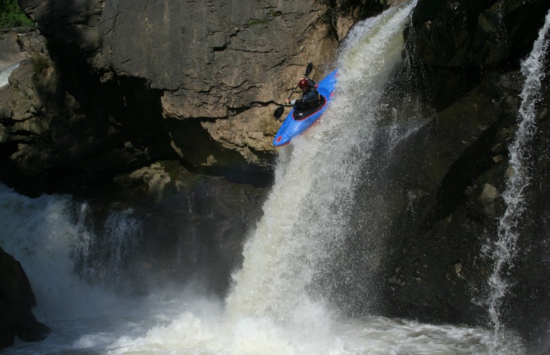
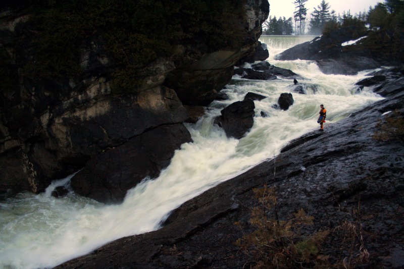
Milton Falls is found just off the main drag of route 7 in 'downtown' Milton. Situated below a dam just downstream of Arrowhead Lake, the Lamoille drops 100' over the course of 1/10th of a mile. The first half is a series of ledges and cascades. To my knowledge none of these have been run. The river then splits into 3 separate channels. River right flows over two back-to-back slides both of about 20-25ft in height. The center channel funnels down into a crack, cascading 30ft or so and being immediately rejoined by the left most channel. The left channel drops over a few smaller ledges and then flows over a 20ft freefall. The geology here is far from pretty, with undercuts, seives, tunnels in the rock, and rocks in landing zones all present in one location or another. Each drop has significant dangers and dilligent scouting and or safety is suggested for anybody contemplating a run here.
NOTE: THE RIVER LEFT 20FT FALLS HAS 2 ROCKS IN THE LANDING ZONE MAKING IT VERY DANGEROUS. Successful descents have been had, but I would highly recommend a low water scout before considering this drop! Please refer to the photos page to see why.
How to get there:
Driving North on route 7 through Milton, look for Ritchie Road on the left (if you have crossed the bridge just below the dam impounding Arrowhead Lake you have gone too far). Follow this road to the bottom lot where you can park. The falls can then be accessed by foot, with the river right side accessed by a ferry across and hike on that bank.
Flows:
Optimal flows will vary depending on the section of river you are looking to run. 1200-1500 on the East Georgia gauge have been considered good for running both the right channel's slides and for a sketchy run off the left side falls.
Despite the caution I have encouraged, these falls can be enjoyed with proper judgement. Have fun and be safe.
Nov 17, 2013
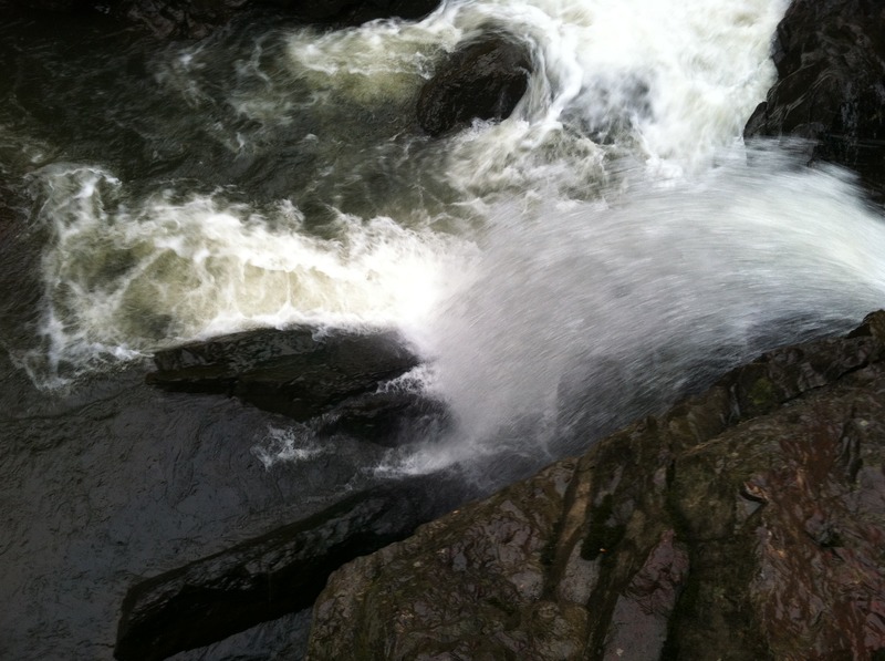
A look at the landing zone of the river left most falls at low water. This is why these falls are so dangerous.
Jun 5, 2011
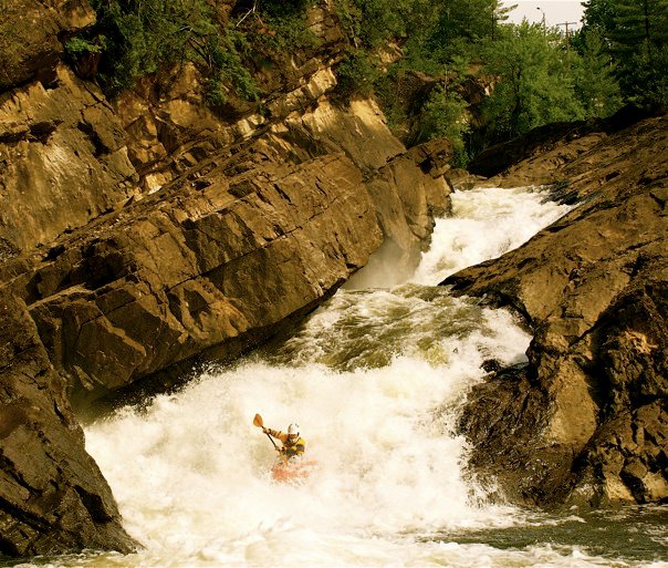
River right channel, first slide
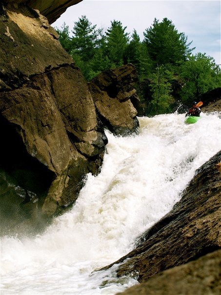
Jun 4, 2011
River right channel. Note this falls has 2 rocks in the landing zone making it particularly dangerous.
Jun 4, 2011
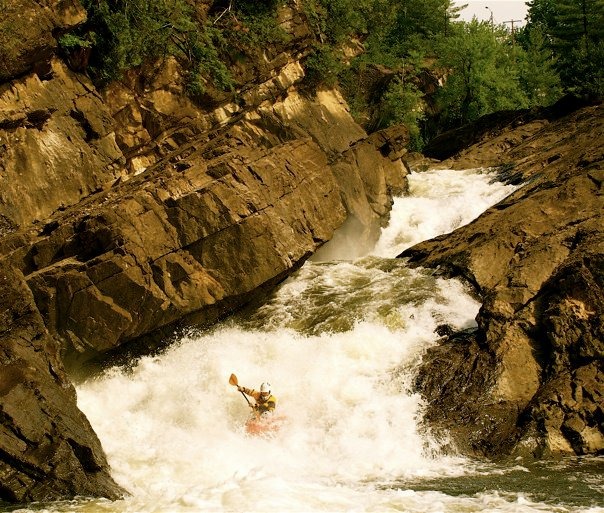
The double set of slides on the river right channel
Apr 4, 2011
Clay inspects the first of the two slides in the river right channel. Hole at the bottom of this slide was very large at this level. We opted to come back at lower flows.