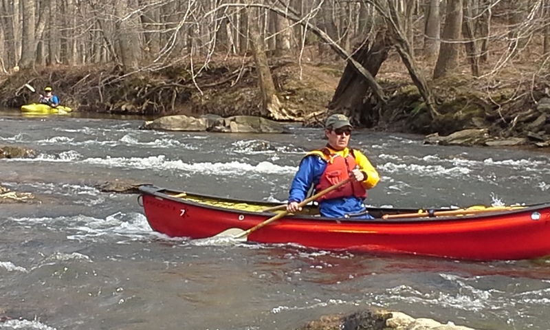
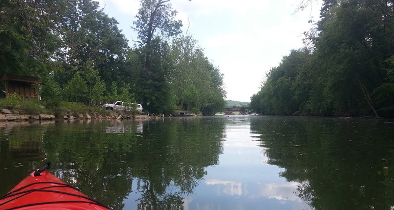
Seneca Creek
Black Rock Mill to Riley's Lock Boat Ramp(Lower Seneca Creek)
| Difficulty | I-II |
| Length | 15.2 mi |
| Avg Gradient | 10 fpm |
| Gauge | Seneca Creek at Dawsonville, Md |
| Flow Rate as of 58 minutes | 55 cfsbelow recommended |
| Reach Info Last Updated | January 28, 2019 |
The entire course of Seneca Creek stretches many, many miles from the headwaters of Great Seneca Creek in Damascus Maryland through the cities of Gaithersburg, and Germantown and on down through Darnestown and Seneca, Maryland to the Potomac River. While not the action-packed whitewater trip that most users of this site are used to, it does offer a nice float trip for beginners with a few navigation and stability challenges thrown in for fun. The creek itself is maintained by a very few volunteers who work in conjunction with the MD park service to remove strainers, but often has large amounts of wood in certain less-maintained stretches which can present a complete set of challenges all their own. The park office can be reached at (301) 924-2127 if you want to report a strainer.
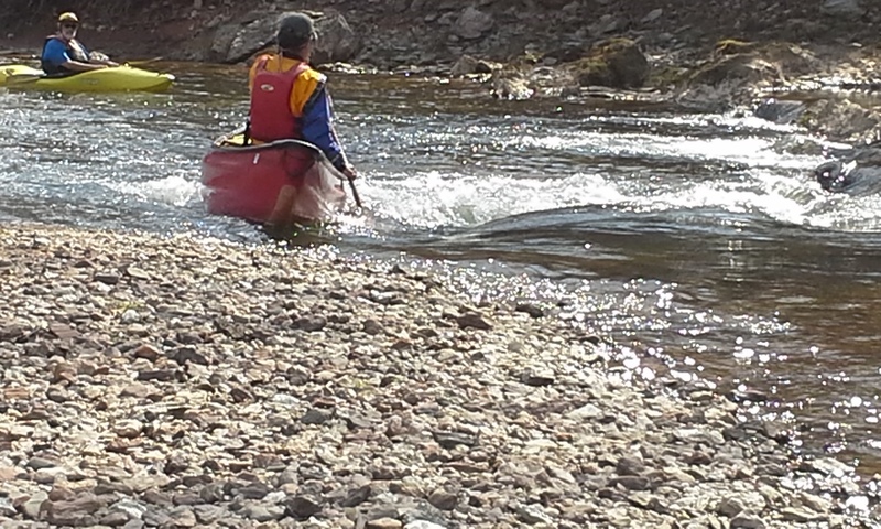
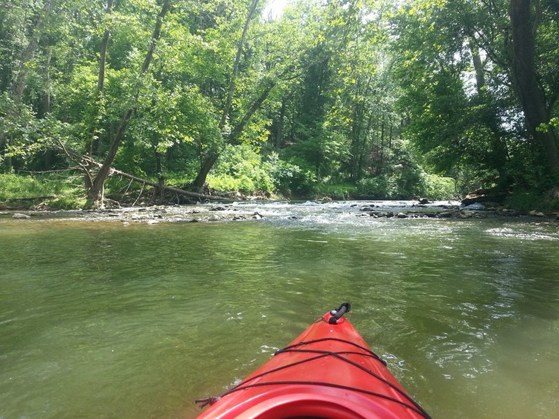
Seneca creek can be run in many different sections thanks to the many access points throughout the course of the creek. Above 120 CFS, Riffle Ford Road to Black Rock Mill Road will have the most class I-II action per mile, and Rte. 28 to Riley's Lock Road will hold its water a little longer than the rest of the creek remaining scrapy but runnable down to 70 CFS or so. Upstream of Riffle Ford road, a better minimum CFS might be 280. Upper levels are uncertain, but above 450 CFS the creek will get pushy and most of the fun will start to wash out.
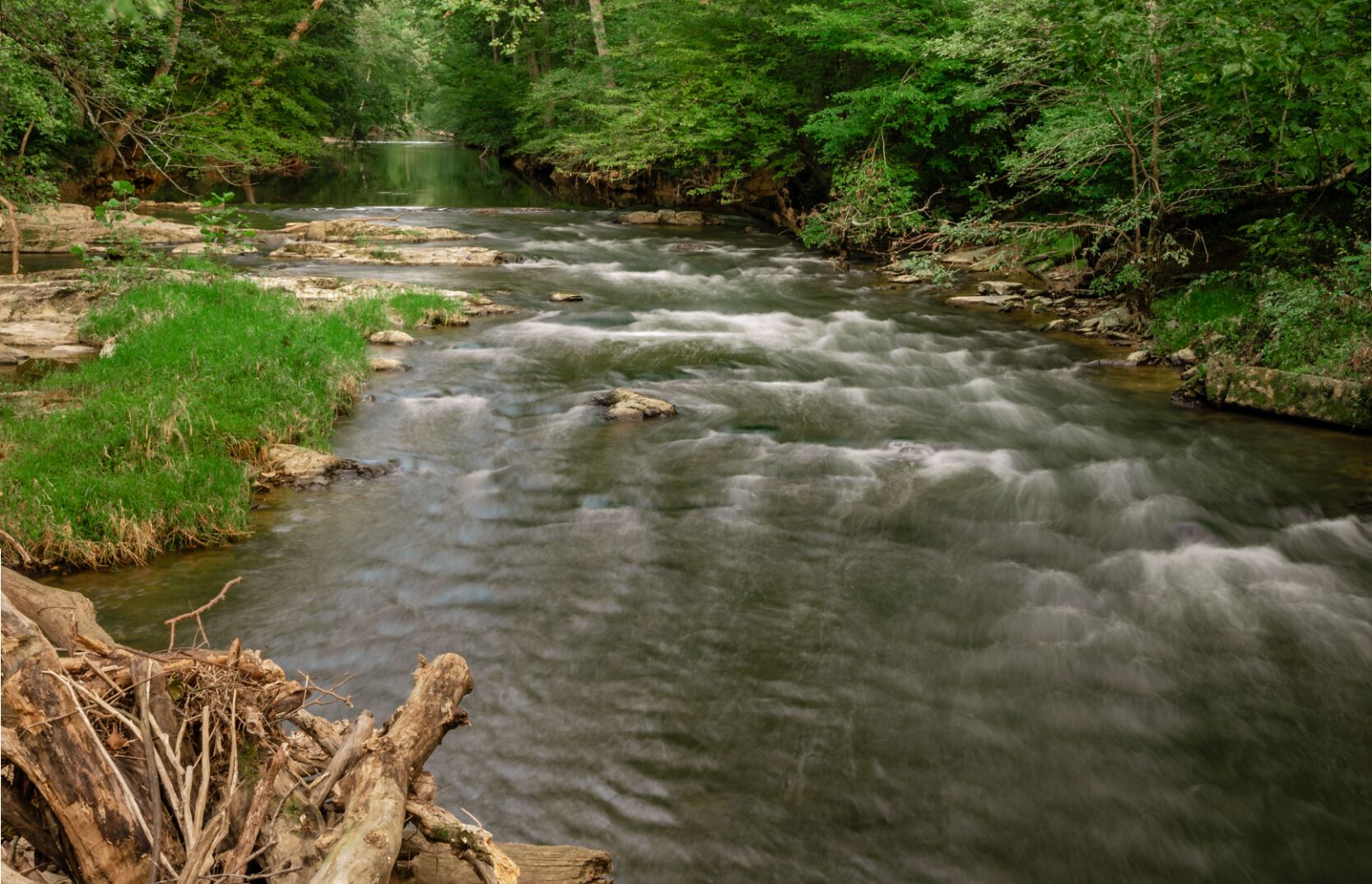
The water quality of this section is generally good. Sediments and pollutants picked up in the more populated areas have, for the most part, dropped out of the water by the time they reach the old Black Rock Mill and the bottom of the creek is clearly visible through most of the trip with the exception of some deep and long pools behind two low dams on the trip.
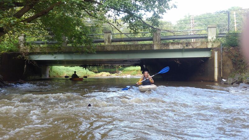
Access is reasonably good as is the ability for rescuers to reach those in trouble thanks to the Seneca Greenway Trail running parallel to the creek for most of its length as well as several access points from local roads which can bring vehicles close to the creek for ei
...
Park at Great Seneca Park 355 Parking lot and put in under the 355 Bridge
The Waring Viaduct is a stone railroad bridge built in 1906 by the Baltimore and Ohio Railroad that is still in use today
Park at the Seneca Creek State Park lot and put in just upstream
Pull off on the side of the road. Access is upstream on river left. Only enough space for two or three cars.
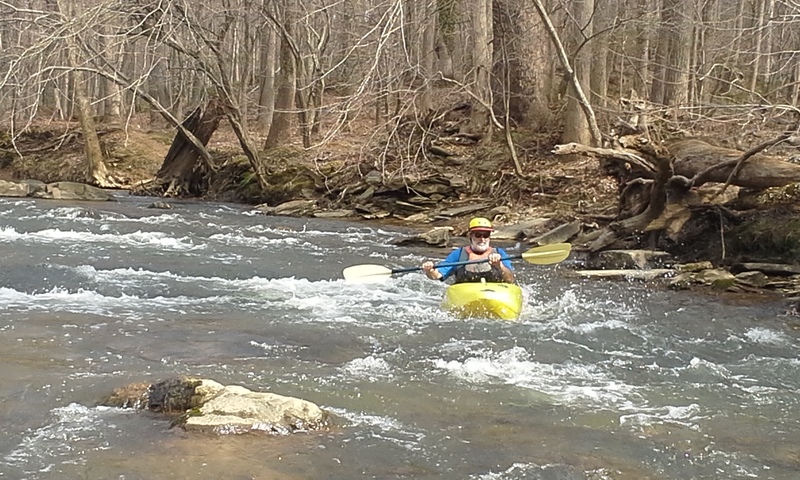
The creek spills through natural stone and the foundations of an old dam just before Black Rock Mill. Follow the wave train on river left and watch out for swimmers in the pool below.
Put in at the old Black Rock Mill on Black Rock Road.
Park at the Seneca Creek State Park lot. The old road leads directly to the Darnestown Road Dam
Low head dam that stands just a few feet high underneath the Route 28 bridge. Either flood control or possibly covering a water or sewer line that runs along the road. Best taken head on just right of center where a tongue forms. Expect some scraping at lower levels and a smoother ride at higher levels.
The tumbledown ruins of a stone and mortar dam built to divert flow from the creek, across the peninsula, and into the mill at Seneca Ford (present day River Road). Expect it after crossing the first long, deep pool on the creek when you can see a distinct horizon line. You will not hear the rapid until you are almost on it. Easily scouted from river right, you'll want to check it out from the shore as it is a quick drop over lots of rocks. The locals often build a sluice out of the loose rocks in the summer for tubing.
Quick access to the stream, and a good place to check the water level before committing to the trip. Park along the side of the road and walk the trail upstream to the ruins of the Tschiffely Mill dam. If there is enough water for you to make a scraping descent of the dam, you'll have enough water for the whole trip.
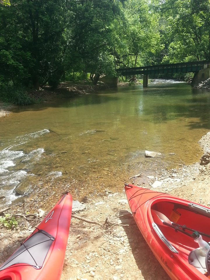
Public boat ramp with access to the Potomac River
Jun 12, 2022
Put in at Block Rock Mill and floated all the way down nearly 8 miles to Riley's Lock for take-out. Great trip. Beautiful, serene, and peacefulfloat with lots of tree cover overhead and dappled shade throughout. Truly a delightful place right in the heart of Montgomery County, MD that feels like you're out in the middle of nowhere. Spotted lots of wildlife including herons, ducks, golden finches, cardinals, turtles, a beaver, and a bald eagle. Flow rate was 136 CFS--very runnable with only a couple scrapes and two 1-minute portages through shallow water. We were able to float around almost all the strainers with a very quick portage over one large trunk no problem--only out of the boat for a minute or so. Lots of fun Class I rapids, maybe one or two could be considered Class II, a couple little 1-2 foot drops (including the one right under the bridge at MD-28, and lots of fast, curvy flowing water and ripples that provide some fun maneuvering challenges with the strainers, shallow water spots, rocks, etc, and curves in the creek. Just watch where the water is flowing the fastest and flow with it for the best and most fun float. Lots of great parking at Riley's Lock, but Black Rock Mill only has a few parking spots so you have to get there early. Only about a 12-minute shuttle between the two, and you get a 3+ hour float with no stopping. You can put in right there on the side where the mill and parking lot are, but if you portage across the one-lane bride and slightly up the creek (only 3 mins portage), you can put in just upstream of the Black Rock Mill rapids and enjoy them right out of the gate. Took us right at about 3 hours.
Apr 17, 2022
4/16/22 - We put in at Seneca Ridge & Greenway Trail Parking lot (mile 4.2) and came across 4 massive strainers where we had to either carry our kayaks around or get out and climb/maneuver over the fallen trees.
https://goo.gl/maps/yyU5UXwn9HVkCyZYA (39°07'56.9'N 77°16'36.1'W)
https://goo.gl/maps/LMFak7ncAL62Zjsv9 (39°08'01.6'N 77°16'41.9'W)
https://goo.gl/maps/2h1qpg7p8myoN2V47 (39°07'43.0'N 77°19'26.1'W)
https://goo.gl/maps/LMFak7ncAL62Zjsv9 (39°08'01.6'N 77°16'41.9'W)
There were plenty of other minor strainers that you could limbo under or squeeze through but we didn't bother noting those. The cfs was ~94 and we bottomed out quite a bit. I wouldn't recommend running this until the water level is a bit higher.
We put out at the end of this run, at the Potomac.
Jun 28, 2020
Strainer Report 27 June 2020:
The massive strainer 3/4 mile below Rt28 is now even worse. You could “limbo” under the far left side previously, at flow rates in the sub-250 CFS range. Now, there is another log tangle immediately after the limbo spot, right at water level. Only way through is a VERY dicey pull yourself under manouver to get past it. Also, the creek channel bottom under this strainer is DEEPLY undercut. Probably 8-10 feet deep, with limbs and flotsam intertwined in it. Total death trap. Needs to be cut out NOW.
There’s another strainer upstream of the Tschiffley Mill Dam pool, requiring a VERY precise leftward pivot at the exact moment, in order not to get pinned against the right bank and front of the strainer. This is another tough spot, and dumped half the people in our group as they tried to negotiate it.
The last strainer is downstream of Berryville Road. Easily passed underneath in two places, but it’s a recently fallen tree, and will get lower and lower as time passes, making it more difficult in the future.
The first strainer below Rt28 is the truly dangerous one though, and that’s the one MoCo Parks needs to focus on cutting out before it drowns someone.
May 24, 2020
Seneca Creek status May 2020, RT 28 to Potomac River
Gage height at Dawsonville, 2.35 ft, 126 cfs
Enough flow for easy paddling the entire trip except for a couple scrapes on shallow gravel riffles here and there.
Two spots with trees entirely across creek. First one is about 3/4 mile from 28, and is extremely large, but allows for a VERY low “limbo” passage at the far left bank of the creek. This would NOT be possible under greater flow conditions, and this would be a very dangerous strainer at higher flows. The second tree is about 1/2 mile below the first one, and offers a easy portage around the gravel bar on the right bank. This is a smaller tree, and could be easily cut out with a chain saw.
There is a tree across the lip of the rubble dam at the mill near Berryville Road. It blocks the best chute, leaving very bumpy rocky passages to the right and left. A good option at this flow level is left side, “dog walking” the boat down on a rope and reboarding at the bottom of the rapid.
There are other trees, but none except those two mentioned above block the entire creek. The rest offer at least some clear passage without difficulties.
Below the mill dam, the rest of the trip down to the Potomac is very easy. There is a massive logjam at the River Road bridge, but it is passable on the far right side.
2.35 ft is about perfect for conditions as they are now. Another 6” of river level would make it impossible to get under the first strainer.
Jun 17, 2019
Seneca Creek Update
*Seneca Creek park rangers just completed chain saw certification from MD DNR and plan to help keep Seneca clear of strainers and /or portage trails clear and marked. The park has acquired a new fleet of canoes and rec boats and has a draft plan to expand their paddling program from just at the lake to include the creek too. Pending approval from Annapolis, they expect to be able to roll out the program this summer.
Meanwhile, here’s the latest strainer report:
Riffle Ford to Black Rock Rd
THREE river-wide tree blockages that required portaging all of which involved steep banks I'd call the portages class three -- 10' elevation gains and a lot of elbow grease to complete. The logs are huge; I don't think the park can cut them easily cut them out. I'd stick with the section from 28 to Rileys while it's reportedly clear.
Black Rock Rd to 28: One massive log jam that had a long, easy drag around on River left earlier this spring but it now badly overgrown. The park may cut a new portage there on river-right, but for now I'd say Rt. 28 is the head of navigation.
MD Rt 28 to Riley’s Lock:
Currenlty clear of river-wide blockages! In addition, the park staff has removed the logs and flotsam that made the Berryville PI/TO a bit of a pain.
Oct 22, 2018
Hi all, here's the latest strainer report that I got from a Seneca
Creek State Park staffer on 10/22/18:
'The last report on Seneca Creek that I got was that the last big rainstorm all but cleared out Black Rock to Berryville, but that Riffle Ford to Black Rock (Which I agree with you is the better section) has become fairly jammed up. Fortunately, we are making plans to do a day of strainer removal some time soon, since a logjam above Riffle Ford has blocked off enough water to threaten to erode the bank enough to threaten one of our trails.'
It's great to see that a few park staffers have taken to paddling the creek on their off hours, and it was a pleasure to meet and paddle with them when CCA put together a trip for them last summer.
Sep 12, 2018
I've run Seneca Creek twice this summer with several Canoe Cruiser's Assn, leaders and SCSP staff to assess the strainer situation report the following as of late August. The Creek is mostly open with a few easy drag arounds/ drag overs, and a few duck unders/tight squeezes, but beware of the following: A massive, newly downed scycamore slipped off the bank earlier this year, and it's river-right root ball may collect wood. The tree blocks enough of the creek that the river-right banks got carved out during the last high water event so that logs clogging its channel got washed out as of late August. If more collect there (about two miles below Rt. 28), the best portage is on river-left, with fairly easy egress and reentry. Below there, about a mile above the Berryville Rd. access point, a new, river-wide strainer presents a more serious challenge, given the steep banks and its propensity to pile up any wood that floats into it. At the 80 or so CFS we had, we were able to hump and over some of the wood, then swim our boats through the rest of the pile. No problems below.
With more high water coming from Hurricane Florence, the situation will likely change in mid Sept. I'll try to post an update an photos later this month. Meanwhile see the CCA Facebook page for phots from our last trip.