South Fork Mills River
Pink Beds to Turkey Creek.
| Difficulty | II-III(IV) |
| Length | 12.1 mi |
| Avg Gradient | n/a |
| Gauge | Mills River Near Mills River, Nc |
| Flow Rate as of 1 hour | 50 cfsbelow recommended |
| Reach Info Last Updated | May 8, 2019 |
The South Fork of the Mills River is a gem of an excursion following a strong rain in Transylvania and Henderson counties. This section, and the river’s headwaters, are entirely within Pisgah National Forest and thus has excellent water quality, even following heavy precipitation.
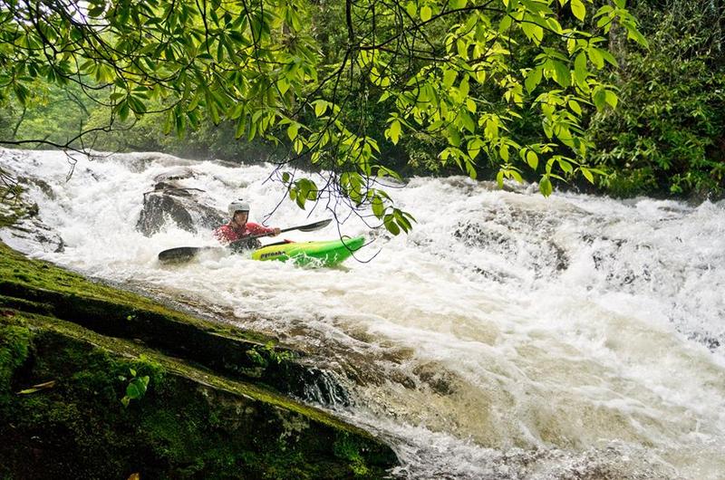
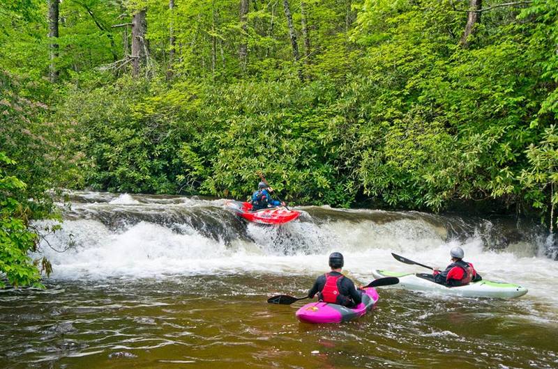
Starting where US Forest Road 476 ends at the S. Mills River Trail, the ‘South Mills’ travels 12 miles through a beautiful and remote valley before passing under the Turkey Pen bridge. Most of the whitewater action is contained to the first few miles of the section, between the put-in and High Falls, a Class VI waterfall with no foreseeable safe line. Between the put-in and the High Falls, there are several class II-III slides, a couple boof moves, and a boulder garden or two, along with a few scattered logs thrown in for good measure. It’s advisable for all paddlers to be on high alert, as fallen trees can appear around blind corners with limited eddies to scout from.
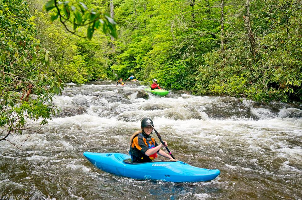
Below High Falls, the South Mills is mostly scenic class II read-and-run, with a few scattered class III slides and boulder gardens, depending on the water level. The whole run’s scenery is exquisite, with notable points of interest including: Otter Hole, High Falls, Wolf Ford, Copperas Rock and Cantrell Creek Lodge.
To reach the take out, find Turkey Pen Road on the west side of Highway 280 (Bolyston Highway), 6.2 miles south of where Highway 191 departs Highway 280 southeastward towards Hendersonville. Travel up Turkey Pen Road (high clearance and four-wheel drive is recommended) approximately 1.2 miles to its terminus at the Turkey Pen Gap parking area (Pisgah National Forest). The trail in front of you, departing the parking lot downhill behind the kiosk, will be the trail you hike out on following the paddle. It’s not a bad idea to walk down to the bridge and note something unique about it’s presence so that you know which bridge to take out at – you’ll pass a few along your trip downstream, and
...
Not a true rapid but more of a notable feature on the river. Has a few lead in slides. Very scenic spot
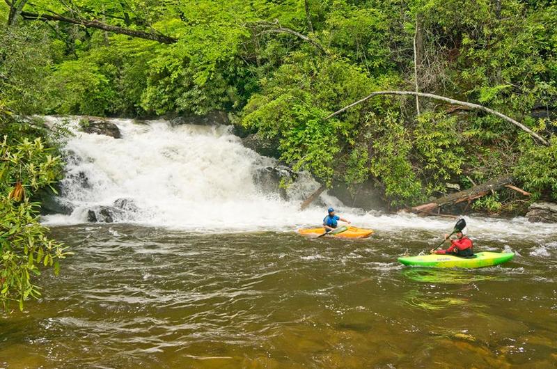
Only about 15ft tall but lands on bit of a shelf. There is a tempting entry slide above that looks great but you may not be able to eddy out before the falls. It has been ran before however. Use trail on river right to portage.
Dec 26, 2023
Group of six put on at trailhead (had to carry boat about 1 mile down FS road as gate was closed. Few eddies at this flow- we split into 2 groups of 3. First significant rapid about 0.3 miles into the run had 2 logs jammed against right bank creating significant hazard- some of us portaged on river left trail and some ran a clean line on far river left. Another 0.5 miles into the run came across a river-wide strainer in class III rapid following large pool. After 2nd concrete bridge is class III rapid preceding rock slide (IV), which had wood in the center and very sketchy wood nearly impossible to see in the right side at the top. Could scout river right but eddy above is small. Must make small eddy at bottom. Rock slide immediately precedes High Falls (must portage river right). After High Falls continuous class II+ boogie, occasional easy to portage river wide strainers. Highly recommend crack of dawn start or an overnight, abundant camping after high falls. True wilderness paddle with very difficult bail options
Apr 5, 2021
Info from our 3/27/2021 run at 700cfs
Put on the water at 11:30 and took out at 4:30. Put in requires ~1 mile hike in if the gates are closed. Take out requires ~.5mile hike. Strongly recommend scouting or marking the take out location. Take out at N 35 20.6217 W 082 39.9156 per my garmin. Shuttle takes about an hour. High clearance vehicle nice but not typically necessary.
The falls lie after the class IV chute. The chute runs river right and drops about 20 feet. The chute is a must scout feature, and itself is preceded by a river right chute or a right of center boof about 150 yards upstream. These features were observed just over an hour into the trip. The falls portage is on the right side of the river. It is narrow and steep.