Beaver Dam
Cotton Mill Park to CTH.J (5.35 miles)

| Difficulty | I-II |
| Length | 5.4 mi |
| Avg Gradient | 10 fpm |
| Gauge | Beaverdam River at Beaver Dam, Wi |
| Flow Rate as of 40 minutes | 22 cfsbelow recommended |
| Reach Info Last Updated | September 21, 2020 |
A fun stretch of river for recreational kayakers and beginner whitewater paddlers. The run contains numerous areas of riffles and rips, and at least a couple waves capable of allowing surfs and (at ideal flows) spins for those in whitewater playboats.
An area paddler has been working with the 'powers that be' in an attempt to get recreational releases a few times during summer months. Stay tuned for further notice on this!
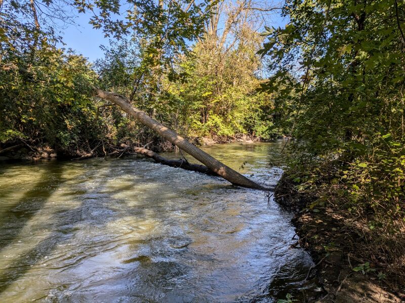
There has been some 'caretaking' of this section, removing some existing strainers. As of this update (2018.07.23) there are NO IMPASSABLE STRAINERS, however there are trees to duck, dodge, or maneuver through! At lower flows (perhaps up to 250-300 cfs), they shouldn't be a major problem, but as flows increase, your skill-level must be significant to confidently maneuver through these! (On a recent trip down this, I found numerous pieces of evidence of mishaps resulting in lost gear by inexperienced recreational paddlers.)
Keep in mind that new deadfall may happen at any time, so you need to be prepared by looking well-downstream, being ready to eddy-out and scramble for whatever strategies are needed to deal with the deadfall in swift current!
Other websites/blogs report wire fence spanning the creek at one or two places, though they appear to have been cut and rolled-back ashore (again, as of 2018.07.23 -- unknown whether they may be restrung or if that will be a permanent removal).
Far more of concern: a couple bridges will become problematic (difficult or impossible to float through/under) at higher flows. DO NOT RUN THIS ABOVE THE RECOMMENDED 'MAX'!!!
This video features highlights of this run: https://youtu.be/p0wkdvgt858?t=20

Signage at the impoundment indicates that there are periodic problems with blue-green algae blooms. When present, people are advised not to swim nor let any pets swim in or drink any water from the pond or river! Blue-green algae produce toxins which are dangerous/fatal to humans and pets!
'If the water is cloudy, looks like green paint or pea soup, or has floating scum layer or floating clumps ...'
These events are most likely when summer temperatures have warmed the millpond.
If you boat during these times, do your best to minimize contact with the water, and make certain to bathe/rinse yourself and any wet gear (clothing, PFD, etc) as soon as possible!
See WIDNR Website for more information. (Several tabbed pages of info to read!)
The put-in area (between the dam and Beaver Street) is very popular with fishermen, so you may have some contention for put-in. Please be courteous and considerate and try to coexist ... remember that YOU represent EVERY paddler ... don't give us all a bad reputation by being rude with fishermen. Do your best to 'negotiate' with them and be as brief an interruption as possible.
The shoreline through this mini-park is lined with rock (to minimize erosion). It will help if you are comfortable with a 'seal launch' from the rocks, otherwise you must steady your craft, get in, and get settled before it is caught in the current.
A short cement 'wall' (weir) crosses the river as it enters the Beaver Street culvert. There may be some very minor play possible here, but it is likely to be a fail at many flows.
NOTE: some blogs and websites have this and the next one listed as 'low-head dams'. They are really far too small to be categorized as such. The TOTAL height is less than a foot, and the river-depth (even at nearly 500 cfs) is not enough to create any uniform, 'keeper' hydraulic of such size and depth as to trap or keep a boat or boater. By the time there would be enough depth for a true hydraulic, the flow would be enough to obliterate any sign of these weirs!
Passing under Center Street, you will find another very short weir which may create a minor playable wave/hole at certain flows. Dead-center-river, not far below, a fair-sized rock awaits to either act as obstacle or entertainment (depending on flow and your skill). A little splishy-splash (minor waves) occurs as the water trips across rocky rubble and curves off to the right (SSE).
As you pass a tall watertower, additional riffles and waves are likely, especially as an outflow culvert dumps in (if your run is during or immediately after a rain), and the river bends further to the right. Novice boaters may be challenged to avoid the rocky shore that the current will take them toward. (Playboaters are not likely to find anything of interest here.)
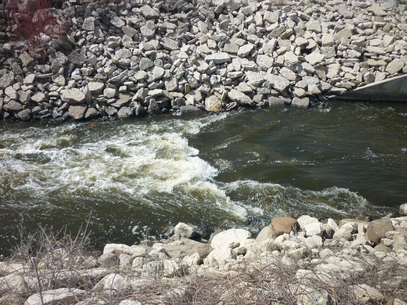
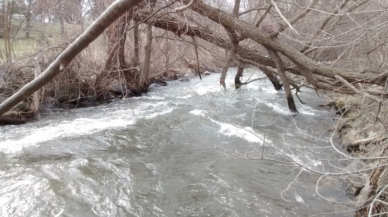
Immediately after passing through the divided (two-tunnel) road bridge/culvert under Mill Street, you'll encounter the first (and arguably biggest and best) good wave on the run. Stronger boaters, at some flows, may be able to turn bow-upstream to catch this on the fly. More likely, it will be necessary to eddy-left and paddle up (bashing river-left rocks with your paddle) to surf (and spin?) on this feature.
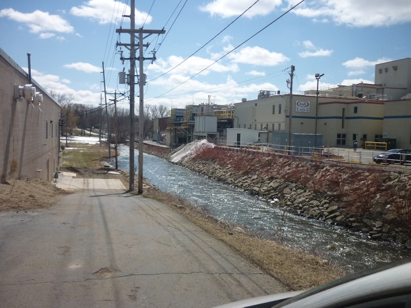
A bit of constriction and riverbed obstruction (near/beyond the South end of Kraft warehouse/building) may make some small waves.
Also (at least, as of 2018.07.23) there are downed trees hanging low and into the river. At this time, passage is possible, but may require a little quick maneuvering. At lower flows (up to maybe 200-250 cfs?) confident paddlers should have no problems. As flow gets more 'pushy' (300-500 cfs), it will take strong, experienced boat handling to assure success here -- others may be taking a roll-of-the-dice, perhaps having success, perhaps suffering a capsize trying to navigate this area.
A stormwater pond was created at this location during 2024. This should only affect flow in the river during (and immediately after) heavy rains. Storm drains (which formerly may have entered the river near here) will now empty into this pond, keeping the river cleaner/clearer during heavy rain events, and thus diminishing those peak flows during rain events. To the best of our understanding, this should not affect flows as regulated by the dam at the put-in.
Site of USGS gauge. For those who may wish a short trip, maximizing swiftwater/whitewater and minimizing flatwater, this may make a good alternate take-out. For those intimidated by the swiftness of the upper section (with its rocky riverbed and shoreline), this may be a better alternate put-in.
As you pass Cooper Street, and the river-left water-treatment plant (which may add some chemical smell to the flow), you begin a LENGTHY stretch of wide, almost lake-like flat water.
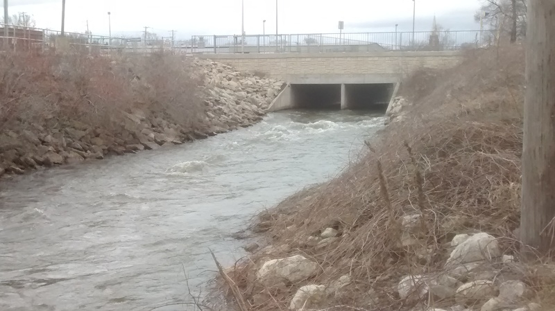
As the river encounters Hwy.151, you will enter a significant box-culvert.
As you enter this trestle, be very alert for a wire fence which may span the creek on the downstream side. As of 2018.07.23 it has been removed, but that could change at any time!
There was another fence to be on the lookout for some distance downstream. BE CAREFUL AND ALERT in case they are restrung.
(Swiftwater, no rapids ... just a curiosity and a way-marker.)
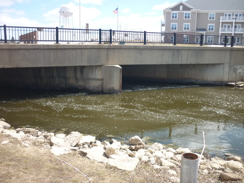
An old rickety (private) bridge is signal for a sweet little wave.
Recreational paddlers will easily 'punch through', while whitewater boaters will likely wish to stall their downstream speed for a 'catch-on-the-fly' surf here. Depending upon flow, this may or may not be regainable, since it lies between vertical bridge-piers. (At 470 cfs, I was unable to regain it.) Depth seems good enough that it could allow vertical moves (unproven, since there was so much algae present the one time I have paddled this that I really didn't want to risk having to roll).
Serious playboaters/whitewater kaykers could attempt take-out here (foregoing nearly 1.25 miles of uneventful paddling, as all which remains downstream is swiftwater and flatwater).
However, guard-rails preclude parking for a bit of distance each side of the bridge, and road shoulders are not very wide for parking off the paved road. Whereas, both CTH.S and CTH.J have better parking and egress from the river.
There is a fair-sized island preceding, with only minor flow going to the right, and the main channel to the left. A minor rock-rubble dam narrows the river, creating a nice minor 'chute' and wave-train (at least, at some flows). (This is the last whitewater/swiftwater feature of this section.)
One could cut off the rest of the run (~0.6 mile of dead-flat water) by taking out at this bridge. The river here still has slightly swift current, the riverbanks are somewhat steep and filled with very tall grass (mid-summer til late-fall), making exit from the river more problematic than the listed take-out (unless you happened to 'beat down' a path when you set shuttle). The listed take-out does have better parking, and the 'locals' may be keeping that landing a bit better 'kept' (mowing, providing a slightly 'improved' landing area).
Mar 21, 2026
No wires but two or three possible portages as of March 2026. The first tree is in between Davis St. and Cooper St. Kayakers in short boats could maybe run it in the middle or butt-scoot over on the far left (at least at our water levels). The second downed tree lies just downstream from the retention pond riprap (river-right). This tree would be easy to cut with a chainsaw. We portaged over the loose, angled riprap. Scroll to the end of the comments at https://milespaddled.com/beaver-dam-river-iii/ for a longer report.
Oct 12, 2024
I paddled this section April 13&15, 2023 at ~230 CFS, and on 10Oct2024 at 210 CFS. (The history of the Beaver Dam River gauge shows that they open and close the dam gates abruptly, so check it shortly before paddling.)
The wave below Mill Street was big enough to douse my life vest. I'm glad I was wearing a spray skirt. My friend took water over the bow of his 14.5 ft. canoe and bailed out a couple of gallons of water downstream from the wave.
At Pearl St., a large retention pond is under construction as of Oct. 2024. How will the pond affect the river for paddlers, I wonder?
As noted in the main description, ' there are trees to duck, dodge, or maneuver through!' On Oct. 10, 2024 there was a log across the entire river downstream from Davis St. and upstream from Cooper St. We portaged river left. Here's a link to 8 photos of the river, including 2 photos of the log: https://photos.app.goo.gl/UsP7yyj1w3v9MLDg7
As of Oct. 10, 2024 a large tree limb blocked the middle channel of the arched railroad bridge, except for a narrow passage near the right wall. We slowly sneaked between the limb and the bridge wall.
The launch at Cotton Mill Park and the landing at Hwy J have been improved within the last few years.
Here's a trip report and video via wisconsinrivertrips.com from April, 2017. The author was caught in an unexpected 420 CFS dam release: https://www.wisconsinrivertrips.com/segments/beaver-dam-river
Be safe out there!