French Broad
6. NC Route 251 to Route 1634 (Woodfin River park to Alexander)
July 23, 2011
| Reporter |
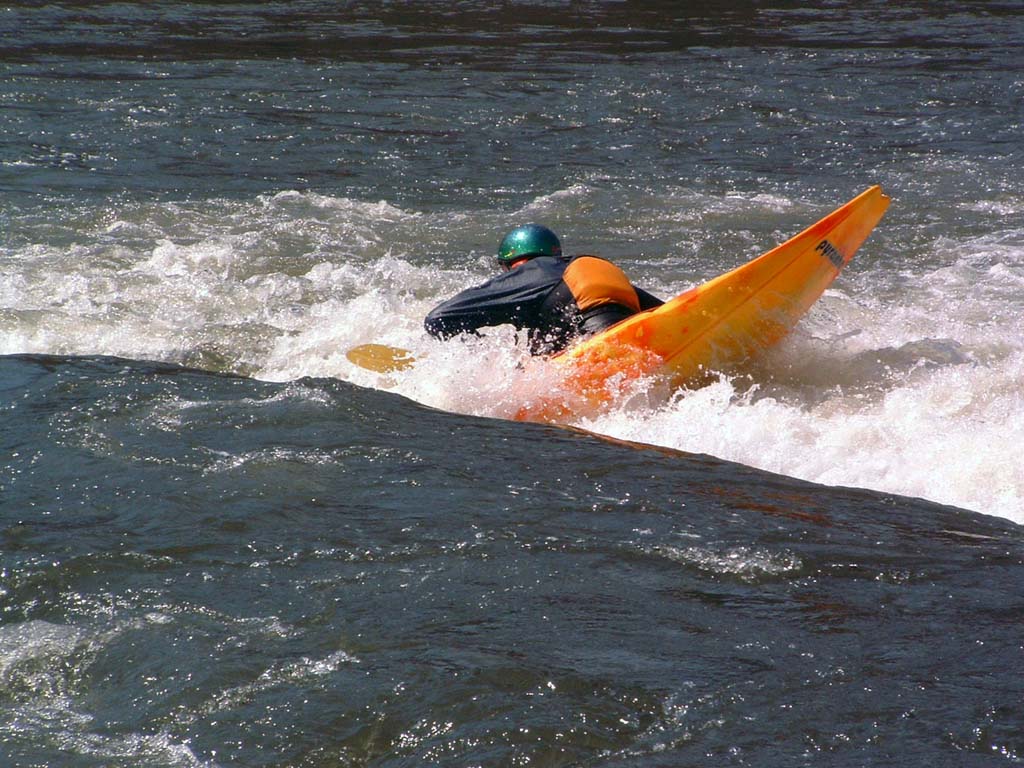
Beta for this section appears quite thin. I have a few observations to add. Put in at Woodfin River Park off 251 and paddle down the flatwater to the dam about 1/2 a mile or so. The portage around Craggy Dam is quite easy. You can take out about 50 feet from the dam on the left, or if water levels are higher, you can take out a bit further upstream near the warning sign for the dam. It says 400 feet, but it feels like considerably less, maybe about 100-150 feet. To put back in you can either put back on immediately below the dam, or carry another 150 feet or so downstream along the railroad embankment to an easy slide down the railroad ballast (we lowered with a throw rope) to an easier re-entry. Below the dam, the water level is more complex than most reports would lead you to believe. The Craggy Dam impoundment bypasses about 3200 feet of river on the river right side , and was generating when we paddled it. This meant the 3200 foot bypassed section was running pretty dry. Documents from NCDENR show that the dam releases 460cfs July through January and 860cfs the remainder of the year, though no release times or schedule were found. When the dam isn't generating, the diverted flow spills over the dam making the 3200 foot 'dries' more runnable. We were still able to paddle it, but had to pick our lines carefully. Once we intersected the release channel on river right below the powerhouse, flow improved greatly, and there is a rocky Class III chute here on far river right that can be run or bypassed by picking your way through the rocks to the left of the rapid, though you'll scrape a bit unless levels are higher than 1500cfs on the Asheville guage. Below this rapid things calm down considerably to class I-II for a good stretch of relatively remote but rocky river, as River Road (251) leaves the river for a few miles here. Once you rejoin the road on river right, you'll pass a campground which signals the beginning of the Ledges section. These areas are class II, but are more like class III above 1000cfs, due to the turns required to negotiate the rapids. Immediately below Ledges park, there are low drops on river left and right. The right side is fun, but drops into a scrapey rock garden with no easy line out at lower levels. The next mile or so of river has good gradient but is constant rock garden. About 2 miles below Ledges Park is the Alexander Bridge rapid. Probably a high class II at low to moderate levels. Run left between the bank and left most pylon at lower levels. There is a wave here which I've seen surfed and which has been reported on before. Note that though it is advised in most guidebooks and online sources to take out at or below this bridge, there really isn't a good place to do so, or parking available here, unless you take out above the bridge, and the bank here is pretty steep, and access is questionable. Instead, you can run down the river a bit further to a riverside park adjacent to the Alexander Mountain Bike park, which has abundant parking and river access, or run even further down to the Walnut Island Park which also has good access. It's 5 miles from Ledges Park to Walnut Island Park. Between Alexander Mountain Bike Park and Walnut Island Park, there's also a ledge that can be run a variety of ways depending on the water level, but other than this the run is mostly Class I-II unless levels are high.
We have run Ledges to Walnut from 750cfs to 2100cfs. 2100 is more fun.
We have run Woodfin Park to Ledges Park at ~850cfs, though with additional water from the dam release below the 'dries' it was more like ~1300cfs. This would have been more fun with more water (low runnable).
Note also that the width of the river makes recovering from swims difficult.