French Broad
6. NC Route 251 to Route 1634 (Woodfin River park to Alexander)
| Difficulty | I-III |
| Length | 8.6 mi |
| Avg Gradient | n/a |
| Gauge | French Broad River at Asheville, Nc |
| Flow Rate as of 28 minutes | 713 cfsrunnable |
| Reach Info Last Updated | August 30, 2024 |
River Description
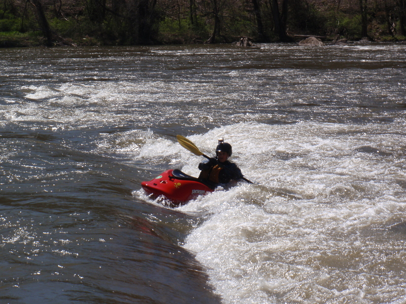
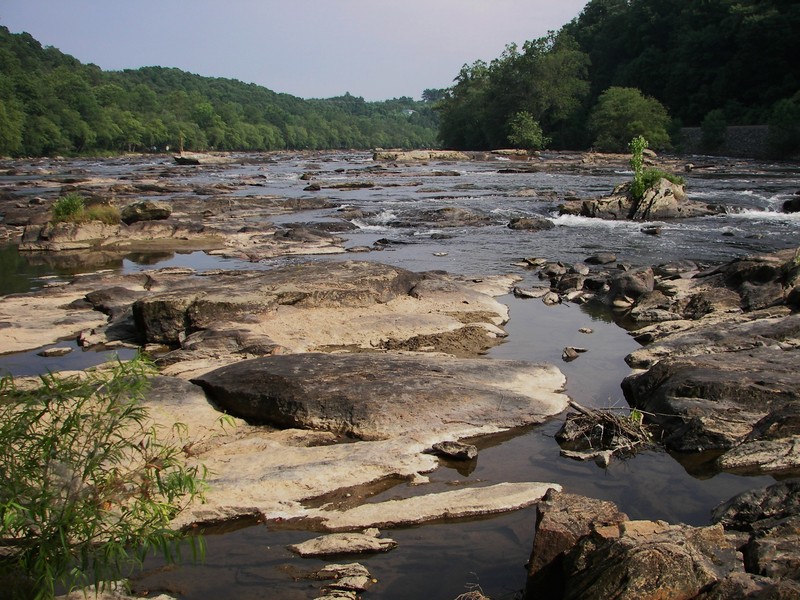
Not a frequently run section of river. Pubic access available at Woodfin Park. A short distance downstream the water is backed up by a dam that supplies water to the Metropolitan Sewage District. Portage on the left (short & steep). This is mostly a class 2 run with one class 3 at medium levels (~2,000 cfs). At the upper end of the range the ledges is probably a 3 also. Many advanced to expert boaters will play at Ledges Park at levels much higher than 5,000 cfs.
Carolina Whitewater, B.Benner
More info is available on Chris Bell's Asheville-Area Canoeing and Kayaking Page. or his newer BoatingBeta.com page.
from Discoduck on boatertalk. March 2003:
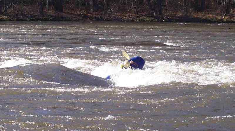
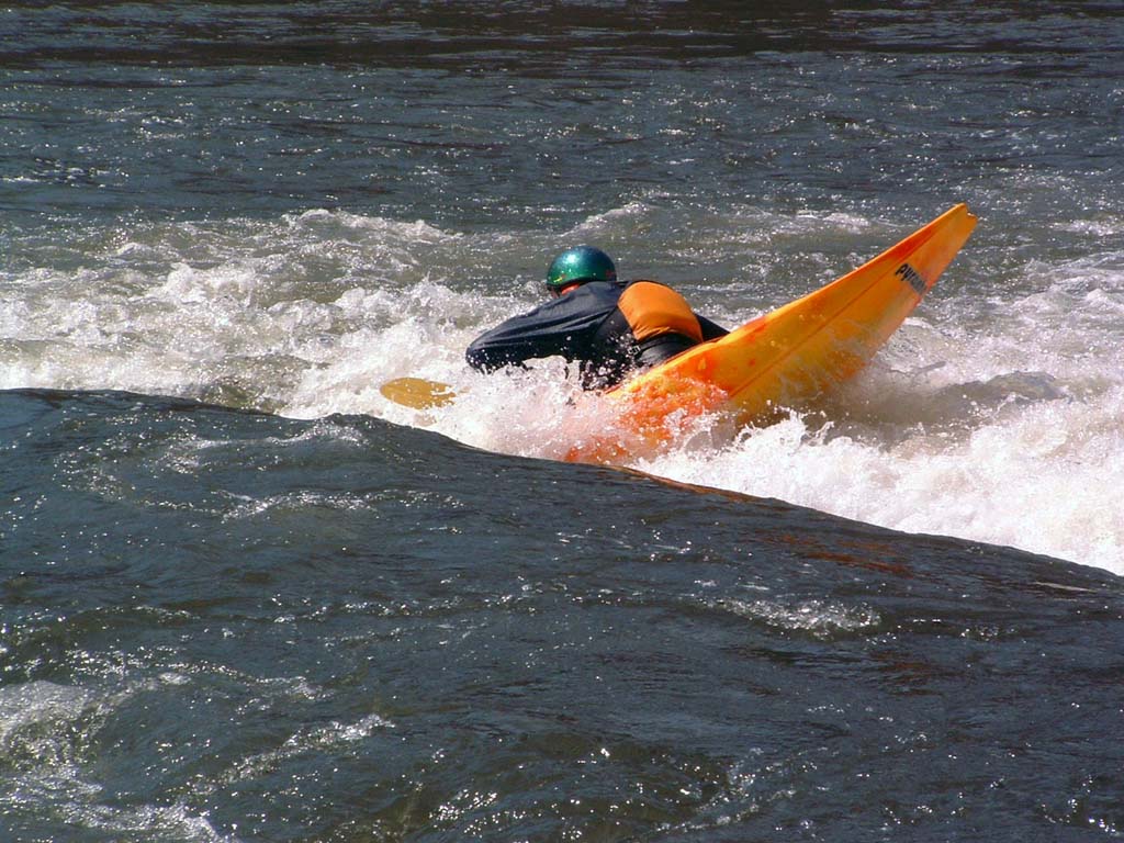
Ok, the ledges park is really fun, because it is close to town, but the quality of the playspots there are not up to the level of quarry or the NOC wave. At the upper most section of the ledges there is a small but nice 360 hole that gets really good at levels from around 2500 to 3500 cfs, and at that level, you can even throw some ends in it. furthur down is a cartwheel pourover that is hard to spot, but really fun once you figure it out. it washes out above 1800 cfs or so. It is really good at lower levels of around 700-1300 cfs of flow. The only drawback to this spot is a rock on the right side that is a real boat breaker if you get off line, but it is worth the boat abuse in my opinion. I have seen a few people get 30-40 ends in this spot. A dozen or so is the best I can do!
Below this is the 'main' drop of the ledges, some fun circular attainments can be done in this rapid (go upstream above a rock using a small hole/wave to slingshot you, come back around across the current and through at slot, repeat again and again). there is also a cartwheel pourover here that is 'walled in' by rocks on both sides that is good at levels of 2000 or so. de
...River Features
Silver-Line Park Put-In
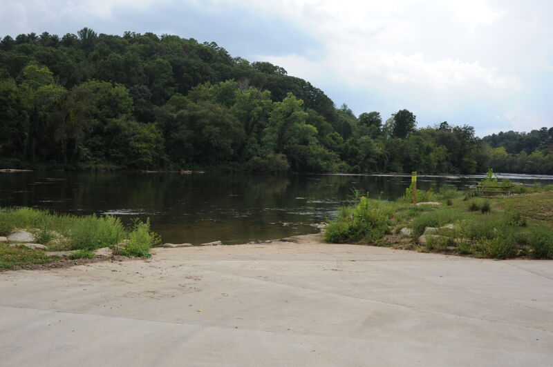
Access on river right at Sliver-Line Park in Woodfin. Concrete ramp to the river's edge.
Woodfin Riverside Park Put-In
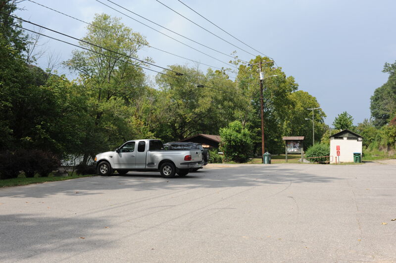
Access on river right in Woodfin Riverside Park. Requires a short carry to the river.
Taylor's Wave
Play wave honoring the memory of Taylor Hunt.
Craggy Dam
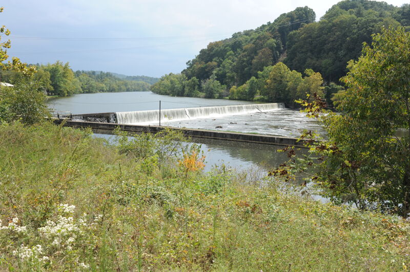
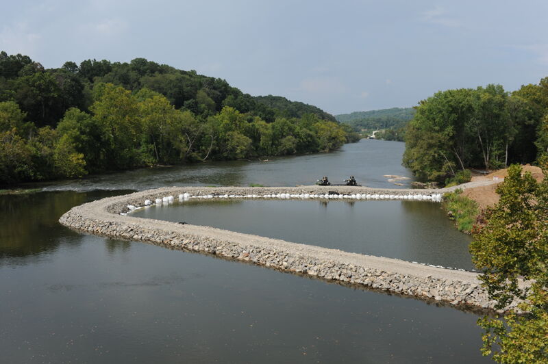
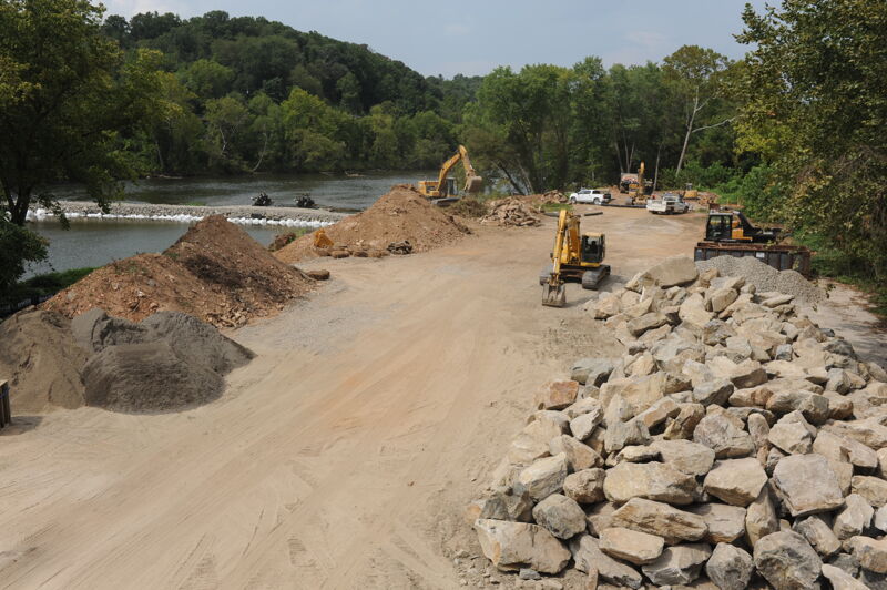
Diversion dam for the Craggy Dam Hydropower Project (FERC P-7497). A short and steep portage on river left.
Metropolitan Sewerage District Hydropower Plant
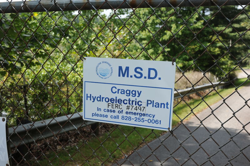
Metropolitan Sewerage District's Hydroelectric Facility and the Craggy Dam Reservoir (originally named Weaver Dam) were constructed in 1904 for electric generation by the W.T. Weaver Power Company and supplied power to Asheville Electric Power Company to operate the City’s street railways. In 1926, Carolina Power and Light Company bought the dam and operated it until 1963 at which time it was deemed uneconomical, and operations were discontinued. Soon thereafter, MSD purchased the hydroelectric dam and power generating facility from Carolina Power and Light Company. In 1984, MSD rehabilitated the facility, reconstructed portions of the flume, and began generating power to offset a significant amount of the plant’s annual electrical demand.
Ledges Park
Access at a public park on river right.
Fletcher Martin Road Bridge Take-Out
Trip Reports
Log in to add a reportPhotos of access points on a drive up along the river.
Biltmore
If you didn't know on April 30th of 2013 millions of gallons of raw sewage flowed into section 6 right above ledges whitewater park due to a mechanical problem at the upstream MSD treatment plant . id stay out of that water for a while at least till the next heavy rain to be safe.
Ran in kayaks yesterday the 2nd of june i guess . it was like 1490 cfs somewhere around there we scraped are way along below the dam there were a few good lines through out the trip where u had plenty of water over all fun run think i would wait for 2000 cfs or higher before i run it agein the best take out to get around the dam is right at the 400ft warning sighn at river left
Beta for this section appears quite thin. I have a few observations to add. Put in at Woodfin River Park off 251 and paddle down the flatwater to the dam about 1/2 a mile or so. The portage around Craggy Dam is quite easy. You can take out about 50 feet from the dam on the left, or if water levels are higher, you can take out a bit further upstream near the warning sign for the dam. It says 400 feet, but it feels like considerably less, maybe about 100-150 feet. To put back in you can either put back on immediately below the dam, or carry another 150 feet or so downstream along the railroad embankment to an easy slide down the railroad ballast (we lowered with a throw rope) to an easier re-entry. Below the dam, the water level is more complex than most reports would lead you to believe. The Craggy Dam impoundment bypasses about 3200 feet of river on the river right side , and was generating when we paddled it. This meant the 3200 foot bypassed section was running pretty dry. Documents from NCDENR show that the dam releases 460cfs July through January and 860cfs the remainder of the year, though no release times or schedule were found. When the dam isn't generating, the diverted flow spills over the dam making the 3200 foot 'dries' more runnable. We were still able to paddle it, but had to pick our lines carefully. Once we intersected the release channel on river right below the powerhouse, flow improved greatly, and there is a rocky Class III chute here on far river right that can be run or bypassed by picking your way through the rocks to the left of the rapid, though you'll scrape a bit unless levels are higher than 1500cfs on the Asheville guage. Below this rapid things calm down considerably to class I-II for a good stretch of relatively remote but rocky river, as River Road (251) leaves the river for a few miles here. Once you rejoin the road on river right, you'll pass a campground which signals the beginning of the Ledges section. These areas are class II, but are more like class III above 1000cfs, due to the turns required to negotiate the rapids. Immediately below Ledges park, there are low drops on river left and right. The right side is fun, but drops into a scrapey rock garden with no easy line out at lower levels. The next mile or so of river has good gradient but is constant rock garden. About 2 miles below Ledges Park is the Alexander Bridge rapid. Probably a high class II at low to moderate levels. Run left between the bank and left most pylon at lower levels. There is a wave here which I've seen surfed and which has been reported on before. Note that though it is advised in most guidebooks and online sources to take out at or below this bridge, there really isn't a good place to do so, or parking available here, unless you take out above the bridge, and the bank here is pretty steep, and access is questionable. Instead, you can run down the river a bit further to a riverside park adjacent to the Alexander Mountain Bike park, which has abundant parking and river access, or run even further down to the Walnut Island Park which also has good access. It's 5 miles from Ledges Park to Walnut Island Park. Between Alexander Mountain Bike Park and Walnut Island Park, there's also a ledge that can be run a variety of ways depending on the water level, but other than this the run is mostly Class I-II unless levels are high.
We have run Ledges to Walnut from 750cfs to 2100cfs. 2100 is more fun.
We have run Woodfin Park to Ledges Park at ~850cfs, though with additional water from the dam release below the 'dries' it was more like ~1300cfs. This would have been more fun with more water (low runnable).
Note also that the width of the river makes recovering from swims difficult.
Surfing S#!% hole I think?
whats the lowest this can be run?
I am not sure if we shoulndn't just forget the boats and bring climbing gear.
Tough eddy work at this level, but do-able and fun for sure. Make sure and check out the Alexander Wave a few miles downstream under the bridge.
If you slide back on the foam, and go over to the river left side of the wave, you can cartwheel in it.
Scott making his way accross the moving water below the shithole