French Broad, North Fork
2) Route 1326 Bridge to US Route 64 Bridge(Classic North Fork FB)
| Difficulty | III-IV+ |
| Length | 7.2 mi |
| Avg Gradient | 55 fpm |
| Gauge | French Broad River at Rosman, Nc |
| Flow Rate as of 15 minutes | 100 cfsbelow recommended |
| Reach Info Last Updated | July 31, 2025 |
American Whitewater has been working with citizens to propose Wild and Scenic River designation for approximately 3.2 miles of the North Fork of the French Broad River, located in Transylvania County, North Carolina, beginning in 2016. This section of the river is entirely on federal lands managed by the [...]Read More
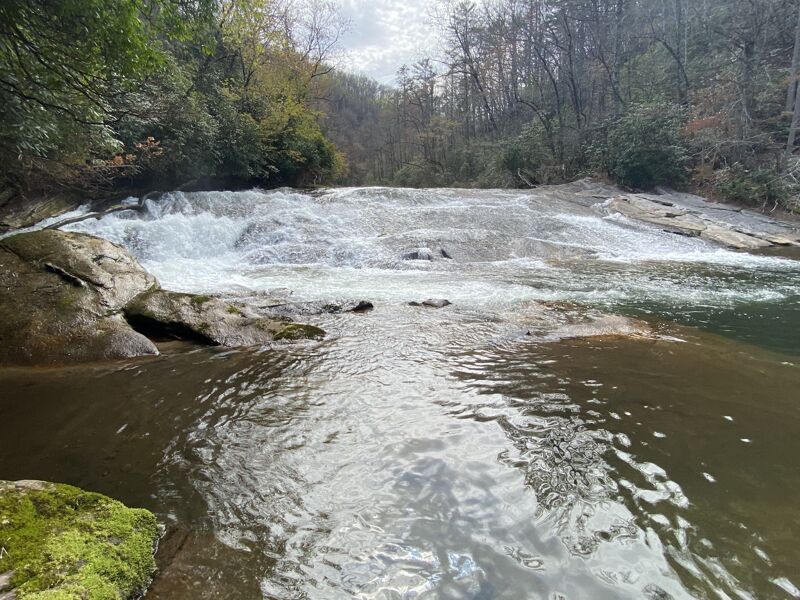
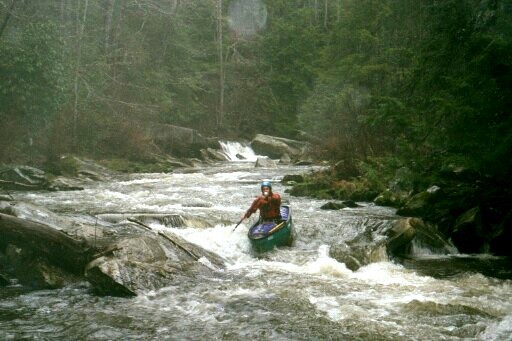
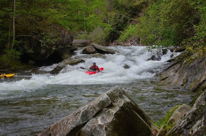
The North Fork is a classic North Carolina intermediate/advanced creek. At moderate flows below 6 inches the majority of the run is class 4, with a big class 5 in Boxcar Falls. From Boxcar to about a mile below Submarine the rapids are continuous with lots of class 3 boat scoutable boogie water between the bigger drops. The run is probably a notch easier than the Watauga and a lot easier than the Green Narrows. With the right water levels and some creative shuttle work you can run the nearby West Fork of the French Broad on the same day. Local Expert Harrison Metzger says: I've probably seen you on the N.Fork since I've run it probably 75 times over the past 11 years. I can help with the rapid names. Also I think the size and difficulty of a few of the rapids may not be quite right. The first slide is known as Sandpaper. I don't think it is 20 feet tall. I would say more like 12 feet. Most local boaters call the left side of Boxcar 'Blind Date.' It is considerably meaner than the right. The first set of rapids below Boxcar is called Island Rapid. There is a huge log that creates the boof on the right. It can be avoided by threading through the boulders at the top of the island and running a set of drops on that side.
The next rapid downstream needs a name. This is the double drop with the slide into the big diagonal hole. Benner's old book referred to the rapid after this as Razorback, but I think that would be a good name for the big slide. I would rate this a III+ to low IV, not IV+ It is pretty easy if you catch the eddy on the right between drops and hit the hole square.
The next rapid downstream was called Razorback in Benner's old book and he rated it a Class VI for some unknown reas
...Located at Macedonia Church Road,
the first paved road on your left as
you exit the top of the gorge on N.C.
215. Putting in here involves about a
mile of flat water and nice scenery.
Not advised if the level is below 3'
A big slide, about 12 feet tall. Scout on the left. There are multiple routes possible. Named because it is really shallow even with a lot of water.
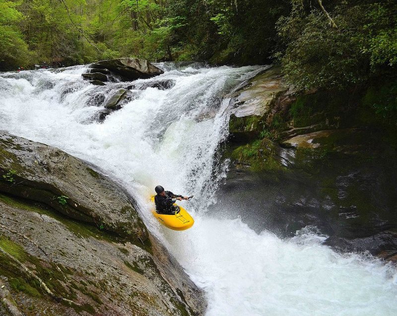
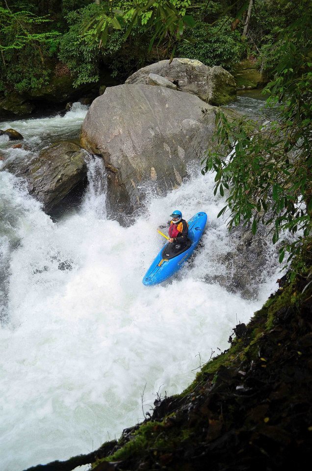
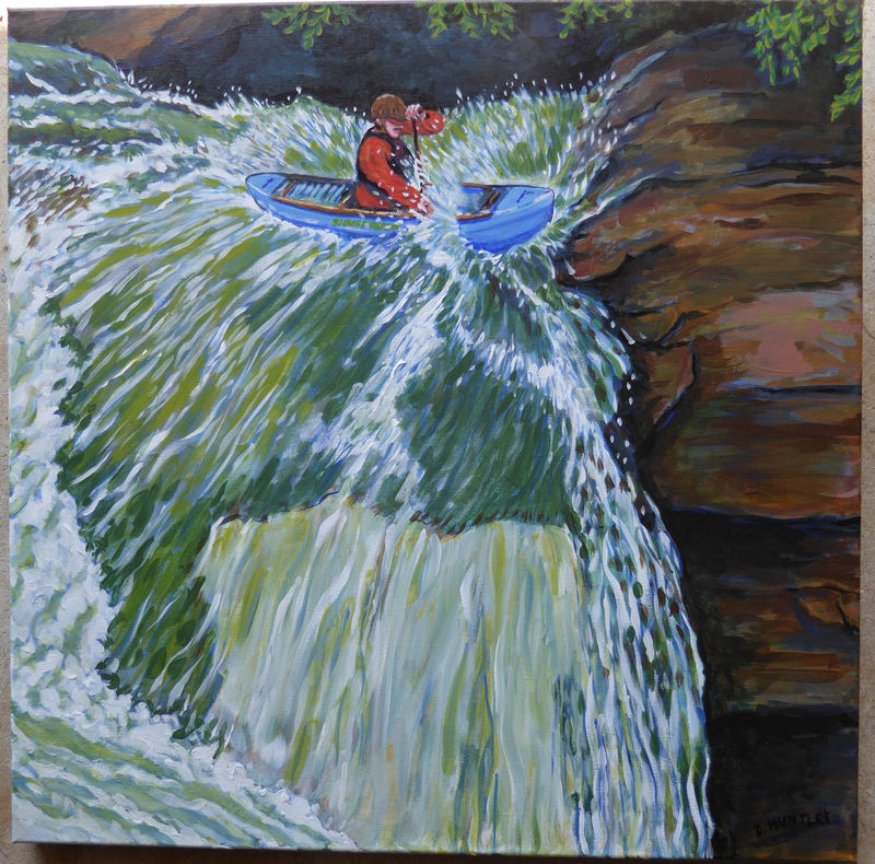
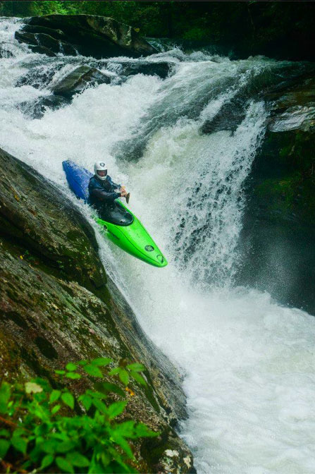
A classic waterfall with two possible routes. The standard line is to enter just right of center and drop down into the sluice paddling to the right to boof off the right edge of the bottom drop. If you miss the boof expect to go deep. There is also a left hand line known as 'Blind Date'. The left hand line is more sketchy, as you must punch a hole and drive hard to the left to avoid dropping into the vortex where the two drops converge. Boats running Blind Date have gotten stuck in the cave under the waterfall; one boater had his eardrum burst when he was driven to the bottom of the river. The portage is on the old railroad bed on river right. There is a seal launch off the sloping rock, which is also a good place to set throw ropes and scout.
After the pool below Boxcar the flow
splits around a large island. The
right side is a series of ledges
leading down to an eddy
on the right above the bottom drop.
This drop formerly harbored a huge
log that had been jammed across
the river for years. However a
massive flow of water from Hurricane
Frances on 9/7-04 dislodged this log
and it is now broached across the
river below Submarine Falls. You can
run the right side bottom drop either
next to the island on the far left or a
boof in the middle. Or you can still cut
left through
the slots at the top of the island and
run the shallow slide on that side.
This 6 foot tall slide runs diagonally
to the main current. There is an
undercut on the bottom left. Above 3
inches on the gauge the hole at the
bottom is stiff. By boofing right into
the eddy behind the large rock on the
right, you can turn and square up to
hit the hole at the bottom. It will surf
you out to an eddy on the right.
A big slide that is bisceted by a long
fin of a rock. Not a place to be
upside down. Watch out for a couple
of diagonal holes on the way down
and a very strong eddy line at the
bottom. Awesome cliff on the left
resembles the left wall below boxcar.
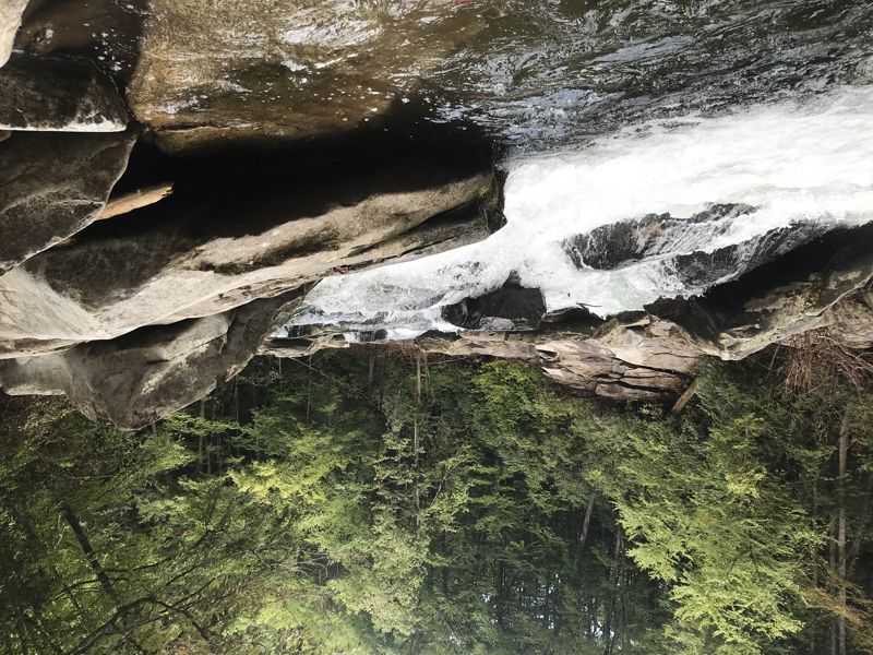
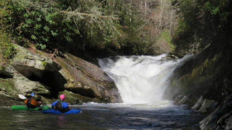
The longest rapid on the river and
one of the more hazardous, the Clog
is a long boulder garden that leads
to a riverwide hole at the bottom. It is
named for a sucking sieve left of
center below the first drop. You can
run the first 5-foot drop in the center
of the river, but that involves a ferry
into the eddies on the left in front of
the Clog. Our you can bang through a
shallow slot top left that puts you on
line for the eddies. These are a good
place to scout the bottom drops.
They can be run on the right or the
left, but beware of pinning rocks in
the center and right lines, and of a
shark-fin rock sticking up in the
middle just above the bottom
river-wide hole, the Black Widow. It is
best to hit this beast on the far right
or far left.
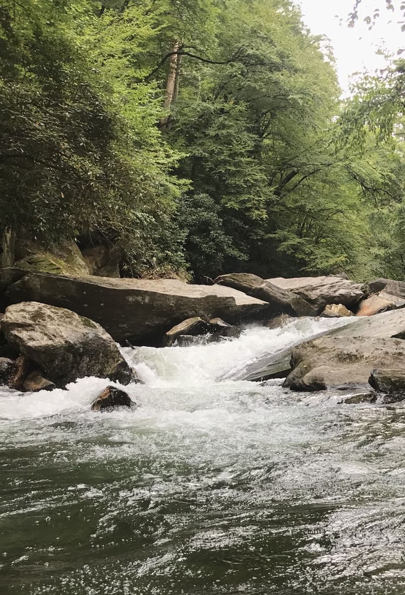
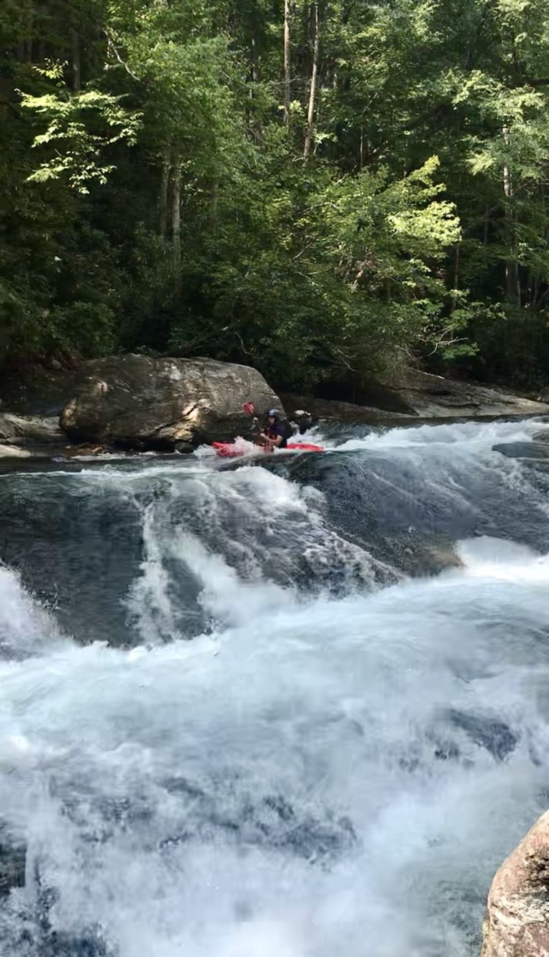
A set of three drops. The first one,
about five feet, is run on the left into a
left eddy. The second, a shallow
scrape of about four feet, feeds the
main drop but you can catch another
left eddy. The main drop is a series
of holes funneling down into a 5-foot
slot at the bottom (the vortex) with
good eddies on both sides. Fun
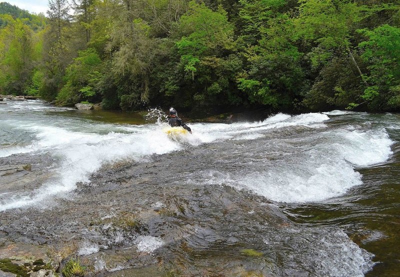
class III boogie water continues
immediately downstream.
Park here and hike upstream along the power line to reach a put in, and then hike back out to this point a rapid or two after Submarine for a no-shuttle North Fork lap. Using this put-in takes out a little over a mile and a half on the run. You miss some flatwater, some class 2 stuff, and the big slide. Look for a pull-off on the left of N.C. 215 about a quarter mile past where the road makes a sharp turn to the right away from the gorge. The large pull-off, usually marked by a big puddle, is the 1/2 mile trail down to just below Submarine Falls. This also serves as a put in for folks wanting to paddle the Class III section downstream of Submarine.
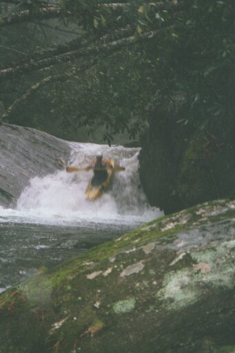
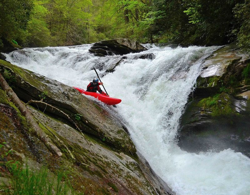
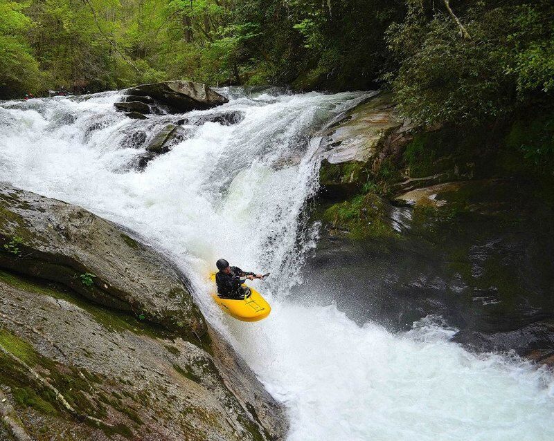
This 8-foot waterfall dramatically changed due to rockfall in early 2021, becoming more difficult and dangerous. Paddlers typically go for an all-water boof on the left side of the drop following a tricky entrance. Skilled paddlers have missed the boof and gotten surfed in the hole, including body surfs after swimming. Scout and/or portage easily on the left.
As of Mar 2024, it has changed again and is less consequential.
About a half mile below submarine is
a small rapid marked by a cliff on the
left and water flowing over an
obstruction on the right. Right below
this is a minor play wave/hole, one of
he only play spots on the NF.
In the class II rapids below
Submarine a double drop appears
that is somewhat larger than
anything since you left the gorge.
The log that was partially blocking this drop has washed out as of 5/15/04. The PVC pipe that was sticking up has also washed out, but beware of future strainers since this spot seems to catch a lot of them. Avoid the left side due to a very undercut rock at
the bottom and a small screw-up
rock that will try to shove you into it.
The first large pull off on N.C. 215 as you are heading up the gorge. You will know when you are getting close when you see the road on the left and a cliff where locals have been dumping garbage for decades. If you ever see anyone dumping garbage, get the license plate and report it to the U.S. Forest Service and to the Streamkeeper. The takeout is named for the jaws-shaped rocks hanging out over the highway just downstream. There is even better parking just bit downstream at the welcome to Pisgah National Forest sign.
Check the gage, and grab a beer and some food truck food.
Submarine