French Broad, North Fork
2) Route 1326 Bridge to US Route 64 Bridge(Classic North Fork FB)
May 7, 2003
| Reporter | Brad Roberts |
Forum: BoaterTalk
Re: Asheville boaters, will N Fork of French Broad be an option on Saturday? by roscoepwavetrain May 07 2003, 12:41 GMT New
Re: We went there last night and couldn't find the guage. It was under water! Trip report on upper Davidson... by tallman May 07 2003, 13:14 GMT New
Date: May 07 2003, 14:20 GMT
From: tcorey
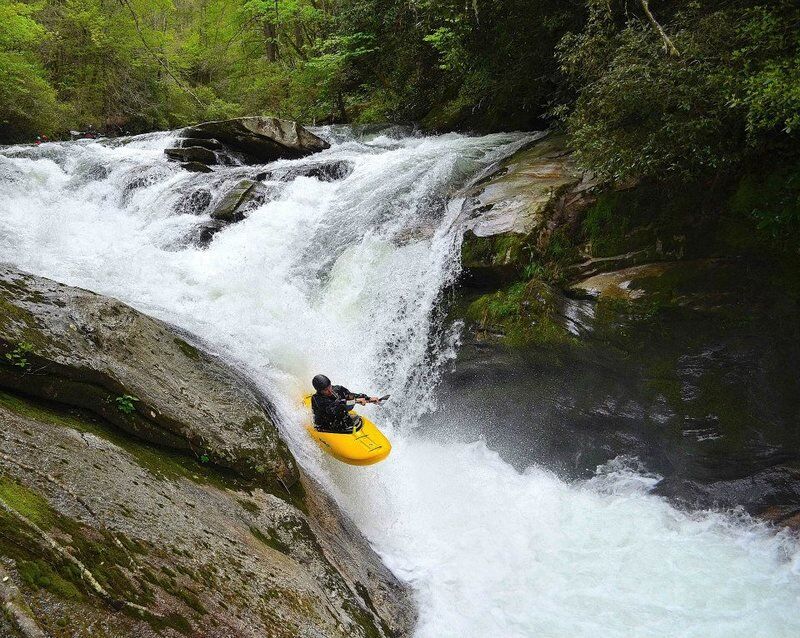
A buddy and I went up there yesterday as well and ran the river.
We left Greenville around 1:15 and got to the gauge around 2:20. Not bad. It was raining hard on the way up there. I was concerned that it may be too high but the gauge was reading right at a foot. NO PROBLEM! The highest I have run it was 1'10' so I knew we would be fine.
When we got to the put in I noticed that the water was definitely higher than a foot. But surely it wasn't 10' higher so we should be fine. When we got through the first few entrance rapids I was thinking it was higher than 1'10' but Ryan is a good paddler so we should be o.k.
Boxcar was fine and we ran it with no problems. Then we hit the next stretch of rapids and I knew then that the water level was higher than I had ever been on. The routes through the rapids didn't change but rock's that you normally see where gone. The Clog was huge and Midnight hole was gone. It was just a huge wave. We walked Submarine. When I ran it at 1'10' it just pushed everyone into the undercut and it looked like it would do the same thing at the level we were at.
We hiked out and decided to hit it again. I had put a mark on the bank at the put in to get an idea of how much the water would rise in case we did do a second run. It had risen over 6' in under an hour and it was still rising. We didn't have any trouble the first time so we decided to hit it again at this level. Let me tell you. 6' makes a HUGE difference on that river. We eddied out high above Boxcar and walked down to it. It was a monster. The swells would push you back into the hole at the bottom and the water was bubbling up 10' past the end of the drop. We opted to walk that and we were wondering what the rest of the river was going to look like. We blinked twice and we were at the Clog. It was amazing how fast that water was. We entered the clog in the center (like normal) and headed left. We hugged the left bank and again, there was no hole, just a huge wave at the bottom.
We walked Submarine again. I think at these levels that is the worst rapid on the river. We hiked out and stopped by the guage on the way out. The top of the gauge was under the water. I'm guessing it was in the 2'6' range.