Green
1. Upper, Tuxedo Powerplant to trail above Hungry Creek(Upper Green)
November 2, 2024
| Reporter | Stratford Douglas |
| Flow | Low Runnable |
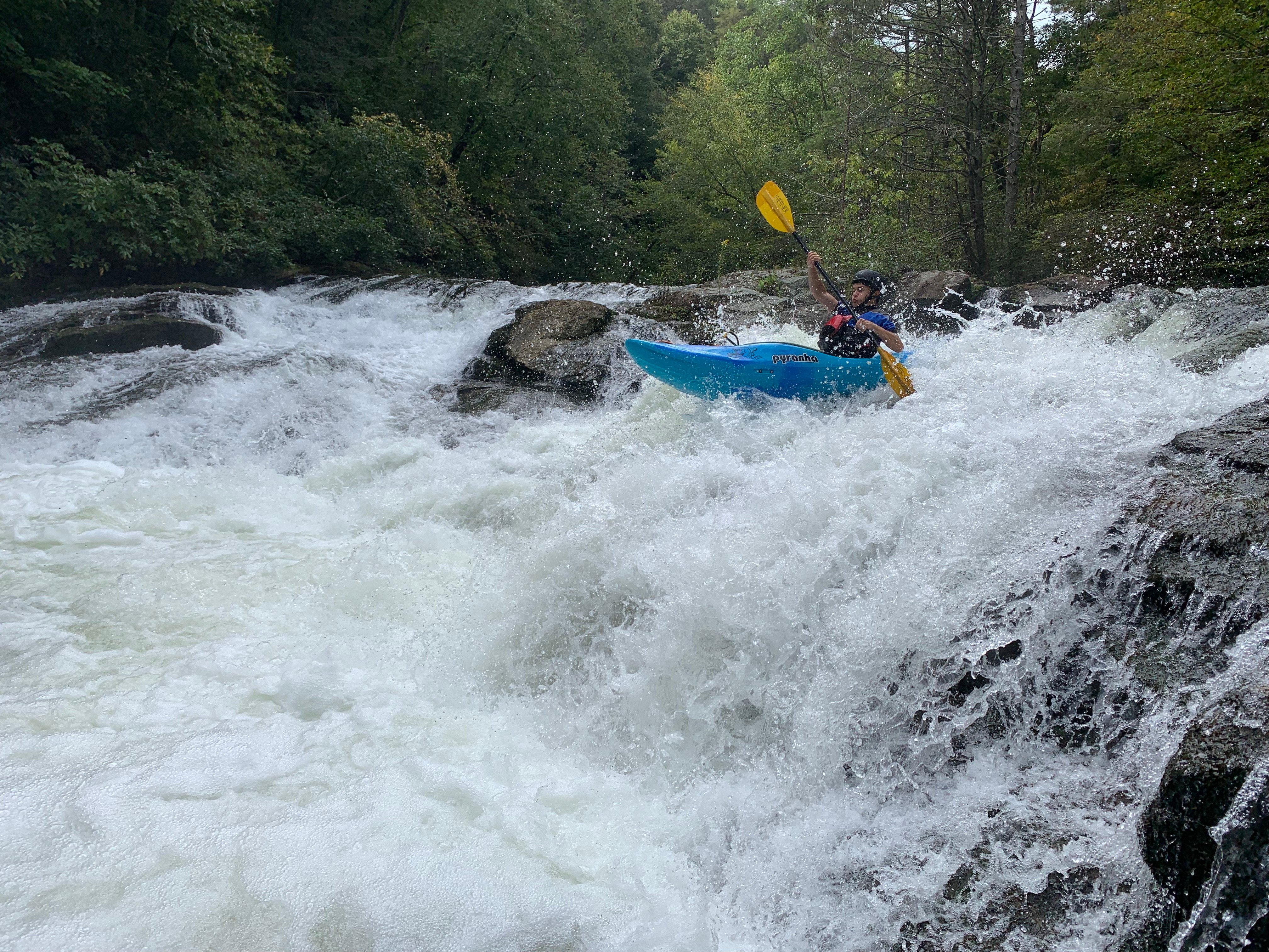
Upper Green 2.0 has some nice surprises and some not so nice. There's one major safety issue, a set of strainers blocking the main channel just above the I-26 bridge. It's covered in the 'Alerts.' Be sure to check that out.
The water level was low, noticeably less than one turbine release equivalent. However, looking at the shoals at the put-in, it was easy to see that there was a shallow but viable path through them. (That's the best I can do for a level measure. Obviously, we need a gauge at Pot Shoals Rd!) At that level, the river is bony in many places, but as long as you pay close attention you probably won't have to get out and drag your boat over rocks. We thought this level would be a good zero for the eventual gauge.
Overall, aside from the strainer above I-26, the main difference in the river's appearance is that there is a lot more exposed rock along the shore, and there are a lot more inviting sandy beaches. There are small landslides and uprooted trees everywhere, and fallen trees line the riverbank in most places. That pleasant slalom warmup at the beginning of the run is mostly replaced now with rubble fields, and there's a tree all the way across the river shortly before the power line crossing. There are a couple of nice new surfing spots, and the old surfing spots are different.
Bayless's Boof should be scouted, which you can do easily from the top of the drop on the right. It's hard to tell how much of the difference was due to the lower water level, but it was different. The usual route on the far left side was not viable. The best route was a bit to the right of that route, and just to the right of that 'halfway-down-the-drop' hole.
Wanda's Hole, Devil's Elbow, and Pinball look a little bit different, but the routes are pretty much the same. You can probably boat-scout and pick your way down. Obviously, watch out for ever-shifting wood and follow your own best judgment.
The take-out is not obvious. It's a small beach next to the mouth of a tiny stream, much closer to the mouth of the Big Hungry than the old take-out. I suggest that you walk down to the take-out and scout it out before putting on the river; otherwise you will probably spend a long unpleasant time picking your way through the piles of fallen trees at the take-out. If there is recovery work going on, go paddle somewhere else. Someone has done a heroic amount of work with chainsaw and backhoe to open that take-out trail. Many thanks to whoever arranged that!
If you loved the old Upper Green, as I did, I think you'll come to love the new Upper Green. It is still beautiful and remote-feeling, with just enough challenge to make it interesting, two big rapids and lots of little features to play in, nice new beaches and rocks to hang out on, and the same old pain-in-the-ass 1 km carry-out that guarantees that you will usually have the river to yourself.