Briggs Creek
Lower
| Difficulty | V |
| Length | 3.6 mi |
| Avg Gradient | 200 fpm |
| Gauge | Illinois River Near Kerby, or |
| Flow Rate as of 19 minutes | 37 cfsbelow recommended |
| Reach Info Last Updated | August 2, 2024 |
Stream: Briggs Creek is a class V run that can be done as a day trip, or used as an alternate (kayak only) put in for the Wild and Scenic section of the Illinois. If you are doing the overnight option, gear can be stashed at Briggs Creek Campground so the creek can be run without loaded boats.
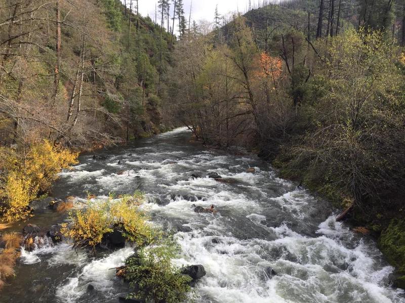
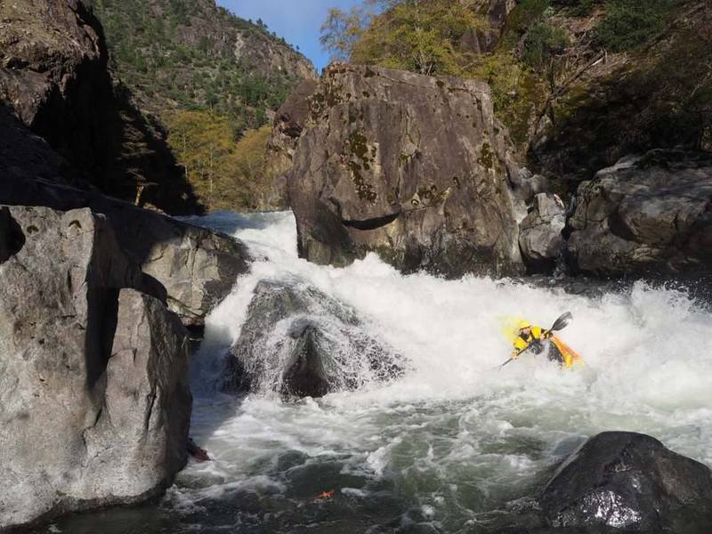
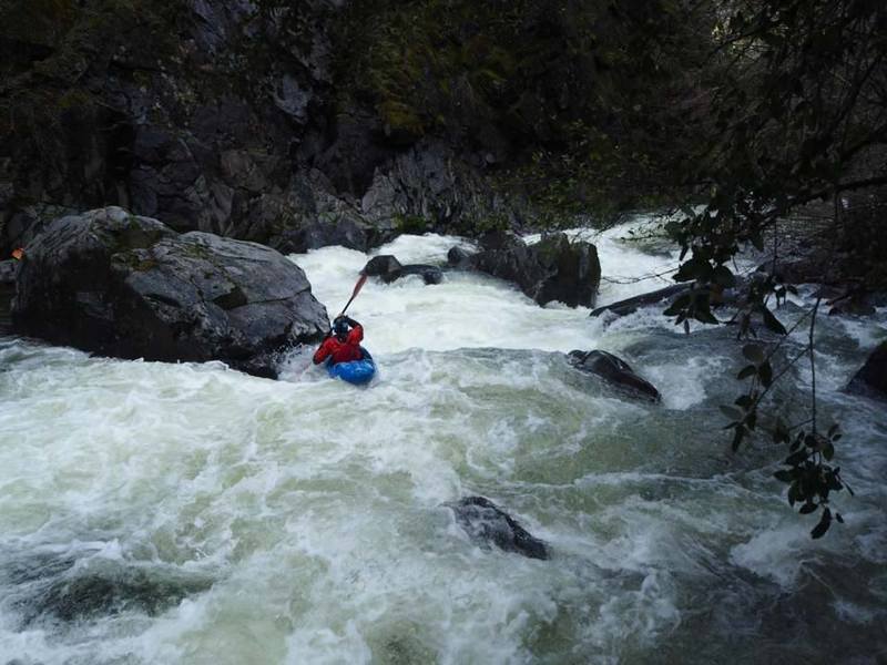
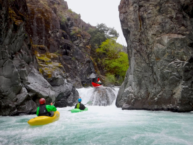
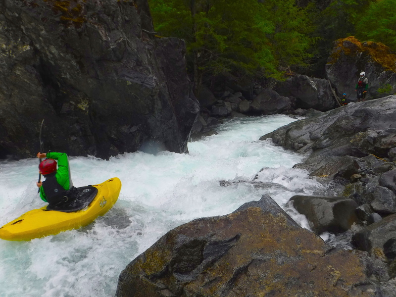
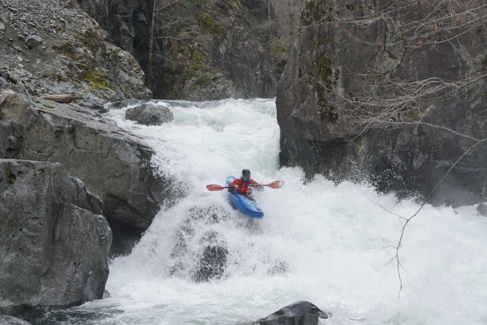
The first mile is class I-III. Once the whitewater picks up its game on until exiting The Brig, a short walled in section near the end. Most of the whitewater is class IV-V at low flows, with 2 solid class Vs. One of the class V's was at the beginning of the whitewater section, the other was at the entrance to The Brig. Both were portageable on the right at low flows. At low flows there are short, moving pools between the rapids allowing for recovery time and the setting of safety if needed. The rapids had plenty of variety and come back to back. At medium flows you can expect a consistent class V experience.
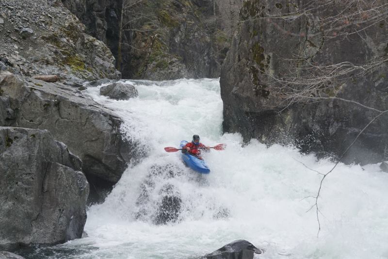
As mentioned above, most of the rapids are bouldery and scoutable and portageable with the notable exception of the rapids in The Brig, this walled in section near the end of the run climaxes at a final un/un rapid that is not portageable, and only partially scoutable. At most flows this rapid can be boofed off the rock in the center, if flows are high it forms a nasty recycling hole. The rapids leading up to that final rapid in The Brig are no harder than what has been encountered upstream.
Trip Report at Into the Outside
Gauge: The creek is visual only, check the photos tab for the scoop on the visual gauge.
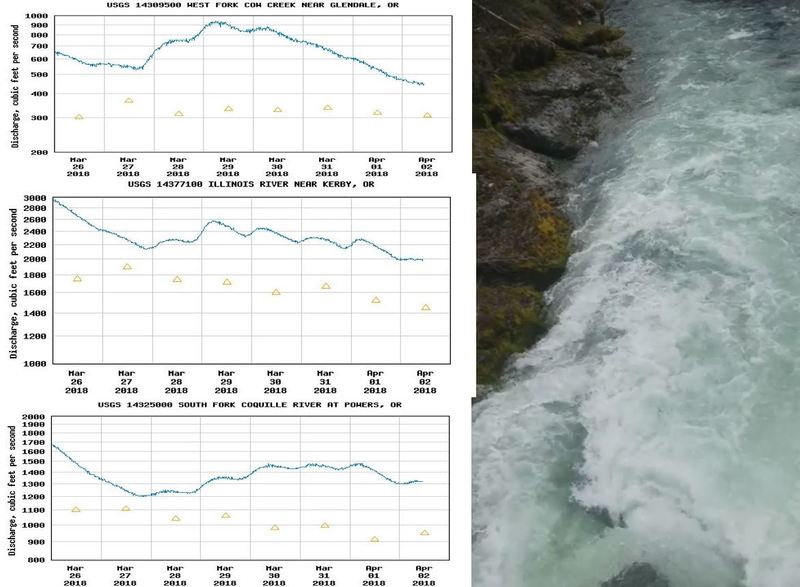
To get an idea of whether there might be water in Briggs, take a look at the Illinois Gauge. 3,000 cf
...Apr 2, 2018
This is a high flow, from snowmelt. Use the three gauges shown here to get a feel for what Briggs is doing.
March 31, 2018
Mar 25, 2018
This is about as high as Briggs should be run. Any higher and the entrance to The Brig would become unscoutable/unportageable on top of the exit. This is also almost about to the flow where the exit ledge from The Brig starts getting into the questionable zone.
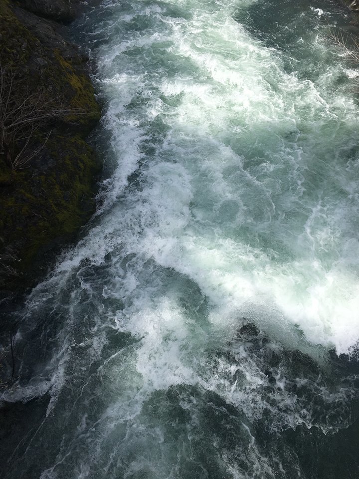
3400>3000 cfs 3/25/18
Mar 25, 2018
3400 cfs
3/25/2018
May 16, 2017
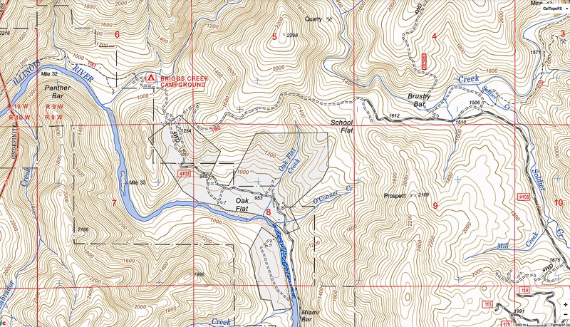
Put in at Brushy Bar, take out at Briggs Creek Campground. Note the proximity to Miami Bar (The put in for the Wild and Scenic section of the Illinois).
The roads shown on the map represented by dashed lines are drivable by high clearance vehicles only, 4WD may also be necessary if the ground is wet. A Subaru can make it to Oak Flat, but not much further.
The road connecting Briggs Creek Campground and Brushy Bar (passing near School Flat) was passable by a Nissan Xterra in 2017 in 2WD under dry conditions.
May 15, 2017
This photo was taken from the footbridge at Briggs Creek Campground. There are two rocks used for flow measurement that are circled with their meaning in the photo.
Ideal flows would probably have some water spilling over the point of the triangle rock, but not so much that you could boof over that point without the rock slowing you down.
Photo taken at a minimal enjoyable flow on May 5, 2017