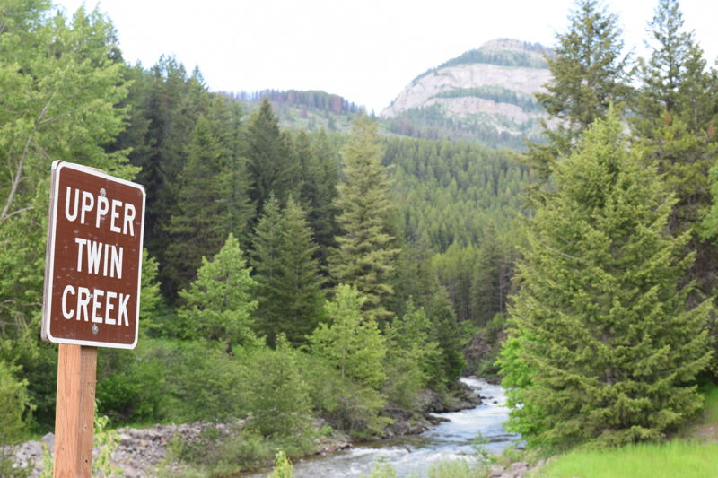
Upper Twin Creek
Nanny Creek to SF Flathead (Hike In)
| Difficulty | III+(V+) |
| Length | 6 mi |
| Avg Gradient | n/a |
| Gauge | S F Flathead R Ab Twin C Nr Hungry Horse Mt |
| Flow Rate as of 1 hour | 1930 cfsbelow recommended |
| Reach Info Last Updated | July 21, 2021 |
Wild rivers and their enthusiasts got some good news with the release of the new 15-20 year Forest plan for the Flathead National Forest late in 2018. The decision newly protected 22 streams as eligible for Wild and Scenic designation (284 river miles), based in large part on the [...]Read More
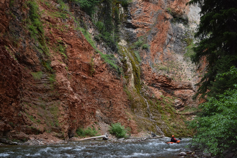
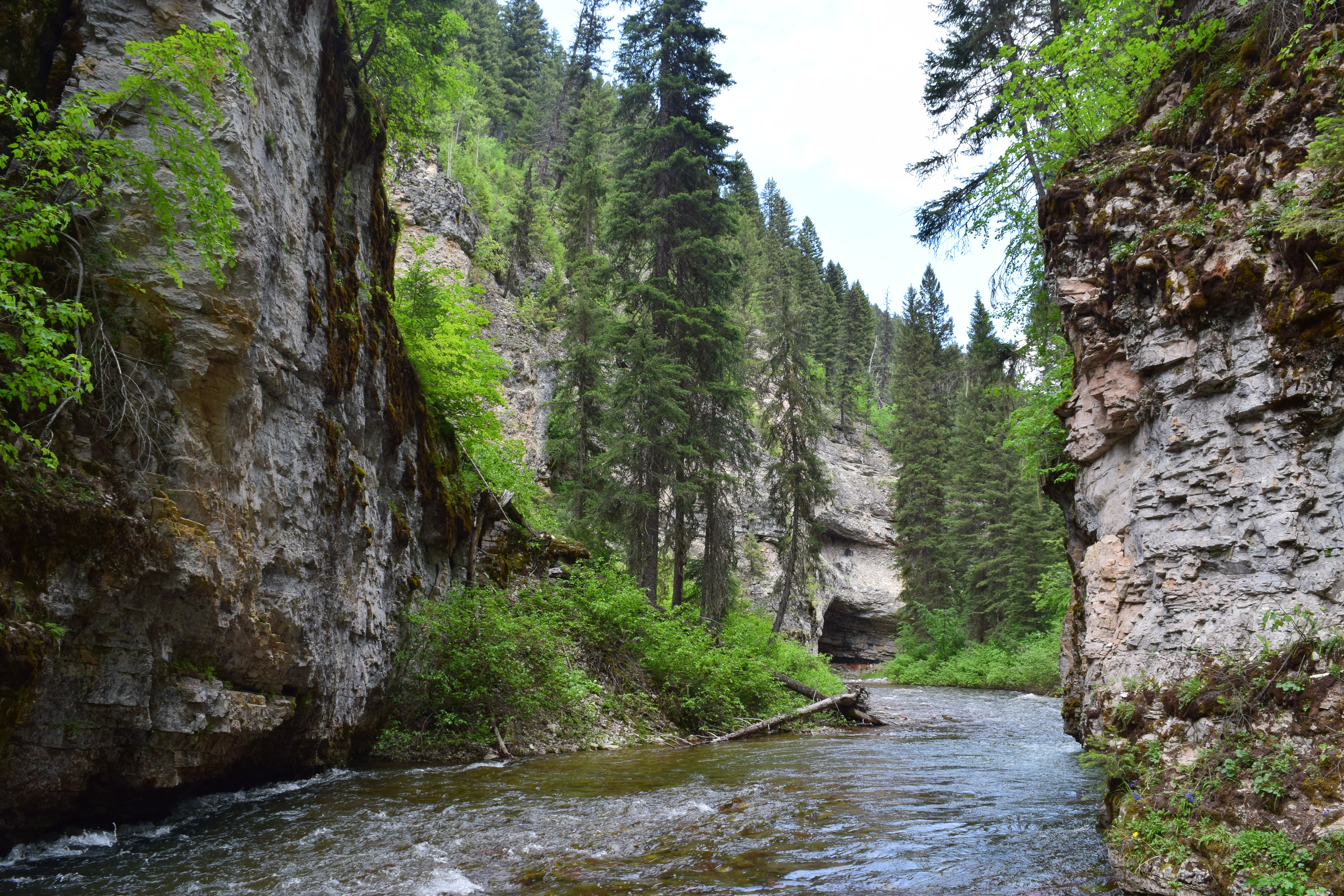
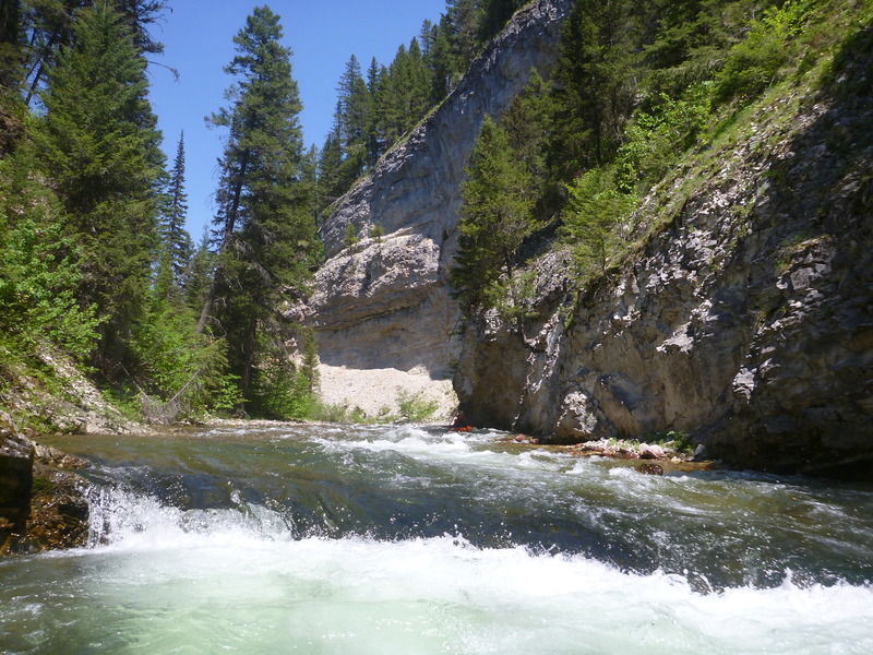
Upper Twin Creek is an extremely scenic stream flowing through cave-riddled limestone and mudstone gorges. It is primarily a Class III run, but with a mandatory portage and occasional wood that could pose serious challenges if lodged in the vertical walled canyons, Upper Twin requires solid backcountry and paddling skills. For those with the skills and sense of adventure it is a visual wonderland well worth the hike-in for a packrafting or kayaking trip.
Hike the South Creek Trail a couple flat miles from near the Spotted Bear River to where it crosses Nanny Creek, and slip down Nanny Creek to Upper Twin. Cobble rapids in an open valley shortly lead to a limestone wall towering over river left, complete with a small cave mouth with water flowing out of it. This is the sign to get out on river right (upstream or immediately downstream of the first little ledge) and hike uphill and downstream to a rough trail about 50 feet above the creek to PORTAGE an unrunnable and beautiful double waterfall through a natural arch. The trail bends around the corner and you can lower yourself and boats down a steep dirt bank to the base of the falls. Enjoy the view!
After one Class IV drop immediately below the falls the Creek flows for several miles through a spectacular pale grey limestone gorge with overhanging cliff walls, cave mouths, and waterfalls pouring in. The limestone eventually turns reddish and then gives way to red and blue-grey mudstone, all the while with nice class II and III whitewater. Strainers in some of the vertical walled canyons could pose serious issues, so be careful. Take out where the East Side Road crosses the Creek, just upstream of its confluence with the South Fork.
Upper Twin was deemed eligible for Wild and Scenic designation by the Flathead National Forest following paddler/AW advocacy.
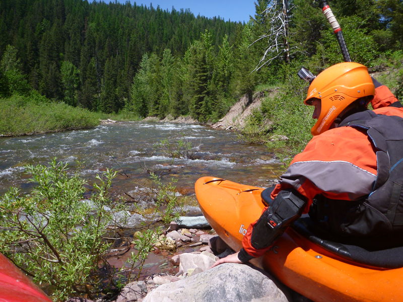
Choose your own put in but scrambling down Nanny Creek to Twin works well following the hike-in.
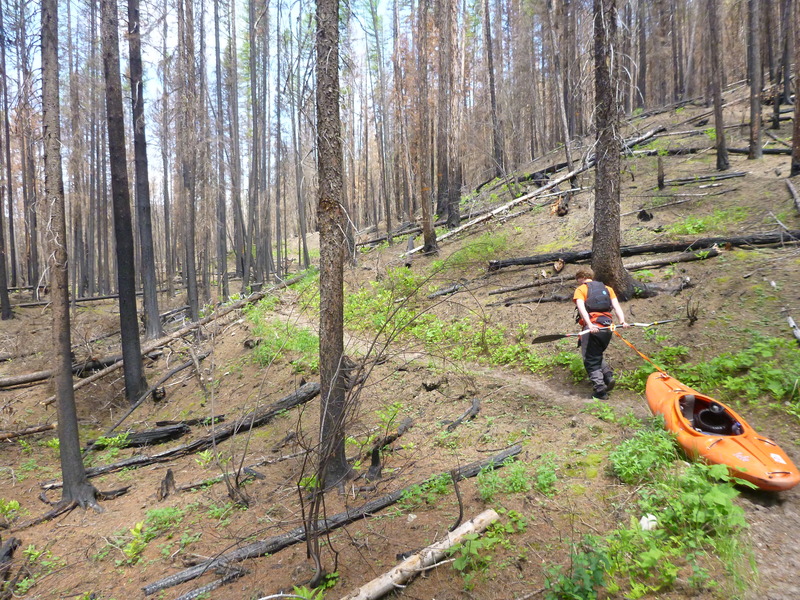
Start your hike in here. It is a good relatively flat trail that should not be a problem for most paddlers.
Portage around the arch on river right from this distinctive spot early in the run. It is easy if you take out upstream enough.
There is a nice parking area on river left at the bridge.