Bay Creek, Hill Branch
Bell Smith Springs (1.4 miles)
| Difficulty | II-III |
| Length | 1.4 mi |
| Avg Gradient | 110 fpm |
| Reach Info Last Updated | December 16, 2020 |
There are about 6 rapids in this short stretch that you will have opportunity to scout on your hike up the creek. When run, you will have about 20 feet to bail before the final sluice/rapid (#6).
With just over a half-square-mile of drainage (at put-in), it will take major snowmelt or significant rain to make this a 'go', and the window of opportunity is likely to be extremely limited (during, or within an hour, after a good rain). USGS StreamStats Beta software lists other interesting and potentially relevant info:
Average Soil Permeability is 1.001 inches per hour, which suggests that when soil is dry/unfrozen, an inch of rain per hour will NOT run off but will soak in.
Thus, in general, it will take rainfall of over an inch an hour before anything hits the creek!
That said, if you try for this and find it too low, you can look at the immediately adjacent run on Bay Creek. With 10 square miles drainage at its put-in, you'll have far more likelihood of catching it runnable. (Though that's still pretty small.)

Drainage area at our listed put-in is approximately 0.57 sq.mi. (as calculated via USGS StreamStats Beta software). Yup, just over 1/2 a square mile! We're talking tiny watershed. Hence, as the picture captions tell, it takes a good storm to put enough water in here, and quick timing to catch it as soon as the rain quits
Mar 13, 2017
Shawnee NF Bell Smith Springs Trail map
Dec 18, 2016
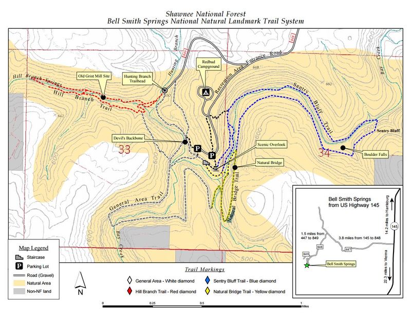
First major drop in the clear (ie out of the woods)
Dec 18, 2016
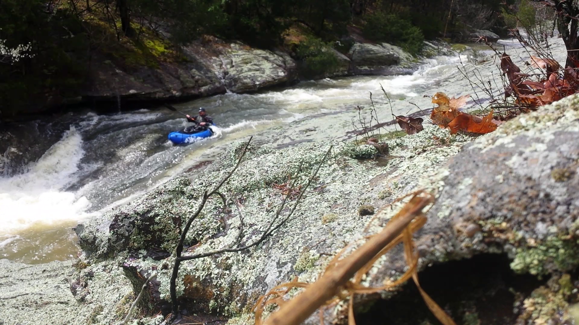
Perfect amount of flow in spring after ~1inch of rain over 12hours and additional 10min downpour prior to paddle put in. Right after this is a kind of sluice that is tricky because of its narrow nature a paddle is useless instead one must lean into the rock so you don't flip. good luck... I ran it once at a very slightly lower level.