Little Tennessee
NC Route 28 to US Route 19
Aug 24, 2025
Overall I'd give it a 2/10. We chose to paddle this to give a brand new padler a taste of whitewater. It was running about 830 cfs when we put in at the foot bridge. We were paddling a custom tandem and a solo canoe. The river was shallow through the 'shoals' which were very far apart with slow flat water in between. The best taste of white water was the right side of Right or Left. We decided to takeout at the 74 bridge after the narrows but the lake was so high that there was no sign of the narrows. In hindsight the river served its purpose as a training run but it didnt have the fun whitewater feel we were hoping for.
Jul 8, 2025
We ran this at Week of Rivers at 850 cfs and slowly rising to 950 cfs. Due to recent rain, the water was more sediment-laden than usual. We put in at Tellico Creek and took out at Panther Branch, the last access on the left along Needmore Road. The first mile or so was the prettiest but we struggled the most with hitting rocks. The rest of the trip we did better, or maybe it was the rising water. I'd want over 1000 cfs to do it again.
Nov 7, 2020
In October 2020, having kayaked for three decades+ three of us decided to take our cataract, NRS Star Slice, on 5-6 miles of the Little Tennessee downstream of Franklin, but well upstream of Fontana Lake. The AWA information and old guidebooks all referred to the section of the Lil Tennessee directly upstream of the highway 23/74/19 bridge over Fontana Lake. We had only one car, two humans and one dog and we did not want to mess around with the gravel Needmore Road, on river left. We drove to Iotla, NC and examine a large, dirt pull-off parking area on river right at the NC hwy 28 bridge, but then continued north on NC28 looking for a different spot to launch. A few miles downstream from that bridge, on river right. we parked a conservation area, created and maintained by the Mainspring Conservation Trust (based in Franklin, NC). It was very close to the river, had parking for 10-12 vehicles, and interpretive displays for old Cherokee Indian Nation cultural history, Cowee Mound. We launched there, floated several miles through occasional class I ripples, floated under a concrete bridge at Rose Creek Road, and then had about a half to three quarters mile of extended class I shoals before reaching a large island, Dean Island, which was our navigation reference for our takeout just downstream, river right of the island. The takeout was another Mainspring Conservation Trust area, this one called Queen Branch. Dirt/grass parking at the takeout for 8-10 vehicles, interpretive display, and a cut grass 90 yard walk to the river itself. Water level was about 1100cfs which was enough for our Slice cataraft to not have any issues with running around, although the long series of class I ledges mentioned previously required a certain amount of maneuvering skill. After finishing the run we went to the Mainspring website and saw that they have created several other areas similar to the 2 that we used which could create other opportunities for different length runs on this river. As well as cooperative efforts between this group and AWA for things like river cleanup, protection, etc. Hopefully other beginners looking to float the Lil Tenn can use this post to mix and match a variety of different trips above and beyond the section closer to Fontana. I phoned Mainspring Conservation office and spoke to someone, mentioned AWA (which they'd never heard of at all) and suggested a few ideas about collaboration on overlapping interests. I told them AWA HQ was just a few miles away, as the crow flies.
Aug 26, 2018
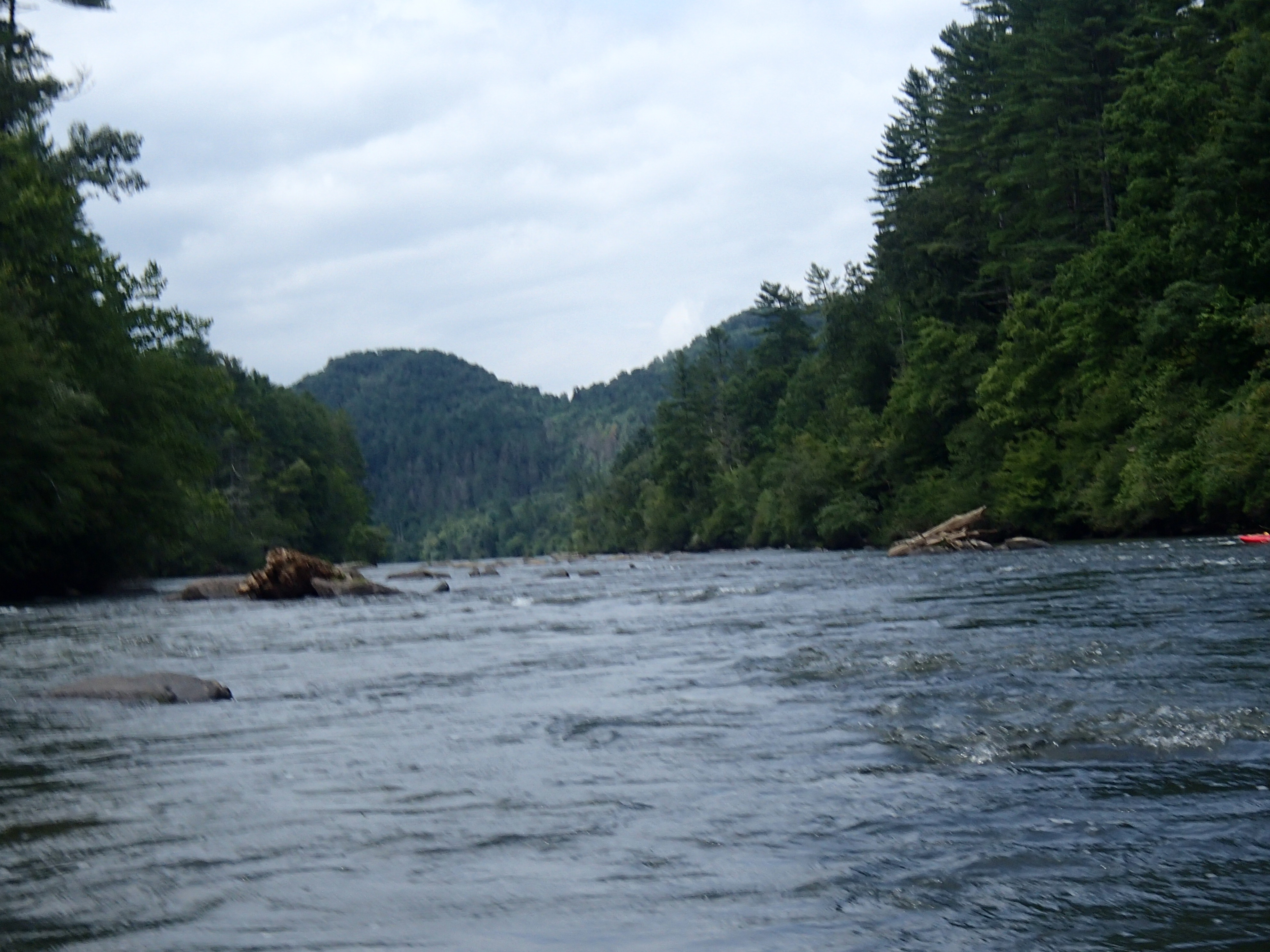
On 8/22/18 nine of us ran the the section alongside Needmore Rd. We dropped a shuttle car at the first access on Needmore Rd and then traveled upstream approximately six miles and put in. The LT was running at 970 CFS and was a nice paddle. Mostly class l with three class lls. We attempted to paddle this section last year at 300 CFS and gave up after a little over a mile as it was too low. Even tho it was an overcast day, the scenery was still nice.
Aug 26, 2018
photo taken 8/22/18 at 970 CFS alongside Needmore Rd.
Feb 11, 2015
There are several official well maintained launch spots along Needmore Road. We ran it at around 650 CFS and it was low but runnable. I would think that around 900- 1000 CFS would be just right for experienced paddlers. Most of the river is class I, II but beware of the 'Narrows' rapid at the end, just before you reach the Fontana Bridge. This is a serious rapid and does have consequences. There is a lot of jagged rubble just beneath the surface after the hole and also a very large undercut rock that you can get washed into. Also, as mentioned in other reports, the 'Narrows' rapid would be underwater in the summer when the lake is up. If you choose to take out up river at any of the designated sites then this is a leisurely river for the most part with a few fun class II rapids. Also, this is a beautiful area with nice mountain views as you paddle.
Mar 9, 2008
We ran it today at 1600cfs. We set up our putin and takeout on Needmore Rd. at the bridges that cross creeks (approximately 5 miles apart). It was almost a constant class I from beginning to end with occasional class II features in the larger rapids. There are a number of spots where you'll hit rocks barely submerged, that would probably normally be above water. Due to trees and branches, there aren't a lot of eddy opportunities, so it may be wiser to paddle a shorter distance.
Sep 28, 2004
FIRST OF ALL RUN THIS IN THE WINTER WHILE THE LAKE IS DOWN AND AFTER IT HAS RAINED. This is a good spot for newbies(especially if starting from needmore. there is a good footbridge out there somewhere it is near the beginning of the lake section. This is where you would want to start if your used to class 2,3 water. There are quiet a few easy and good play spots near there, but the good hole right above the bridge gets shallow real quick right after it.
Once you get into the lake section is where all the good stuff is. It has a couple class 2 rapids that are fun to goof around in, but there is nothing to serious. Then you will round a few corners and see a couple large waves. The first is above the rapid by about 20 ft and it was about 4 feet when we were out. Then into the rapid we hit some 6ft waves that were nice. Then there is a drop that was pretty signifigant the day we went out, but the drop is only on the left side of the river and straight into a crazy hole. The river is channeled all to one side so right near that crazy hole was a huge wave. REMEMBER THIS IS ALL ON A DAY AFTER GOOD RAIN AND THE LAKE WAS DOWN FAR.
