Wequiock Creek
Wequiock Falls to Nicolet Drive (1.25 miles) *Access Issues*

| Difficulty | II-IV |
| Length | 1.2 mi |
| Avg Gradient | 88 fpm |
| Reach Info Last Updated | March 4, 2025 |
Quick Facts:
Location: EastCentral Wisconsin, ~10 miles ENE from Green Bay.
Shuttle Length/DriveTime: 1.9 miles/4 minutes
Character: A small lazy stream (upriver of this point) drops into a wooded up, Midwest-style canyon, and races toward the bay of Green Bay.
Put-in elevation is approximately 710'.
Take-out elevation is approximately 600'.
Thus total elevation change is approximately 110'.
Drainage area at the falls is 8.72 sq.mi. (as calculated via USGS StreamStats Beta software).
Video link: https://youtu.be/OdPKR_lQkiE
A scenic waterfall in a small wayside park makes one wonder 'what lies downstream?' Taking a look (on the downstream side of the culvert passing under the road below the falls) the creek continues for a ways in a deep (for EastCentral Wisconsin) gorge. Unfortunately, much of the ~1.25 miles to the next road is heavily wooded; Deadfall and snags would be everywhere. The road at the take-out (where numerous deadfall and snags are apparent just upstream), is posted 'No Parking' (on both sides) for a good distance either side of the creek, so you would have a bit of a carry at the end of the run to anyplace you would be able to park your shuttle vehicle (admittedly not a problem for most boaters).
So . . . why put this on AW? To save anyone the error of thinking they may have discovered a possible new whitewater run from going here with great expectations. It would take extensive logging (and with great regularity) to make this a 'go'.
That said, if you are bored some time and feel like exploring . . . it could be interesting to walk down this creek to see what all is there. (Hint: Aerial photos appear to show a couple significant drops downstream!) Just keep in mind . . . Wisconsin law says you have the right to be on the water or in the water, but you have no right
...
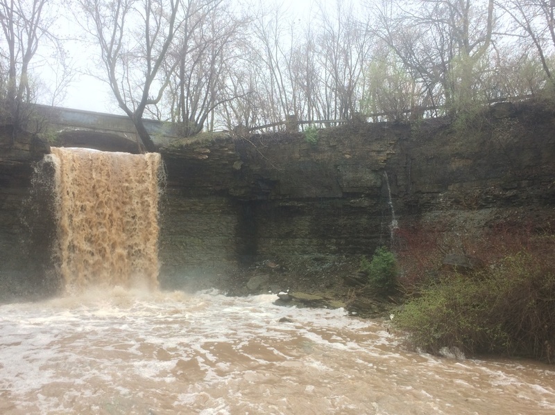
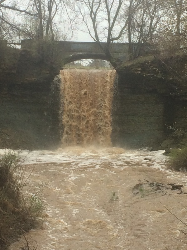
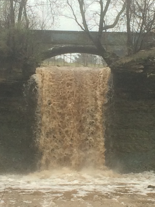
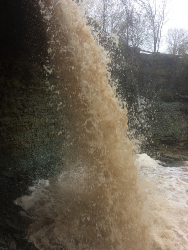
Upstream, this creek meanders lazily through flatlands. As it passes under a long-defunct roadbridge (now only for pedestrian traffic in a small park), the creek drops off a rock shelf into a fine little grotto between the roads. Anyone considering running the drop should know that the landing zone is uniformly shallow! That said, with high flows, and proper technique, this drop has, indeed, been run!
Immediately downstream of the falls, the creek enters a box-culvert under Bay Settlement Road. On the downstream side, there is a drop out of the culvert into a bit of a pool. If this were ever to be run, one would certainly want to have a look at this (before putting on above it) both to check the boil-line on the pool and to check the wood situation.
Not far downstream, a large (relative to the size of this stream) island splits the flow. It is very likely that wood will accumulate at the head of this island, as well as in each of the narrower channels downstream. (It appears the right channel is smaller, and has a ledge-drop in the early going as well as a drop as the island ends, whereas the left channel (carrying a bit more of the flow) has nothing apparent (though hard to tell through the trees in the aerial view) until the end of the island, where there appears to be a fine ledge-drop into the flow from the other channel.
Immediately after the end of the island (with its apparent ledge-drops as the flows from the two channels rejoin), there appears to be another ledge-drop.
Most of the remaining distance to the next road (our 'take-out' for this fantasy run) is too obscured by trees (in the aerial view) to determine if there are any other particular features.
A special note about the area downstream of the listed 'take out' (CTH.A/Nicolet Drive). While there are private properties ('inholdings'), much of this area has been donated/acquired by The Nature Conservancy and has been desgnated as 'Point au Sable Nature Preserve'. From a website regarding this area: 'The Point au Sable Tract is accessible only by water or with a guide who has permission to cross the private land. The road from County Road A is locked and cannot be used to visit the Point.' (That would be the road marked as 'Au Sable Drive' when you zoom-in on this area.)
Find out more by visiting the UW-Green Bay website page on this area.
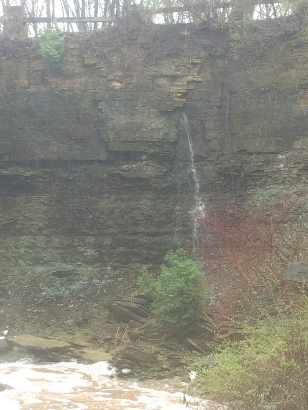
An interesting seep cascades from the wall of the grotto (at least, at times when there is a lot of water around).