Mayo, N. Fork
Va Route 629 to NC Route 1359
| Difficulty | II-III |
| Length | 3.4 mi |
| Avg Gradient | 15 fpm |
| Gauge | Mayo River Near Price, Nc |
| Flow Rate as of 45 minutes | 75 cfsbelow recommended |
| Reach Info Last Updated | September 17, 2025 |
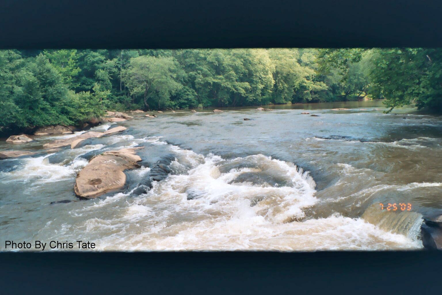
The north fork is mostly class I water with 2 or 3 class II ledges. It flows through beautiful woods with little sign of civilization. After it joins the south fork to form the Mayo there is a section of class III water. This section starts with a complicated series of ledges (the Stairsteps) then a 3 foot ledge (the Boiling Hole) then another series of ledges. This section which runs beside Mayo Beach Road (NC route 1359) is a favorite playspot.
See Also:
Virginia Whitewater, Roger Corbett (2000 ed.), p. 521.
Exploring Virginia's Waterways, Ed Gertler (2022 ed.), p. 319.
Carolina Whitewater: A Paddler's Guide to the Western Carolinas, Bob and David Benner (2005 ed.), p. 188
Sep 26, 2024
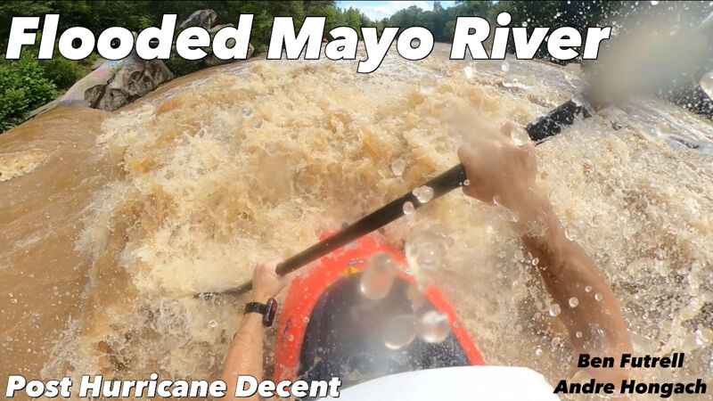
Ran this entire section at a little over 3000 cfs right after hurricane Debby. Ive paddled this river many many times at various levels, but this level was wild. It turns into a completely different river. Especially the steps/ledges before the last bridge and the class 3 section at the end next to Mayo Beach Road. A whole lot of fun, but watch out for all the dangers such as massive holes and strainers that pop up at this level. My buddy and I scouted every major rapid. all the class 2s turn into 3s and all the class 3s get close to 4. Big wave trains throughout. Very few spots where a swim wont be consequential. also, the hole at boiling hole rapid is no joke at this stage. Stay clear of it and be safe out there!
-Ben Futrell (RipLadz)
Go check out my run on YouTube!
Apr 21, 2019
Kayaked this today (Easter), high and fast water. The section of class III looked to be almost IV. Still locals partying at this spot. Just gorgeous but be careful!
May 15, 2014
The address given for the take out is the Anglin Mill Road Bridge over the Mayo River. The take out is actually on Old Anglin Mill Loop Road. This is a gravel road 8/10 mile east of the Anglin Mill Road Bridge. Turn on the gravel road next to the small green concrete block house.
If coming from Smith Road. go 8/10 mile west from Smith Road to the gravel road next to the green concrete block house.
Oct 30, 2009
The volume for the North Fork is misleading, in that it includes the junction of BOTH forks, whereas the South Fork volume is accurate. Therefore, when you read more volume coming from the North Fork, that is NOT correct. I wouldn't play-run the North Fork at anything less than 3'. Less than 2.5' is scrapy. le scott
Sep 18, 2009
The best level to play Boiling Hole is between 1.7 and 2.1. The river can be run lower than these levels but the best level to run is 2.7, especially Lunch Stop, the last rapid before the confluence. Above this level, the rapids on the north section flush out. As the levels get higher, the boulder field after the confluence gets wilder and wilder. Rocks that are normally dry create holes. Mack
Jun 24, 2009
6/24/2009 There have been a few of us playing at the boiling hole since spring. The locals seem to be friendly, however they tend to get wild as the beer flow picks up. No real issues so far. If your polite they seem to be polite back. Still would'nt leave any gear unattended. The Rockingham County Sheriff is suposed to start their patrols again now that summer is here. That should curb the underage drinking, and excess vehicle traffic. SYOTW- GM
Feb 4, 2009
8/8/07
Went out last week after a rain storm and ran the river. It was running at about 200 CFS and about 2.25ft. Not to bad for kayaking, but difficult for the canoe that went along with us pretty bumpy until you get to the lower section as well. The boiling hole was definitley most enjoyalbe and fun to play around in at this water level even though it was a little low. POLICE have been doing a great job keeping people away that are gettin rowdy, but there were a few people that came down and jumped in for a swim. There is some amount of vehicles that we saw going up and down the road, dunno what that is about, but just a caution park down at the public put in and paddle down to the boiling hole only about a 2 min. paddle. Right past the 'S' turns then you can take out on the beach carry your boat back up to the boiling hole and walk up to get your car, just don't leave it unattended. See ya on the water!
JB
Aug 9, 2005
Went this past Sunday and it was awesome, great place to play and practice. It would be nice to have the police come check out the area...had a lot of young people drinking and carrying on..had to pack up and leave did not feel comfortable with the atmosphere. If the police checked in more often it would be a great place for us to play and practice.
Apr 18, 2004
Just returned from this spot. They are fixing the bridge at the exit from 220 to horsepasture road, so take the next one to the south. Very nice short spot with a pleasant Policeman and his K-9 partner patrolling the area (when we went). Gage height was 2.5 which was good.
Jan 31, 2002
Even though Joe G has posted this, it is actually from an email by Justin Emmert (local boater) dated 1/28/2002. It is a comment on levels.
Justin's comments-The boiling hole can be played at just about any level. I played in it this summer at levels as low as .75 . I use the usgs gauge for levels. The best levels are 1.6 and above for running the river. i have run it as low as 1.2, but it was not a fun trip. Typically there is no problem with the local hicks this time of year when the river is running because they can't get their atv's across from their hangout on river right. I have not seen the sheriff's deputies since the public put in and take out were built. I would not park my car at the boiling hole like we used to though. If the river is at 1.6 and above like it should be this weekend, run the whole thing. It's a nice run. We ran it Sunday and had a great time. We will probably run it this weekend again, maybe Saturday and Sunday.. See you on the river.