Patapsco, South Branch
1. Gaither Rd. to Henryton Rd.("Gaither Gorge"/S. Branch Patapsco)

| Difficulty | II+(III) |
| Length | 5.4 mi |
| Avg Gradient | 17 fpm |
| Gauge | Patapsco, S. Branch - Woodbine to Henryton |
| Flow Rate as of 55 minutes | 23 cfsbelow recommended |
| Reach Info Last Updated | August 24, 2022 |
Note: read below and/or click the Map tab to see the multiple access points for this section.
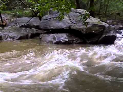
This seldom paddled, (and seldom paddleable), little gem flows through a progressively deepening gorge that separates Howard and Carroll County and makes a delightful jaunt for either a day trip, or for a much shorter paddle when done in sections. Difficulty consists of a good deal of moving flatwater, a great selection of class 2+ ledges, and a couple of easy class 3's. Pray for rain though; it's going to be a long day without enough water.
Put-on at Gaither Road (2.2 miles from Gaither Road to River Road just past Sykesville; 5.4 miles from Gaither Road to Henryton Rd.) the river now begins to reach its potential, cutting into a gorge that continues to shelter it all the way to the confluence and beyond. Rapids are frequent and mostly easy with tumbles down boulder piles and ledges with a lazy, flat, but moving current in between. On no other place in the Patapsco watershed can you find as many class 2 to 2+ rapids. There are some slightly technical, mini-boulder gardens and an occasional (but almost never river wide) strainer, but the trip is mostly just an interesting and highly entertaining ride all the way down into Sykesville.
After picking a line down the last rapid, you'll notice Baldwin Station, a restaurant built on the edge of the train tracks, dead ahead on river left. Outdoor dining in the summertime usually provides a small audience in case you decide to crash and burn. Proceed past (through?) downtown Sykesville to either the Main Street bridge, or the far larger Route 32 overpass for good takeout spots at both places. Or enjoy a series of continuous, rocky rapids into the Patapsco State Park. River Road, visible through the trees on river right, is also a good place to take out/put in, depending on where you're headed to/from. When the river takes a sharp right over a steep gravel bar, and then abrupt left to avoid flowing into the roa
...
Put-in - Park next to Railroad. River winds into a small gorge called Gaither Gorge
At the top of the rapid is an eddy river left. If you catch this eddy, immediately downstream is a pointed rock that breaks the current. Go to the left of the pointed rock and move to the center of the current. Eddy out. After a short pool, there is another easy rapid run mostly in the center.
This rapid is trashy with rocks. Line is generally in the center, but rock dodging. Particularly at the bottom it is hard to avoid hitting rocks
You'll come to a large rock in the center of the Stream, pull out and scout. Behind the big rock, at most levels the river goes through a rocky shoal. This rapid is harder at low water. Chose your own line, but basically eddy out behind the big rock and work your way to river right through the rocks. There is no clean line and you will get stuck (hence the name) in the rocks, but at lower water, getting stuck is not a problem and at higher water, the line is clearer.
You'll notice Baldwin Station, a restaurant built on the edge of the train tracks, dead ahead on river left as the rapid starts. Outdoor dining in the summertime usually provides a small audience in case you decide to crash and burn. The rapid starts center and work left and back to center and eddy out at the bottom. But you're not done. The rapid resumes under the Main Street, Sykesville Bridge. For this second half, start in the center and dodge rocks - favor the center and right sides. Avoid the left side, as there are pinning opportunities on the far left at the bottom of the rapid. Eddy at the bottom.
The river suddenly takes a sharp right over a steep gravel bar, and then makes an abrupt left to avoid flowing into the roadway. Take care in picking a line. At high water, the current will try and put you directly into the (ragged concrete) river right bank, which would love to borrow a good deal of your unprotected skin.
This rapid is very dependent upon water levels. At higher water there is an easy line down the right side involving little more than punching a wave. At low water, the right side is dry, so you need to make a sharp left turn above a large rock, but this move is fairly easy at low water because there is not much current into the large rock. This rapid is hardest at moderately high levels when the right side is too low to run, but there's significant current into the large rock as you make the left turn. Usually class II, but class III at certain water levels. There is a tree root strainer on river left immediately below this rapid.
River road continues to follow the river below the 'River Road' and 'Upper Labyrinth' rapids. Where a small creek comes in from the right, there is a short takeout if you don't want to go all the way to Henryton Rd.
There is a lead in of two easy unnamed ledge rapids. The third and last of the rapids in the lower (River Rd. to Henryton Rd.) section of this reach, is called 'Lower Labyrinth' for the way it twists and turns over rock ledges. 'Lower Labyrinth' can definitely surprise the unwary. Below this rapid, the river continues to wind for another 1.5 miles to the Henryton Rd. Take-out. While the difficulty through this area is only Class I flat and moving water, the river bed is very unstable. Here, look for at least one riverwide strainer, requiring a portage, and particularly after a hard rain, a spectacular jog jam. Keep an eye out and be ready to portage.
Take-out - Park where Henryton Rd. abruptly ends at a bridge abutment for a now gone bridge.