| Difficulty | I |
| Length | 19 mi |
| Avg Gradient | n/a |
| Gauge | North Branch Potomac River at Luke, Md |
| Flow Rate as of 27 minutes | 332 cfsbelow recommended |
| Reach Info Last Updated | February 22, 2026 |
River Description
River Description: Easy (but long) paddle with mostly good current through wooded valley with views of high cliffs on WV side.
Rapid Description: None. Gravel bars in constricted areas could contain strainers.
River Features
Put In - Gary Yoder (Black Oak) River Access Nr. Rawlings, MD
Access PointDistance: 0 mi
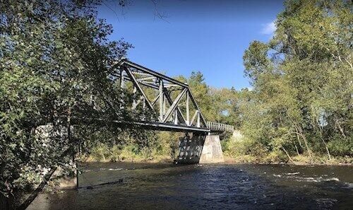
The put-in is at the Gary Yoder Soft Launch, formerly known as Black Oak Bottom, is just above the private bridge - river left - Maryland side. The take-out can be hard to see from the river, but it is just above the bridge. Directions: The Black Oak boat access is located on the Maryland shore just upstream of the Black Oak trestle bridge at Dawson. To reach the ramp, take Maryland Rt. 220 South to Black Oak Road. Cross the railroad tracks, take a right, and then an immediate left. The turn from US 220 is across an unprotected active railroad crossing - be sure to look both ways as you cross the railroad tracks. Park in the open, grassy field and carry your boat to or from the river. There are great fisheries along this stretch of the river. This site is for non-motorized vessels (canoes and kayaks) only. There is a picnic table on location. The site can be muddy in wet weather and there is a gravel road down to the ramp. Please beware of the sometimes slippery riverbank and poison ivy.
Closed River Access - Pinto, MD/WV 956
HazardDistance: 9.89 mi
The old access (takeout/put-in) underneath the Rt. 956 bridge is no longer available. The property was sold in 2021 and the current owner doesn’t want people trespassing on the road that goes under the bridge. He has apparently indicated his willingness to have vehicles towed if left at this location and the road in is usually gated. Also, an older access at the railroad culvert at the end of Pinto Rd is festooned with no parking signs, gated and closed. Locals talk of putting in/taking out from the Allegany Ballistics Laboratory Property, but the level of security at the facility dues not seem to suggest a place to take-out or leave a car.
Short Take-out - Allegany Fairgrounds River Access
Access PointDistance: 16.42 mi
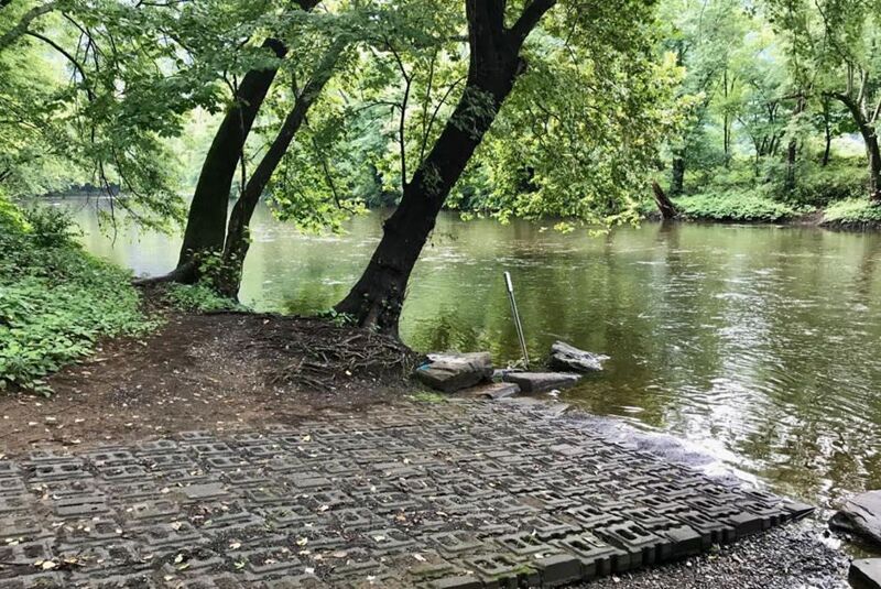
The Boat Ramp at the Allegany Fairgrounds is an easy launch with a short concrete launch pad. This area of the has become a popular spot for smallmouth bass fishing. Directions: From I-68 east, take exit 42 US-220 (Greene Street) south. Follow US-220 and make a left onto Moss Avenue. The fairgrounds are at the end of the street after you cross the railroad tracks.
Long Take-out - Upper Potomac Industrial Park (upstream of Cumberland, MD)
Access PointDistance: 19.02 mi