Southridge Ditch
S.76th to Root River Parkway (0.45 mile) **Access Issues**
| Difficulty | II |
| Length | 0.45 mi |
| Avg Gradient | 20 fpm |
| Gauge | Wilson Park Creek @ Gmia Outfall 7 @ Milwaukee,wi |
| Flow Rate as of 41 minutes | 0 cfsbelow recommended |
| Reach Info Last Updated | October 12, 2025 |
Quick Facts:
Location: Greendale, WI (Milwaukee)
Put-in: '42.9504, -88.0088' (between Richlonns/Goodyear Tire Center and Starbucks)
Take-out: '42.9475, -88.0158' (or use 5300 S.84th St, Greendale WI., then head east on N. Root River Parkway ... east of 84th St., north of Grange Ave.)
Shuttle Length/Drive-Time: 1 mile/3 minutes; otherwise (recommended) walk ~0.5 miles, dragging/carrying boat through woods
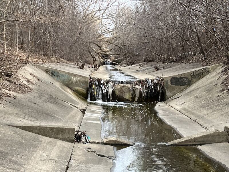
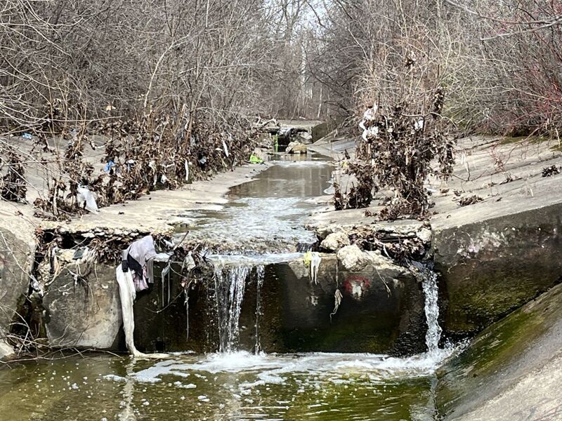
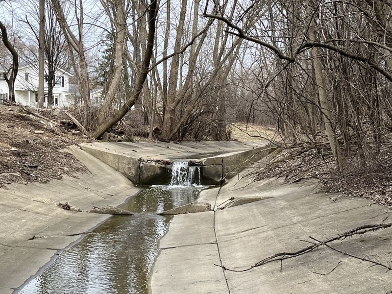
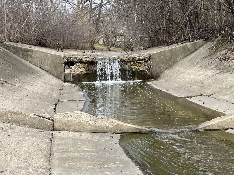
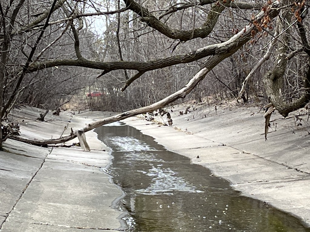
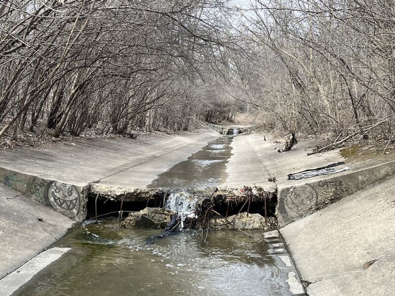
Character: Uniform width/depth cement ditch, with seven 'hydraulic jumps'/pour-overs, from 1'-3.25' (12' - 40').
Drainage area: less than 1 square mile (Yes, extremely small!)
Gradient: ~25' of drop in 0.45 mile, for an equivalent of ~55 FPM
Gauging: Get here while it's still raining (or IMMEDIATELY after) or you've missed it! (While we have linked this to a gauge, it is not really reliable to approximate flow here, as this will flash up and down more quickly than any gauge which updates online only hourly.)
Best I can tell, all waters here come from parking lots and street drains in Southridge Mall and immediately surrounding area. Water quality may be 'iffy', being 100% urban runoff. At S.76th Street it comes out from underground to run through just under a half-mile of cement ditch before flowing into the Root River.
Access at the upper end may be a bit problematic. A Starbucks and Martin Luther High School sit river-left. Richlonn's/Goodyear Tire Center sits river-right, and would be a better bet for parking. To keep things proper you'd have to talk to someone before parking a car in either lot. (Boaters should never assume it is ok to park without first asking and securing permission from business/church/school property, just as from other private property. Failure to get permission to park at a business, while n
...Three options:
HIGHLY VISIBLE (from the store, 76th street, and the sidewalk): in front of Richlonn's/Goodyear: The uppermost reasonable point of access is at the upstream edge of the parking lot (closest to 76th Street). Load into your boat from the sloped cement. (A 'stop-block'/step of concrete may aid in keeping your boat from launching before you are ready).
Slightly less conspicuous: From behind Richlonn's/Goodyear (west end of building): the first 'jump' is right there. Either put-in immediately above it, or carry up along the building to the above-mentioned spot.
Moderately conspicuous: From the Starbuck's parking lot: Park in the northwest corner (against the creek). Carry down to the cement ditch, then put-in immediately (to be just upstream of the first 'jump'), or carry upstream to a few more paddle strokes before the first 'jump'.
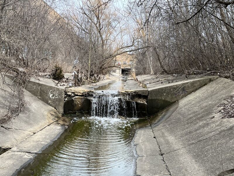
Just beyond the downstream end of the Richlonn building, you'll encounter the first 'hydraulic jump'.
In general, you'll find that water 'sheets' downstream from each of the jumps quite well at nearly any level you are likely to find runnable, so nearly no worries of keeper hydraulics. That said, this series of jumps make fine place to practice 'boofing' a drop.
This location would provide really handy legal access except there is no street parking (and parking on the grass is not advised, especially if it has rained enough to pop this up!) so the only real option would be knocking on a door and asking permission to park in a private driveway. You could then either put in here or hike (bushwhack upstream to our listed put-in) to catch the first two hydraulic jumps (which you'd otherwise miss if you just put in here).
This 'jump' is visible on aerial views, and is scoutable directly across the street from 7830 W.Abbott Avenue.
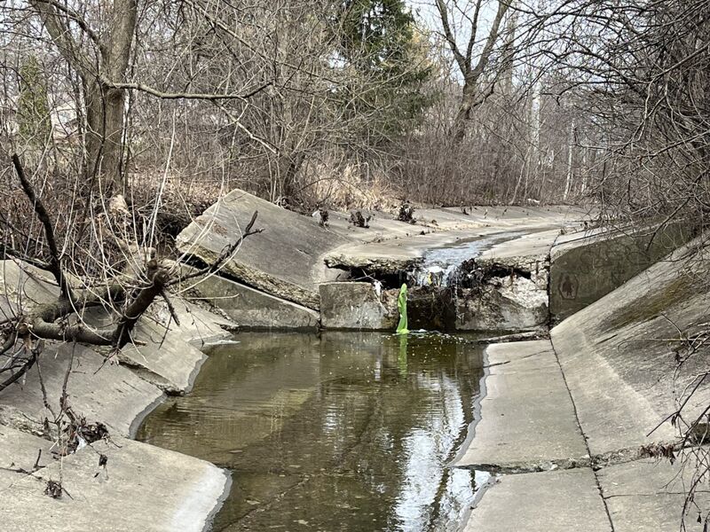
This jump is in disrepair. Cracks formed between the cement slabs, and years of water seeping through those cracks eroded the dirt beneath the right-shore slab and the bottom-center slab. Both have caved and now make a sweet sliding drop.
Additional erosion may cause more concrete to collapse, so SCOUT THIS LOCATION BEFORE PUTTING ON ABOVE IT!
The final jump lies within sight of the parkway road bridge. This is the shortest of the jumps, and will be no jump at all (at any boatable flow) due to the water being 'backed up' from the Root River downstream. (You could use this as a go/no-go indicator ... if any drop visible here, the ditch is likley too low to bother ... if this drop is underwater, you have a fine flow!)
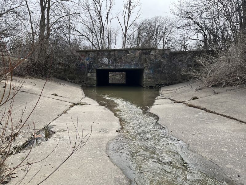
NOTE: When rains are sufficient to make this little ditch runnable, it is highly likely that the Root River (which this ditch runs into just downstream of our listed take-out) will be running high (or be on the rise). Its waters will likely back up into the lower end of this ditch, making passage under the parkway road impossible.
That actually is for the better, since that means you are not likely to have strong flows trying to sweep you into the culvert under the road, and should have a relatively easier time taking out, either at a bit of a clearing where a fairway on the Disk Golf (frisbee golf) course crosses the ditch, or virtually right at the parkway road bridge/culvert.