Popple
D) Hwy 101 to Pine River (6.4 miles)
| Difficulty | II(III) |
| Length | 6.1 mi |
| Avg Gradient | 11 fpm |
| Gauge | Popple River Near Fence, Wi |
| Flow Rate as of 56 minutes | 37 cfsbelow recommended |
| Reach Info Last Updated | September 7, 2020 |
This remote, scenic run is 89% swifts/flatwater. 3 rocky rapids (I-II) have drops over bedrock shelves (II-III). Trip time 2.5-5 hrs (avg 3.5)
Little input (30cfs) to flow from groundwater (springs) is a limiting factor for this river. The best water levels are usually not from snowmelt. They are from early spring rains that come when the ground is still frozen until trees fully leaf-out. A rain of 1” at this time will provide excellent water levels while during the summer it may take a 3” rain (See Photos Tab: Popple River Flow Pattern Graph)
In 1965 the Popple River became a State of Wisconsin, designated “Wild River.” This state designation pre-dated and was the model for the national Wild and Scenic River program. Because of this special designation, today over 95 % of the land along this stretch of the Popple is owned and protected from development by the WI DNR and Florence County. Geologically the bedrock outcrops (at each falls) along this stretch is metamorphosed basalt and intruded volcanic granite that originally solidified off the ocean floor south of the equator nearly 2 billion years ago. It is some of the oldest rock in North America. The unique values of ancient bedrock and wildness add depth and value to your run down this remote stretch of river.
Drops include Champeau(II), Washburn Falls(III), and Jennings Falls(II+ to III). Only Washburn Falls has a marked portage trails that facilitates scouting. Champeau ca n be viewed from East River Rd off (from Hwy 101). Jennings is usually scouted from the right shore. Lining or portaging (no trail) on the right is a possible option. None of these are 'falls' in the traditional, vertical sense.
Champeau is a short, small ledge drop with a fun s-shape path. The drop is a quarter of the way into a long (1/3 mile) complex rocky rapids ( I-II)
Washburn Falls, being a close, cascading sequence of
...
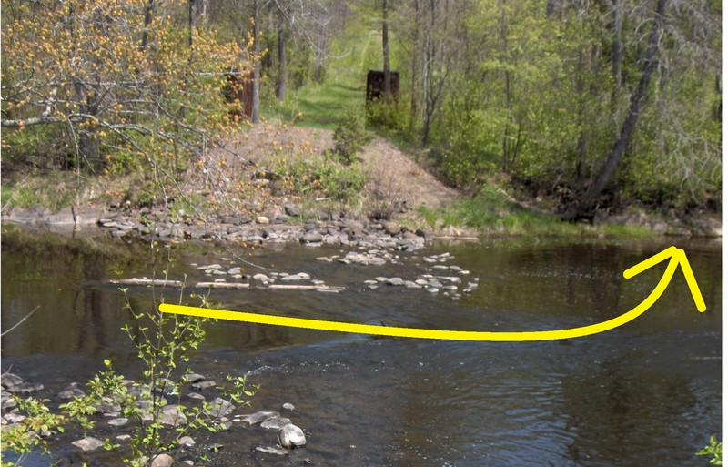
Check the staff-gauge on downriver-left bridge support before launching. Put-in from right just before the little rapids or from left on the shallow gravel shore just after the rapids.
This fun warm-up drop (with playspot) is unlikely to need scouting but is viewable down a steep bank by parking on East River Rd (off of Hwy 101) at 45.799664, -88.388126. A designated parking area with walk-in trail (not steep) to the river just below Champeau Ledge is at 45.800035, -88.386525.
After passing an obstructing tree and a large river-right boulder (45.810524, -88.366105), the signed portage trail is 200 feet ahead on the right (45.810674, -88.365339). At low flows, submerged rocks may require going just past then coming back upriver to the landing. The portage trail is 440 feet (with a steep, rocky end) and provides excellent scouting for the falls.
Washburn Falls can be reached by White Ash Rd. (45.810145, -88.363939). The gravel road (and ATV trail) is 4-miles and the last half is often rough. A parking lot and a 400-foot trail to the falls is on the left. Driving in from the east can be a rougher or impassable drive.
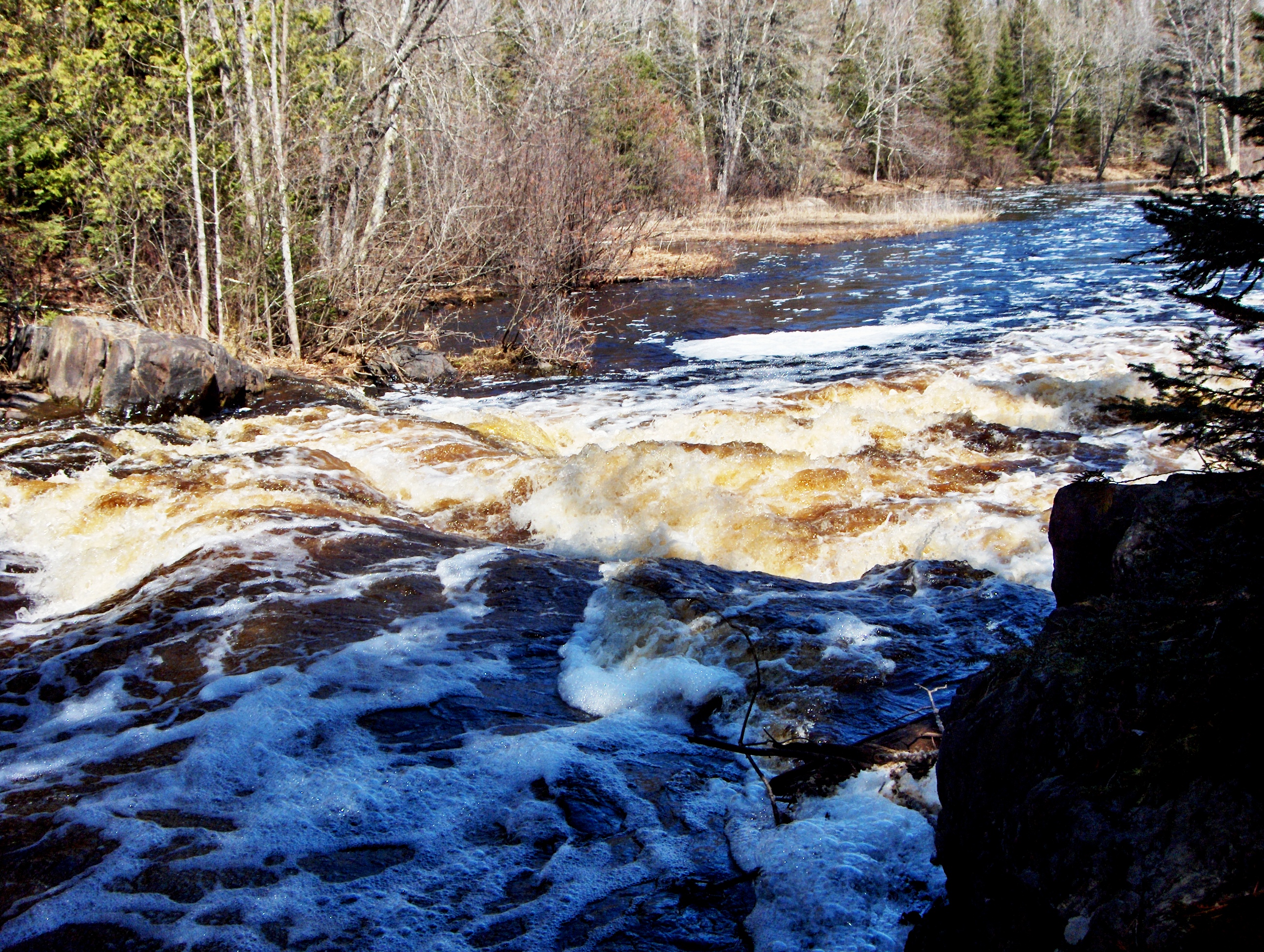
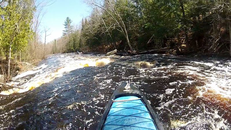
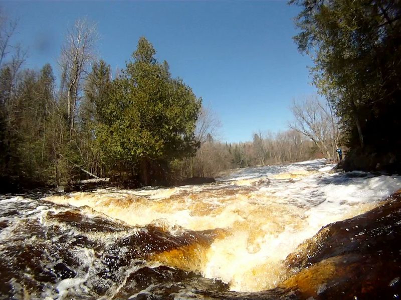
From mile 4.28 (45.832318, -88.366572) for a ¼ mile to the mouth of Woods Creek (45.834118, -88.368173) is a stretch of swifts, embedded boulders, and islands that were installed to restore this river back to some resemblance to what may have been before in-river obstacles were blown up or dragged to the riverbank during the logging era. At the end of the restoration area, a vertical wall of rock rises out of the water on river-right signaling Jennings Falls is near. Follow closely to the right, around the 2nd point into the quiet water at the unmarked landing (45.836795, -88.363941) to scout Jennings Falls. Rock outcrops appear on (or near) either shore almost all the way to the Pine River.
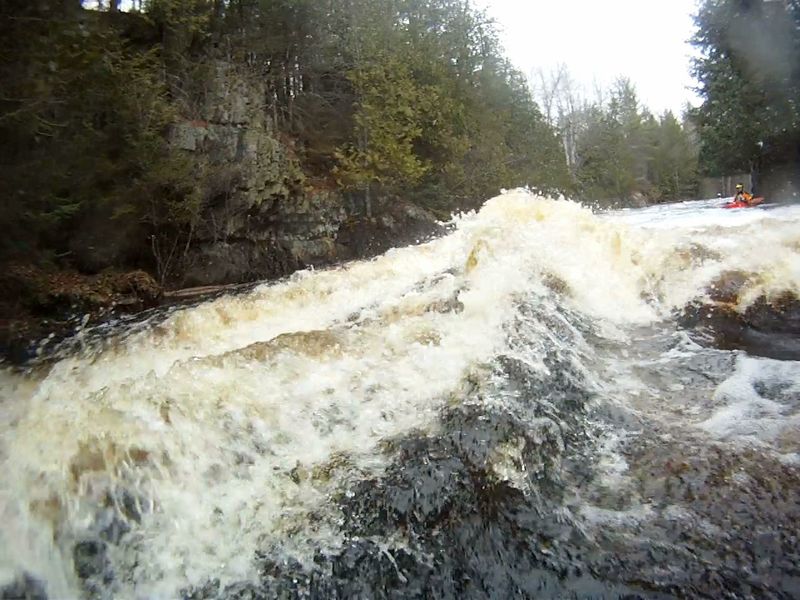
Passing just to the left of the 1st haystack, a boat will deflect towards the rock wall. I have not yet seen anyone hit the wall but it will come by fast and very close. Passing on the right of the 1st haystack increases the odds of tip-over (experienced paddler or not) because of the height of rise to the standing wave and the depth of the hole just to the right of it (see photo).
The ¼-mile gravel drive from the end of Jack Pine Drive to the takeout landing is on private property and is gated but available to paddlers who obtain permission. For permission to use the river-left takeout (or arrange shuttle assistance) contact Dwayne of Wild Rivers Adventure Co. (Florence, WI) at 715-528-5266 or 715-952-8027
Feb 12, 2018
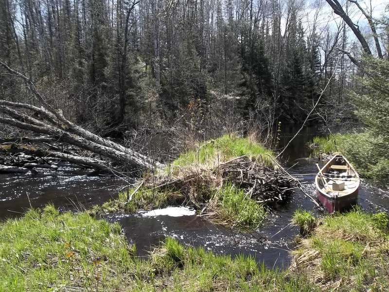
Passage is around root-wad end.
Apr 27, 2014
If you pass just to the left of the 1st haystack and a boat will deflect towards the rock wall. I have not yet seen anyone hit the wall but it will come by fast and very close. Passing on the right of the 1st haystack increases the odds of tip-over (experienced paddler or not) because of the height of rise to the standing wave and the depth of the hole just to the right of it (see photo). This is drop is quick, exciting, and fun!!!
May 10, 2013
Washburn Falls can be reached by White Ash Rd. (45.810145, -88.363939). The gravel road (and ATV trail) is 4-miles and the last half is often rough. A parking lot and a 400-foot trail to the falls is on the left. Driving in from the east can be a rougher or impassable drive.