Deschutes
09. Farewell Bend Park to Sawyer Park(Deschutes in City of Bend)
| Difficulty | I-II |
| Length | 5.1 mi |
| Avg Gradient | n/a |
| Gauge | Deschutes River at Benham Falls, or |
| Flow Rate as of 7 hours | 1430 cfsrunnable |
| Reach Info Last Updated | May 22, 2018 |
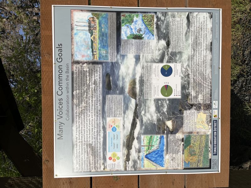
The City of Bend has a few paddling opportunities with a whitewater park and slalom courses. The river is still interrupted by a series of dams but this may change in the future.
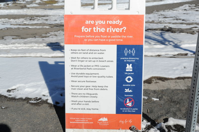
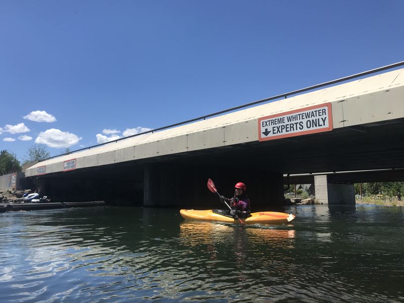
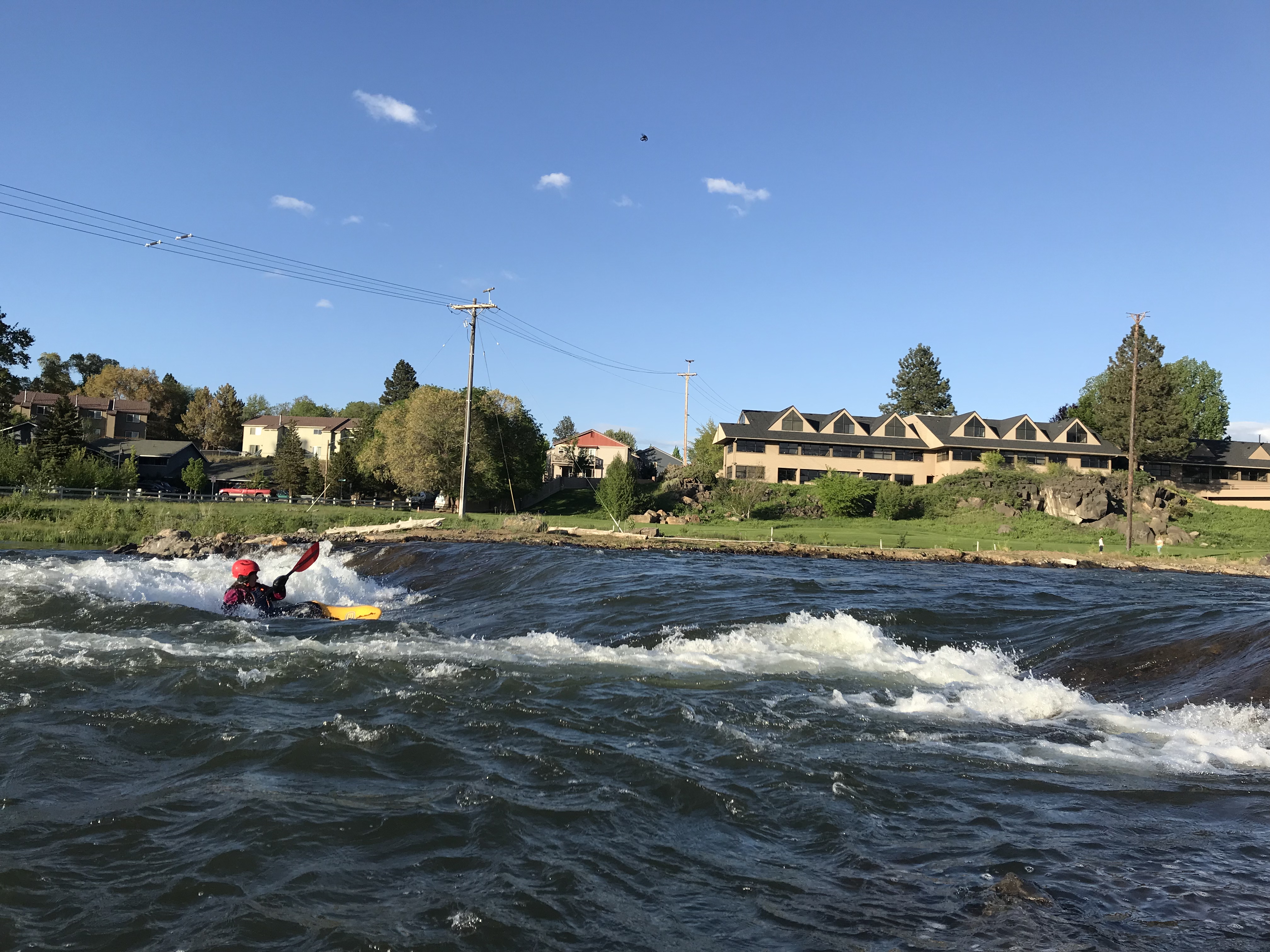
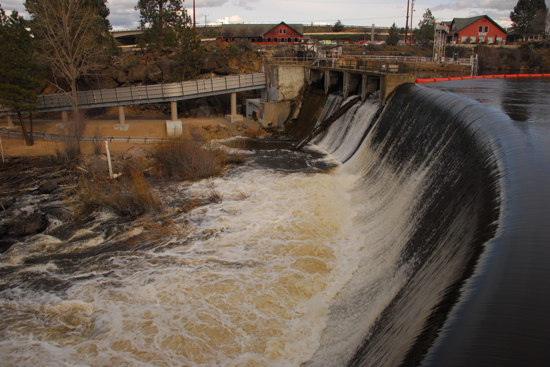
Bend Whitewater Park: The Bend Whitewater Park is located in the Old Mill District immediately downstream of the Colorado Avenue Bridge and accessed from McKay Park on river left. The park was developed in 2015 with the removal of the Colorado Avenue Dam that was a safety hazard for floaters. The park consists of three channels: a river right habitat channel, a center whitewater experts channel with constructed play features, and a river left passageway channel for those looking for the more mellow float. Flow in the channels is controlled by a series of gates and 23 bladders. Whitewater kayakers, surfers, bodyboarders, paddleboarders, and tubers can all be found enjoying the park. For more information check out the Bend Whitewater Park web page.
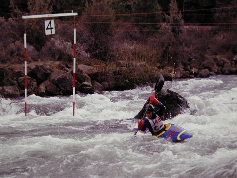
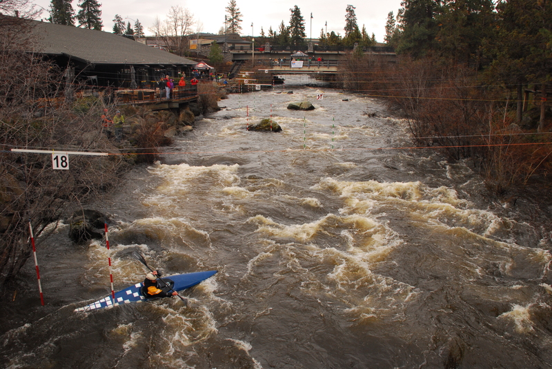
First Street Rapids Slalom Site: First Street Rapids is a rapid located just upstream of the First Street Bridge and has served as a training site for slalom paddlers within the city limits.
Riverhouse Rendevous Slalom Course: The annual Riverhouse Rendevous occurs in late March each year and attracts racers from across the Pacific Northwest. The course is set up behind the Riverhouse Hotel, at 3065 N Hwy 97, Bend, OR 97701. As the season’s opener for the Northwest Cup Slalom Paddle Series and a Junior Olympic qualifier, the Rendezvous is also an opportunity for local whitewater enthusiasts to celebrate navigable flow levels before canal diversions are made in April.
This is the upper put-in but parking is limited and it is typically used as the take-out for the Meadowcamp run.
Developed in 2015 as a whitewater park with several features at river mile 167.6.
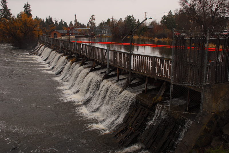
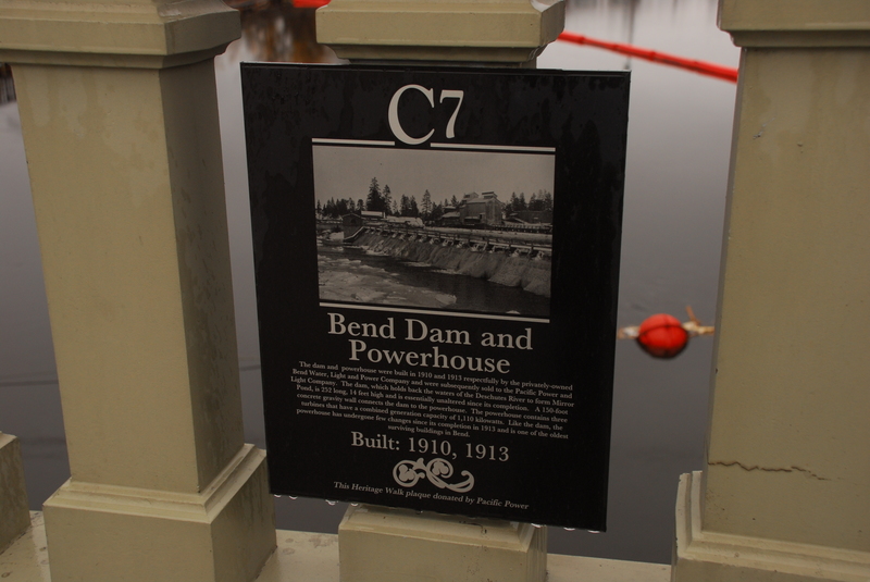
The dam forming 'Mirror Pond' was originally constructed in 1910 by Bend Water, Light & Power Company before acquisition by Pacific Power in 1926 that operates the dam for hydroelectricity today. The dam represents a hazard and barrier to navigation at river mile 166.2.
The Steidl Dam or Tumalo Irrigation District Diversion adjacent to Pioneer Park is used for a canal intake. It represents a hazard and barrier to navigation at river mile 165.8.
A slalom training site used the whitewater paddling community at river mile 165.7.
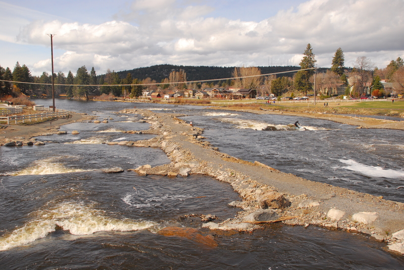
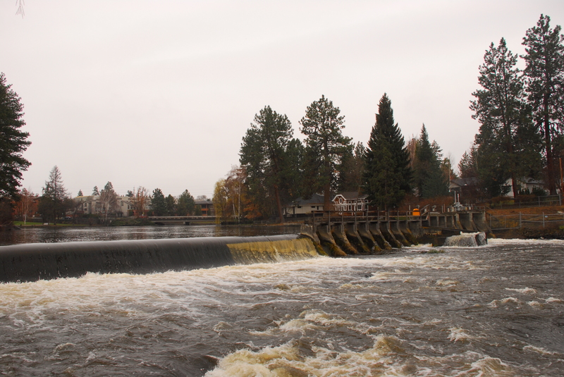
Constructed in 1912, the North Canal Diversion Dam is a 33-foot-high dam that diverts irrigation water. When water diversion begins in April it marks the end of boating opportunities on the downstream Riverhouse reach. The dam represents a hazard and barrier to navigation at river mile 164.8.
Site of the annual Riverhouse Rendevous Slalom Race held in March. It is located at river mile 164.6.
A take-out is available in Sawyer Park on river right at the foot bridge.