| Difficulty | II-III |
| Length | 3.7 mi |
| Avg Gradient | n/a |
| Permit | No permit required, National Park Service jurisdiction. Downstream of the visitor center, it becomes Cherokee Indian Reservation land and paddling is not permitted. |
| Gauge | Oconaluftee River at Birdtown, Nc |
| Flow Rate as of 30 minutes | 342 cfsbelow recommended |
| Reach Info Last Updated | March 2, 2022 |
River Description
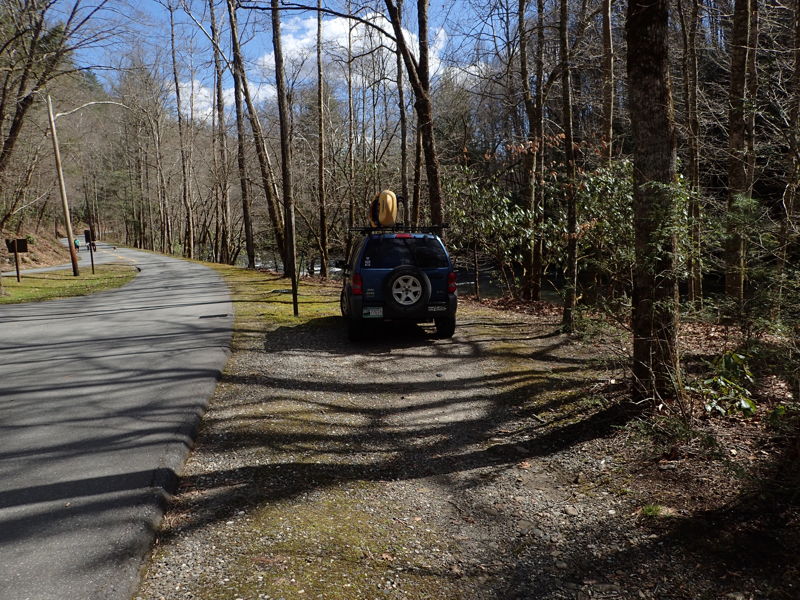
This is an under appreciated and very scenic Class II-III run in Great Smoky Mountains National Park, near Cherokee, NC. The shuttle logistics are easy, as the run is mostly roadside. The takeout offers bathrooms, vending and a very nice NPS Visitor Center with a wealth of local information.
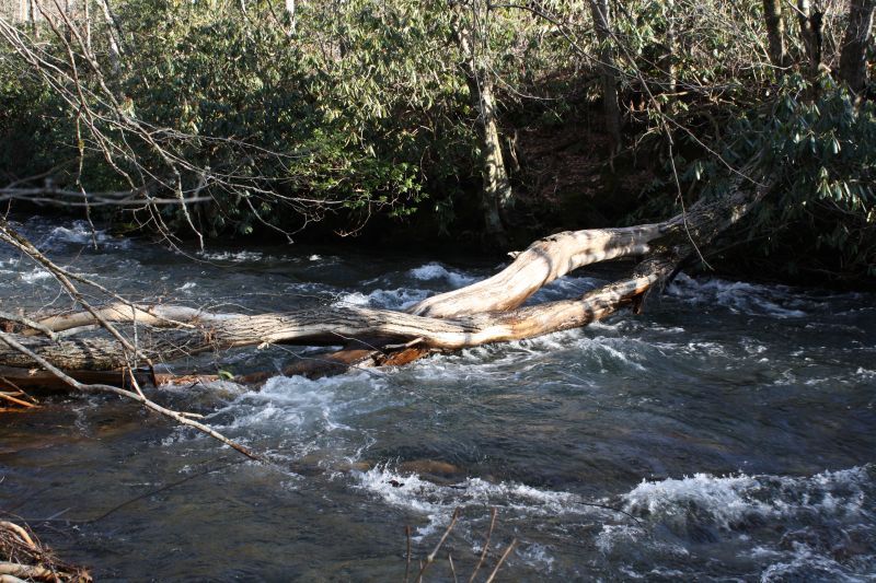
Overall, the difficulty level is close to the Nantahala and more challending than the Tuckaseegee Gorge. It offers a good introduction to Smoky Mountain creeking. That being said, this reach is not paddled often and requires some additional skills. This run is prone to tree strainers and has some blind curves. The leader should be able to boat scout Class III and communicate quickly to the group hazard locations. Adequate group spacing is manadatory. Everyone in the group should be able to quickly eddy out and stop if a strainer hazard is present. It's a fun and scenic run, just be ready for hazards. If you encounter a hazard, please post to this page and/or notify the NPS at the visitor center.
As of February 2022, this river section has several potentially dangerous strainers. Comprehensive pre-run scouting and safety preparations are recommended. With the abundance of wood, this is not an easy Class II-III run. It requires a high level of situational awareness and the ability to avoid potential hazards. On February 24, 2022, there was a fatality from a strainer upstream of the Smokemont Bridge. An abundance of caution, group skill assessment and risk evaulation is reccomended.
River Features
Smokemont Campground
Access PointDistance: 0 mi
Putting in here gives you an extra 0.2 miles of river and the rapid before Smokemont Bridge. There is only space to park 1-2 cars here, and unknown if it's acceptable during the summer season. More parking is available at the Smokemont Bridge.
Smokemont Rapid
OtherClass: IIIDistance: 0.15 mi
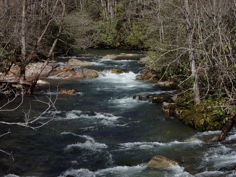
Easy Class III rapid with a nice boof over a decent hole. Take the right channel. Left side was woody as of 3/4/18.
Smokemont Bridge
Access PointDistance: 0.2 mi

Alternate put in with more parking than at the campground. Easy access to river.
Beck's Ledge
OtherClass: II+Distance: 0.8 mi
As the river approachs the road there is a fun rapid with a large boof rock in the center.
Rockwall Rapid
OtherClass: IIIDistance: 1 mi
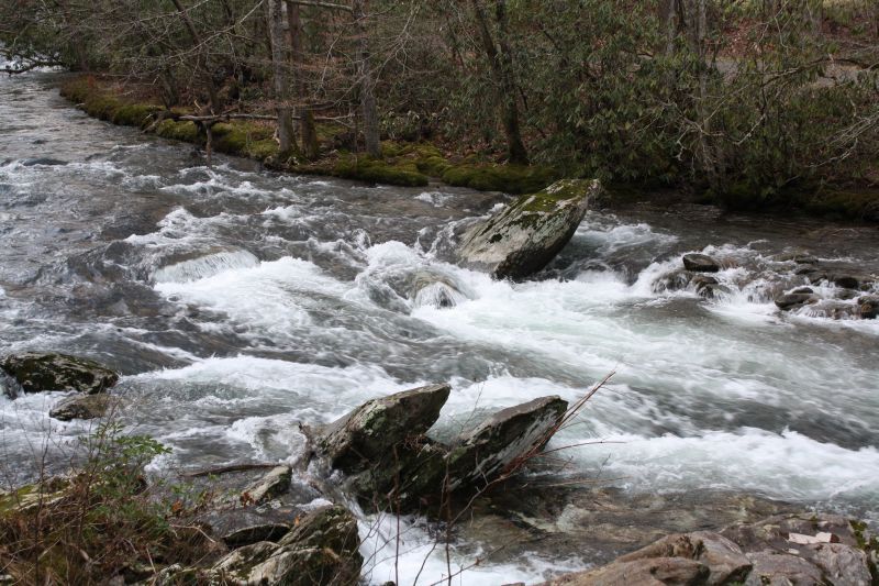
Easy Class III rapid, drops over a couple small ledges. Starts just past the rockwall. As of 3/4/18 there was a treee sticking out of the right bank, easily seen and missed by angling right.
Tow String Bridge
Access PointPlayspotClass: IIDistance: 1.3 mi
Tow String Bridge and Rapid. Class II with some play spots and alternate river access with parking.
Elbow (Island)
OtherClass: IIIDistance: 1.6 mi
The river divides at an island into two channels. Both are easy Class III rapids and clear of wood, as of 3/4/18. The left channel is a drop over a couple of ledges, somewhat scrapy at 1300 cfs. The right channel drops over a ledge into a nice eddy, allowing scouting of the remaining rapid. As of 3/4/18, it was clear with some low hanging branches, best down the left bank.
Island
OtherClass: IIDistance: 2.1 mi (approx.)
Class II rapid. River splits at Island. Right channel clear 3/4/18. Nice little pourover/hole at bottom that can be surprising.
Oconaluftee Visitor's Center
Access PointDistance: 3.2 mi
Take out on the eddies on river right, just below the visitors center. Follow path up to parking lot. Bathrooms and vending machines are available.
Trip Reports
Log in to add a reportSP
Steve Pack
Nov 13, 2018
The run was clear of dangerous wood. The only potential problem was a decent sized tree parallel to the current, in the center of the river, under the Job Corps bridge. It has moved over the last week or so. Watch for it, in case if becomes a river wide. issue. Other than that, only a few trees on the edges, but easy to avoid. The level was about 1700 cfs.
SP
Steve Pack
Nov 6, 2018
No wood obvious from the road today. Running about 2000 cfs. Looked good.
SP
Steve Pack
Mar 30, 2018