| Difficulty | I |
| Length | 6.3 mi |
| Avg Gradient | n/a |
| Gauge | Patapsco River at Hollofield, Md |
| Flow Rate as of 36 minutes | 37 cfsbelow recommended |
| Reach Info Last Updated | July 17, 2022 |
River Description
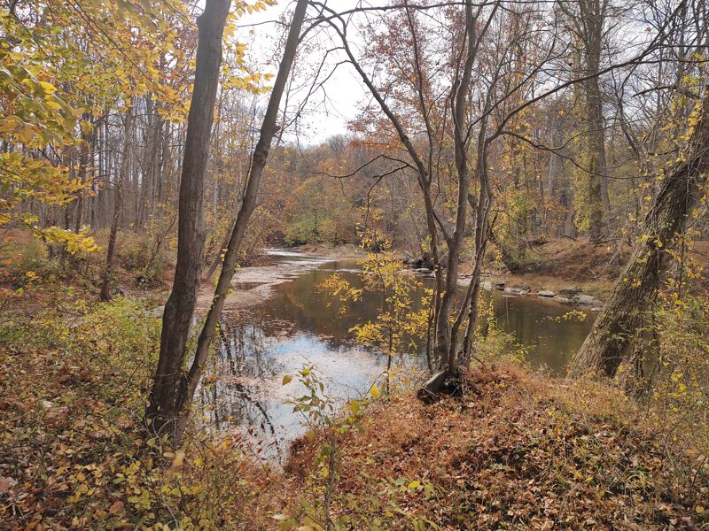
This class I float section begins at the confluence of the North and South Branches of the Patapsco. There is no road access to the confluence, but in a high water year such as 2018, when water is going over Liberty Dam, you can put in on the North Branch, just above Marriottsville Rd. to run a 2.5 mile stretch of the North Branch (also class I - although strainers are likely), to the confluence. However, in a normal year, it's rare to see water going over Liberty Dam. Another possibility is to put in 1.8 miles downstream of the confluence at Woodstock Road, leaving about a 4.5 mile run down to Daniels. Yet another possibility is to put in on the South Branch and portage or run the Class IV 'McKeldin Falls' (the 'McKeldin Falls' section of the South Branch is covered in a separate AW listing). Finally, you can hike in from either the North or South Branch crossings with Marriottsville Rd. on the park trails with your boat to the confluence (not my taste, but last time I was there I ran into someone doing exactly that). A whitewater boater would not seek out this section, but it is run, so it's included for the sake of completeness.
River Features
Start of Reach - Confluence of North & South Branchs of the Patapsco
Access PointDistance: 0 mi
There is no road access to the confluence, but in a high water year such as 2018, when water is going over Liberty Dam, you can put in on the North Branch, just above Marriottsville Rd. to run a 2.5 mile stretch of the North Branch (also class I - although strainers are likely), to the confluence. However, in a normal year, it's rare to see water going over Liberty Dam. Yet another possibility is to put in on the South Branch and portage or run the Class IV 'McKeldin Falls' (the 'McKeldin Falls' section of the South Branch is covered in a separate AW listing). Finally, you can hike in from either the North or South Branch crossings with Marriottsville Rd. on the park trails with your boat to the confluence (not my taste, but last time I was there I ran into someone doing exactly that). There is another access at Woodstock Road 1.8 miles downstream that is the more common access to this reach (see next feature).
Woodstock Rd - common put-in
Access PointDistance: 1.78 mi
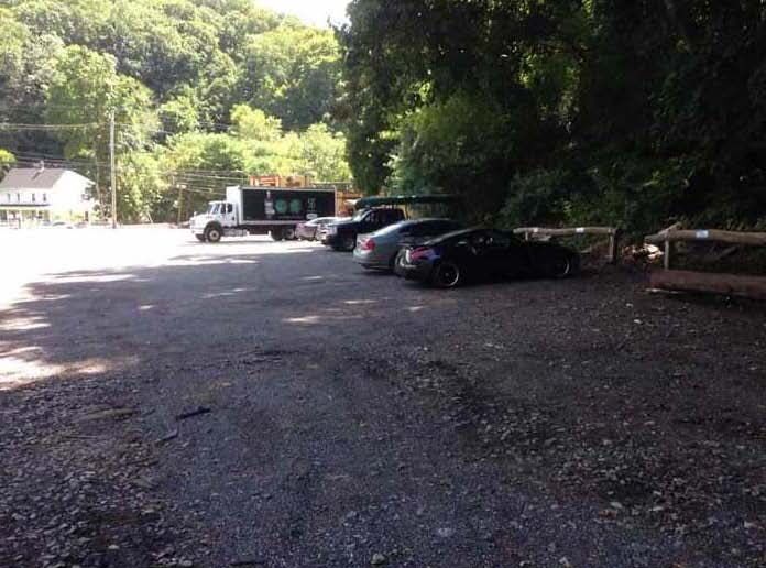
Woodstock Rd. is the more common put-in for this stretch. Woodstock Rd. is 1.8 miles downstream of the confluence at Woodstock Road, leaving about a 4.5 mile run down to Daniels.
Take Out - Daniels River Access
Access PointDistance: 6.3 mi
Take Out - Daniels River Access.