| Difficulty | I(II) |
| Length | 2 mi |
| Avg Gradient | 10 fpm |
| Gauge | Milwaukee River Near Cedarburg, Wi |
| Flow Rate as of 40 minutes | 140 cfsbelow recommended |
| Reach Info Last Updated | March 4, 2025 |
River Description
Quick Facts
Location: West Bend, downtown to east of town.
Put-in: 43.4272, -88.1836
Take-out: 43.4253, -88.1619 (Riverfront Park Landing, Riverfront Parkway, West Bend, WI)
Shuttle Length/DriveTIme: 1.3 miles/3 minutes (by car) or biking the multi-use trail, 1.7 miles/9 minutes.
Video Link: https://www.youtube.com/watch?v=Q3E1ar0OffE
IMPORTANT NOTE: Gradient values should always be used for general comparative purposes only! Differences (even up to 15-20% and more) mean very little in the grand scheme of all things whitewater! Similarly, class/rating can mean relatively little. Far more important than either gradient or class/rating should be other less-quantifiable 'character factors' such as: (1) continuous versus pool/drop, (2) wide-channel with multiple routes versus narrow channel with essentially one route, (3) straight-shot routes versus complex technical maneuvering-required routes, (4) gradual river banks versus rocky shores or steep-walled gorges, et cetera. Never rely solely on class/rating to decide if you should run a river/rapids!
Character: Fairly continuous current, wide-open routes, moderately wide-channel.
River banks: Begins with some areas of 'city gorge' (vertical cement walls) with occasional steps and grassy slopes , but quickly becomes much more pastoral.
Typical width: 30-70 ft.
Drainage area at put-in: 233 square miles
Drainage area at take-out: 246 square miles
Drainage increase: 5.58%
10/85 Gradient Upstream of Put-in: 4 fpm
Percent Developed Upstream of Put-in: 8.7 %
(The higher the above two values, the 'flashier' the stream will be! Especially if the drainage area is small.)
Description
West Bend has made great use of land exposed by dam removal(s) outside of town to create a multi-use trail (which criss-crosses river via numerous brdges) c
...River Features
Put In
Access PointDistance: 0 mi
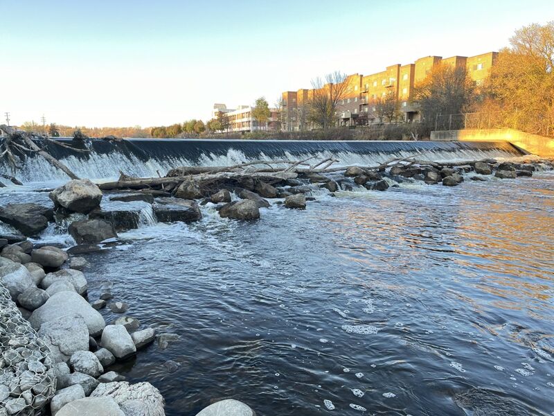
A small parking area (for about 6 vehicles) in a little park next to the dam allows a very short carry to put in below the dam.
Do not even think about running the dam ... the 'stilling area' at the base of the dam is filled with rocks to prevent or reduce scouring of the riverbed.
The first 0.6 mile of river is flanked by roads (Veterans Avenue and Auxiliary Court) river-left, and parking lots and backsides of buildings on river-right.
Silverbird Rips
OtherDistance: 0.25 mi
At a slight narrowing in the river (where the shore path has a large metal sculpture of a bird) the river encounters some minor shoals. At some moderate flows, the waves may form well enought to allow some minor play. More likely, it will just be fun splishy-splash for novice paddlers.
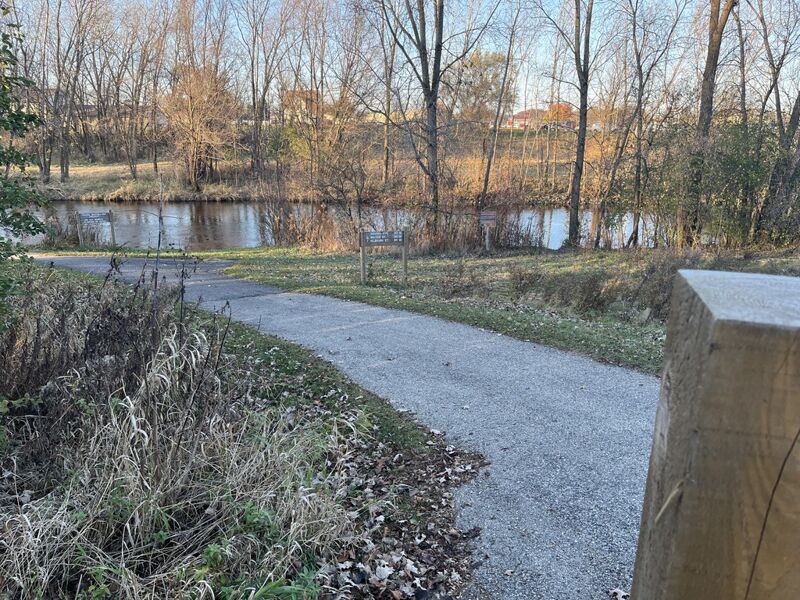
Eisenbahn State Trail
OtherDistance: 0.62 mi
As the river bends to the left (east), you'll pass under the 'Eisenbahn State Trail'. Not far beyond, the river becomes flanked by parkland, becoming far more pastoral.
Riverside Disc Golf Rips
OtherClass: IDistance: 0.9 mi
A minor line of rubble (a 'rock-dam') creates what may be one of the more substantial riffles on the run. At some nominal flows, there may be tame surfs available here.
Take Out
Access PointDistance: 2.03 mi
A small 'improved landing' allows a short walk to parking off of S.River Road/CTH.G.
The parking here is also a trailhead/terminus for the multi-use trail they've named 'Riverfront Parkway'.