Rocky Broad
1. Upper, Bridge at Flat Creek Rd to Bridge at U.S. Route 64
| Difficulty | IV-V |
| Length | 3.5 mi |
| Avg Gradient | 127 fpm |
| Gauge | Broad River at Highway 9 Near Chimney Rock |
| Flow Rate as of 39 minutes | 1 cfs |
| Reach Info Last Updated | August 5, 2015 |
Technically still the Broad River on all the maps but well known as the 'Rocky Broad'. The second down to Hwy. 64 is known as the Upper Rocky Broad.
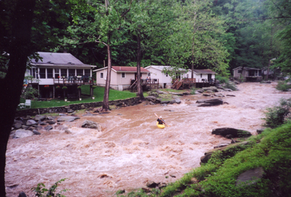
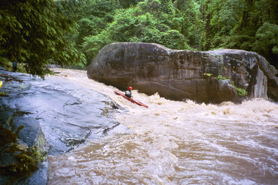
The highlight of the URB 4 good back to back waterfalls in the upper stretch. These are followed by a tree filled boulder garden, then a fast multi-level drop called Flight Simulator, then two slides, then lots of good boulder gardens and boogie water. The last notable rapid before the takeout is a slide around a very nastily undercut boulder that tends to collect a bit of wood. Be aware of trees and strainers on any part of this run, and please post new strainers below using our comments section.
Leland Davis wrote a nice story about the Rocky Broad that honored the memory of the late Pablo Perez -- A Rite of Friendship. This article appeared in the July/August '98 issue of American Whitewater. That incident, which involved a blind drop and a hidden log took the life of one the SE's top paddlers. You can read the AWA Safety Report about that incident.
Levels are determined largely by the amount of rain that hits the top of the watershed, which is between Fairview and Black Mountain, NC. This rugged area, just over the ridge from much of Asheville's hyper-development has thus far stayed largely rural, and responds well to rain, often holding for a solid day at decent levels after a winter rain storm hits the headwaters.
Fortunately for paddlers, that rain is measured by the Automated Flood Warning System, which has rain gauges and a river gauge on the Rocky Broad here. Check the Bat Cave river gauge #1917 for the river level.
AFWS has both a rain and stream gauge located on the Broad River at the intersection of Hwy 64 and Hwy 9 in Bat Cave. The stream gauge does not correlat
...10 or 15 foot tall waterfall with a questionable landing zone. You'll be landing very close to rocks.
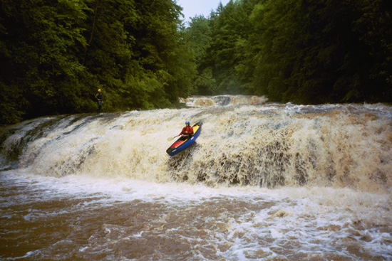
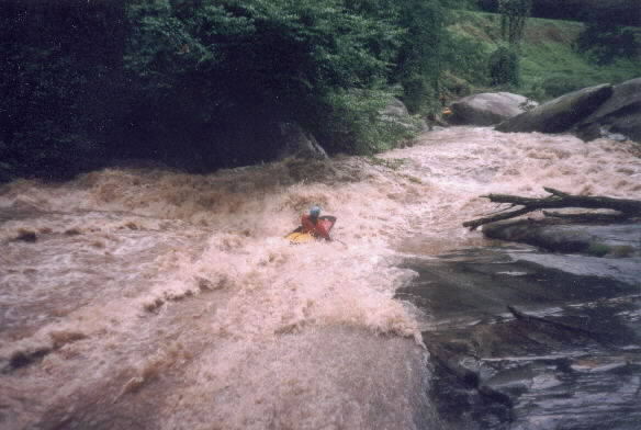
Big waterfall that leads into two more big drops
Center is best. The line in the photo lands on rocks. Don't blame the boater, blame the guy at the bottom who showed him a bad line.
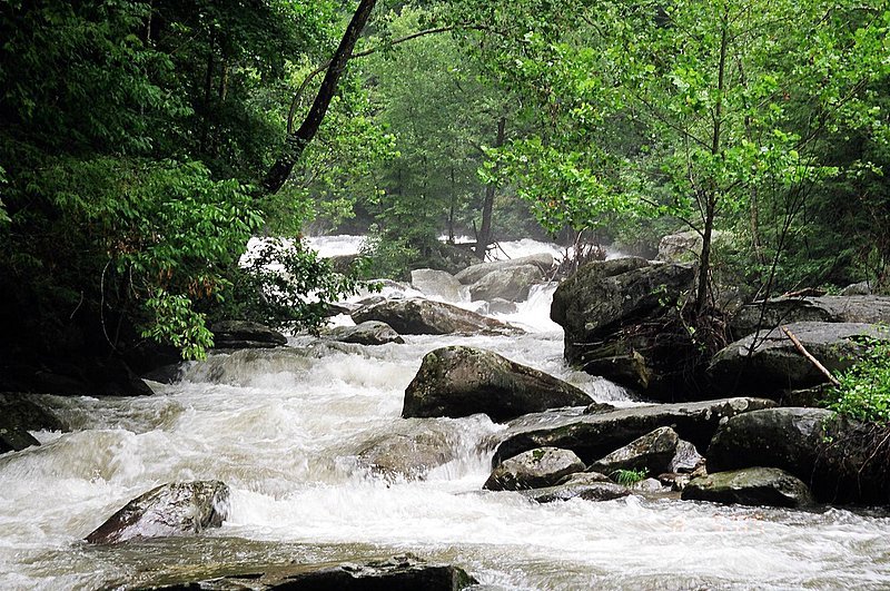
The boulder clog is most often full of wood, so scout it and see what you think. There are a variety of possible routes, but none of them are easy and neither is the portage. A standard line if there is no wood is to go to the left side of the rock-pile island and take the far left slot and immediate the far left slot, though stay right in this slot to be up on a boulder to boof off. The run out is class IV down to the eddies above Flight Simulator.
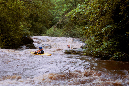
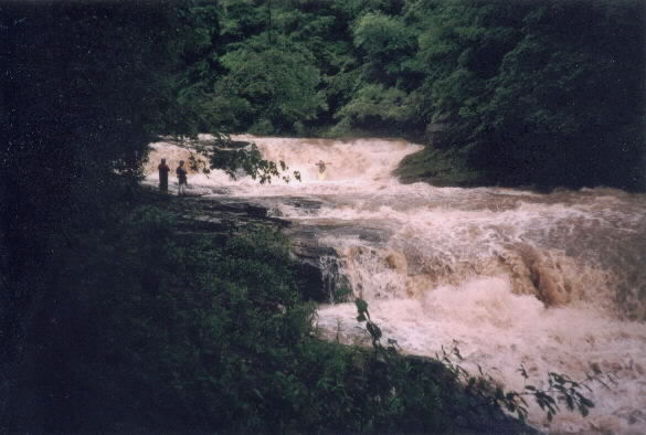
Immediately below the boulder clog is a small slide. Around the corner from that is a big one that leads into some large ledge hole.
A slide into a big hole, back by an undercut with wood crammed into the base of the undercut.
Come around the undercut on the right, try not to get stuck in the eddy, then slide down the ramp and punch the hole at the bottom. At this waterflow the eddy at the bottom was 'interesting'.
May 29, 2009
as of 5/28/2009 all wood is easily avoidable...from the river you can see on the river left bank at the second drop, a tree is barely handing on by the roots...may be a concern after another hard rain...watch for wood and a few hidden pin/sieves...other than that..this run is a total classic run...look @ the bridge gauge to be between 4.1/5 ft...Jwall
Aug 9, 2005
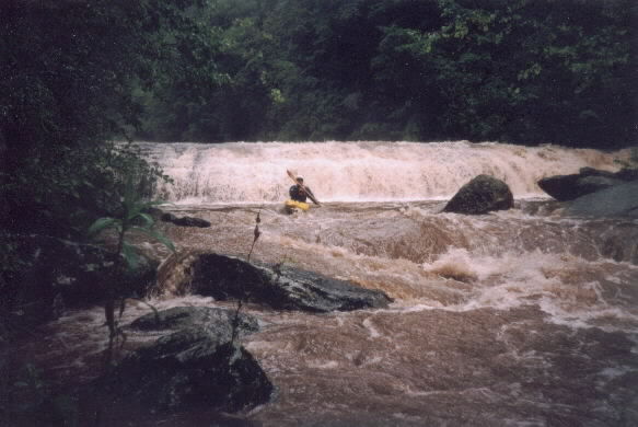
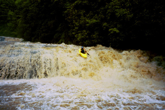
Glen boofing the second of four consecutive waterfalls.
This is the upper part of the class 5 boulder garden immediately below the falls. At this level the lines were tight.
Jul 9, 2003
Still being worked out.... New
Forum: BoaterTalk
Re: New Trees in Rocky Broad.... by moheinous Jul 09 2003, 12:15 GMT New
Re: What's the minimum Level? by
From: moheinous
The AWFS site is very unreliable, but recently it's been showing a flow @ Bat Cave. I ran the lower with a too low flow yesterday at 4.1 AWFS online reading, I would guess about 4.5 would be a good minimum. This number dosen't coorespond with the USGS bridge guage(not online) at Bat Cave(1st bridge over the lower). The bridge guage said 3.6, so I would quess about 4.0 for that guage