St. Joe
6. Packsaddle CG near Avery to Lake Coeur d'Alene(The Shadowy St. Joe)
| Difficulty | I-II |
| Length | 57 mi |
| Avg Gradient | n/a |
| Reach Info Last Updated | March 2, 2023 |
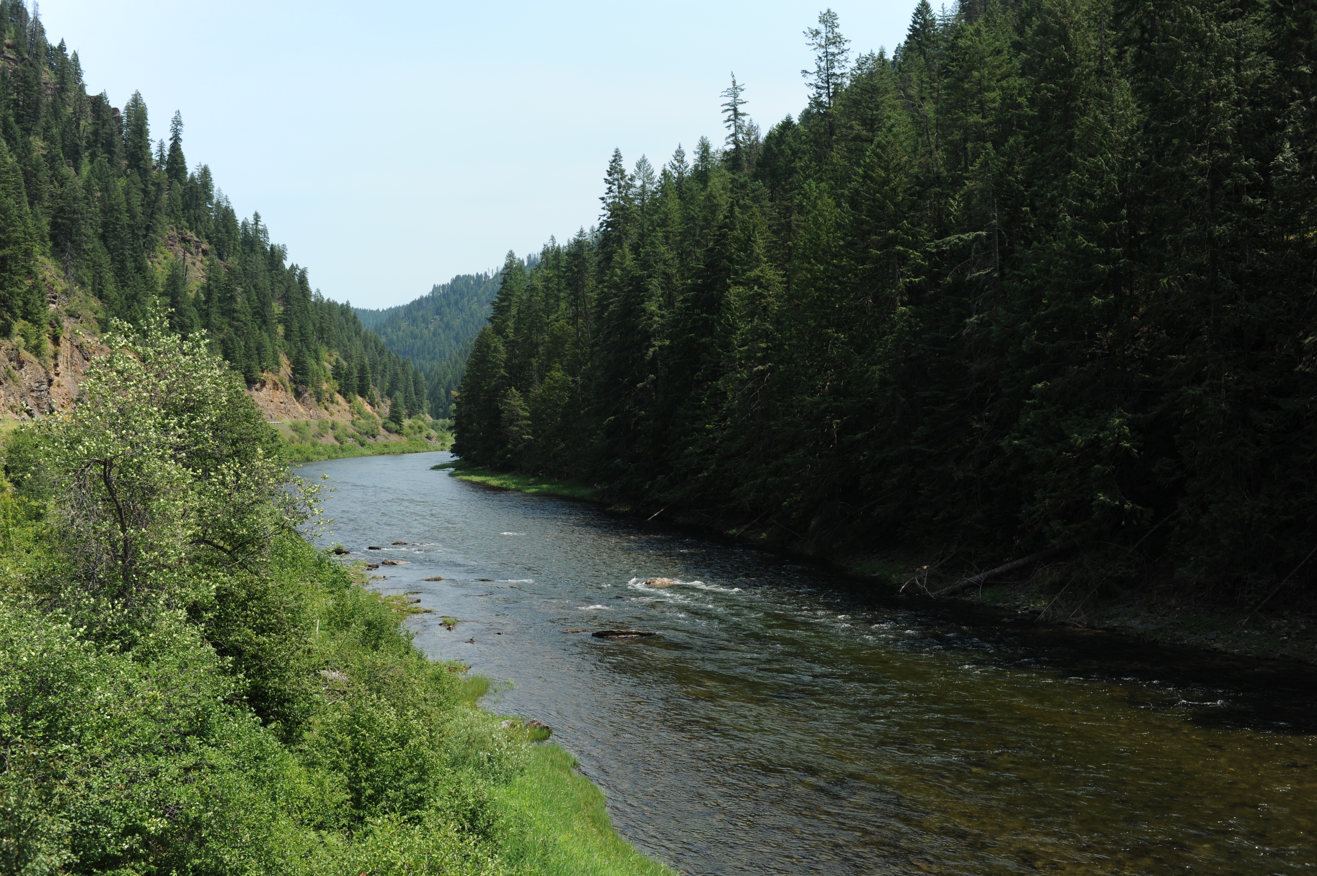
The four mile stretch to Avery contains some class II whitewater and class II riffles continue for another half dozen miles downstream of Avery. At Marble Creek the conifer forests and canyon walls transition to more open country with private land and less forested areas along the river. By the time you reach Huckleberry Campground the river moves at a much slower pace where recreational kayaks and SUPs dominate. Moving downstream agricultural fields are interspered with private homes. Below Shadowy St. Joe, the pace slows even more and several river-front properties have docks. While this lower segment of the river does not have whitewater, it becomes mellow float down to Lake Coeur d'Alene with easy road access and a long summer season that invites swimming and water play.
Key access points and features along Highway 50, a paved two-lane highway, that parallels the river:
Mile 10.7 Shadowy St. Joe Campground, Forest Service: 14 accessible camp units, a group picnic shelter, boat ramp and docks, vault toilets, and potable water.
Mile 29.4 Huckleberry Campground, BLM: 33 camp sites (3 of these are group sites) with paved parking, potable water, electricity, picnic table, fire ring, and toilets. The campground has an undeveloped boat ramp.
Mile 34.2 Marble Creek Historical site interpretting the logging history of the region
Mile 34.8 bridge across St. Joe
Mile 40.6 Avery Ranger Station
Mile 47.0 Avery Store: The Avery store has gas, basic camping supplies and a few food essentials (canned goods, chips, milk, eggs, and a generous assortment of liquor), trout flies, and an assortment of small items you may haver forgotten.
Mile 47.2 North Fork St. Joe confluence
Mile 47.8 Upper Landing, day use and picnic area
Mile 51.4 Packsaddle Camgpround with designated boat launch
Located at Highway 50 Mile 51.4. This Forest Service campground offers two camp sites, a vault toilet, drinking water (June- October), and a dedicated boat launch area immediately downstream of the first campsite. Parking is available on a pullout along the highway at the upstream exit of the camgpround near the toilet.
Private access point on river right with limited access at Idaho Fly Fishing Company across from the Avery Store. Located at Highway 50 mile 47.0 on the highway.
Primitive boat ramp on river left off Sibert River Road upstream of Fishhook Creek.
Access site maintained by Shoshone County.
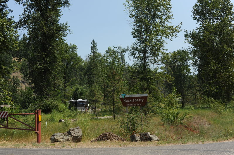
Located at Highway 50 mile 29.4. BLM Campground with 33 sites and an unimproved boat ramp.
Located at Highway 50 mile 10.7. The Shadowy St. Joe Campground is a Forest Service Campground on river river right has 14 accessible camp units, a group picnic shelter, boat ramp, vault toilets, and potable water.
Park and boat ramp in St. Maries on river left.