Spring Creek
Route 1171 to NC Route 209 in Hot Springs
| Difficulty | III-IV(V) |
| Length | 5.8 mi |
| Avg Gradient | 80 fpm |
| Gauge | Ivy River Near Marshall, Nc |
| Flow Rate as of 1 hour | 73 cfsbelow recommended |
| Reach Info Last Updated | May 8, 2019 |
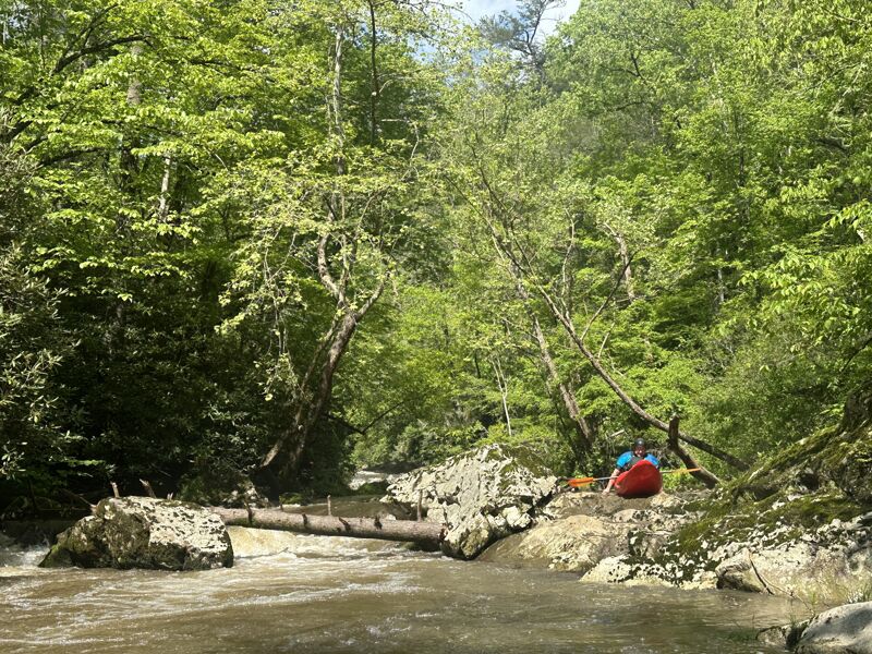
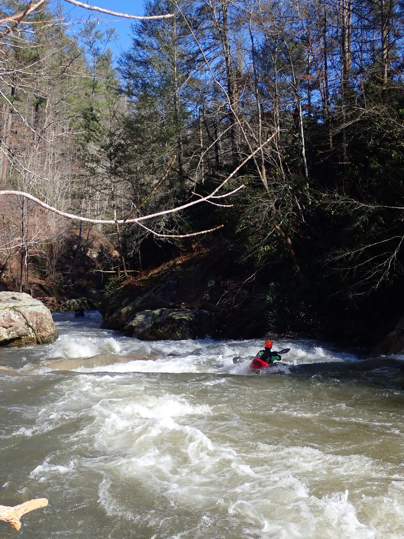
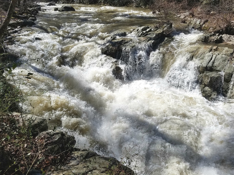
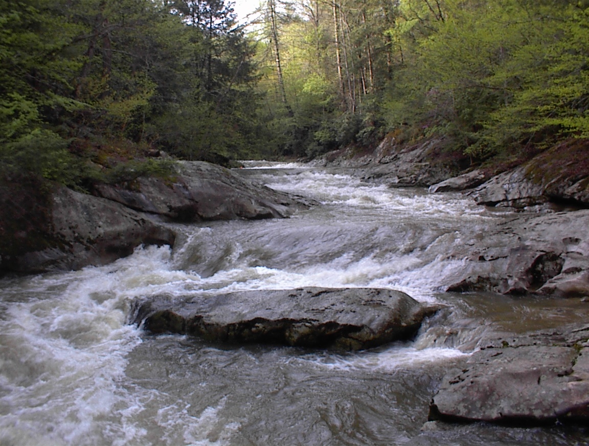
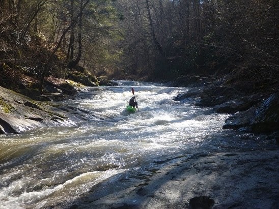
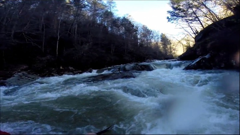
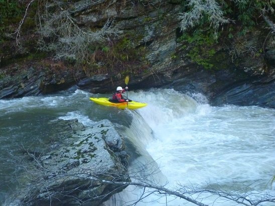
Spring creek cuts a deep gorge as it drops into Hot Springs. This run really starts off with some good drops. The major rapids begin a few yards from the put-in and when the creek is really running they are somewhat intimidating. The first mile consists of almost non-stop ledges and boulder gardens. Unfortunately these things can't keep up forever and Spring creek begins to slow after the first mile. By the end of the second mile, all of the big stuff is done and the creek consists of small ledges or rock gardens. There is one major exception. After Spring Creek emerges from the gorge and reaches NC 209 it has one final big drop. The most dangerous and largest rapid on the creek is less than a half mile above Hot Springs. The rapid drops over 10 feet into a monstrous rocky hole and then slams into a rock wall. Unless you are dead set on running this rapid it seems logical to take out above the final drop and skip the last urban section of Spring Creek. There are no real rapids so if you can get to off the river safely after the NC 209 intersection go ahead and do so. Otherwise paddle down into town and take out.
Here are some correlations:
The multiple numbers represent the level at the beginning and the end of the day.
4/6/13
Spring Creek 9 inches
FB 8000-5000
Ivy 500 - 400
1/12/14
Spring Creek 12-13 inches
FB 10,000 ->8000
Ivy 1000->500
2013-01-19
Spring Creek 18 inches
FB 13,000
Ivy 1100 - 700
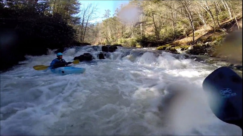
Chutes and Ladders
There is a trail on river left that can be used to scout the entire first rapid. This rapid is a decent sample of the gradient and difficulty of the river.
The second rapid has a nasty hole in the middle. You can either scrape left or run right to avoid, although the right line is harder to boat scout and may have wood in it.
This is the longest rapid of the run. At 18 inches it's quite a ride. At 9-12' it's not that bad.
I start right, working left for a 4-5 foot drop then immediately back to the right. I call this one Mini Vortex because it reminds me
of Vortex on NFFB, but not as big.
There are lots of easy 360 holes in the first mile of the run at least if the water is up.
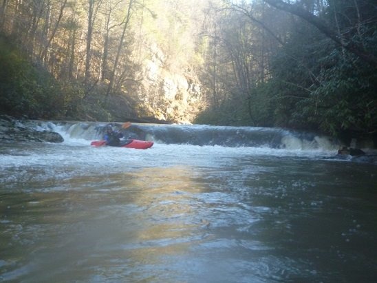
There is around a mile of calm until you get to the Banana Split Ledge. Scout right. Going far left or far right looks nasty, start in the middle, hit the ledge in the middle and boof.
There is a ledge that sneaks up on you quick that has a pretty decent hole at most levels. It may be more forgiving to the right, but if you hit it straight on paddle hard and boof if you can.

Not difficult at all, but it often has a tree in the middle. There is a giant rock in the middle of the river, start on the right then go all the way
across to the left, do a U Turn around the big rock and go all the way back to the right. Behind the rock is where wood ends up, you can scout it from river left or right to check.
After this there really isn't much to the bridge.
May 7, 2024
Epic adventure going over, under and around logs. Creek was great, but there was a lot more wood than last time I went a few years ago. Too many to specify rapids. If it's a blind rapid, assume there is wood. The gorge is really beautiful with a wilderness feel you don't get many other places around here
Big Laurel was 1'5' on the way up. Level was as low as I would go, and couple more inches would have been ideal.
Mar 4, 2023
Water level was 18' (possibly higher, we checked after the run). The normal put in at the bridge over spring creek at Bluff is under construction. There is a spot to park on the left side of the road further up 209 if you continue south.
Continue to watch for wood before the river picks up just before chutes and ladders. You will go under a small bridge for a private drive just before chutes and ladders. NOTE: The trail on river left to scout chutes and ladders may be private property.
Chutes and ladders should be scouted if possible on river left to check for wood. On 1st drop, boof towards left or right eddy (right is easier) and head down toward a large river left eddy before the second drop. Then ferry to river right and head down the second drop and stay right of center. You don't want to be too far right, as you will run into a cliff face, but if you're too far left there is an underwater rock (exposed at lower flows). If the rock is exposed, you want to be almost touching it. Water after the 1st drop is very pushy at higher flows. Route down this rapid after the first drop may be flow dependent, as the large rock in the second drop in river center/left that was covered up at 18'.
Cookie monster can be boat or shore scouted, watch for wood on each side. Left or right is fine depending on wood.
Mini vortex is difficult to shore scout. Rapid info has good description. Enter on river right, and head towards a large eddy in river center. It is a good spot to boat scout the second part of the rapid. From the the center eddy, ferry back to river right, then work quickly towards river left before the first big drop. (Note: you may be able to bleed out of the center eddy for an easier trip to the first drop on the left, but there was wood in this route when we ran it). You want to be on the left side of the first big drop. The river right drop could be run, but hole looks munchy. One of our boaters flipped and rolled back up going over this drop. The second drop is much easier. Main line is on river right for the second drop, but at higher flows, the left line can also be run. Watch for wood throughout the rapid.
Bannana split can be partially shore scouted on river right before the rapid. Main line is just barely to the left of the large rock before the drop in river center. Avoid the drop on far river right (right side of big rock). Not only is there a nasty hole at the bottom, but there is also a severly undercut ledge. It would be a tough rescue, at least at the level we ran it. The river left drop could potentially be run, but none of us were brave enough to try it, water pushes you into cliff face.
Surprise ledge has a good description with nothing extra to add. Boof in center. Watch for wood.
U-Turn has a good description with nothing extra to add. Watch for wood.
Unlike what the description says, there is quite a bit of active whitewater from U-Turn to the bridge. Pretty much constant class 2-3 read and run, at least at 18'. Perhaps it is different at lower flows, but it's certainly not flat water.
The takeout at the 209 bridge has a nice staircase up to the road, but the eddy at the takeout is very small.