Crooked, North Fork
Deep Creek to SE Paulina Hwy (OR-380)
| Difficulty | III+(V) |
| Length | 27 mi |
| Avg Gradient | n/a |
| Gauge | Crooked River Above Prineville Reservoir, Nr Post or |
| Flow Rate as of 7 hours | 0 cfs |
| Reach Info Last Updated | March 10, 2026 |
The National Conservation Lands—a 26-million-acre collection of national monuments, wilderness areas, wild and scenic rivers, trails, and historic sites—are managed by the Bureau of Land Management (BLM) to conserve some of the most treasured landscapes in the American West. Established administratively by the BLM in 2000 and made permanent [...]Read More
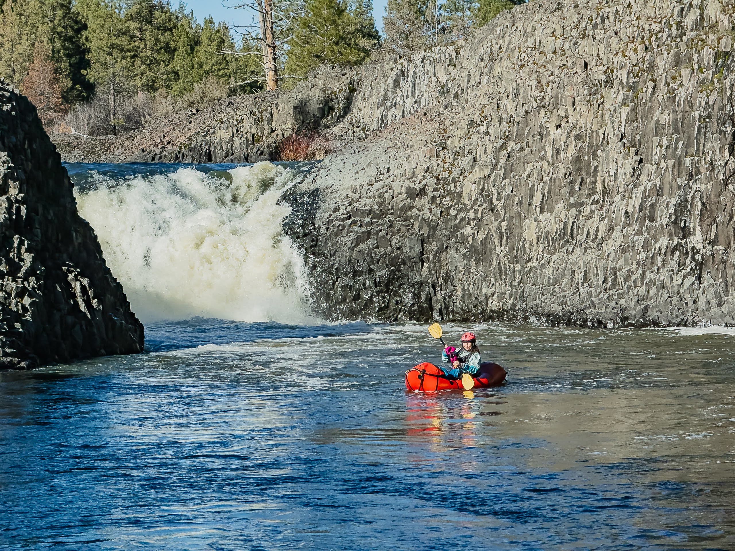
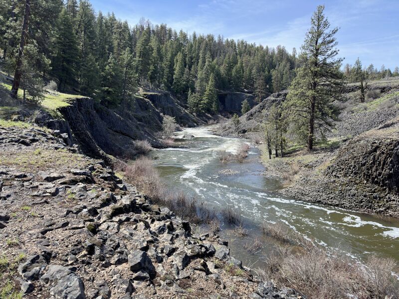
This is a 27 mile wilderness trip with awesome scenery, camping and two waterfalls. Can be run as a self-support multi-day or in a single day with a long shuttle. The run passes through alpine forest, narrow basalt canyons, and big benches of ponderosa. Geese, ducks, eagles, and other birds are abundant. There are two waterfalls, Upper and Lower. Upper falls is clean and runnable and Lower falls is currently choked with large old-growth logs, and both are easily portaged with a kayak on the right. Other than the waterfalls, there is some class II-III rapids throughout and a IV- section below Upper falls. The run is remote and difficult to catch with the right flow in the early spring. The road access as well as shuttles can be complicated.
The easiest shuttle route from the takeout is back to Prineville and up to Big Summit Prairie to the Deep Creek campground. This takes about 1.5 hours one way. There is a NF road (Paulina Valley road) that follows east of the NF Crooked that would greatly cut shuttle distance to about 40 miles, but conditions of the road can be of question. Expect to need a 4wd high clearance vehicle and road conditions can be marginal at best when the flow is good.
The bridge takeout is surrounded by private property, so it is best to have so
...This Forest Service Campground managed by Ochoco National Forest and Crooked River National Grassland is located among large ponderosa pine trees and serves as the put-in for this run.
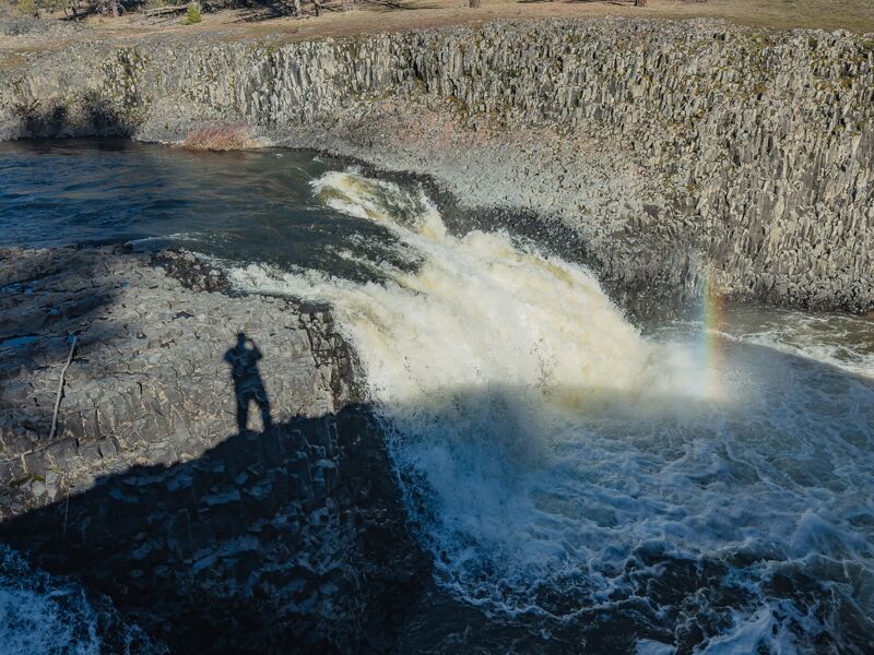
Upper Falls, portage river right.
Series of riverwide ledges. Can be scouted from the cliff edge during the portage of Upper Falls.
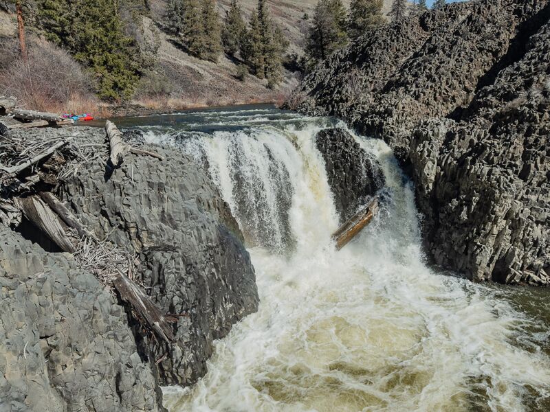
Lower Falls, currently has large log in the waterfall (March 2026). Portage right.
The bridge takeout is surrounded by private property, so it is best to have someone pick you up at the takeout and not park on the highway or on the private ranch driveways.
Public land at the end of Shotgun Road serves as a potential take-out approximately one mile downstream from the North Fork confluence with the main stem.
Mar 10, 2026
Flow was about 450cfs on the CRPO gauge which is low but doable. Lots of wood in the river, probably 4 or 5 trees that that could be avoided since they were in mostly calm stretches, but we had one river wide strainer to portage just above the Crooked Mile (first significant rapid below the lower falls). And we portaged the final barb wire fence about a half mile from the bridge.
This is a remote and committing wilderness run with a long shuttle. Much of the paddling at these flows are short class II features, wall shots, wood dodging, willow bashing and braid hunting. But there are a small number of class III-IV rapids that deserve attention, especially as the flows go up.
We left our shuttle car at the dead end of Shotgun road approximately one mile down stream on the mainstem Crooked from the North Fork Confluence. That is public land and away from the highway. There is a small barbwire fence to cross from the old bridge pylons to the parking area.
Apr 25, 2021
Video of a recent trip
https://www.youtube.com/watch?v=JPQT\_oWQGpo