| Difficulty | I-IV+ |
| Length | 91.3 mi |
| Avg Gradient | n/a |
| Permit | No permit necessary |
| Gauge | Chevelon Fork Below Wildcat Canyon, Nr Winslow, Az |
| Flow Rate as of 48 minutes | 0 cfsbelow recommended |
| Reach Info Last Updated | March 15, 2023 |
River Description
Information on boating Chevelon Creek is spotty at best. The run is in a remote canyon with quite steep and very remote. This creek can be broken down into two sections if boaters takeout or putin at FR504 near Chevelon Lake. That shorter run is about 15 miles. This run was done in Holoform Kayakys back in 'the day'.
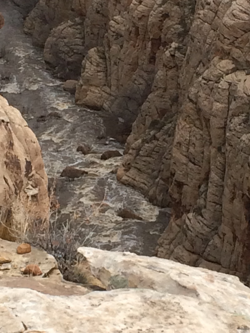
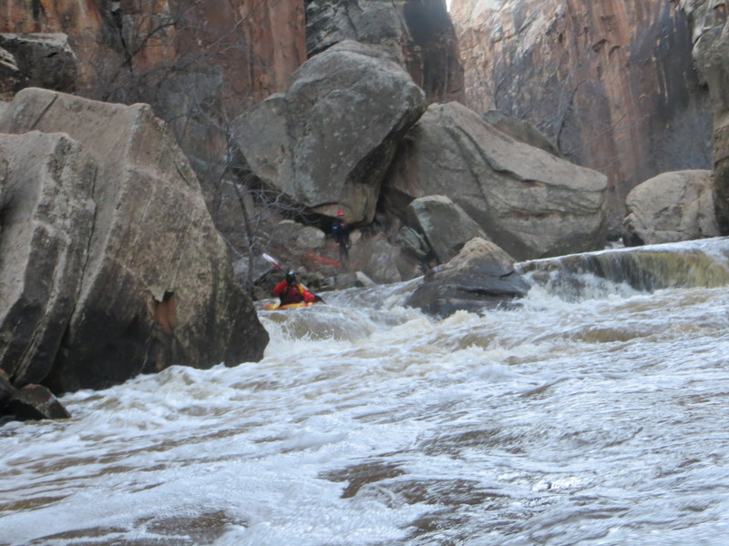
We did this run as an overnight yet could be done in a day. There are multiple dirt roads off the main paved road that can be possible put in locations. We chose to put in at a series of cliffs that required roping out boats down. This was above a grad IV series of rapids.
We had 440cfs on the gauge and this would definitely be my minimum. Twice this flow would be awesome.
Overnight locations for camping in the canyon are very limited due to the slot canyon nature of the run. We did find a nice sandy beach area in the middle of the run in a flatwater section above the biggest rapid. If you paddle down to an obviously larger rapid that what you've encountered, you can back track up the pool and stay river left.
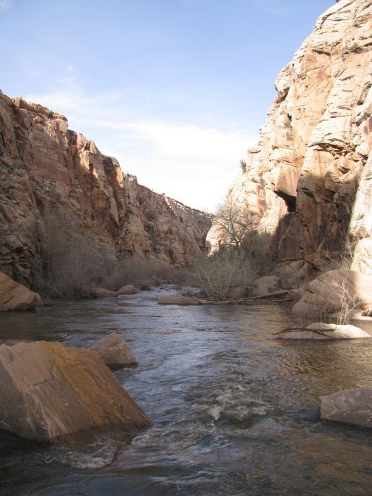
This is a brilliant run with vertical sandstone walls, slot canyon sections, fun and challenging grade III/IV rapids, amazing petroglyphs, and you float through a bolted climbing section that is one of the best I've seen in AZ.
Set your shuttle at the bridge easily identifiable on google earth and then pick a spot to put in.
River Features
Chevelon Lake
PortageDistance: 8.4 mi

The lake is man-made. The coordinates are to the dam, which looks like the most reasonable access point.
Take Out
Access PointDistance: 75 mi
Trip Reports
Log in to add a report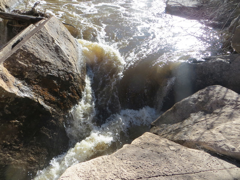
BB
Brady Black
Oct 15, 2015
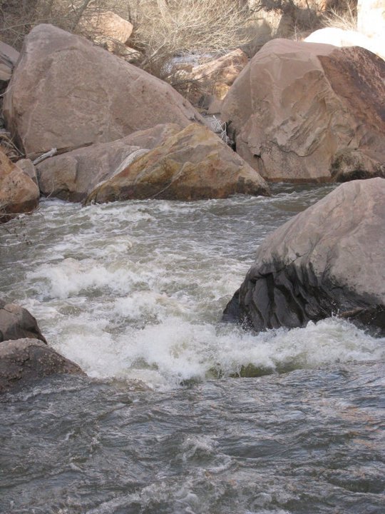
Scout high river left here. River is splits around a big truck size boulder. RIght side is a fun double drop into aerated water. Left run is a violent drop that appears to run by and under the giant boulder you can stand on, off the river left bank.
BB
Brady Black
Oct 15, 2015
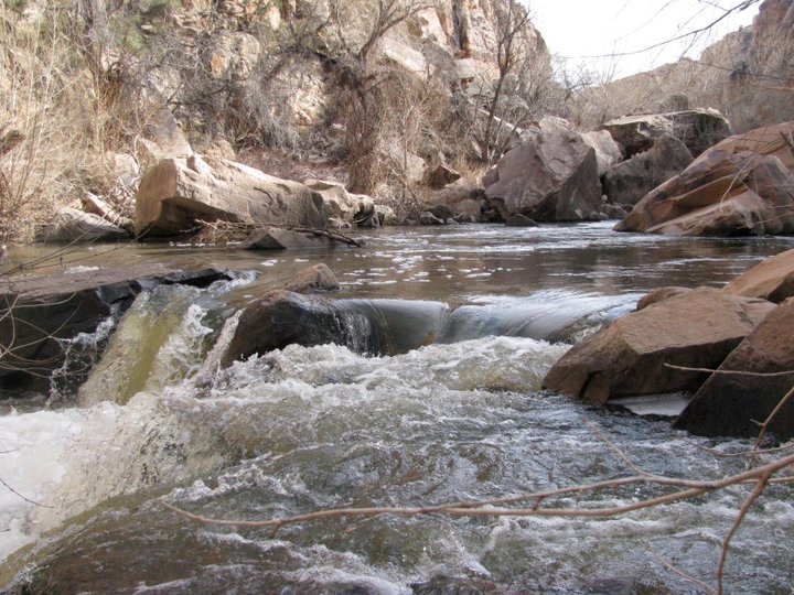
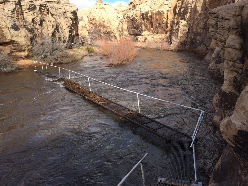
This is the ladder at the Rockin Art Ranch. It is private property. The walkway could be a hazard as it is built right in the waterway. This is probably 300-500 cfs. From here down it is an easy class III fun run to the bridge that crosses the canyon off frontier road. There are 3 50 foot long bizarre log rafts you will need to portage in order to get out.
BB
Brady Black
Oct 14, 2015
One Takeout is off McLaws Road(Frontier Rd) where it passes across a bridge 40 feet over the creek.
BB
Brady Black
Oct 14, 2015
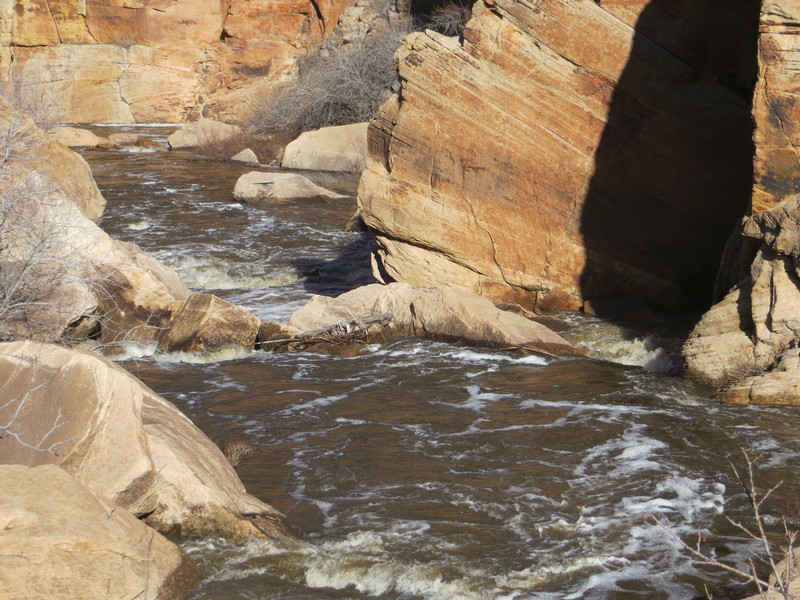
Gods Pocket run has alot of debris potential and sieves. The rapids are pool drops behind behemoth boulders that clog the stream nearly from wall to wall. The cliffs are from 200+ to 350 ft high. Most are shear. It would be very difficult to bail on most of the 9 m? Gods Pocket run. Takeout is either at or near the Rockin Art Ranch or continue down through the Class III section another 5 miles+ to the bridge over Chevelon Canyon at the north end of the canyon. When the gauge is reading, it will take approximately 24 hours for water to reach the God's Pocket section.
BB
Brady Black
Sep 21, 2011
15 miles up from Winslow off of 99, Take Stetson road and take the 45degree left after the cattle guard until you hit the canyon. There's a hike down and you will take out at the bridge on Frontier road north

BB
Brady Black
Sep 21, 2011
15 miles up from Winslow off of 99, Take Stetson road and take the 45degree left after the cattle guard until you hit the canyon. There's a hike down and you will take out at the bridge on Frontier road north