Swannanoa
Charles D. Owen Park to Azalea Rd
| Difficulty | I-II |
| Length | 6.9 mi |
| Avg Gradient | n/a |
| Gauge | Swannanoa River at Biltmore, Nc |
| Flow Rate as of 51 minutes | 28 cfsbelow recommended |
| Reach Info Last Updated | May 6, 2025 |
River Description
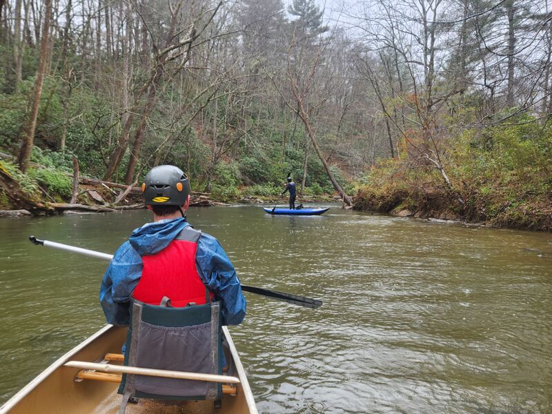
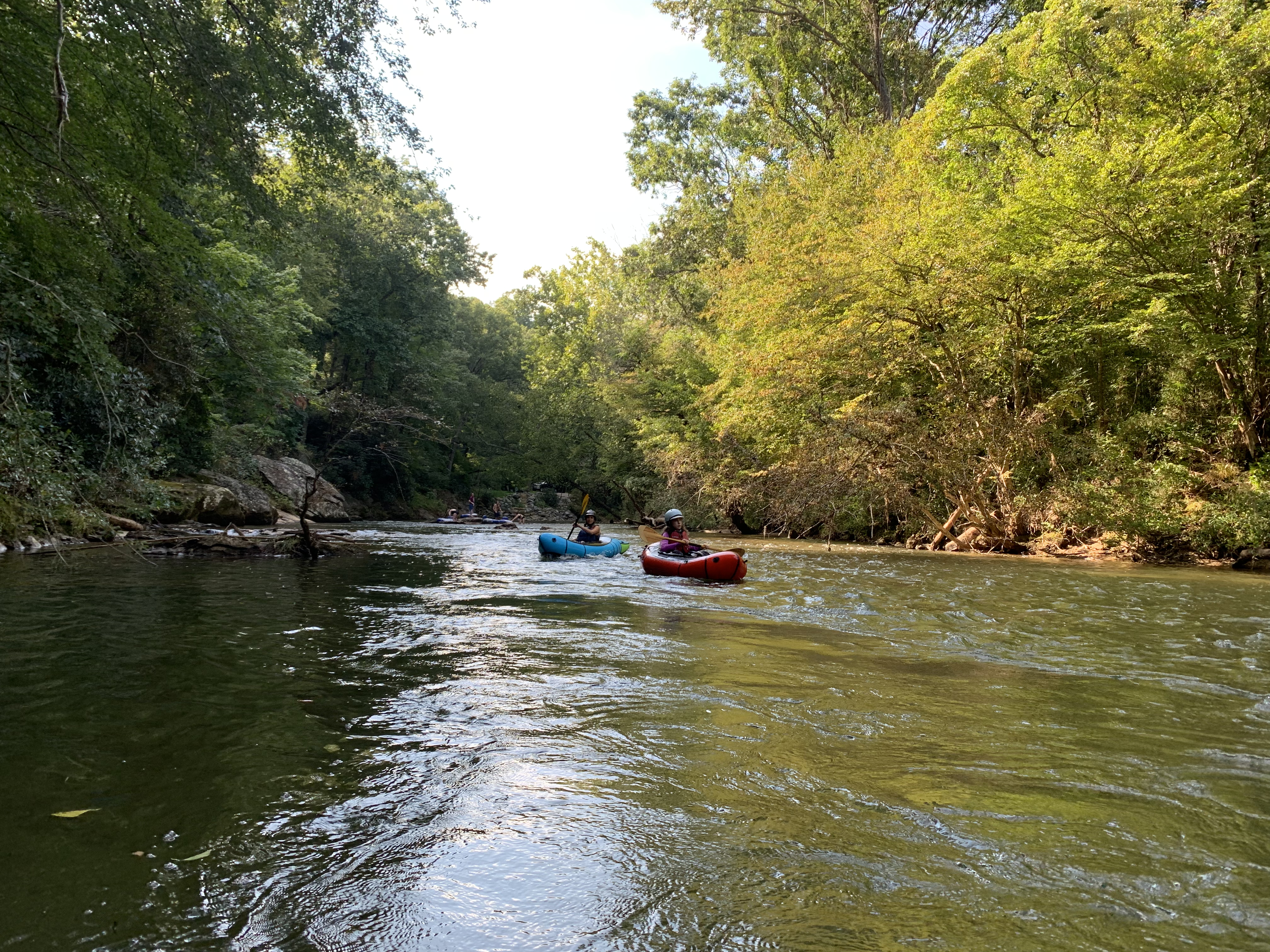
The Swannanoa River is a surprisingly nice Class II run in the Asheville area. At normal flows, start your run at Charles D Owen Park where Bee Tree Creek kicks the volume up a notch. The first mile to the bridge at Warren Wilson has some shallow cobble bars, but shortly thereafter the river changes character, with deeper pools alternating small boulder and bedrock rapids set between wooded hills. Where the river nears Farm School Rd, it suddenly feels like a larger real river. There are lots of well defined eddies. For the final mile or so before 70 the river flows through a neighborhood. It is likely wise to be weary of the water quality at high flows given the developed nature of the watershed, but the water quality is pretty good a couple days after a rain or longer.
There are several options for taking out in the vicinity of Highway 70 at various businesses, or continue on to the County Recreation Park. Be sure to get out before the dam at the Western North Carolina Nature Center. A decent spot that seems public is at the Anchor Steam Plant entrance on Azalea Rd.
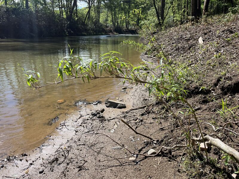
Hurricane Helene totally changed this run. All of the rapids are different and in different places. The river has a sunnier, open feel, and pretty much all of the houses that had been built in the floodplain are gone. The river is a bit wider and shallower, and the rapids are less smooth. Still, obvious and clear lines exist through all the small rapids, and the river is still enjoyable. A lot of rock walls have been exposed, and the river is going to be OK. The old rough Farm School Rd access area is now blocked with a guard rail so this run just keeps getting longer as we lose access.
River Features
Owen Park Put In
This is an ideal put in for the run, with the caveat that at low flows a few cobble bars will get shallow and woody.
Azalea Road Take Out
A large pull-off works well for parking. Be mindful of broken glass.
Trip Reports
Log in to add a reportHurricane Helene totally changed this run. All of the rapids are different and in different places, made of sharper rock, and of similar difficulty as before the storm. The river is a bit wider and more shallow, and way sunnier and more open. It feels like a bigger river than before, and more water will be better. The whitewater is less good than before the storm, but some time might help.
I got dropped off at Warren Wilson bridge after being surprised (and so disappointed) to find the Farm School Road blocked by a new guard rail. The destructive actions of the Army Corps of Engineers was evident, as I could see where trucks had entered the river, and see where they had cut down mature live trees, cleared vegetation, scraped banks, and scalped cobble bars. Who knows what damage they did to the riverbed. In the Warren Wilson property, where the riverside forest is protected, you can't even tell there was a flood. Downstreams where roads and houses had encroached on the river there were a lot of impacts.
I saw fish, an osprey, a kingfisher catch a fish, a little green heron, and a great blue heron. The native river cane was unfazed by the flood. Livestaked shrubs planted after the storm were growing well. The seedbank was producing lots of new plants. The river is pretty healthy and recovering well.
The destructive forces of the flood are very clear. All houses that had been built in the floodplain, including the handful built in the river channel itself, are entirely gone. A lot of new rock walls were exposed by the flood, and the scenery is very different. Along the roads at the bottom end nearly all the riparian trees are gone, and road reconstruction is evident.
I'm very interested to see how this river continues to recover, and if Buncombe County will ever do right by it.
Due to the low flow (157 CFS) we put-in at the spot off Old Farm School Rd near Bull Creek (35.608096, -82.459028). The parking area is small and super messed up, med-high clearance or careful maneuvering required.
The flow was quite low and we scraped rocks and hit some low spots but nothing was impassable. I was in an two person kayak and my friends in a Canoe. Had to portage one river wide tree.
Made the run clean except the canoe capsized at one of the last rapids that flowed straight into downed tree root-ball/strainer. They managed to pull off to the side and dump the water out of the canoe to finish up.
Took out at the bridge in front of the Anchor Steam Power complex, there's a small parking/pull off east of the bridge (35.580943, -82.473157).
After School Special at low release-see comments for details on this drop
Paddler: John Wood
The Playhole/ wave is no longer there. Some streambank restoration work that wzas donein the area has changed the streamflow in the area and has killed the White Thrash hole. I've been out several times to look with appropriate water levels (800 cfs+) and unfotunately the hole/wave no longer forms..
Matt C.
Great park and huck on the North Fork of the Swannanoa. Slide with two boofs about 20 feet long. Only runs when the reservoir is releasing. From old 70 head north on North Fork road bearing left. Drop is under bridge. Stay left on the main slide as there is a hidden piton rock on the right. Hole is not bad at the bottom. The students at Warren Wilson College just down the road call this drop 'after school special' look for releases after rain when they draw down the resivior, the gauge is useless because it is too far down stream.
New Playspot in East Asheville.... New
Forum: BoaterTalk
Date: Jun 14 2005, 3:11 GMT
From: moheinous
I know i'm not the first to surf it but at today's level on the Swannanoa (about 800 on the boating beta guage) a nice breaking wave hole forms at a small rapid at Owen Park. Seemed decent for cartwheels and some fast back and forth surfing(blunts?) but i'm not much of a playboater to really feel it out. A small clean wave was surfable in the washout just behind the hole.At higher water it even gets bigger and it always has nice eddy service. It's probably not worth skipping a high level on the Ledges but for folks in the Swannanoa/East Asheville area it makes a nice afterwork park and play spot. Warren Wilson students could walk to it.
Directions: Interstate 40 east to Exit 55. Follow signs to Warren Wilson College. Go Past the College to the Owen Factory and turn r at the far end of the plant. Go behind the plant to the park. Walk to the backside of the lake and upstream to where Beetree Creek enters the Swannanoa.