Salmon, South Fork
3. Matthews Creek to Methodist Creek(Middle South Fork Run)
| Difficulty | II-III+(IV) |
| Length | 3.6 mi |
| Avg Gradient | n/a |
| Gauge | Salmon R a Somes Bar Ca |
| Flow Rate as of 18 minutes | 277 cfsbelow recommended |
| Reach Info Last Updated | May 7, 2024 |
The section of the South Fork Salmon between Matthews Creek and Methodist Creek is not often boated. It's a wonderful run but has a dichotomous character: most of the run is class II+/III but it concludes with a tight class IV+ gorge just above the take-out at the Methodist Creek River Access. It's this split character that keeps most boaters away and most who do run this section are doing it as an add-on the the upstream South Fork Gorge Run. However, it is possible to take out just above the class IV+ gorge and keep this run in the class III range or (for smaller baorts) portage the class IV+ gorge.
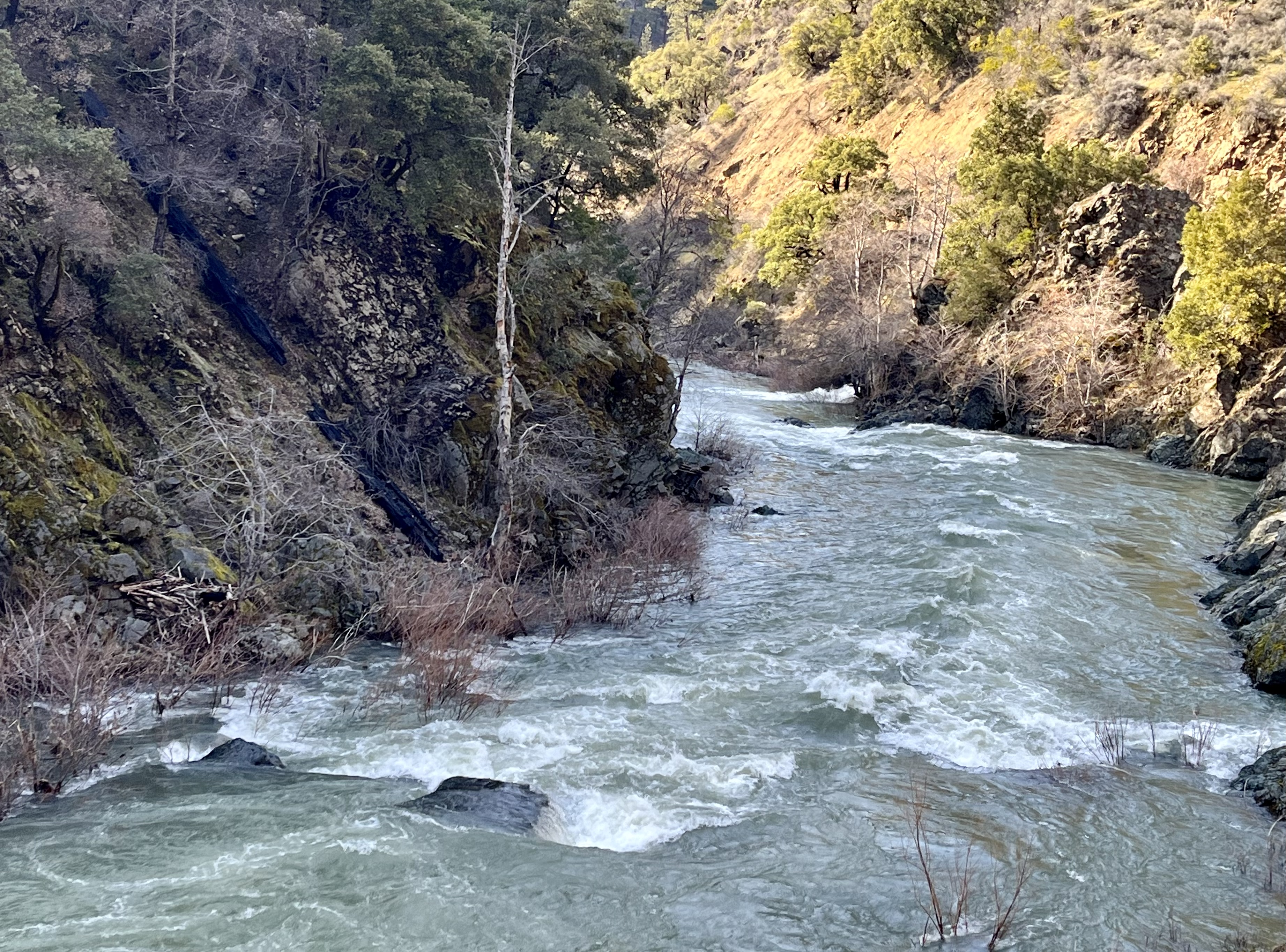
The class IV+ gorge aside, this run has abundant rapids in a pool-drop configuration. At medium and higher flows there are some fun surf waves and play features but it is also boatable at lower flows and a slower pace. A scenic highlight of this section is Big Rock and the beautiful, circulating pool on river right at the base of the towering rock. Some of this run can be seen from Cecilville Road but much of it is out of sight. As usual for a Salmon watershed run, the scenery is great.
For boaters not interested in running the class IV+ gorge, it is possible to take out a ways above it, but the access point is unmarked so most boaters are unaware of its existence. It is not obvious yet includes a wood staircase to help you climb up from the river. Definitely scout this informal take-out before boating if this is your plan.
Although the grand finale class IV+ gorge is perfectly runnable if not a bit snaggletoothed at certain flows or punchy at others, it's possible to portage on the right. The portage isn't super easy because the bedrock is slick and you'll need to climb up and down over small outcrops and boulders. Packrafters will find that their light craft make the portage easier, kayakers will manage, but rafters will not be able to easily portage this gorge, and lining would be very challenging if not impossible.
Flows & Sea
...Put in at the unsigned Matthews Creek River Access. This is downstream of the bridge over Matthews Creek as well as the campground. There is a large clearing where US Forest Service road 54D0022 departs from Cecilville Road and heads toward the river. You'll see a brown 54D0022 sign where the road leaves the clearing and begins heading downhill to the river.
Big Rock (its actual name) is a big rock on river right on a swerving left bend in the river. It's a scenic place but, if you're planning on using the alternate take-out to finish this run before it enters the class IV+ Methodist Gorge it is also an indicator that you're getting close.
After a straight ahead lead-in, this rapid finishes with a route through some congested boulders in the center of the river. It is more technical than previous rapids and is also the last rapid before the alternate take-out above the class IV+ Methodist Gorge. If you're using that take-out, it's on river right in the pool immediately below the boulders. Look for the hidden stairs on the slope above the river banks. This is near Graham Gulch.
Take out here if you don't want to run the tight class IV gorge immediately downstream. This is an unmarked access point and it is not obvious from Cecilville Road or the river. There is a short dirt road off Cecilville Road here and a small area for parking. This is between the 6-mile and 7-mile marker on Cecilville Road and 0.7 miles upstream of the Methodist Creek River Access and bridge over the river. The last rapid before this take-out has a group of laerge boulders in the center of the river that you must navigate and it stands out as more technical than the previous rapids. Look closely from the pool below the boulders and you'll see a makeshift wood staircase on river right that goes from the above high water mark to the parking area further uphill. This is near Graham Gulch.
A short series of prelude rapids lead in to the Methodist Gorge.
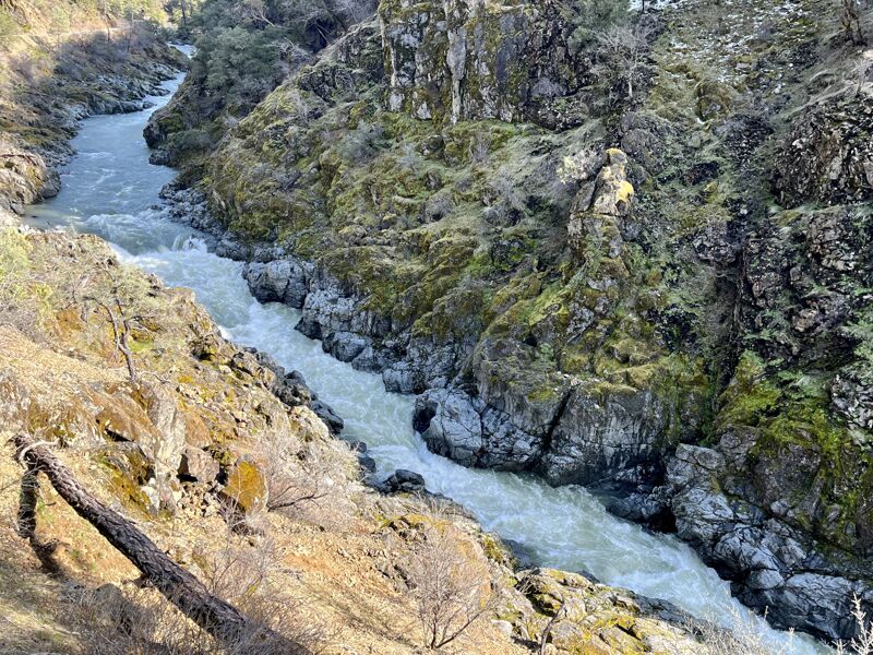
Tight bedrock gorge rapid just upstream of Methodist Creek confluence. The simple way to describe the line is 'drop in right, punch the hole, and hang on.' More detailed would be 'go right, there's a crazy seam, a large hole, a curler, a serious snaggletooth rock or roostertail on left of center, lots of boily water, and super narrow gap at the bottom.' You get the idea. In two places the gorge pinches down to about five feet wide. This rapid bears some similarities to Amusement Park, one of the more exciting rapids in the South Fork Gorge Run upstream, but is even narrower and has less zig-zag.
Take out at the Matthews Creek River Access, just upriver of the bridge over the South Fork Salmon near the six mile marker on Cecilville Road.
May 16, 2023
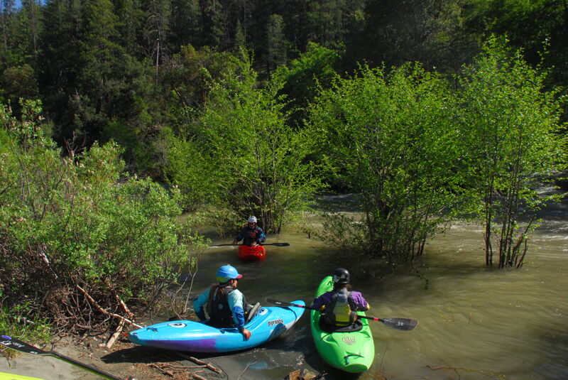
Photos of the access at Methodist Creek. We were using it as the put-in for the run downstream but the images are included here as photos for the take-out.
Mar 15, 2023
A few photos taken from Cecilville Road along the Middle SF Salmon Run.
