Missisquoi (Troy) MINT
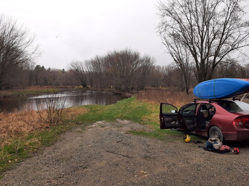
River Road (near oxbow) to Big Falls State Park
| Difficulty | II-IV |
| Length | 4.2 mi |
| Avg Gradient | n/a |
| Gauge | Missisquoi River Near North Troy, Vt |
| Flow Rate as of 48 minutes | 47 cfsbelow recommended |
| Reach Info Last Updated | May 1, 2023 |
This run is high up in the Missisquoi's watershed, where the river is essentially a large creek. It is characterized by a series of fairly large and well separated drops and one longer rapid, and ends above Big Falls, a 60 foot unrunnable cascade. It is commonly referred to as the 'Missisquoi in North Troy' or 'MINT' for short.
Comes up regularly after summer rain
You could combo this section with the Jay branch section below au revoir flat road (IV+)
Two nices doubles drops waterfalls on each arms of a river split, a miles before the put in. Part of the flow is diverted for electricity. watch out for rock at bottom of drops.
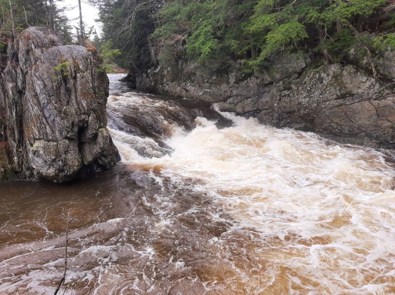
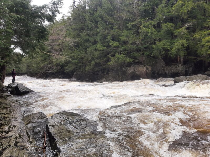
First rapid after putin, house on overlook river right . Scout right or left , start left and run diagonaaly to center in a ledgey line or straight down center right This drops ends in a 70 yard long pool above John Little Falls, which you want to get to river right to assess your line. Get swimmers to right side above falls
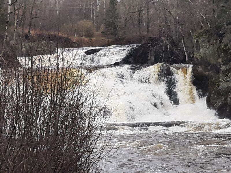
J Little Falls: River wide ledge, you can see where river broke thru 20 foot rock band in geologic times. A 7 foot drop usually run on right. Is a big backwash on left center to left shore above 1400 cfs. Can scout R or left, portage left. When river is high ^1800 cfs Raven's Roost and JL Falls run together, get to the right above JL Falls
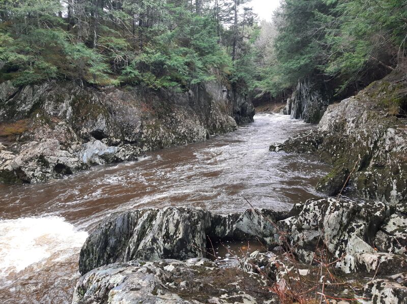
After a few C1 drops the river slow down approaching ironing board. The rapid is noted by a small stream coming in from left in a diagonal manner, walls begin to close in. Scout on right as there is not many eddies to grab before the Ironing Board drop. Pretty easy approach, the key is to run close to river right wall at the lip and then run right to left down a flume. Easy 4 but very challenging and consequential above 2000. The scout is easy and you lookdown into the drop from high above on right wall
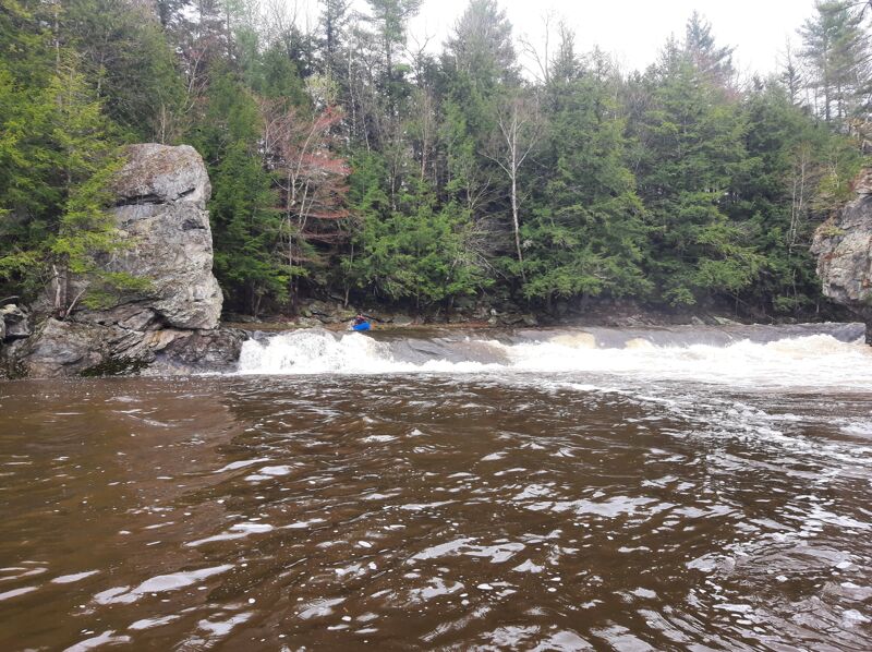
Name taken from a ski trail at Jay noting our shared passion for skiing and boating with our Canadian neighbors. CanAm cimes up after soon after Ironing Board,a short bit of moving water, horizon line, then CanAm. Scout left but if you decide on far river right line check it from right shore for wood and line thru a hole. Is a nice line in center running left side of a rock then making a move going over ledge. Also, can enter left and work center through ledgey drop.
Longest of MINT's rapids, some play water level dependent. This is followed by small rapids and flatwater to first takeout on river left at Bergeron rd/Vieulleux rd. There is a temporary bridge replacing burnt covered bridge destroyed in 2021. Takeout on left above bridge
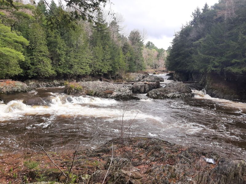
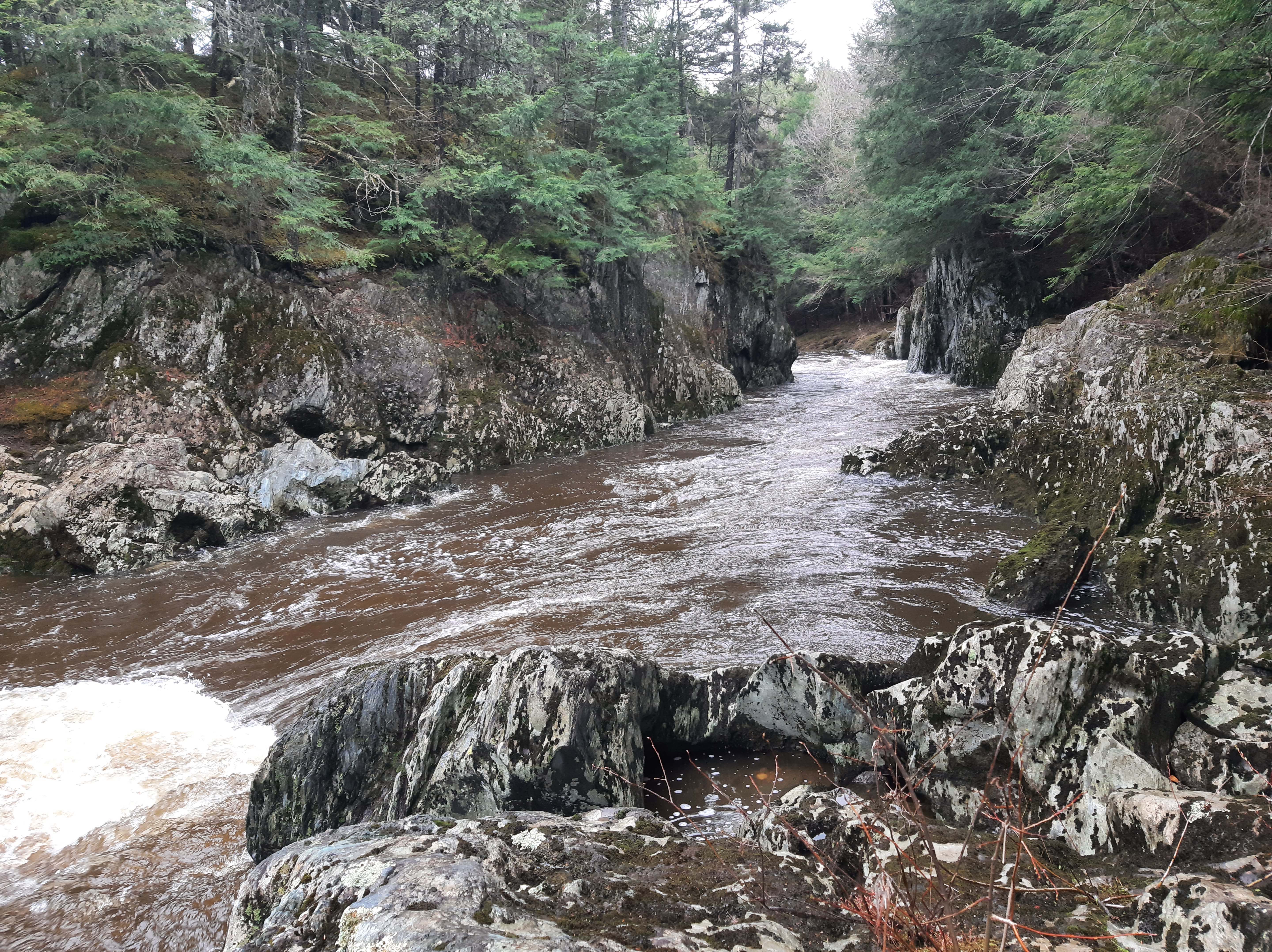
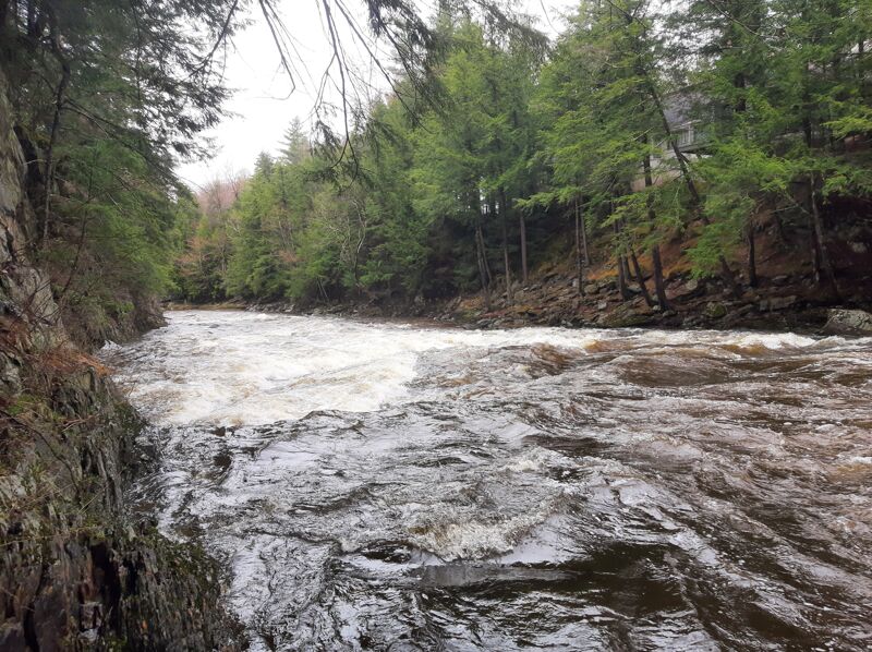
Below the bridge is some flatwater and then several cl 3 drops drops below 650 that you can boat scout. Higher levels require caution.
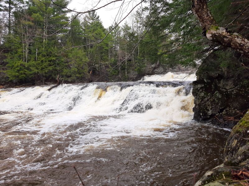
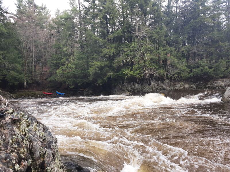
The most scenic part of the river. Nothing to hard, but watch out cause big falls just around the corner. Get boily with more water.
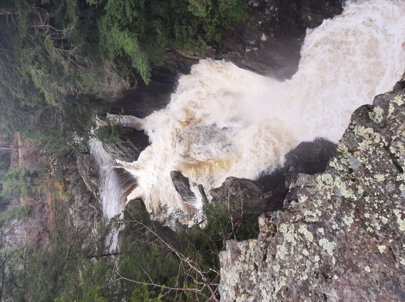
Scout the takeout on river right above 60' falls. Run the drop on the right leading into takeout. The takeout makes a nice place to change clothes and everyone should see this drop before putting on. Be realy carefull