Trinity, Stuart Fork
Deer Creek to Bridge Camp Campground(Wilderness Run)
| Difficulty | IV(V) |
| Length | 6.8 mi |
| Avg Gradient | n/a |
| Reach Info Last Updated | February 12, 2025 |
Flowing forth from the largest glaciated drainage in the high Trinity Alps, the Stuart Fork carries meltwater from winter snowpack that caps the granitic peaks of the White Trinities and the ultramafic peaks of the Red Trinities. This fork of the river is a powerhouse and it was tapped heavily in the mining era and was diverted 29 miles through an extensive tunnel and ditch network to the LaGrange Mine to the west of Weaverville. Now, with its water all back in its natural stream channel, the Stuart Fork flows forth from the Trinities until it is impounded in Trinity Lake, its confluence with the main Trinity River now buried in the depths of the reservoir.
But rejoice: the Stuart Fork offers up an epic hike-in wilderness run for intrepid paddlers. This is prime territory for packrafts: a 7-mile hike on the Stuart Fork Trail to a put-in at the confluence with Deer Creek, epic camping opportunities in a vast wilderness area, and a challenging whitewater run to get you back to civilization. Expect views of thick forest, snow-capped peaks, and water that is very clear and cold. The river canyon here is over 4,000 feet deep as its squeezes between Monument Peak at the southern tip of the White Trinities and Granite Peak in the Red Trinities. It is possible to hike even further in and paddle more of the Stuart Fork: consider this cutting-edge backcountry exploration.
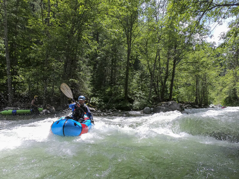
The whitewater is continuous, non-stop action. The largest single drop is at Alpine Creek (scout left) but you will have been out to scout several drops before here.
Hazards
Mining activity in the stream channel has created some hazards, big holes, and undercuts so be alert. There are guaranteed wood hazards on this run: always be alert.
Flow & Season
There is no gage on the Stuart Fork. Generally, it will be boatable when the Trinity above Trinity Lake, Canyon Creek, and NF Trinity are flowing at medium boatable flows. The best cor
...Park and begin the hike in at the Stuart Fork Trailhead that is adjacent to the Bridge Camp Campground.
Put in at the confluence with Deer Creek (off-trail).
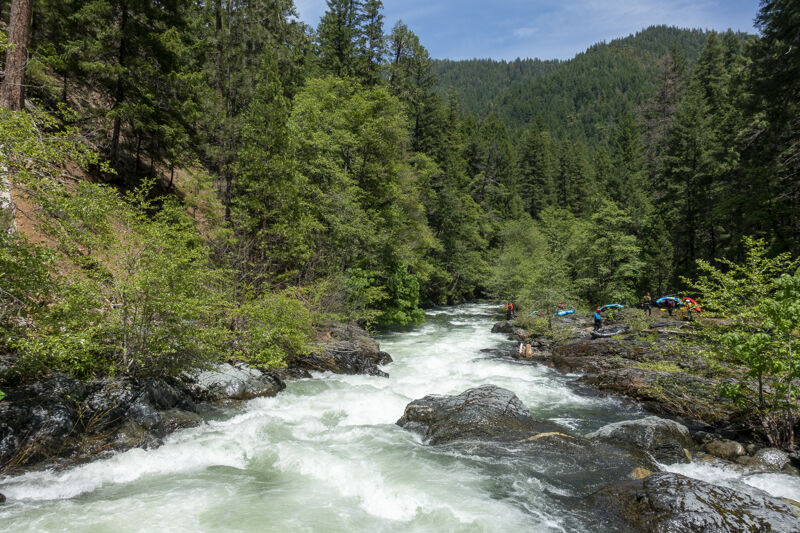
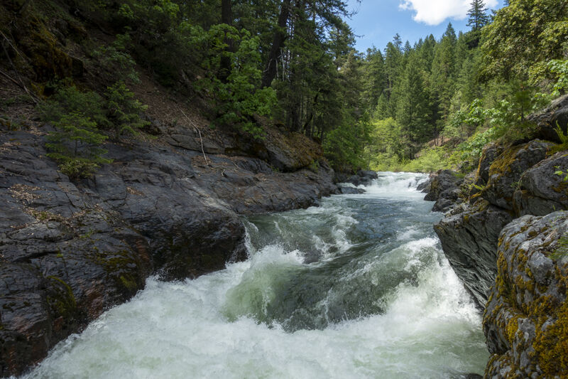
Large rapid just upstream of the confluence with Alpine Creek. This may be labeled as Boulder Creek on some maps (it drains Alpine Lake). Scout on river left. The rapid is long and squeezes through granite boulders.
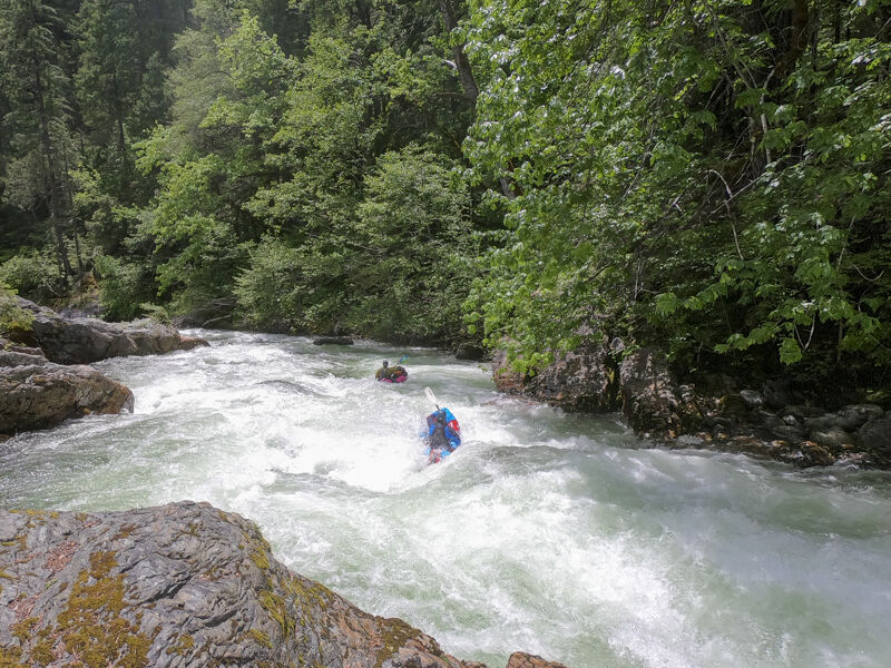
A longer rapid with a series of small drops and medium-sized holes.
This rapid comes on a lefthand bend not far below the river left confluence of Monday Creek (which you'll likely not notice). Eddy, scout, and (if desired) portage on the right right. The first drop in the rapid features a large riverwide hole and the runout has a couple more holes below.
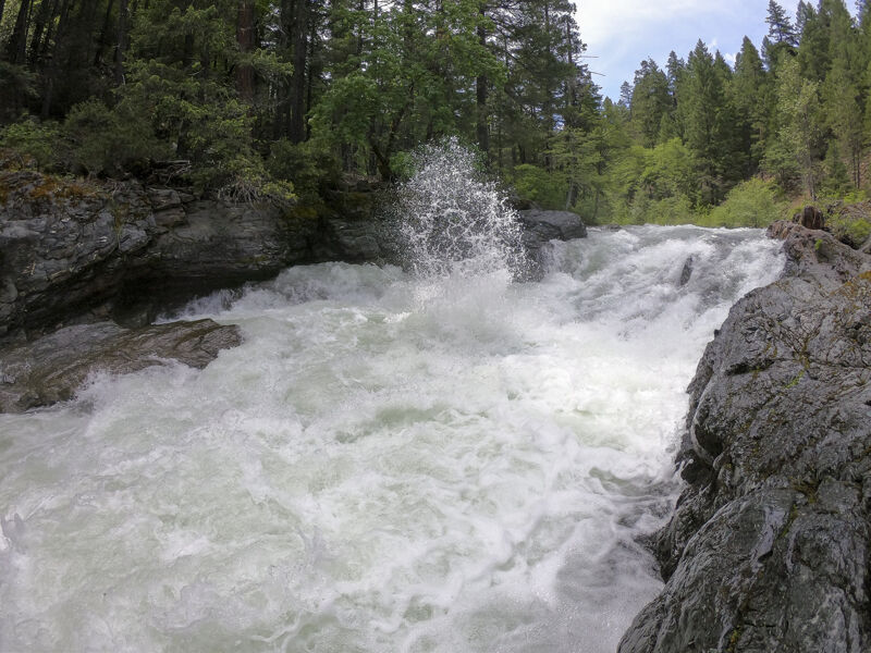
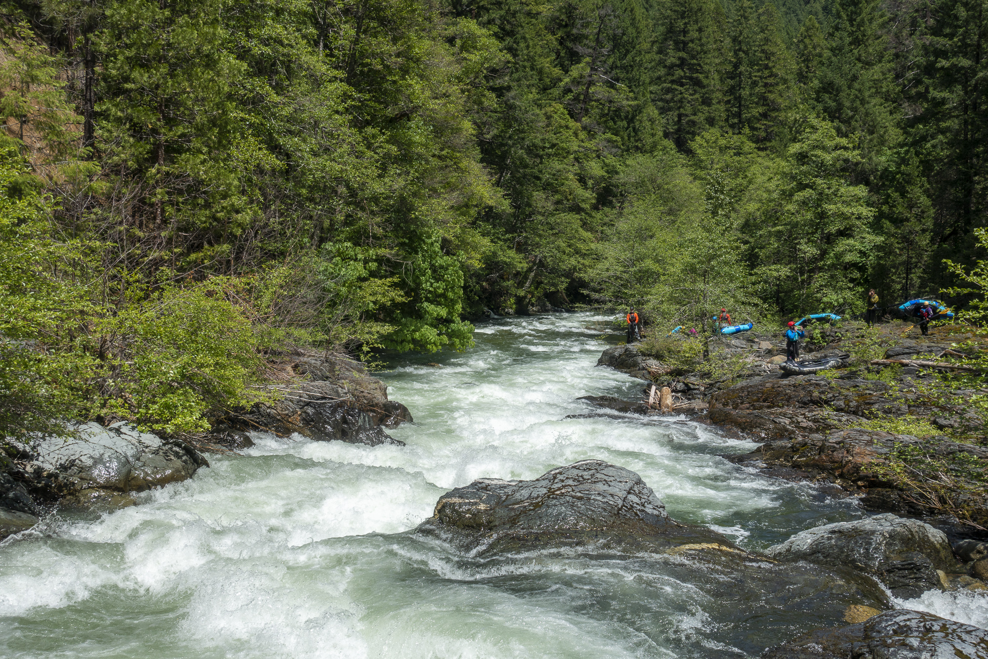
This narrow bedrock gorge holds two rapids that will get any boater's attention. The first drop is a tall, ramping ledge with a rock rib that splits it into a right and left channel. There's a curious exploding water feature at its base of the right channel. Spray shoots vertically about 10 feet high and all the way across the river in irregular intervals, somewhat like a geyser. The runout remains tightly bound in the gorge walls and speeds quickly toward the second drop.
This is the second drop in a tight bedrock gorge and is a low angle pourover/ledge with a decent-sized riverwide hole. There's a little more rapid about 75 feet beond before it drops into a moving pool to finish.
Punchy rapid just above the first bridge over the Stuart Fork on this run. this is outside the Trinity Alps Wilderness Area.
Take out at the upriver end of Bridge Camp Campground on river left. This is a developed National Forest campground that is open for camping from May 15 to October 31. Walk-in access to the river is open all year.
Jun 10, 2023
With good flows in June from the 180% snowpack from winter 2022-2023, a group of 15 packrafters hiked in to run the lower 2.5 miles of the Upper Stuart Fork Run plus the full lower run. It was the Saturday of the American Packraft Association's 2023 Roundup which was based out of Junction City along the Trinity River.
The hike was easy and straightforward. We put in at the first place where the trail dropped to river level and provided an easy entry (a 2.1-mile hike from the trailhead, just upstream of Lightning Creek). There's a lot more whitewater upstream of this for sure.
The river was a good level for packrafting, even good for kayaking, and was slightly padded out without being pushy. There were holes that could eat packrafts but options for going around, over, or through them too. Flows on the Trinity River above Coffee Creek gage were about 1,200 cfs on the diurnal swing. Not surprisingly, the Stuart Fork bears similarities to other central Klamath Mountain hike-in runs like the Upper NF Salmon, Upper New, and the middle gorge of Wooley Creek.
About a mile below out put-in, we came across two sets of rapids we all portaged. The first rapid comes on a lefthand bend not far downstream from the confluence of Monday Creek (which comes in on river left and is not very noticable).
About a mile in, we reached a gorge with larger rapids which were actually a bit menacing for packrafts and even a bit stout for kayaks. The prelude rapid that's one bend in the river above above the gorge had a boat-eating hole that would devour any craft, much less our inflatable beach balls. Everyone portaged; river right is best. At the sight of the horizon line for the gorge below, half the group exited and hiked back out. The rest of us continued, portaged the gorge and its double drop, and paddled through a bunch of other fun rapids before reaching the put-in for the lower run at Bridge Camp Campground.
The next 2.5 miles down to Trinity Alps Resort was quick and mostly constant gradient rapids on boulders. There was a portage around full tree blockage at the campground and a bedrock ledge drop that stood out from the others and broadend so wide that it was shallow and sharp. We took out at the second footbridge at the resort, rolled up the boats and walked, as packrafters do, up the the road to the resort store and got some ice cream.
This exploratory trip just makes me want to return and go higher up the Stuart Fork to get a longer hike-in river experience in the wilderness.